
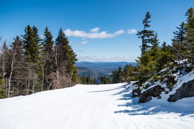
Whistler leads North America with 90% terrain open after fresh snowfall
Updated April 16, 2025: Big late-season dumps hit the Northeast and Canada, while Rockies brace for Easter snow—some resorts still skiing into May.
Please sign in with your Snow-Forecast account details below.


Gressoney-Saint-Jean Weather (Next 3 days): The snow forecast for Gressoney-Saint-Jean is: A heavy fall of snow, heaviest during Thu morning. Freeze-thaw conditions (max 2°C on Fri afternoon, min -2°C on Thu night). Wind will be generally light.
Gressoney-Saint-Jean Weather (Days 4-6): A moderate fall of snow, heaviest on Sun morning. Freeze-thaw conditions (max 2°C on Tue afternoon, min -2°C on Sun night). Wind will be generally light.
| Resort | Snow Depth | Temp. (°C) | Wind (km/h) | Weather | ||
|---|---|---|---|---|---|---|
| Top Lift: | 0.0 m | 1 | ||||
| Middle Lift: | 3 | |||||
| Bottom Lift: | 0.0 m | 3 |
Latest snow reports near Gressoney-Saint-Jean:
Light rain reported from Promiod at 1469 metres elevation only 2 kms S of Antey Saint Andre but it is forecast cold enough for snow at the ski area from Antey Saint Andre

Thursday 17 | Friday 18 | Saturday 19 | Sunday 20 | Monday 21 | Tuesday 22 | Wednesday 23 | |||||||||||||||
AM | PM | night | AM | PM | night | AM | PM | night | AM | PM | night | AM | PM | night | AM | PM | night | AM | PM | night | |
heavy snow | mod. snow | mod. snow | snow shwrs | some clouds | snow shwrs | light snow | light snow | mod. snow | mod. snow | light snow | snow shwrs | cloudy | cloudy | snow shwrs | clear | snow shwrs | light snow | light snow | light rain | snow shwrs | |
km/h | |||||||||||||||||||||
Snow map |  |  |  |  |  |  |  | ||||||||||||||
26 | 9 | 6 | — | — | — | 1.0 | 1.0 | 6 | 7 | 1.0 | — | — | — | — | — | — | 3 | 1.0 | — | — | |
— | — | — | — | — | — | — | — | — | — | — | — | — | — | — | — | — | — | — | 2.0 | — | |
max°C | 1 | 1 | 0 | 0 | 2 | 1 | 1 | 1 | 1 | 0 | 1 | 0 | 0 | 1 | 0 | 1 | 2 | 1 | 1 | 3 | 2 |
min°C | 1 | 0 | -2 | -2 | 1 | 0 | 0 | 1 | 0 | 0 | 1 | -2 | -1 | 1 | -2 | 0 | 2 | 0 | 0 | 2 | 1 |
-3 | -3 | -4 | -4 | 1 | 0 | -2 | -1 | -3 | -2 | -1 | -2 | -1 | 1 | -4 | 0 | 2 | 0 | 0 | 2 | 0 | |
99 | 98 | 95 | 83 | 75 | 89 | 99 | 99 | 99 | 98 | 93 | 75 | 69 | 81 | 75 | 80 | 93 | 98 | 98 | 89 | 79 | |
2200 | 2200 | 1700 | 2050 | 2350 | 2050 | 2100 | 2150 | 2100 | 2050 | 2150 | 1450 | 2050 | 2150 | 1550 | 2200 | 2300 | 2000 | 2200 | 2450 | 2200 | |
6:39 | — | — | 6:37 | — | — | 6:37 | — | — | 6:35 | — | — | 6:33 | — | — | 6:31 | — | — | 6:30 | — | — | |
— | — | 8:16 | — | — | 8:17 | — | — | 8:19 | — | — | 8:21 | — | — | 8:22 | — | — | 8:22 | — | — | 8:23 | |
A heavy fall of snow, heaviest during Thu morning. Freeze-thaw conditions (max 2°C on Fri afternoon, min -2°C on Thu night). Wind will be generally light.
A moderate fall of snow, heaviest on Sun morning. Freeze-thaw conditions (max 2°C on Tue afternoon, min -2°C on Sun night). Wind will be generally light.
Latest snow reports near Gressoney-Saint-Jean:
Light rain reported from Promiod at 1469 metres elevation only 2 kms S of Antey Saint Andre but it is forecast cold enough for snow at the ski area from Antey Saint Andre
| Top snow depth: | 0 cm |
|---|---|
| Bottom snow depth: | 0 cm |
| Fresh snowfall depth: | — |
| Last snowfall: | 2 Apr 2025 |
| Snow Alerts | Create Alert |
0.0 | Bluebird Powder days Fresh snow, mostly sunny, light wind. |
|---|---|
1.3 | Powder days Fresh snow, limited sun, any wind. |
0.0 | Bluebird days Average snow, mostly sunny, light wind. |


The above table gives the weather forecast for Gressoney-Saint-Jean at the specific elevation of 2022 m. Our sophisticated weather models allow us to provide snow forecasts for the top, middle and bottom ski stations of Gressoney-Saint-Jean. To access the weather forecasts for the other elevations, use the tab navigation above the table. For a wider view of the weather, check out the Weather Map of Italy.
Click here to read further information on freezing levels and how we forecast our temperatures.
Overall 4.2 Based on 1 vote and 1 review
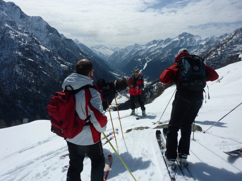
Was staying in Gressoney, so got the ski bus down. It's a small area, one slow 2 man chair, and several pistes, probably enough for a morning's skiing, which is what we did. Pistes are mainly through the trees, with the blue surprisingly long. The floodlit black is quite tricky if conditions aren't great, i.e icy. The resort is probably better with fresh snow as there's some good off-piste between the trees when conditions allow. But if conditions are that good, you might as well stay in Gressoney/Alagna and go off-piste there. It's really only worth going if you're a Gressoney regular and curious. But your curiosity will be sated after just a few hours.
bradley from United Kingdom writes:
Was staying in Gressoney, so got the ski bus down. It's a small area, one slow 2 man chair, and several pistes, probably enough for a morning's skiing, which is what we did. Pistes are mainly through the trees, with the blue surprisingly long. The floodlit black is quite tricky if conditions aren't great, i.e icy. The resort is probably better with fresh snow as there's some good off-piste between the trees when conditions allow. But if conditions are that good, you might as well stay in Gressoney/Alagna and go off-piste there. It's really only worth going if you're a Gressoney regular and curious. But your curiosity will be sated after just a few hours.
Click here to submit your own review of Gressoney-Saint-Jean
The Gressoney-Saint-Jean skiing weather widget is available to embed on external websites free of charge. It provides a daily summary of our Gressoney-Saint-Jean snow forecast and current weather conditions. Simply go to the feed configuration page and follow the 3 simple steps to grab the custom html code snippet and paste it into your own site. You can choose the snow forecast elevation (summit, mid-mountain or bottom lift) and metric/imperial units for the snow forecast feed to suit your own website…. Click here to get the code.
View detailed snow forecast for Gressoney-Saint-Jean at:
snow-forecast.com


 Nearest