The above table gives the weather forecast for Gressoney-la-Trinite at the specific elevation of 1940 m. Our sophisticated weather models allow us to provide snow forecasts for the top, middle and bottom ski stations of Gressoney-la-Trinite. To access the weather forecasts for the other elevations, use the tab navigation above the table. For a wider view of the weather, check out the Weather Map of Italy.
Click here to read further information on freezing levels and how we forecast our temperatures.
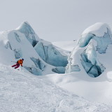
Back to Gressoney for the first time since 2019. Some things never change. Hotel Dufour remains as excellent as ever, but guys, come on? that pool table, please, sort it out! Check out the bar next door for friendly staff and excellent music. Resort remains a hidden gem and in a world of Covid restrictions, its' quiet pistes and lack of queues are even more of an attraction. Some new stuff to talk about. There's a 'fun slope' on the long red down from Champuloc and a basic fun park in Gressoney next to the blue run and a new short black in Alagna.
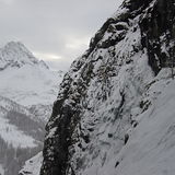
The 2 very slow twin chairs out of Gressoney still need upgrading. No progress on the plans to link to Cervinia and Zermatt via Frachey, but I think that would spoil what Champoluc, Gressoney and Alagna have to offer.
If you find yourself in Champuloc, visit Bierreria Brasserie in the town for stunning burgers and an even more stunning selection of beers.
Back to Gressoney for the first time since 2019. Some things never change. Hotel Dufour remains as excellent as ever, but guys, come on? that pool table, please, sort it out! Check out the bar next door for friendly staff and excellent music. Resort remains a hidden gem and in a world of Covid restrictions, its' quiet pistes and lack of queues are even more of an attraction. Some new stuff to talk about. There's a 'fun slope' on the long red down from Champuloc and a basic fun park in Gressoney next to the blue run and a new short black in Alagna.
The 2 very slow twin chairs out of Gressoney still need upgrading. No progress on the plans to link to Cervinia and Zermatt via Frachey, but I think that would spoil what Champoluc, Gressoney and Alagna have to offer.
If you find yourself in Champuloc, visit Bierreria Brasserie in the town for stunning burgers and an even more stunning selection of beers.
Free Snow-Forecast.com weather widget for your website
Embed the Gressoney-la-Trinite weather widget on your site for free. It provides a weekly snapshot of snow and rain conditions across all elevations. Follow the two quick steps to grab your custom code and paste it into your site. Choose between metric or imperial units. Click here to get the code.


 Nearest