

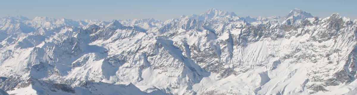
Massive Snowfall in the Alps
A huge snowfall is underway in the Alps, by far the biggest of the 24-25 season.
Please sign in with your Snow-Forecast account details below.

Goms - Oberwald Weather (Next 3 days): The snow forecast for Goms - Oberwald is: A moderate fall of snow, heaviest on Mon morning. Freeze-thaw conditions (max 1°C on Sat morning, min -1°C on Sun night). Wind will be generally light.
Goms - Oberwald Weather (Days 4-6): Light rain (total 3.0mm) at first, then becoming colder with a dusting of snow on Thu afternoon. Freeze-thaw conditions (max 3°C on Wed afternoon, min -2°C on Thu night). Wind will be generally light.
| Resort | Snow Depth | Temp. (°C) | Wind (km/h) | Weather | ||
|---|---|---|---|---|---|---|
| Top Lift: | 1 | |||||
| Middle Lift: | 2 | |||||
| Bottom Lift: | 2 |
Latest snow reports near Goms - Oberwald:
Light rain reported from Unterwassern wx at 1545 metres elevation only 3 kms E of Goms - Oberwald but it is forecast cold enough for snow at the ski area from Goms - Oberwald
Drizzle reported from Buochs Airport at 450 metres elevation 6 kms N of Dallenwil Wirzweli but it is forecast cold enough for snow at the ski area from Dallenwil Wirzweli

Saturday 19 | Sunday 20 | Monday 21 | Tuesday 22 | Wednesday 23 | Thursday 24 | Friday 25 | |||||||||||||||
AM | PM | night | AM | PM | night | AM | PM | night | AM | PM | night | AM | PM | night | AM | PM | night | AM | PM | night | |
light snow | light snow | light snow | light snow | light snow | light snow | light snow | light snow | snow shwrs | light snow | light snow | snow shwrs | some clouds | light rain | some clouds | cloudy | snow shwrs | snow shwrs | light snow | light snow | snow shwrs | |
km/h | |||||||||||||||||||||
Snow map |  |  |  |  |  |  |  | ||||||||||||||
— | — | 2.0 | 1.0 | 2.0 | 4 | 3 | 2.0 | — | — | — | — | — | — | — | — | 1.0 | 1.0 | — | — | 1.0 | |
— | — | — | — | — | — | — | — | — | — | 1.0 | — | — | 2.0 | — | — | — | — | — | — | — | |
max°C | 1 | 1 | 0 | 0 | 0 | 0 | 0 | 1 | 1 | 1 | 2 | 2 | 2 | 3 | 2 | 1 | 2 | 0 | -1 | 0 | -1 |
min°C | 1 | 1 | 0 | 0 | 0 | -1 | 0 | 1 | -1 | 0 | 2 | 0 | 1 | 2 | 0 | 0 | 2 | -2 | -2 | -1 | -3 |
-2 | -3 | -5 | -4 | -4 | -4 | -3 | -2 | -1 | 0 | 1 | 0 | 1 | 2 | -2 | -2 | 0 | -6 | -5 | -4 | -7 | |
93 | 96 | 94 | 97 | 97 | 96 | 99 | 99 | 95 | 92 | 94 | 88 | 94 | 93 | 84 | 89 | 86 | 85 | 88 | 88 | 81 | |
2300 | 2350 | 2200 | 2250 | 2250 | 2100 | 2300 | 2350 | 2050 | 2400 | 2600 | 2400 | 2500 | 2650 | 2350 | 2400 | 2450 | 1950 | 2000 | 2100 | 1800 | |
6:33 | — | — | 6:31 | — | — | 6:30 | — | — | 6:28 | — | — | 6:26 | — | — | 6:24 | — | — | 6:22 | — | — | |
— | — | 8:19 | — | — | 8:20 | — | — | 8:21 | — | — | 8:22 | — | — | 8:23 | — | — | 8:24 | — | — | 8:27 | |
A moderate fall of snow, heaviest on Mon morning. Freeze-thaw conditions (max 1°C on Sat morning, min -1°C on Sun night). Wind will be generally light.
Light rain (total 3.0mm) at first, then becoming colder with a dusting of snow on Thu afternoon. Freeze-thaw conditions (max 3°C on Wed afternoon, min -2°C on Thu night). Wind will be generally light.
Latest snow reports near Goms - Oberwald:
Light rain reported from Unterwassern wx at 1545 metres elevation only 3 kms E of Goms - Oberwald but it is forecast cold enough for snow at the ski area from Goms - Oberwald
Drizzle reported from Buochs Airport at 450 metres elevation 6 kms N of Dallenwil Wirzweli but it is forecast cold enough for snow at the ski area from Dallenwil Wirzweli
| Top snow depth: | — |
|---|---|
| Bottom snow depth: | — |
| Fresh snowfall depth: | 19 cm |
| Last snowfall: | 17 Apr 2025 |
| Snow Alerts | Create Alert |
0.0 | Bluebird Powder days Fresh snow, mostly sunny, light wind. |
|---|---|
1.9 | Powder days Fresh snow, limited sun, any wind. |
0.4 | Bluebird days Average snow, mostly sunny, light wind. |
The above table gives the weather forecast for Goms - Oberwald at the specific elevation of 2206 m. Our sophisticated weather models allow us to provide snow forecasts for the top, middle and bottom ski stations of Goms - Oberwald. To access the weather forecasts for the other elevations, use the tab navigation above the table. For a wider view of the weather, check out the Weather Map of Switzerland.
Click here to read further information on freezing levels and how we forecast our temperatures.
The Obergoms, in the Valais high valley, is considered to be the snowiest region in Switzerland. The very cold temperatures also ensure that the snow remains until spring. The very wide trails (classic and skating) are always in top condition. A night trail between Ulrichen and Obergesteln also has its charm. The trails leading through the whole valley (about 20 km) run along the Rhone (Rottu). With the cross-country ski pass, the return journey is even free. Das Obergoms im Walliser Hochtal, gilt an schneesicherste Region in der Schweiz. Die sehr kalten Temperaturen sorgen zusätzlich dafür, dass der Schnee bis in den Frühling liegen bleibt. Die sehr breiten Loipen (Klassisch und Skating) sind immer in einem Top Zustand. Eine Nachtloipe zwischen Ulrichen und Obergesteln hat zusätzlich ihren Reiz. Die durch das ganze Tal (ca. 20 km) führenden Loipen verlaufen der Rhone (Rottu) entlang. Mit dem Loipenpass, ist die Rückreise sogar kostenlos.
Martin Spahr from Switzerland writes:
The Obergoms, in the Valais high valley, is considered to be the snowiest region in Switzerland. The very cold temperatures also ensure that the snow remains until spring. The very wide trails (classic and skating) are always in top condition. A night trail between Ulrichen and Obergesteln also has its charm. The trails leading through the whole valley (about 20 km) run along the Rhone (Rottu). With the cross-country ski pass, the return journey is even free.
Das Obergoms im Walliser Hochtal, gilt an schneesicherste Region in der Schweiz. Die sehr kalten Temperaturen sorgen zusätzlich dafür, dass der Schnee bis in den Frühling liegen bleibt. Die sehr breiten Loipen (Klassisch und Skating) sind immer in einem Top Zustand. Eine Nachtloipe zwischen Ulrichen und Obergesteln hat zusätzlich ihren Reiz. Die durch das ganze Tal (ca. 20 km) führenden Loipen verlaufen der Rhone (Rottu) entlang. Mit dem Loipenpass, ist die Rückreise sogar kostenlos.
The Goms - Oberwald skiing weather widget is available to embed on external websites free of charge. It provides a daily summary of our Goms - Oberwald snow forecast and current weather conditions. Simply go to the feed configuration page and follow the 3 simple steps to grab the custom html code snippet and paste it into your own site. You can choose the snow forecast elevation (summit, mid-mountain or bottom lift) and metric/imperial units for the snow forecast feed to suit your own website…. Click here to get the code.
View detailed snow forecast for Goms - Oberwald at:
snow-forecast.com


 Nearest