

French Ski Areas Announce 2025 Summer Ski Plans
Three French ski areas have announced their opening plans in May, June and July after the winter season ends on May 4th.
Please sign in with your Snow-Forecast account details below.

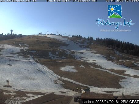
Feldberg Weather (Next 3 days): The snow forecast for Feldberg is: Mild with moderate rain (total 13.0mm) on Tue night, Becoming colder with a light covering of snow, mostly falling on Wed night. Freeze-thaw conditions (max 10°C on Tue afternoon, min 0°C on Wed night). Winds decreasing (fresh winds from the ESE on Mon night, calm by Tue night).
Feldberg Weather (Days 4-6): A dusting of snow turning to light rain (total 2.0mm) on Fri night. Freeze-thaw conditions (max 9°C on Fri night, min -1°C on Sat afternoon). Winds increasing (calm on Thu afternoon, near gales from the WSW by Sat morning).
| Resort | Snow Depth | Temp. (°C) | Wind (km/h) | Weather | ||
|---|---|---|---|---|---|---|
| Top Lift: | 0.0 m | 9 | ||||
| Middle Lift: | 11 | |||||
| Bottom Lift: | 0.0 m | 13 |
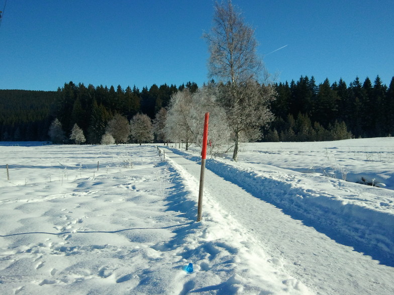
Latest snow reports near Feldberg:

Mon 14 | Tuesday 15 | Wednesday 16 | Thursday 17 | Friday 18 | Saturday 19 | Sunday 20 | ||||||||||||||
PM | night | AM | PM | night | AM | PM | night | AM | PM | night | AM | PM | night | AM | PM | night | AM | PM | night | |
rain shwrs | some clouds | light rain | risk thun- der | mod. rain | light rain | light snow | light snow | light snow | light snow | light snow | cloudy | clear | rain shwrs | light snow | light snow | snow shwrs | clear | cloudy | light snow | |
km/h | ||||||||||||||||||||
Snow map |  |  |  |  |  |  |  | |||||||||||||
— | — | — | — | — | — | — | 5 | — | — | 1.0 | — | — | — | — | — | — | — | — | 2.0 | |
2.0 | — | 1.0 | 2.0 | 6 | 1.0 | 1.0 | — | — | — | — | — | — | 1.0 | 1.0 | — | — | — | — | — | |
max°C | 9 | 9 | 7 | 10 | 10 | 4 | 4 | 1 | 1 | 1 | 2 | 3 | 8 | 9 | 3 | -1 | 0 | 1 | 3 | 2 |
min°C | 7 | 8 | 7 | 9 | 5 | 4 | 2 | 0 | 0 | 1 | 1 | 2 | 6 | 5 | 2 | -1 | 0 | 0 | 3 | 2 |
6 | 4 | 6 | 7 | 1 | 1 | -3 | -3 | -2 | 1 | -2 | -2 | 5 | -1 | -6 | -8 | -4 | -4 | -2 | -5 | |
74 | 81 | 94 | 71 | 83 | 100 | 99 | 100 | 99 | 99 | 98 | 99 | 78 | 75 | 98 | 95 | 88 | 77 | 84 | 98 | |
2750 | 2800 | 2550 | 2800 | 2350 | 2200 | 2000 | 1650 | 1650 | 1950 | 2500 | 3100 | 2950 | 2700 | 1850 | 1300 | 1450 | 1600 | 1900 | 1700 | |
— | — | 6:39 | — | — | 6:37 | — | — | 6:35 | — | — | 6:33 | — | — | 6:31 | — | — | 6:30 | — | — | |
— | 8:15 | — | — | 8:15 | — | — | 8:17 | — | — | 8:19 | — | — | 8:20 | — | — | 8:22 | — | — | 8:22 | |
Mild with moderate rain (total 13.0mm) on Tue night, Becoming colder with a light covering of snow, mostly falling on Wed night. Freeze-thaw conditions (max 10°C on Tue afternoon, min 0°C on Wed night). Winds decreasing (fresh winds from the ESE on Mon night, calm by Tue night).
A dusting of snow turning to light rain (total 2.0mm) on Fri night. Freeze-thaw conditions (max 9°C on Fri night, min -1°C on Sat afternoon). Winds increasing (calm on Thu afternoon, near gales from the WSW by Sat morning).
Latest snow reports near Feldberg:
| Top snow depth: | 0 cm |
|---|---|
| Bottom snow depth: | 0 cm |
| Fresh snowfall depth: | — |
| Last snowfall: | 16 Mar 2025 |
| Snow Alerts | Create Alert |
0.2 | Bluebird Powder days Fresh snow, mostly sunny, light wind. |
|---|---|
0.6 | Powder days Fresh snow, limited sun, any wind. |
0.1 | Bluebird days Average snow, mostly sunny, light wind. |


The above table gives the weather forecast for Feldberg at the specific elevation of 1448 m. Our sophisticated weather models allow us to provide snow forecasts for the top, middle and bottom ski stations of Feldberg. To access the weather forecasts for the other elevations, use the tab navigation above the table. For a wider view of the weather, check out the Weather Map of Germany.
Click here to read further information on freezing levels and how we forecast our temperatures.
Overall 4.0 Based on 13 votes and 10 reviews
Drove to Feldberg from Basel which took a couple of hours due to the snow. We arrived to fantastic conditions with powder everywhere. The sun popped its head out a few times for perfect visibility. The staff in the ski rental were super helpful & friendly. We were just skiing for the day. Skis, boots & poles for 2 adults & a 16 & 12 year old was just 60 euros all in, with the lift passes just 36€ & 24€ for adult & child; great value. Plenty of slopes to get stuck into for the day; a great experience. Just 1 hour 10 minutes driving back to Basel on clear roads. Would definitely recommend.
Arran Smith from United Kingdom writes:
Drove to Feldberg from Basel which took a couple of hours due to the snow. We arrived to fantastic conditions with powder everywhere. The sun popped its head out a few times for perfect visibility.
The staff in the ski rental were super helpful & friendly. We were just skiing for the day. Skis, boots & poles for 2 adults & a 16 & 12 year old was just 60 euros all in, with the lift passes just 36€ & 24€ for adult & child; great value.
Plenty of slopes to get stuck into for the day; a great experience. Just 1 hour 10 minutes driving back to Basel on clear roads. Would definitely recommend.
The Feldberg skiing weather widget is available to embed on external websites free of charge. It provides a daily summary of our Feldberg snow forecast and current weather conditions. Simply go to the feed configuration page and follow the 3 simple steps to grab the custom html code snippet and paste it into your own site. You can choose the snow forecast elevation (summit, mid-mountain or bottom lift) and metric/imperial units for the snow forecast feed to suit your own website…. Click here to get the code.
View detailed snow forecast for Feldberg at:
snow-forecast.com


 Nearest