

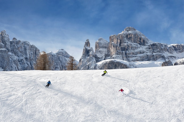
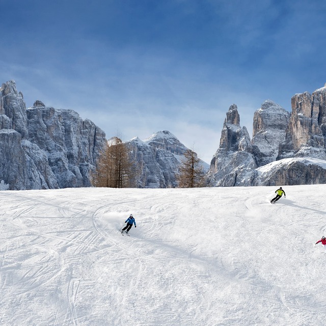
Massive Snowfall in the Alps
A huge snowfall is underway in the Alps, by far the biggest of the 24-25 season.
Please sign in with your Snow-Forecast account details below.


Corvara (Alta Badia) Weather (Next 3 days): The snow forecast for Corvara (Alta Badia) is: Light rain (total 7.0mm), mostly falling on Mon afternoon. Freeze-thaw conditions (max 3°C on Mon afternoon, min -2°C on Sat morning). Wind will be generally light.
Corvara (Alta Badia) Weather (Days 4-6): Moderate rain (total 18.0mm) heaviest on Wed afternoon, then becoming colder with a dusting of snow on Wed night. Freeze-thaw conditions (max 4°C on Tue afternoon, min -2°C on Thu night). Wind will be generally light.
| Resort | Snow Depth | Temp. (°C) | Wind (km/h) | Weather | ||
|---|---|---|---|---|---|---|
| Top Lift: | -1 | |||||
| Middle Lift: | 2 | |||||
| Bottom Lift: | 5 |
Latest snow reports near Corvara (Alta Badia):
Rain reported from Sillian at 1084 metres elevation one km SSE of Sillian but it is forecast cold enough for snow at higher elevations in the ski area from Sillian
Light rain reported from Rolle Pass Airport at 2083 metres elevation only 2 kms S of Passo Rolle but it is forecast cold enough for snow at the ski area from Passo Rolle

Saturday 19 | Sunday 20 | Monday 21 | Tuesday 22 | Wednesday 23 | Thursday 24 | Friday 25 | |||||||||||||||
AM | PM | night | AM | PM | night | AM | PM | night | AM | PM | night | AM | PM | night | AM | PM | night | AM | PM | night | |
cloudy | light snow | snow shwrs | some clouds | snow shwrs | light snow | some clouds | light rain | rain shwrs | light rain | risk thun- der | light snow | light snow | mod. rain | light snow | light snow | rain shwrs | snow shwrs | some clouds | snow shwrs | snow shwrs | |
km/h | |||||||||||||||||||||
Snow map |  |  |  |  |  |  |  | ||||||||||||||
— | — | — | — | — | — | — | — | — | — | — | — | — | — | 2.0 | 1.0 | — | 1.0 | — | — | — | |
— | — | — | — | — | — | — | 5 | 2.0 | 1.0 | 5 | 2.0 | — | 6 | — | — | 4 | — | — | 1.0 | — | |
max°C | -1 | 0 | -1 | 0 | 2 | 1 | 2 | 3 | 2 | 3 | 4 | 2 | 2 | 3 | 2 | 2 | 3 | 1 | -1 | 2 | 0 |
min°C | -2 | -1 | -2 | -1 | 1 | 0 | 1 | 3 | 1 | 2 | 3 | 1 | 1 | 3 | 0 | 1 | 3 | -2 | -1 | 2 | -2 |
-4 | -4 | -6 | -5 | -2 | -3 | -2 | 0 | 1 | 0 | 1 | 0 | 1 | 1 | -2 | 0 | 0 | -4 | -4 | 0 | -2 | |
81 | 95 | 89 | 85 | 86 | 97 | 80 | 85 | 76 | 72 | 84 | 87 | 86 | 90 | 98 | 83 | 75 | 72 | 67 | 52 | 73 | |
2350 | 2450 | 2250 | 2550 | 2750 | 2500 | 2800 | 2850 | 2800 | 2850 | 2900 | 2700 | 2750 | 2850 | 2650 | 2700 | 2800 | 2200 | 2450 | 2750 | 2100 | |
6:18 | — | — | 6:16 | — | — | 6:15 | — | — | 6:13 | — | — | 6:11 | — | — | 6:09 | — | — | 6:07 | — | — | |
— | — | 8:04 | — | — | 8:06 | — | — | 8:07 | — | — | 8:07 | — | — | 8:09 | — | — | 8:10 | — | — | 8:12 | |
Light rain (total 7.0mm), mostly falling on Mon afternoon. Freeze-thaw conditions (max 3°C on Mon afternoon, min -2°C on Sat morning). Wind will be generally light.
Moderate rain (total 18.0mm) heaviest on Wed afternoon, then becoming colder with a dusting of snow on Wed night. Freeze-thaw conditions (max 4°C on Tue afternoon, min -2°C on Thu night). Wind will be generally light.
Latest snow reports near Corvara (Alta Badia):
Rain reported from Sillian at 1084 metres elevation one km SSE of Sillian but it is forecast cold enough for snow at higher elevations in the ski area from Sillian
Light rain reported from Rolle Pass Airport at 2083 metres elevation only 2 kms S of Passo Rolle but it is forecast cold enough for snow at the ski area from Passo Rolle
| Top snow depth: | — |
|---|---|
| Bottom snow depth: | — |
| Fresh snowfall depth: | 19 cm |
| Last snowfall: | 18 Apr 2025 |
| Snow Alerts | Create Alert |
0.6 | Bluebird Powder days Fresh snow, mostly sunny, light wind. |
|---|---|
1.9 | Powder days Fresh snow, limited sun, any wind. |
1.0 | Bluebird days Average snow, mostly sunny, light wind. |
The above table gives the weather forecast for Corvara (Alta Badia) at the specific elevation of 2500 m. Our sophisticated weather models allow us to provide snow forecasts for the top, middle and bottom ski stations of Corvara (Alta Badia). To access the weather forecasts for the other elevations, use the tab navigation above the table. For a wider view of the weather, check out the Weather Map of Italy.
Click here to read further information on freezing levels and how we forecast our temperatures.
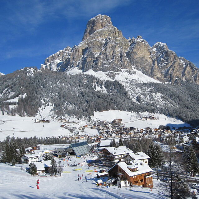
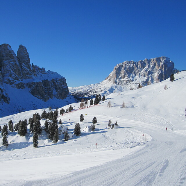
Resort name is also written as Corvara.
Overall 4.3 Based on 15 votes and 11 reviews
Three times here and so much to explore. 2016 had a poor start with snow but the piste maintenance was superb. Did the Sella Ronda in both directions with all pistes perfect. Many mountain restaurants and good food at good prices. Corvara is very quiet; don't go for apres-ski, but go for no queues, easy access, stunning scenery and friendly service. Can't fault it and struggling to find a better place for a relaxing and adventurous ski week.
Terry Roberts from United Kingdom writes:
Three times here and so much to explore. 2016 had a poor start with snow but the piste maintenance was superb. Did the Sella Ronda in both directions with all pistes perfect. Many mountain restaurants and good food at good prices. Corvara is very quiet; don't go for apres-ski, but go for no queues, easy access, stunning scenery and friendly service. Can't fault it and struggling to find a better place for a relaxing and adventurous ski week.
Read 10 more reviews of Corvara (Alta Badia) or submit your own
The Corvara (Alta Badia) skiing weather widget is available to embed on external websites free of charge. It provides a daily summary of our Corvara (Alta Badia) snow forecast and current weather conditions. Simply go to the feed configuration page and follow the 3 simple steps to grab the custom html code snippet and paste it into your own site. You can choose the snow forecast elevation (summit, mid-mountain or bottom lift) and metric/imperial units for the snow forecast feed to suit your own website…. Click here to get the code.
View detailed snow forecast for Corvara (Alta Badia) at:
snow-forecast.com


 Nearest