

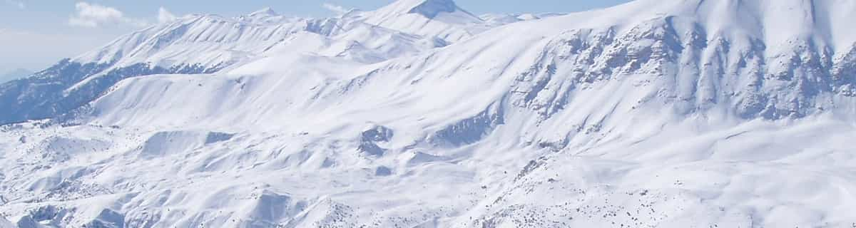
Massive Snowfall in the Alps
A huge snowfall is underway in the Alps, by far the biggest of the 24-25 season.
Please sign in with your Snow-Forecast account details below.


Champorcher Weather (Next 3 days): The snow forecast for Champorcher is: A dusting of snow turning to light rain (total 8.0mm) on Tue night. Freeze-thaw conditions (max 6°C on Tue afternoon, min -1°C on Sun night). Wind will be generally light.
Champorcher Weather (Days 4-6): Moderate rain (total 12.0mm), heaviest on Wed night. Mild temperatures (max 7°C on Thu afternoon, min 2°C on Wed night). Wind will be generally light.
| Resort | Snow Depth | Temp. (°C) | Wind (km/h) | Weather | ||
|---|---|---|---|---|---|---|
| Top Lift: | -3 | |||||
| Middle Lift: | 0 | |||||
| Bottom Lift: | 2 |
Latest snow reports near Champorcher:
Light rain reported from Promiod at 1469 metres elevation only 3 kms ESE of Torgnon but it is forecast cold enough for snow at the ski area from Torgnon
Light rain reported from Donnas at 322 metres elevation 8 kms E of Champorcher but it is forecast cold enough for snow at higher elevations in the ski area from Champorcher

Monday 21 | Tuesday 22 | Wednesday 23 | Thursday 24 | Friday 25 | Saturday 26 | ||||||||||||||
night | AM | PM | night | AM | PM | night | AM | PM | night | AM | PM | night | AM | PM | night | AM | PM | night | |
snow shwrs | some clouds | some clouds | clear | some clouds | light rain | light rain | cloudy | risk thun- der | rain shwrs | some clouds | rain shwrs | clear | clear | clear | clear | cloudy | light rain | light snow | |
km/h | |||||||||||||||||||
Snow map |  |  |  |  |  |  |  | ||||||||||||
1.0 | — | — | — | — | — | — | — | — | — | — | — | — | — | — | — | — | — | 4 | |
— | — | — | — | — | 2.0 | 3 | — | 3 | 10 | — | 1.0 | — | — | — | — | — | 1.0 | 4 | |
max°C | 1 | 2 | 4 | 3 | 4 | 6 | 5 | 5 | 6 | 4 | 5 | 7 | 5 | 6 | 7 | 6 | 5 | 6 | 5 |
min°C | -1 | 0 | 3 | 2 | 2 | 5 | 3 | 3 | 5 | 2 | 3 | 7 | 2 | 3 | 7 | 3 | 3 | 6 | 2 |
-1 | 0 | 3 | 1 | 2 | 5 | 3 | 3 | 4 | 0 | 1 | 6 | -2 | 0 | 7 | 2 | 3 | 6 | 2 | |
92 | 70 | 76 | 69 | 69 | 74 | 71 | 63 | 74 | 84 | 59 | 67 | 60 | 32 | 51 | 66 | 55 | 79 | 96 | |
1900 | 2250 | 2500 | 2350 | 2500 | 2700 | 2550 | 2550 | 2650 | 2400 | 2700 | 2750 | 2550 | 2800 | 2900 | 2800 | 2900 | 2900 | 2450 | |
— | 6:33 | — | — | 6:31 | — | — | 6:31 | — | — | 6:28 | — | — | 6:26 | — | — | 6:26 | — | — | |
— | — | — | 8:22 | — | — | 8:22 | — | — | 8:24 | — | — | 8:25 | — | — | 8:27 | — | — | 8:29 | |
A dusting of snow turning to light rain (total 8.0mm) on Tue night. Freeze-thaw conditions (max 6°C on Tue afternoon, min -1°C on Sun night). Wind will be generally light.
Moderate rain (total 12.0mm), heaviest on Wed night. Mild temperatures (max 7°C on Thu afternoon, min 2°C on Wed night). Wind will be generally light.
Latest snow reports near Champorcher:
Light rain reported from Promiod at 1469 metres elevation only 3 kms ESE of Torgnon but it is forecast cold enough for snow at the ski area from Torgnon
Light rain reported from Donnas at 322 metres elevation 8 kms E of Champorcher but it is forecast cold enough for snow at higher elevations in the ski area from Champorcher
| Top snow depth: | — |
|---|---|
| Bottom snow depth: | — |
| Fresh snowfall depth: | 16 cm |
| Last snowfall: | 19 Apr 2025 |
| Snow Alerts | Create Alert |
0.3 | Bluebird Powder days Fresh snow, mostly sunny, light wind. |
|---|---|
0.6 | Powder days Fresh snow, limited sun, any wind. |
0.4 | Bluebird days Average snow, mostly sunny, light wind. |
The above table gives the weather forecast for Champorcher at the specific elevation of 1975 m. Our sophisticated weather models allow us to provide snow forecasts for the top, middle and bottom ski stations of Champorcher. To access the weather forecasts for the other elevations, use the tab navigation above the table. For a wider view of the weather, check out the Weather Map of Italy.
Click here to read further information on freezing levels and how we forecast our temperatures.
Overall 3.9 Based on 3 votes and 1 review
We visited Champorcher in February of 2019 just for the day. The drive up from Pont St Martin is really nice and the Valley really lovely. The Cable Car is 5 minutes on from Champorcher at Chardoney and is an attractive old village with a few bars and a couple of hotels. Unfortunately, the snowfall was less than recent years and upon arrival we noticed a few runs were closed including the long black down to Chardoney which looked quite testing from our view going up in the old gondola. With a few of the runs being closed we expected slushy and pretty basic skiing to be had but were really surprised. It was a Saturday and quite busy with day trippers and school ski clubs but basically just used the 2 lifts up after the gondola. The resort is, basically, a big bowl though very pretty and the skiing was quite challenging and steeper than we had expected and the snow was pretty good. Only a couple of canteen style restaurants to be had but plenty to keep any visitors busy for a weekend or 3 day break and i'd imagine very good for families. There is a long piste set aside also for ski tourers up past the Rifugio Dondena that would be great to try if we'd have had time. But would certainly recommend a weekend without hesitation. We stayed just outside of Champorcher in the bed and breakfast: De Grand Maman run by the very friendly Massimiliano which again we would recommend without hesitation.
David Legget from United Kingdom writes:
We visited Champorcher in February of 2019 just for the day. The drive up from Pont St Martin is really nice and the Valley really lovely. The Cable Car is 5 minutes on from Champorcher at Chardoney and is an attractive old village with a few bars and a couple of hotels. Unfortunately, the snowfall was less than recent years and upon arrival we noticed a few runs were closed including the long black down to Chardoney which looked quite testing from our view going up in the old gondola. With a few of the runs being closed we expected slushy and pretty basic skiing to be had but were really surprised. It was a Saturday and quite busy with day trippers and school ski clubs but basically just used the 2 lifts up after the gondola. The resort is, basically, a big bowl though very pretty and the skiing was quite challenging and steeper than we had expected and the snow was pretty good. Only a couple of canteen style restaurants to be had but plenty to keep any visitors busy for a weekend or 3 day break and i'd imagine very good for families. There is a long piste set aside also for ski tourers up past the Rifugio Dondena that would be great to try if we'd have had time. But would certainly recommend a weekend without hesitation. We stayed just outside of Champorcher in the bed and breakfast: De Grand Maman run by the very friendly Massimiliano which again we would recommend without hesitation.
The Champorcher skiing weather widget is available to embed on external websites free of charge. It provides a daily summary of our Champorcher snow forecast and current weather conditions. Simply go to the feed configuration page and follow the 3 simple steps to grab the custom html code snippet and paste it into your own site. You can choose the snow forecast elevation (summit, mid-mountain or bottom lift) and metric/imperial units for the snow forecast feed to suit your own website…. Click here to get the code.
View detailed snow forecast for Champorcher at:
snow-forecast.com


 Nearest