

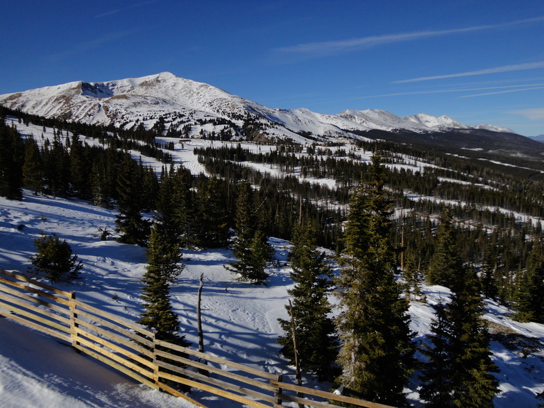
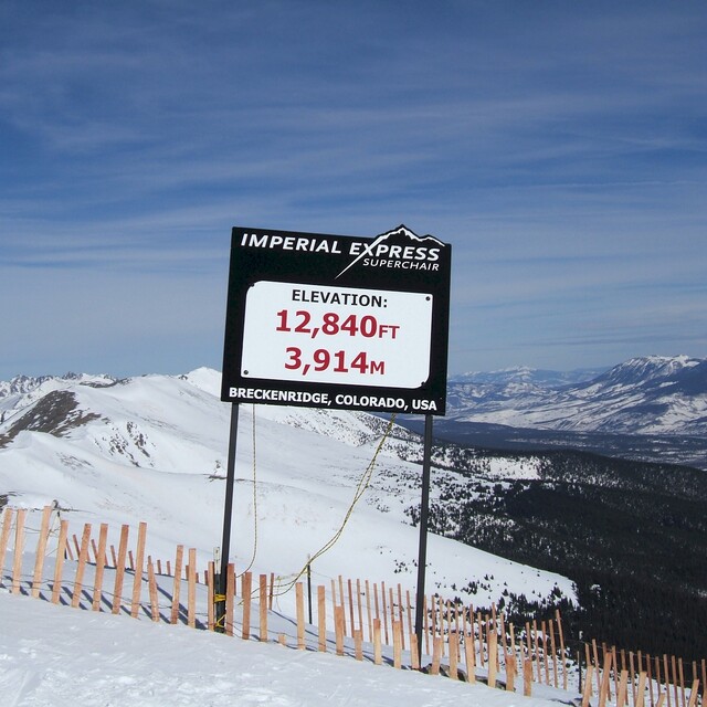
US Set To Be Home To World’s New Highest Ski Lift
The US looks set to become the new home of the world’s highest ski lift after Colorado’s Copper Mountain got the go ahead from the White River National Forest to expand its ski area.
Please sign in with your Snow-Forecast account details below.


Breckenridge Weather (Next 3 days): The snow forecast for Breckenridge is: Drizzle on Thu afternoon followed by colder weather and a moderate fall of snow, heaviest on Fri afternoon. Freeze-thaw conditions (max 6°C on Thu afternoon, min -12°C on Fri night). Winds decreasing (fresh winds from the WSW on Thu afternoon, calm by Sat morning).
Breckenridge Weather (Days 4-6): Light rain (total 4.0mm), mostly falling on Sun afternoon. Freeze-thaw conditions (max 8°C on Tue morning, min -4°C on Sun night). Wind will be generally light.
| Resort | Snow Depth | Temp. (°C) | Wind (km/h) | Weather | ||
|---|---|---|---|---|---|---|
| Top Lift: | 1.5 m | -2 | ||||
| Middle Lift: | 2 | |||||
| Bottom Lift: | 0.3 m | 6 |
Latest snow reports near Breckenridge:
Light snow reported from Red Cliff Pass Airport at 11732 feet one mile SSE of Copper Mountain but it is probably falling as rain at the bottom of the ski area from Copper Mountain
Moderate snow reported from Red Cliff Pass Airport at 11732 feet one mile SSE of Copper Mountain but it is probably falling as rain at the bottom of the ski area from Copper Mountain

Thursday 17 | Friday 18 | Saturday 19 | Sunday 20 | Monday 21 | Tuesday 22 | Wednesday 23 | |||||||||||||||
AM | PM | night | AM | PM | night | AM | PM | night | AM | PM | night | AM | PM | night | AM | PM | night | AM | PM | night | |
some clouds | rain shwrs | snow shwrs | light snow | mod. snow | mod. snow | some clouds | light snow | snow shwrs | light snow | rain shwrs | clear | clear | rain shwrs | clear | clear | some clouds | some clouds | some clouds | light rain | rain shwrs | |
km/h | |||||||||||||||||||||
Snow map |  |  |  |  |  |  |  | ||||||||||||||
— | — | 2.0 | 2.0 | 5 | 6 | — | 2.0 | 1.0 | — | — | — | — | — | — | — | — | — | — | — | — | |
— | 1.0 | — | — | — | — | — | — | — | — | 2.0 | — | — | 2.0 | — | — | — | — | — | 1.0 | 1.0 | |
max°C | 5 | 6 | 1 | -2 | -3 | -5 | 0 | 1 | -6 | 1 | 3 | -2 | 6 | 7 | 0 | 8 | 8 | 1 | 9 | 9 | 2 |
min°C | 4 | 4 | -3 | -2 | -3 | -12 | -4 | -1 | -9 | -3 | 2 | -4 | 3 | 6 | -1 | 5 | 7 | -1 | 5 | 7 | 0 |
0 | -1 | -6 | -4 | -3 | -12 | -4 | -4 | -12 | -6 | -3 | -4 | -2 | 3 | -3 | 1 | 4 | -4 | 3 | 5 | -2 | |
43 | 32 | 53 | 50 | 84 | 94 | 70 | 64 | 88 | 76 | 56 | 81 | 47 | 38 | 60 | 35 | 32 | 67 | 41 | 30 | 55 | |
3450 | 3700 | 2950 | 2600 | 2500 | 1900 | 2150 | 2950 | 1900 | 2500 | 3300 | 2500 | 3450 | 3800 | 3000 | 3650 | 3900 | 3150 | 3650 | 4000 | 3300 | |
6:24 | — | — | 6:22 | — | — | 6:20 | — | — | 6:20 | — | — | 6:18 | — | — | 6:16 | — | — | 6:16 | — | — | |
— | 7:43 | — | — | 7:44 | — | — | 7:45 | — | — | 7:45 | — | — | 7:46 | — | — | 7:47 | — | — | 7:49 | — | |
Drizzle on Thu afternoon followed by colder weather and a moderate fall of snow, heaviest on Fri afternoon. Freeze-thaw conditions (max 6°C on Thu afternoon, min -12°C on Fri night). Winds decreasing (fresh winds from the WSW on Thu afternoon, calm by Sat morning).
Light rain (total 4.0mm), mostly falling on Sun afternoon. Freeze-thaw conditions (max 8°C on Tue morning, min -4°C on Sun night). Wind will be generally light.
Latest snow reports near Breckenridge:
Light snow reported from Red Cliff Pass Airport at 11732 feet one mile SSE of Copper Mountain but it is probably falling as rain at the bottom of the ski area from Copper Mountain
Moderate snow reported from Red Cliff Pass Airport at 11732 feet one mile SSE of Copper Mountain but it is probably falling as rain at the bottom of the ski area from Copper Mountain
| Top snow depth: | 149 cm |
|---|---|
| Bottom snow depth: | 30 cm |
| Fresh snowfall depth: | 1 cm |
| Last snowfall: | 16 Apr 2025 |
| Snow Alerts | Create Alert |
0.2 | Bluebird Powder days Fresh snow, mostly sunny, light wind. |
|---|---|
1.7 | Powder days Fresh snow, limited sun, any wind. |
0.1 | Bluebird days Average snow, mostly sunny, light wind. |
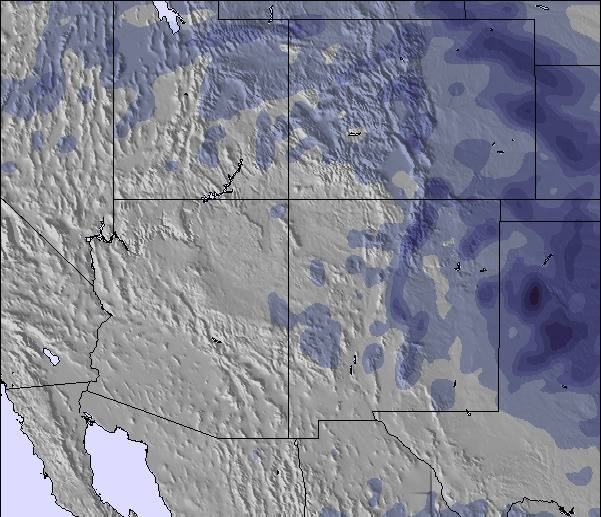
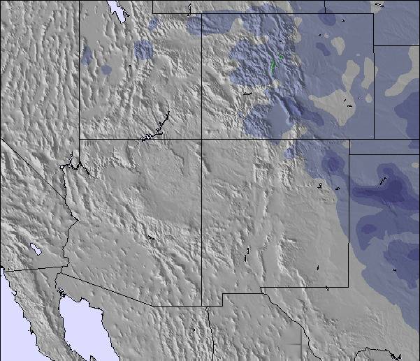
The above table gives the weather forecast for Breckenridge at the specific elevation of 2925 m. Our sophisticated weather models allow us to provide snow forecasts for the top, middle and bottom ski stations of Breckenridge. To access the weather forecasts for the other elevations, use the tab navigation above the table. For a wider view of the weather, check out the Weather Map of United States.
Click here to read further information on freezing levels and how we forecast our temperatures.
Overall 4.3 Based on 11 votes and 9 reviews
Breckenridge is a great mountain and wonderful if you have kids. The terrain parks are great and the adventure forests are heaps of fun. Unfortunately, snow was ordinary and lots of rocks and trees around. Second year running that we hit poor snow conditions in the USA (went to Heavenly last January). Still the runs are great and lots of variety. Beware of the altitude..it really does hit you for six and it's quite scary not getting enough oxygen. The altitude will probably mean other Colorado resorts in the future. Don't forget to check out the Silverthorne outlets as they are great. Foodwise all was great..went to Lucha, Breck Brewery (go for the 3-6 happy hour) and Quandary Grill (2 for 1 burgers on Tues that are awesome).
Megan Saville from Australia writes:
Breckenridge is a great mountain and wonderful if you have kids. The terrain parks are great and the adventure forests are heaps of fun. Unfortunately, snow was ordinary and lots of rocks and trees around. Second year running that we hit poor snow conditions in the USA (went to Heavenly last January). Still the runs are great and lots of variety. Beware of the altitude..it really does hit you for six and it's quite scary not getting enough oxygen. The altitude will probably mean other Colorado resorts in the future. Don't forget to check out the Silverthorne outlets as they are great. Foodwise all was great..went to Lucha, Breck Brewery (go for the 3-6 happy hour) and Quandary Grill (2 for 1 burgers on Tues that are awesome).
The Breckenridge skiing weather widget is available to embed on external websites free of charge. It provides a daily summary of our Breckenridge snow forecast and current weather conditions. Simply go to the feed configuration page and follow the 3 simple steps to grab the custom html code snippet and paste it into your own site. You can choose the snow forecast elevation (summit, mid-mountain or bottom lift) and metric/imperial units for the snow forecast feed to suit your own website…. Click here to get the code.
View detailed snow forecast for Breckenridge at:
snow-forecast.com

 Nearest