
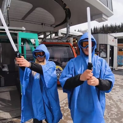
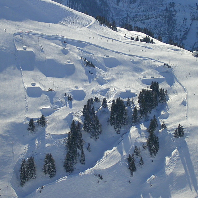
Ski Areas Ready for Star Wars Day
Several North American ski areas that are still open plan to celebrate the unofficial Star Wars Day tomorrow, May the Fourth (be with you).
Please sign in with your Snow-Forecast account details below.


Avoriaz Weather (Next 3 days): The snow forecast for Avoriaz is: A dusting of new snow. Temperatures will be below freezing (max 0°C on Tue morning, min -2°C on Wed afternoon). Wind will be generally light.
Avoriaz Weather (Days 4-6): Moderate rain (total 11.0mm), heaviest on Fri afternoon. Freeze-thaw conditions (max 6°C on Sun afternoon, min -1°C on Fri morning). Wind will be generally light.
| Resort | Snow Depth | Temp. (°F) | Wind (mph) | Weather | ||
|---|---|---|---|---|---|---|
| Top Lift: | 0 ft | 30 | ||||
| Middle Lift: | 36 | |||||
| Bottom Lift: | 0 ft | 39 |
Latest snow reports near Avoriaz:
Light rain reported from Sion at 339 metres elevation only 2 kms NW of Veysonnaz-Printse but it is forecast cold enough for snow at higher elevations in the ski area from Veysonnaz-Printse

Tuesday 6 | Wednesday 7 | Thursday 8 | Friday 9 | Saturday 10 | Sunday 11 | Monday 12 | |||||||||||||||
AM | PM | night | AM | PM | night | AM | PM | night | AM | PM | night | AM | PM | night | AM | PM | night | AM | PM | night | |
cloudy | cloudy | cloudy | light snow | light snow | light snow | light snow | light snow | snow shwrs | some clouds | light snow | snow shwrs | clear | rain shwrs | rain shwrs | clear | risk thun- der | rain shwrs | rain shwrs | rain shwrs | rain shwrs | |
mph | |||||||||||||||||||||
Snow map |  |  |  |  |  |  |  | ||||||||||||||
— | — | — | — | 1 | 0.4 | — | — | — | — | — | 0.4 | — | — | — | — | — | — | — | — | — | |
— | — | — | — | — | — | — | — | — | — | 0.08 | — | — | 0.1 | 0.04 | — | 0.08 | 0.1 | 0.04 | 0.2 | 0.08 | |
max°F | 32 | 32 | 32 | 30 | 30 | 28 | 30 | 32 | 32 | 34 | 36 | 36 | 37 | 39 | 39 | 41 | 43 | 41 | 41 | 43 | 41 |
min°F | 30 | 32 | 30 | 30 | 28 | 28 | 28 | 30 | 30 | 30 | 34 | 34 | 34 | 39 | 37 | 37 | 43 | 37 | 37 | 41 | 37 |
30 | 32 | 30 | 30 | 28 | 23 | 28 | 30 | 30 | 30 | 34 | 30 | 34 | 39 | 37 | 37 | 43 | 37 | 34 | 41 | 37 | |
84 | 95 | 96 | 98 | 98 | 91 | 90 | 91 | 90 | 83 | 80 | 75 | 60 | 65 | 59 | 52 | 70 | 82 | 70 | 72 | 89 | |
7500 | 7700 | 7200 | 6600 | 6100 | 6200 | 6700 | 7400 | 7200 | 7700 | 8400 | 8000 | 8500 | 9200 | 9000 | 9400 | 9700 | 9200 | 9200 | 9500 | 9000 | |
6:11 | — | — | 6:11 | — | — | 6:09 | — | — | 6:07 | — | — | 6:07 | — | — | 6:05 | — | — | 6:03 | — | — | |
— | — | 8:46 | — | — | 8:47 | — | — | 8:49 | — | — | 8:50 | — | — | 8:52 | — | — | 8:52 | — | — | 8:53 | |
A dusting of new snow. Temperatures will be below freezing (max 0°C on Tue morning, min -2°C on Wed afternoon). Wind will be generally light.
Moderate rain (total 11.0mm), heaviest on Fri afternoon. Freeze-thaw conditions (max 6°C on Sun afternoon, min -1°C on Fri morning). Wind will be generally light.
Latest snow reports near Avoriaz:
Light rain reported from Sion at 339 metres elevation only 2 kms NW of Veysonnaz-Printse but it is forecast cold enough for snow at higher elevations in the ski area from Veysonnaz-Printse
| Top snow depth: | 0 in |
|---|---|
| Bottom snow depth: | 0 in |
| Fresh snowfall depth: | — |
| Last snowfall: | 23 Apr 2025 |
| Snow Alerts | Create Alert |
0.1 | Bluebird Powder days Fresh snow, mostly sunny, light wind. |
|---|---|
1.5 | Powder days Fresh snow, limited sun, any wind. |
0.2 | Bluebird days Average snow, mostly sunny, light wind. |


The above table gives the weather forecast for Avoriaz at the specific elevation of 2254 m. Our sophisticated weather models allow us to provide snow forecasts for the top, middle and bottom ski stations of Avoriaz. To access the weather forecasts for the other elevations, use the tab navigation above the table. For a wider view of the weather, check out the Weather Map of France.
Click here to read further information on freezing levels and how we forecast our temperatures.
Overall 4.2 Based on 52 votes and 42 reviews
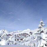
If you are looking for a totally ski in/out experience, with short airport transfers, then you cannot go wrong with a visit to Avoriaz. Nightlife and apres is limited, as it is a very family focused resort. But there is still a great buzz and ambience with music pumping out at La Folie Douce, which is pretty central and within staggering or skiing distance to all residencies. You will not be disappointed with the ski coverage on the Portes du Soleil lift pass, that takes you into Switzerland. Snow conditions have always been perfect when I have visited. Usually big dumps before I arrive and clear blue skies for my week. I think this may be sheer luck. Eating and drinking out is what it is .. you are in France. Although this year I have booked into the Club Belambra Hotel on a fully inclusive deal. One of the very few hotels in this resort. Fingers crossed, it is worth it. No matter where you decide to go, happy and safe skiing to you all.
Liam from Ireland writes:
If you are looking for a totally ski in/out experience, with short airport transfers, then you cannot go wrong with a visit to Avoriaz.
Nightlife and apres is limited, as it is a very family focused resort. But there is still a great buzz and ambience with music pumping out at La Folie Douce, which is pretty central and within staggering or skiing distance to all residencies.
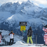
You will not be disappointed with the ski coverage on the Portes du Soleil lift pass, that takes you into Switzerland.
Snow conditions have always been perfect when I have visited. Usually big dumps before I arrive and clear blue skies for my week. I think this may be sheer luck.
Eating and drinking out is what it is .. you are in France.
Although this year I have booked into the Club Belambra Hotel on a fully inclusive deal. One of the very few hotels in this resort. Fingers crossed, it is worth it.
No matter where you decide to go, happy and safe skiing to you all.
The Avoriaz skiing weather widget is available to embed on external websites free of charge. It provides a daily summary of our Avoriaz snow forecast and current weather conditions. Simply go to the feed configuration page and follow the 3 simple steps to grab the custom html code snippet and paste it into your own site. You can choose the snow forecast elevation (summit, mid-mountain or bottom lift) and metric/imperial units for the snow forecast feed to suit your own website…. Click here to get the code.
View detailed snow forecast for Avoriaz at:
snow-forecast.com


 Nearest