

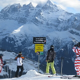
Portillo Re-Opens To Guests Arriving By Helicopter
Chile’s famous Portillo ski resort is reported to have re-opened to guests arriving by helicopter after being cut off by road for more than two weeks by over 6m/20 feet of snowfall.

Next 3 days weather summary:Heavy rain (total 50.0mm), heaviest during Tue afternoon. Very mild (max 18°C on Mon afternoon, min 12°C on Mon afternoon). Wind will be generally light. | Days 4-6 weather summary:Moderate rain (total 10.0mm), heaviest on Thu afternoon. Very mild (max 15°C on Sat afternoon, min 10°C on Thu night). Wind will be generally light. | ||||||||||||||||
Mon 3 | Tuesday 4 | Wednesday 5 | Thursday 6 | Friday 7 | Saturday 8 | ||||||||||||
PM | night | AM | PM | night | AM | PM | night | AM | PM | night | AM | PM | night | AM | PM | night | |
t-storm risk | rain shwrs | clear | t-storm risk | rain shwrs | clear | t-storm risk | rain shwrs | clear | mod. rain | rain shwrs | clear | some clouds | clear | clear | clear | clear | |
km/h | |||||||||||||||||
Snow map |  |  |  |  |  |  | |||||||||||
— | — | — | — | — | — | — | — | — | — | — | — | — | — | — | — | — | |
mm | 11 | 13 | — | 16 | 7 | — | 2 | 1 | — | 7 | 3 | — | — | — | — | — | — |
max °C | 18 | 14 | 15 | 16 | 13 | 14 | 15 | 14 | 14 | 13 | 11 | 11 | 13 | 12 | 13 | 15 | 14 |
min °C | 12 | 14 | 14 | 12 | 12 | 12 | 15 | 13 | 13 | 11 | 10 | 10 | 12 | 11 | 11 | 14 | 14 |
chill °C | 11 | 13 | 14 | 11 | 11 | 12 | 15 | 13 | 13 | 11 | 10 | 10 | 12 | 11 | 11 | 14 | 14 |
Humid % | 85 | 64 | 56 | 80 | 71 | 66 | 69 | 53 | 62 | 91 | 74 | 65 | 66 | 50 | 38 | 40 | 36 |
Freeze m | 4200 | 4500 | 4450 | 4250 | 4400 | 4300 | 4300 | 4400 | 4300 | 4150 | 4200 | 4100 | 4200 | 4300 | 4300 | 4350 | 4500 |
— | — | 6:16 | — | — | 6:18 | — | — | 6:18 | — | — | 6:20 | — | — | 6:22 | — | — | |
— | 9:00 | — | — | 8:59 | — | — | 8:58 | — | — | 8:55 | — | — | 8:54 | — | — | 8:53 | |
Go pro and carve into:
Avalanche information: European Avalanche Warning Services (EAWS)
Latest snow reports near Avoriaz:
| Top snow depth: | 0 cm |
|---|---|
| Bottom snow depth: | 0 cm |
| Fresh snowfall depth: | — |
| Last snowfall: | 16 May 2026 |
| Snow Alerts | Create Alert |
0.0 | Bluebird Powder days Fresh snow, mostly sunny, light wind. |
|---|---|
0.1 | Powder days Fresh snow, limited sun, any wind. |
0.0 | Bluebird days Average snow, mostly sunny, light wind. |
The above table gives the weather forecast for Avoriaz at the specific elevation of 2254 m. Our sophisticated weather models allow us to provide snow forecasts for the top, middle and bottom ski stations of Avoriaz. To access the weather forecasts for the other elevations, use the tab navigation above the table. For a wider view of the weather, check out the Weather Map of France.
Click here to read further information on freezing levels and how we forecast our temperatures.
Overall 4.2 Based on 63 votes and 43 reviews
The skiing center absolutely cannot handle the capacity of people. There is nowhere to eat, poor service, no services in the evening except for a couple of bars, the slopes are crowded. I do not recommend.
David from Czechia writes:
The skiing center absolutely cannot handle the capacity of people. There is nowhere to eat, poor service, no services in the evening except for a couple of bars, the slopes are crowded. I do not recommend.


 Nearest