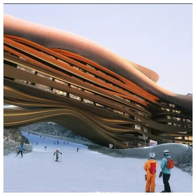
Future Of Saudi Arabia's Ski Resort Development Unclear
The status of a planned year-round outdoor ski area in Saudi Arabia is currently uncertain, and not just because of the current war in the region.

Asahidake Weather (Next 3 days): The snow forecast for Asahidake is: Light rain (total 3.0mm) on Sun morning. Becoming colder with heavy fall of snow, heaviest during Tue morning. Freeze-thaw conditions (max 4°C on Sun afternoon, min -6°C on Tue night). Winds increasing (calm on Sun afternoon, strong winds from the SSW by Tue morning).
Asahidake Weather (Days 4-6): A dusting of snow turning to light rain (total 9.0mm) on Fri night. Freeze-thaw conditions (max 5°C on Fri night, min -7°C on Wed morning). Winds decreasing (near gales from the SW on Wed night, light winds from the SSW by Fri morning).
| Resort | Snow Depth | Temp. (°C) | Wind (km/h) | Weather | ||
|---|---|---|---|---|---|---|
| Top Lift: | 1 | |||||
| Middle Lift: | 3 | |||||
| Bottom Lift: | 2 |

Sunday 5 | Monday 6 | Tuesday 7 | Wednesday 8 | Thursday 9 | Friday 10 | |||||||||||||
AM | PM | night | AM | PM | night | AM | PM | night | AM | PM | night | AM | PM | night | AM | PM | night | |
light rain | rain shwrs | some clouds | clear | some clouds | light snow | mod. snow | light snow | mod. snow | snow shwrs | clear | some clouds | clear | cloudy | some clouds | cloudy | light rain | mod. rain | |
km/h | ||||||||||||||||||
Snow map |  | 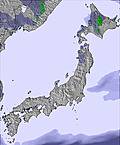 | 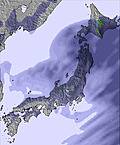 | 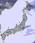 | 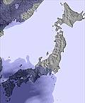 | 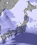 | ||||||||||||
— | — | — | — | — | 3 | 8 | 2 | 9 | 4 | — | — | — | — | — | — | — | — | |
1 | 1 | — | — | — | 1 | — | — | — | — | — | — | — | — | — | — | 2 | 7 | |
max °C | 3 | 4 | 4 | 2 | 3 | 3 | 1 | -4 | -5 | -6 | -4 | -1 | 0 | 1 | 2 | 3 | 3 | 5 |
min °C | 3 | 2 | 2 | 1 | 2 | 2 | -4 | -5 | -6 | -7 | -4 | -4 | -1 | 1 | 1 | 2 | 3 | 3 |
-2 | -2 | -3 | -4 | -2 | -5 | -11 | -14 | -14 | -15 | -12 | -14 | -9 | -6 | -4 | -1 | -1 | 0 | |
99 | 94 | 57 | 96 | 83 | 73 | 95 | 90 | 96 | 96 | 56 | 61 | 59 | 80 | 58 | 85 | 88 | 94 | |
1950 | 2050 | 2200 | 1500 | 1800 | 2000 | 1500 | 800 | 550 | 350 | 800 | 750 | 1250 | 1450 | 1850 | 1700 | 1850 | 2150 | |
5:03 | — | — | 5:01 | — | — | 5:01 | — | — | 4:58 | — | — | 4:56 | — | — | 4:56 | — | — | |
— | 5:59 | — | — | 6:00 | — | — | 6:00 | — | — | 6:01 | — | — | 6:04 | — | — | 6:05 | — | |
Light rain (total 3.0mm) on Sun morning. Becoming colder with heavy fall of snow, heaviest during Tue morning. Freeze-thaw conditions (max 4°C on Sun afternoon, min -6°C on Tue night). Winds increasing (calm on Sun afternoon, strong winds from the SSW by Tue morning).
A dusting of snow turning to light rain (total 9.0mm) on Fri night. Freeze-thaw conditions (max 5°C on Fri night, min -7°C on Wed morning). Winds decreasing (near gales from the SW on Wed night, light winds from the SSW by Fri morning).
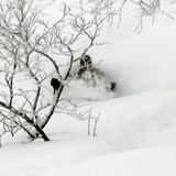
Latest snow reports near Asahidake:
Continuous light rain reported from Asahikawa at 240 metres elevation only 4 kms E of Santa Present Park but it is forecast cold enough for snow at higher elevations in the ski area from Santa Present Park
| Top snow depth: | — |
|---|---|
| Bottom snow depth: | — |
| Fresh snowfall depth: | — |
| Last snowfall: | 2 Apr 2026 |
| Snow Alerts | Create Alert |
1.2 | Bluebird Powder days Fresh snow, mostly sunny, light wind. |
|---|---|
2.0 | Powder days Fresh snow, limited sun, any wind. |
1.4 | Bluebird days Average snow, mostly sunny, light wind. |
The above table gives the weather forecast for Asahidake at the specific elevation of 1350 m. Our sophisticated weather models allow us to provide snow forecasts for the top, middle and bottom ski stations of Asahidake. To access the weather forecasts for the other elevations, use the tab navigation above the table. For a wider view of the weather, check out the Weather Map of Japan.
Click here to read further information on freezing levels and how we forecast our temperatures.
Overall 2.6 Based on 4 votes and 14 reviews
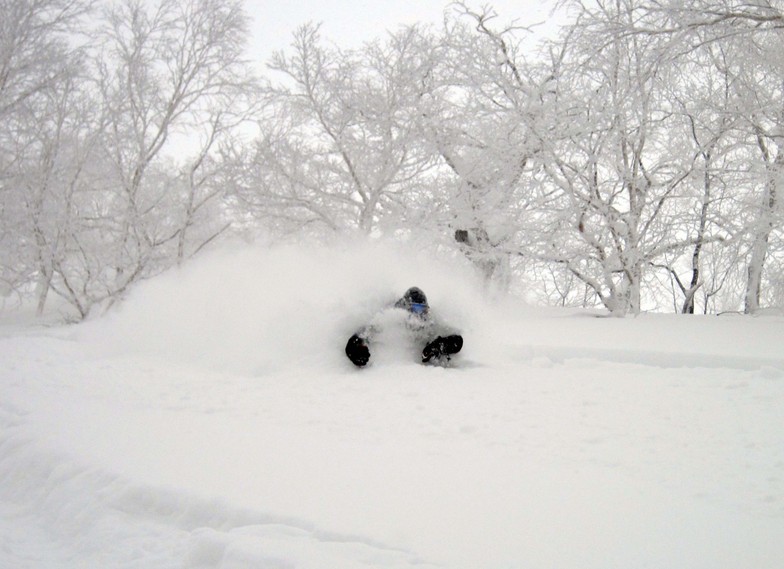
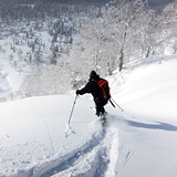
This is my third time here. It used to be a quiet place with few visitors. Now that the Europeans and Americans have discovered it as well as the Chinese it’s become very busy. Expect huge lift lines for the ropeway that leaves every 20 minutes. On one day I got 6 runs of a 500m descent each time. While it’s a fantastic place the over tourism has spoiled it. The downhill and backcountry skiing is ok but not as long and varied as other places. I take XC and BC skis, which give me plenty of options when the weather is bad or when the ropeway closes due to wind, which is often.
Emmbee from Australia writes:
This is my third time here. It used to be a quiet place with few visitors. Now that the Europeans and Americans have discovered it as well as the Chinese it’s become very busy. Expect huge lift lines for the ropeway that leaves every 20 minutes. On one day I got 6 runs of a 500m descent each time. While it’s a fantastic place the over tourism has spoiled it. The downhill and backcountry skiing is ok but not as long and varied as other places. I take XC and BC skis, which give me plenty of options when the weather is bad or when the ropeway closes due to wind, which is often.


 Nearest