
Fresh Snowfall In Australia With 2026 Season Starting This Weekend
An early-winter storm is gathering momentum in Australia ahead of the start of the 2026 ski season in the country this weekend.

Next 3 days weather summary:Mild with heavy rain (total 47.0mm), heaviest during Tue night. Becoming colder with a moderate fall of snow heaviest on Thu night. Freeze-thaw conditions (max 8°C on Tue afternoon, min 0°C on Thu night). Wind will be generally light. | Days 4-6 weather summary:Light rain (total 4.0mm), mostly falling on Sat afternoon. Very mild (max 12°C on Mon morning, min 3°C on Fri afternoon). Wind will be generally light. | ||||||||||||||||
Tue 2 | Wednesday 3 | Thursday 4 | Friday 5 | Saturday 6 | Sunday 7 | ||||||||||||
PM | night | AM | PM | night | AM | PM | night | AM | PM | night | AM | PM | night | AM | PM | night | |
mod. rain | light snow | light snow | light rain | some clouds | rain shwrs | light rain | heavy snow | light snow | cloudy | some clouds | cloudy | rain shwrs | some clouds | some clouds | risk thun- der | rain shwrs | |
km/h | |||||||||||||||||
Snow map |  |  |  |  |  |  | |||||||||||
— | 1 | — | — | — | — | — | 14 | 1 | — | — | — | — | — | — | — | — | |
10 | 25 | 1 | 2 | — | 1 | 3 | 5 | — | — | — | — | 1 | — | — | 2 | 1 | |
max °C | 8 | 4 | 3 | 6 | 7 | 6 | 7 | 5 | 2 | 4 | 5 | 6 | 9 | 9 | 9 | 10 | 9 |
min °C | 7 | 2 | 1 | 5 | 6 | 6 | 7 | 0 | 1 | 3 | 4 | 5 | 8 | 6 | 7 | 9 | 8 |
6 | -2 | -3 | 3 | 5 | 4 | 5 | -4 | -2 | 3 | 3 | 3 | 7 | 6 | 7 | 8 | 8 | |
93 | 95 | 86 | 76 | 58 | 89 | 90 | 98 | 81 | 78 | 86 | 87 | 77 | 89 | 81 | 85 | 65 | |
3300 | 2550 | 2550 | 2950 | 3500 | 3100 | 3150 | 2350 | 2550 | 2900 | 3200 | 3250 | 3400 | 3450 | 3400 | 3600 | 3800 | |
— | — | 5:35 | — | — | 5:33 | — | — | 5:33 | — | — | 5:33 | — | — | 5:33 | — | — | |
— | 9:10 | — | — | 9:12 | — | — | 9:13 | — | — | 9:14 | — | — | 9:15 | — | — | 9:15 | |
Latest snow reports near Andermatt:
| Top snow depth: | 0 cm |
|---|---|
| Bottom snow depth: | 0 cm |
| Fresh snowfall depth: | — |
| Last snowfall: | 18 May 2026 |
| Snow Alerts | Create Alert |
0.0 | Bluebird Powder days Fresh snow, mostly sunny, light wind. |
|---|---|
0.0 | Powder days Fresh snow, limited sun, any wind. |
0.0 | Bluebird days Average snow, mostly sunny, light wind. |
The above table gives the weather forecast for Andermatt at the specific elevation of 2200 m. Our sophisticated weather models allow us to provide snow forecasts for the top, middle and bottom ski stations of Andermatt. To access the weather forecasts for the other elevations, use the tab navigation above the table. For a wider view of the weather, check out the Weather Map of Switzerland.
Click here to read further information on freezing levels and how we forecast our temperatures.
Overall 3.9 Based on 24 votes and 15 reviews
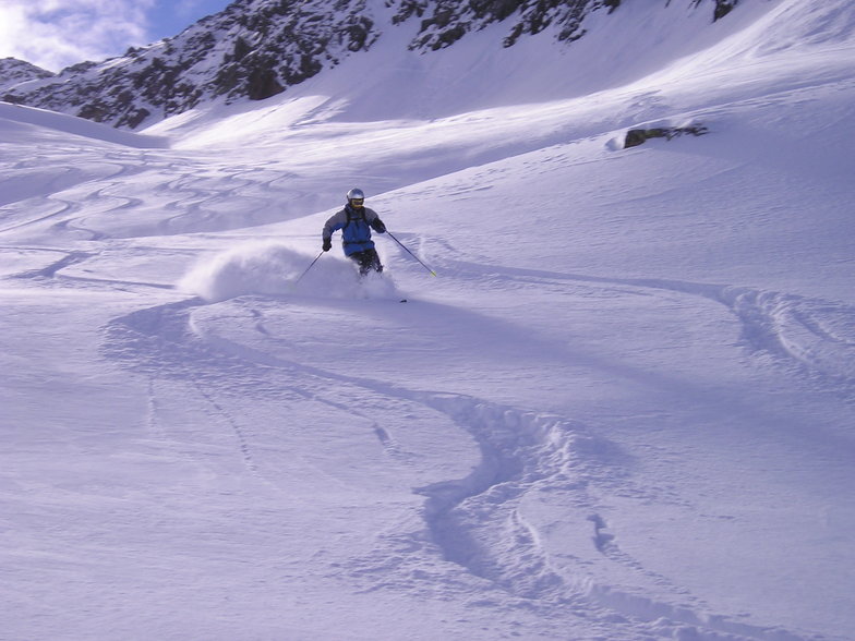
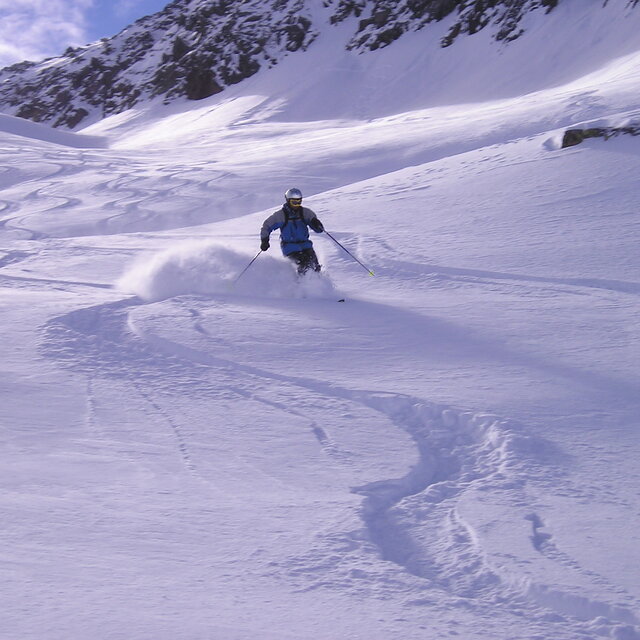
A quirky place, friendly village and different to other resorts. In fact, perhaps Andermatt is better described as a developing village that happens to have some fantastic opportunities for off-piste skiing/boarding on the doorstep. We didn't see a queue for any lift when we visited, it was the end of April though, and still we had some great conditions. New developments like the Chedi and Raddisson concert hall show there is investment and an attempt to bring a wealthy clientele to the area. Time will tell. For now it still has a different kind of charm, and did I mention the awesome off-piste?
PT from United Kingdom writes:
A quirky place, friendly village and different to other resorts. In fact, perhaps Andermatt is better described as a developing village that happens to have some fantastic opportunities for off-piste skiing/boarding on the doorstep.
We didn't see a queue for any lift when we visited, it was the end of April though, and still we had some great conditions.
New developments like the Chedi and Raddisson concert hall show there is investment and an attempt to bring a wealthy clientele to the area. Time will tell. For now it still has a different kind of charm, and did I mention the awesome off-piste?


 Nearest