

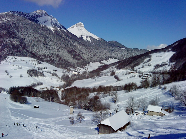
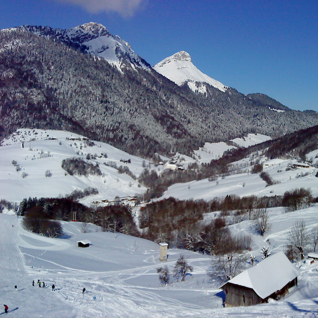
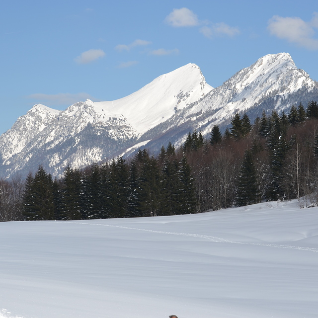
Massive Snowfall in the Alps
A huge snowfall is underway in the Alps, by far the biggest of the 24-25 season.
Please sign in with your Snow-Forecast account details below.

Aillons-Margeriaz Weather (Next 3 days): The snow forecast for Aillons-Margeriaz is: Moderate rain (total 19.0mm) heaviest on Wed night, then becoming colder with a dusting of snow on Wed night. Mild temperatures (max 7°C on Tue afternoon, min 1°C on Wed night). Wind will be generally light.
Aillons-Margeriaz Weather (Days 4-6): Light rain (total 8.0mm), mostly falling on Sat afternoon. Very mild (max 10°C on Sun night, min 4°C on Fri morning). Wind will be generally light.
| Resort | Snow Depth | Temp. (°C) | Wind (km/h) | Weather | ||
|---|---|---|---|---|---|---|
| Top Lift: | 2 | |||||
| Middle Lift: | 4 | |||||
| Bottom Lift: | 5 |
Latest snow reports near Aillons-Margeriaz:
Drizzle reported from Haute-Savoie Mont Blanc Airport/Aéroport Annecy/Meythet at 711 metres elevation only 3 kms WNW of Annecy-LeSemnoz but it is forecast cold enough for snow at the ski area from Annecy-LeSemnoz

Tuesday 22 | Wednesday 23 | Thursday 24 | Friday 25 | Saturday 26 | Sunday 27 | Monday 28 | |||||||||||||||
AM | PM | night | AM | PM | night | AM | PM | night | AM | PM | night | AM | PM | night | AM | PM | night | AM | PM | night | |
some clouds | cloudy | light rain | rain shwrs | light rain | light snow | light snow | rain shwrs | clear | clear | clear | some clouds | cloudy | light rain | rain shwrs | some clouds | clear | cloudy | some clouds | some clouds | some clouds | |
km/h | |||||||||||||||||||||
Snow map |  |  |  |  |  |  |  | ||||||||||||||
— | — | — | — | — | 1.0 | — | — | — | — | — | — | — | — | — | — | — | — | — | — | — | |
— | — | 3 | 1.0 | 2.0 | 10 | 1.0 | 2.0 | — | — | — | — | — | 5 | 3 | — | — | — | — | — | — | |
max°C | 4 | 7 | 6 | 4 | 6 | 2 | 2 | 5 | 5 | 4 | 9 | 9 | 8 | 6 | 6 | 4 | 9 | 10 | 11 | 13 | 12 |
min°C | 4 | 6 | 5 | 4 | 6 | 1 | 2 | 4 | 4 | 4 | 7 | 8 | 7 | 6 | 4 | 4 | 7 | 9 | 10 | 13 | 8 |
2 | 5 | 4 | 4 | 4 | -1 | -1 | 2 | 1 | 2 | 6 | 8 | 5 | 4 | 1 | 0 | 5 | 8 | 9 | 12 | 7 | |
89 | 77 | 94 | 97 | 82 | 99 | 97 | 83 | 85 | 84 | 65 | 67 | 77 | 87 | 86 | 87 | 61 | 64 | 59 | 60 | 68 | |
2350 | 2550 | 2300 | 2250 | 2300 | 1700 | 1900 | 2550 | 2950 | 3300 | 3350 | 3350 | 2700 | 2350 | 2450 | 3000 | 3200 | 3300 | 3250 | 3350 | 3300 | |
6:39 | — | — | 6:37 | — | — | 6:35 | — | — | 6:33 | — | — | 6:31 | — | — | 6:31 | — | — | 6:28 | — | — | |
— | — | 8:30 | — | — | 8:30 | — | — | 8:32 | — | — | 8:34 | — | — | 8:35 | — | — | 8:37 | — | — | 8:37 | |
Moderate rain (total 19.0mm) heaviest on Wed night, then becoming colder with a dusting of snow on Wed night. Mild temperatures (max 7°C on Tue afternoon, min 1°C on Wed night). Wind will be generally light.
Light rain (total 8.0mm), mostly falling on Sat afternoon. Very mild (max 10°C on Sun night, min 4°C on Fri morning). Wind will be generally light.
Latest snow reports near Aillons-Margeriaz:
Drizzle reported from Haute-Savoie Mont Blanc Airport/Aéroport Annecy/Meythet at 711 metres elevation only 3 kms WNW of Annecy-LeSemnoz but it is forecast cold enough for snow at the ski area from Annecy-LeSemnoz
| Top snow depth: | — |
|---|---|
| Bottom snow depth: | — |
| Fresh snowfall depth: | — |
| Last snowfall: | 17 Apr 2025 |
| Snow Alerts | Create Alert |
0.1 | Bluebird Powder days Fresh snow, mostly sunny, light wind. |
|---|---|
0.2 | Powder days Fresh snow, limited sun, any wind. |
0.1 | Bluebird days Average snow, mostly sunny, light wind. |

The above table gives the weather forecast for Aillons-Margeriaz at the specific elevation of 1450 m. Our sophisticated weather models allow us to provide snow forecasts for the top, middle and bottom ski stations of Aillons-Margeriaz. To access the weather forecasts for the other elevations, use the tab navigation above the table. For a wider view of the weather, check out the Weather Map of France.
Click here to read further information on freezing levels and how we forecast our temperatures.
Overall 3.6 Based on 7 votes and 6 reviews
Station avec deux sites complètement différents,a 1400, domaine exclusivement réservé aux débutants,très peu de dénivelé, beaucoup de neige, restaurants pas super, parking gratuit mais surchargé les weekends,se garer a 2 kms, forfaits chers pour le domaine...a 1000 domaine spécial plaisir,pente,pistes noires, forfaits pas chers, parkings gratuits et disponibles aux pieds des pistes,seul bémol et de taille,trop peu de canons neige donc ouverture souvent aléatoire...
Yann from France writes:
Station avec deux sites complètement différents,a 1400, domaine exclusivement réservé aux débutants,très peu de dénivelé, beaucoup de neige, restaurants pas super, parking gratuit mais surchargé les weekends,se garer a 2 kms, forfaits chers pour le domaine...a 1000 domaine spécial plaisir,pente,pistes noires, forfaits pas chers, parkings gratuits et disponibles aux pieds des pistes,seul bémol et de taille,trop peu de canons neige donc ouverture souvent aléatoire...
The Aillons-Margeriaz skiing weather widget is available to embed on external websites free of charge. It provides a daily summary of our Aillons-Margeriaz snow forecast and current weather conditions. Simply go to the feed configuration page and follow the 3 simple steps to grab the custom html code snippet and paste it into your own site. You can choose the snow forecast elevation (summit, mid-mountain or bottom lift) and metric/imperial units for the snow forecast feed to suit your own website…. Click here to get the code.
View detailed snow forecast for Aillons-Margeriaz at:
snow-forecast.com


 Nearest