

French Ski Areas Announce 2025 Summer Ski Plans
Three French ski areas have announced their opening plans in May, June and July after the winter season ends on May 4th.
Please sign in with your Snow-Forecast account details below.


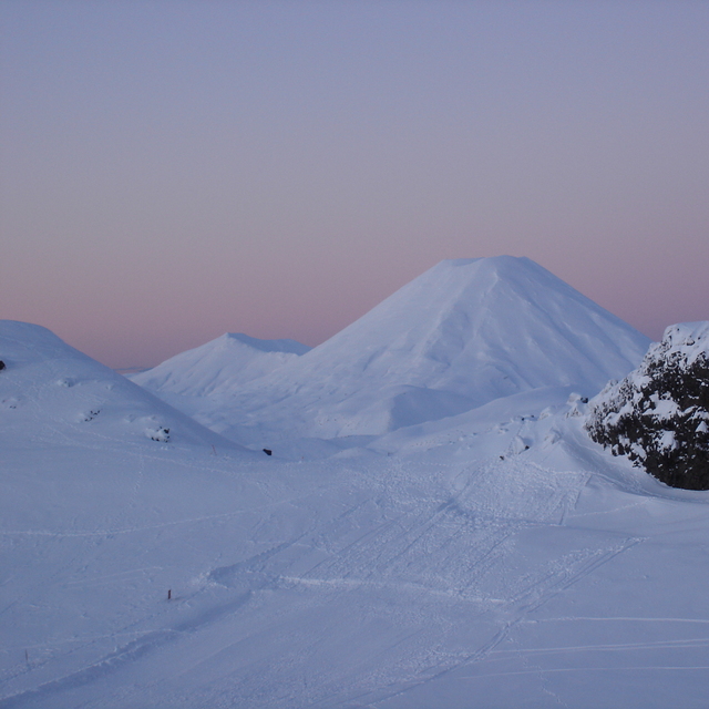
Whakapapa Weather (Next 3 days): The snow forecast for Whakapapa is: Moderate rain (total 13.0mm), heaviest on Thu morning. Mild temperatures (max 8°C on Tue morning, min 6°C on Tue afternoon). Winds increasing (calm on Tue morning, near gales from the NNE by Thu night).
Whakapapa Weather (Days 4-6): Heavy rain (total 29.0mm), heaviest during Fri night. Mild temperatures (max 9°C on Fri morning, min 7°C on Sat night). Winds decreasing (near gales from the N on Sat night, moderate winds from the NNW by Sun night).
| Resort | Snow Depth | Temp. (°C) | Wind (km/h) | Weather | ||
|---|---|---|---|---|---|---|
| Top Lift: | 0.0 m | 7 | ||||
| Middle Lift: | 8 | |||||
| Bottom Lift: | 0.0 m | 10 |
Latest snow reports near Whakapapa:

Tuesday 15 | Wednesday 16 | Thursday 17 | Friday 18 | Saturday 19 | Sunday 20 | Monday 21 | |||||||||||||||
AM | PM | night | AM | PM | night | AM | PM | night | AM | PM | night | AM | PM | night | AM | PM | night | AM | PM | night | |
clear | some clouds | cloudy | cloudy | cloudy | cloudy | mod. rain | light rain | light rain | light rain | light rain | mod. rain | light rain | rain shwrs | light rain | light rain | light rain | light rain | some clouds | some clouds | clear | |
km/h | |||||||||||||||||||||
Snow map |  |  |  |  |  |  |  | ||||||||||||||
— | — | — | — | — | — | — | — | — | — | — | — | — | — | — | — | — | — | — | — | — | |
— | — | — | — | — | — | 7 | 2.0 | 4 | 2.0 | 2.0 | 8 | 1.0 | 2.0 | 4 | 2.0 | 3 | 5 | — | — | — | |
max°C | 8 | 8 | 7 | 7 | 6 | 7 | 6 | 7 | 8 | 9 | 9 | 8 | 8 | 8 | 8 | 8 | 8 | 8 | 7 | 8 | 8 |
min°C | 7 | 6 | 6 | 6 | 6 | 6 | 6 | 7 | 8 | 9 | 8 | 8 | 8 | 8 | 7 | 7 | 8 | 7 | 7 | 7 | 7 |
6 | 5 | 3 | 2 | 2 | 1 | 0 | 2 | 3 | 4 | 3 | 2 | 2 | 3 | 1 | 2 | 3 | 2 | 4 | 4 | 4 | |
38 | 45 | 55 | 81 | 90 | 72 | 91 | 93 | 91 | 86 | 81 | 96 | 96 | 90 | 88 | 96 | 97 | 93 | 93 | 71 | 51 | |
3600 | 3600 | 3500 | 3400 | 3550 | 3950 | 3850 | 3950 | 3800 | 3800 | 3550 | 3350 | 3550 | 3450 | 3400 | 3400 | 3400 | 3300 | 3350 | 3600 | 3550 | |
6:43 | — | — | 6:45 | — | — | 6:46 | — | — | 6:47 | — | — | 6:48 | — | — | 6:48 | — | — | 6:50 | — | — | |
— | 5:50 | — | — | 5:49 | — | — | 5:46 | — | — | 5:45 | — | — | 5:45 | — | — | 5:43 | — | — | 5:42 | — | |
Moderate rain (total 13.0mm), heaviest on Thu morning. Mild temperatures (max 8°C on Tue morning, min 6°C on Tue afternoon). Winds increasing (calm on Tue morning, near gales from the NNE by Thu night).
Heavy rain (total 29.0mm), heaviest during Fri night. Mild temperatures (max 9°C on Fri morning, min 7°C on Sat night). Winds decreasing (near gales from the N on Sat night, moderate winds from the NNW by Sun night).
Latest snow reports near Whakapapa:
| Top snow depth: | 0 cm |
|---|---|
| Bottom snow depth: | 0 cm |
| Fresh snowfall depth: | — |
| Last snowfall: | 6 Jan 2025 |
| Snow Alerts | Create Alert |
0.0 | Bluebird Powder days Fresh snow, mostly sunny, light wind. |
|---|---|
0.1 | Powder days Fresh snow, limited sun, any wind. |
0.1 | Bluebird days Average snow, mostly sunny, light wind. |
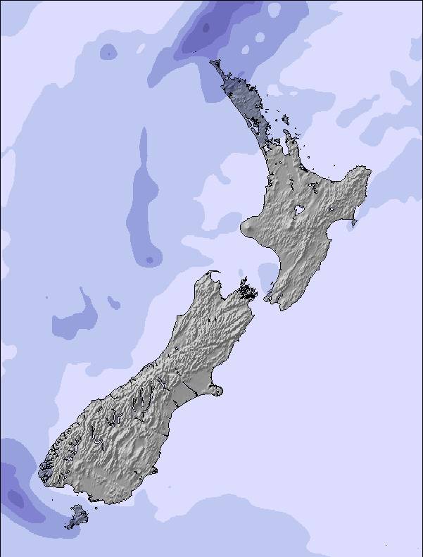
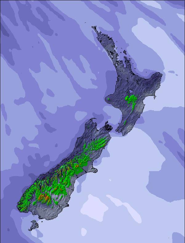
The above table gives the weather forecast for Whakapapa at the specific elevation of 1962 m. Our sophisticated weather models allow us to provide snow forecasts for the top, middle and bottom ski stations of Whakapapa. To access the weather forecasts for the other elevations, use the tab navigation above the table. For a wider view of the weather, check out the Weather Map of New Zealand.
Click here to read further information on freezing levels and how we forecast our temperatures.
Overall 3.2 Based on 41 votes and 58 reviews
Went up to Whakapapa last Friday, amazing, lots of snow. The staff were just fantastic. It was a great experience. The restaurant was lovely and clean. All the staff were welcoming. I hope everything is sorted for next year. What a well run business. The lifties were so great holding the seat back for us. I have nothing but praise for the team at Whakapapa and the facilities. And the snow was amazing, brilliant day.
Janet from New Zealand writes:
Went up to Whakapapa last Friday, amazing, lots of snow. The staff were just fantastic. It was a great experience. The restaurant was lovely and clean. All the staff were welcoming. I hope everything is sorted for next year. What a well run business. The lifties were so great holding the seat back for us. I have nothing but praise for the team at Whakapapa and the facilities. And the snow was amazing, brilliant day.
The Whakapapa skiing weather widget is available to embed on external websites free of charge. It provides a daily summary of our Whakapapa snow forecast and current weather conditions. Simply go to the feed configuration page and follow the 3 simple steps to grab the custom html code snippet and paste it into your own site. You can choose the snow forecast elevation (summit, mid-mountain or bottom lift) and metric/imperial units for the snow forecast feed to suit your own website…. Click here to get the code.
View detailed snow forecast for Whakapapa at:
snow-forecast.com

 Nearest