

Tignes Unlimited Festival Into May
Tignes, one of the few French ski areas staying open into May, will round off the 2025–26 winter season with the return of the Tignes Unlimited electronic music festival, running from 25 April to 3 May 2026.

Next 3 days weather summary:Light rain (total 5.0mm), mostly falling on Wed morning. Mild temperatures (max 8°C on Thu afternoon, min 1°C on Wed night). Wind will be generally light. | Days 4-6 weather summary:Mostly dry. Very mild (max 11°C on Sun afternoon, min 6°C on Fri morning). Wind will be generally light. | |||||||||||||||||
Tuesday 21 | Wednesday 22 | Thursday 23 | Friday 24 | Saturday 25 | Sunday 26 | |||||||||||||
AM | PM | night | AM | PM | night | AM | PM | night | AM | PM | night | AM | PM | night | AM | PM | night | |
clear | some clouds | some clouds | light rain | light rain | snow shwrs | clear | some clouds | rain shwrs | clear | clear | clear | clear | clear | clear | clear | some clouds | clear | |
km/h | ||||||||||||||||||
Snow map |  |  |  |  |  |  | ||||||||||||
— | — | — | — | — | — | — | — | — | — | — | — | — | — | — | — | — | — | |
— | — | — | 1 | 2 | 1 | — | — | 1 | — | — | — | — | — | — | — | — | — | |
max °C | 4 | 5 | 4 | 3 | 4 | 2 | 4 | 8 | 6 | 9 | 10 | 9 | 9 | 10 | 8 | 10 | 11 | 9 |
min °C | 2 | 5 | 2 | 2 | 4 | 1 | 2 | 7 | 5 | 6 | 10 | 6 | 7 | 10 | 6 | 7 | 11 | 6 |
0 | 3 | 1 | 2 | 3 | 1 | 2 | 7 | 4 | 5 | 9 | 5 | 6 | 10 | 5 | 7 | 11 | 6 | |
34 | 56 | 63 | 77 | 83 | 89 | 48 | 47 | 59 | 27 | 45 | 44 | 27 | 46 | 56 | 22 | 47 | 63 | |
2650 | 2750 | 2600 | 2500 | 2650 | 2300 | 2650 | 3050 | 3150 | 3300 | 3400 | 3450 | 3350 | 3350 | 3350 | 3400 | 3500 | 3250 | |
6:37 | — | — | 6:35 | — | — | 6:33 | — | — | 6:33 | — | — | 6:31 | — | — | 6:28 | — | — | |
— | — | 8:24 | — | — | 8:25 | — | — | 8:27 | — | — | 8:29 | — | — | 8:30 | — | — | 8:30 | |
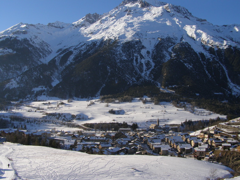
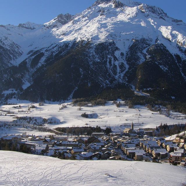
Latest snow reports near Val Cenis:
Very good piste conditions, best at top. Clear blue skies, all lifts open. from Val Thorens
| Top snow depth: | 0 cm |
|---|---|
| Bottom snow depth: | 0 cm |
| Fresh snowfall depth: | — |
| Last snowfall: | 13 Apr 2026 |
| Snow Alerts | Create Alert |
0.3 | Bluebird Powder days Fresh snow, mostly sunny, light wind. |
|---|---|
0.7 | Powder days Fresh snow, limited sun, any wind. |
0.5 | Bluebird days Average snow, mostly sunny, light wind. |
The above table gives the weather forecast for Val Cenis at the specific elevation of 2100 m. Our sophisticated weather models allow us to provide snow forecasts for the top, middle and bottom ski stations of Val Cenis. To access the weather forecasts for the other elevations, use the tab navigation above the table. For a wider view of the weather, check out the Weather Map of France.
Click here to read further information on freezing levels and how we forecast our temperatures.
Overall 4.2 Based on 31 votes and 11 reviews
I've stayed in the Alpazur, via Snowcoach, several times. Nowadays, with 4 grown up sons we self drive/train and stay in Les Balcons de Val Cenis village up in Lanslevillard. I love Val Cenis, it's unpretentious, pretty, and you can ski a significant distance. Now going back for the 7th time in the last 20 years, which proves how much we love it.
helen mason from United Kingdom writes:
I've stayed in the Alpazur, via Snowcoach, several times. Nowadays, with 4 grown up sons we self drive/train and stay in Les Balcons de Val Cenis village up in Lanslevillard. I love Val Cenis, it's unpretentious, pretty, and you can ski a significant distance. Now going back for the 7th time in the last 20 years, which proves how much we love it.


 Nearest