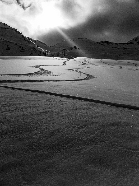
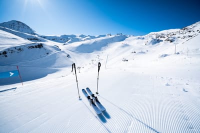
The snow forecast for Piau Engaly is: Heavy rain (total 24.0mm), heaviest during Fri morning. Freeze-thaw conditions (max 6°C on Sat morning, min 0°C on Fri night). Wind will be generally light.
Piau Engaly Weather (Next 3 days): The snow forecast for Piau Engaly is: Heavy rain (total 24.0mm), heaviest during Fri morning. Freeze-thaw conditions (max 6°C on Sat morning, min 0°C on Fri night). Wind will be generally light.
Piau Engaly Weather (Days 4-6): Heavy rain (total 23.0mm), mainly falling Wed night. Becoming colder with a light covering of snow, mostly falling on Wed night. Freeze-thaw conditions (max 6°C on Wed morning, min -1°C on Tue night). Wind will be generally light.
Issued by Snow-Forecast.com at:12 pm (local time) / 06 Mar 2026
Piau Engaly Weather
(Next 3 days):
The snow forecast for Piau Engaly is: Heavy rain (total 24.0mm), heaviest during Fri morning. Freeze-thaw conditions (max 6°C on Sat morning, min 0°C on Fri night). Wind will be generally light.
Piau Engaly Weather (Days 4-6):
Heavy rain (total 23.0mm), mainly falling Wed night. Becoming colder with a light covering of snow, mostly falling on Wed night. Freeze-thaw conditions (max 6°C on Wed morning, min -1°C on Tue night). Wind will be generally light.
Piau Engaly Weather (Days 7-16):
Interested in the 16-day Forecast? Unlock the full forecast and many more features by becoming a Pro member.
Heavy rain (total 24.0mm), heaviest during Fri morning. Freeze-thaw conditions (max 6°C on Sat morning, min 0°C on Fri night). Wind will be generally light.
Next 4-6 days weather summary:
Heavy rain (total 23.0mm), mainly falling Wed night. Becoming colder with a light covering of snow, mostly falling on Wed night. Freeze-thaw conditions (max 6°C on Wed morning, min -1°C on Tue night). Wind will be generally light.
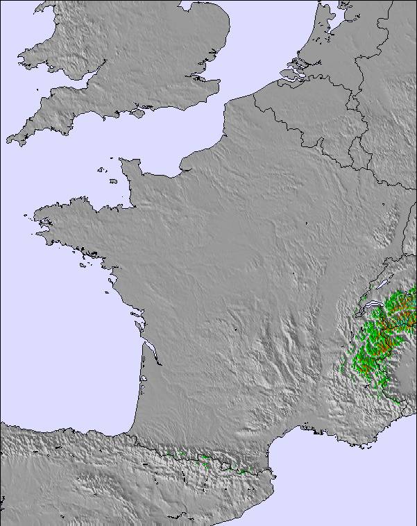
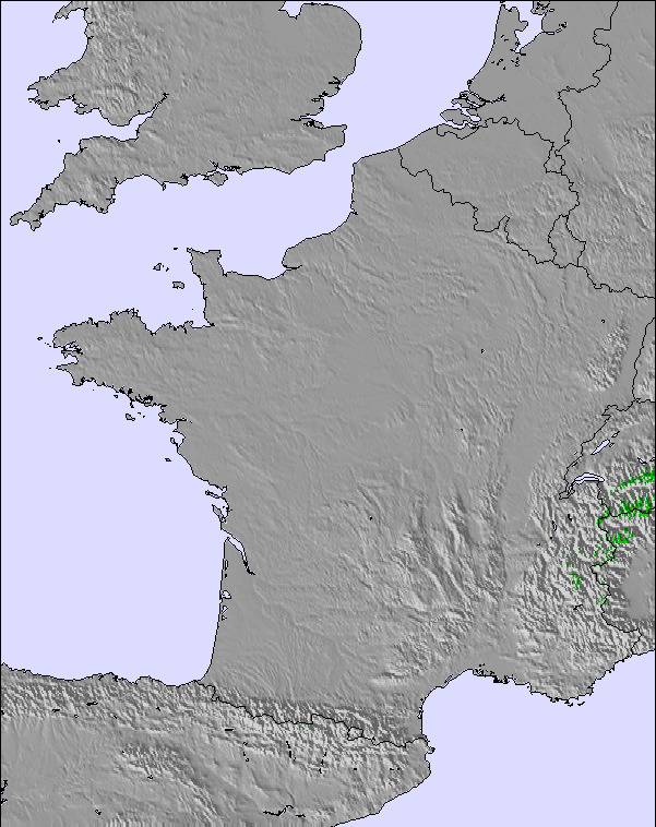
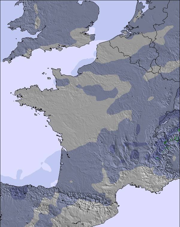
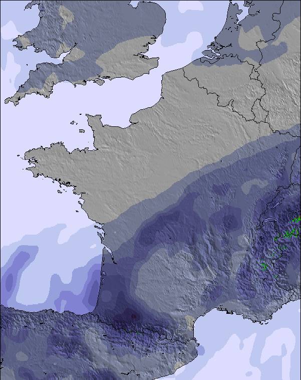
The above table gives the weather forecast for Piau Engaly at the specific elevation of 1420 m. Our sophisticated weather models allow us to provide snow forecasts for the top, middle and bottom ski stations of Piau Engaly. To access the weather forecasts for the other elevations, use the tab navigation above the table. For a wider view of the weather, check out the Weather Map of France.
Click here to read further information on freezing levels and how we forecast our temperatures.
Ol
Esquiei nesta estância 3 anos seguidos, devo dizer que adorei, é fantástica...excelente neve, excelente tratamento de pistas e muito importante ainda, tem zonas dificeis como zonas ideais para aprendizagem de desportos de neve como o esqui e snowboard. Esta estancia é também ideal para o freeride, já que tem muitas zonas de neve virgem e de excelente qualidade, relativamente aos "forfaits", esta estancia oferece preços extremamente competitivos e ainda mais para estudantes, deixando a concorrência sem meios para competir. Mas como não há bela sem senão, tenho 1 reparo a fazer, na minha opinião é inconcebivel as pessoas que se localizam na venda de "forfaits" não terem conhecimentos básicos de inglês, idioma universal e "obrigatório" em regiões turisticas.
Devido a todos estes factores aconselho a visitarem esta estância, tenho a certeza que vão gostar.
Saudações desportivas
Ol
Esquiei nesta estância 3 anos seguidos, devo dizer que adorei, é fantástica...excelente neve, excelente tratamento de pistas e muito importante ainda, tem zonas dificeis como zonas ideais para aprendizagem de desportos de neve como o esqui e snowboard. Esta estancia é também ideal para o freeride, já que tem muitas zonas de neve virgem e de excelente qualidade, relativamente aos "forfaits", esta estancia oferece preços extremamente competitivos e ainda mais para estudantes, deixando a concorrência sem meios para competir. Mas como não há bela sem senão, tenho 1 reparo a fazer, na minha opinião é inconcebivel as pessoas que se localizam na venda de "forfaits" não terem conhecimentos básicos de inglês, idioma universal e "obrigatório" em regiões turisticas.
Devido a todos estes factores aconselho a visitarem esta estância, tenho a certeza que vão gostar.
Free Snow-Forecast.com weather widget for your website
Embed the Piau Engaly weather widget on your site for free. It provides a weekly snapshot of snow and rain conditions across all elevations. Follow the two quick steps to grab your custom code and paste it into your site. Choose between metric or imperial units. Click here to get the code.


 Nearest