

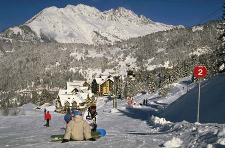
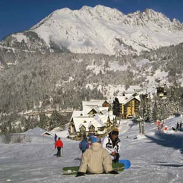
Massive Snowfall in the Alps
A huge snowfall is underway in the Alps, by far the biggest of the 24-25 season.
Please sign in with your Snow-Forecast account details below.


Oz en Oisans Weather (Next 3 days): The snow forecast for Oz en Oisans is: Light rain (total 2.0mm) at first, then becoming colder with a dusting of snow on Sat night. Freeze-thaw conditions (max 5°C on Fri afternoon, min 0°C on Sun morning). Wind will be generally light.
Oz en Oisans Weather (Days 4-6): Mild with moderate rain (total 10.0mm) on Wed night, Becoming colder with a light covering of snow, mostly falling on Wed night. Freeze-thaw conditions (max 5°C on Wed afternoon, min -2°C on Thu morning). Wind will be generally light.
| Resort | Snow Depth | Temp. (°C) | Wind (km/h) | Weather | ||
|---|---|---|---|---|---|---|
| Top Lift: | 0 | |||||
| Middle Lift: | 4 | |||||
| Bottom Lift: | 8 |
Latest snow reports near Oz en Oisans:
Powder day!. Another glorious day. from Val Thorens
It is snowing steadily at Val Thorens. from Val Thorens
Snow is falling in Val Thorens. from Val Thorens

Fri 18 | Saturday 19 | Sunday 20 | Monday 21 | Tuesday 22 | Wednesday 23 | Thursday 24 | ||||||||||||||
PM | night | AM | PM | night | AM | PM | night | AM | PM | night | AM | PM | night | AM | PM | night | AM | PM | night | |
some clouds | clear | some clouds | rain shwrs | snow shwrs | clear | light rain | light snow | some clouds | cloudy | light rain | light snow | light rain | light snow | some clouds | light rain | mod. snow | light snow | light snow | light snow | |
km/h | ||||||||||||||||||||
Snow map |  |  |  |  |  |  |  | |||||||||||||
— | — | — | — | 1.0 | — | — | — | — | — | — | — | — | — | — | — | 5 | 2.0 | — | 2.0 | |
— | — | — | 1.0 | — | — | 1.0 | — | — | — | 1.0 | — | 2.0 | 1.0 | — | 3 | 3 | — | — | — | |
max°C | 5 | 4 | 5 | 5 | 3 | 2 | 3 | 2 | 2 | 3 | 2 | 1 | 3 | 2 | 3 | 5 | 3 | -1 | 0 | 0 |
min°C | 4 | 2 | 3 | 5 | 1 | 0 | 3 | 0 | 0 | 3 | 1 | 1 | 2 | 1 | 1 | 5 | -1 | -2 | 0 | -1 |
3 | -1 | 0 | 2 | -4 | -4 | 0 | -2 | 0 | 3 | 0 | 1 | 2 | 1 | 1 | 3 | -4 | -4 | -3 | -5 | |
54 | 55 | 61 | 75 | 81 | 44 | 66 | 87 | 75 | 80 | 96 | 96 | 91 | 91 | 70 | 80 | 98 | 97 | 88 | 96 | |
2900 | 3000 | 2750 | 2700 | 2350 | 2350 | 2400 | 2100 | 2350 | 2450 | 2250 | 2300 | 2500 | 2350 | 2600 | 2700 | 2200 | 1850 | 2150 | 1900 | |
— | — | 6:45 | — | — | 6:43 | — | — | 6:41 | — | — | 6:39 | — | — | 6:37 | — | — | 6:35 | — | — | |
— | 8:23 | — | — | 8:24 | — | — | 8:25 | — | — | 8:28 | — | — | 8:29 | — | — | 8:30 | — | — | 8:30 | |
Light rain (total 2.0mm) at first, then becoming colder with a dusting of snow on Sat night. Freeze-thaw conditions (max 5°C on Fri afternoon, min 0°C on Sun morning). Wind will be generally light.
Mild with moderate rain (total 10.0mm) on Wed night, Becoming colder with a light covering of snow, mostly falling on Wed night. Freeze-thaw conditions (max 5°C on Wed afternoon, min -2°C on Thu morning). Wind will be generally light.
Latest snow reports near Oz en Oisans:
Powder day!. Another glorious day. from Val Thorens
It is snowing steadily at Val Thorens. from Val Thorens
Snow is falling in Val Thorens. from Val Thorens
| Top snow depth: | — |
|---|---|
| Bottom snow depth: | — |
| Fresh snowfall depth: | 44 cm |
| Last snowfall: | 17 Apr 2025 |
| Snow Alerts | Create Alert |
0.2 | Bluebird Powder days Fresh snow, mostly sunny, light wind. |
|---|---|
0.8 | Powder days Fresh snow, limited sun, any wind. |
0.4 | Bluebird days Average snow, mostly sunny, light wind. |
The above table gives the weather forecast for Oz en Oisans at the specific elevation of 2074 m. Our sophisticated weather models allow us to provide snow forecasts for the top, middle and bottom ski stations of Oz en Oisans. To access the weather forecasts for the other elevations, use the tab navigation above the table. For a wider view of the weather, check out the Weather Map of France.
Click here to read further information on freezing levels and how we forecast our temperatures.
Overall 4.3 Based on 15 votes and 13 reviews
A quick warning about the lift passes if you're planning to use them for Deux Alpes (2 days included in the 6 day passes). We've bought ours online and had them delivered. You're told to collect a voucher/ticket from one of the lift offices before visiting Deux Alpes. I did so and was told (at 2 separate lift offices in Oz en Oisans and Alpe d'Huez) that this wasn't necessary, that the lift pass would work (and if not that the confirmation of our payment was enough). We visited Deux Alpes in 2018 and 2019 from Oz and: a) the lift passes don't work there, you have to pick up a Deux Alpes pass, b) they wanted a voucher! This entailed a long wait at the lift office at Les Deux Alpes while they called Oz to confirm our eligibility, even after we showed the online confirmation of purchase. They eventually supplied us with passes, somewhat begrudgingly and with a mild telling off for not having the correct documents. It might be easier if you buy the passes directly from the station in Oz, but in either case, I would recommend you bring the receipt and some identification with you if using them in Deux Alpes.
Simon from United Kingdom writes:
A quick warning about the lift passes if you're planning to use them for Deux Alpes (2 days included in the 6 day passes).
We've bought ours online and had them delivered. You're told to collect a voucher/ticket from one of the lift offices before visiting Deux Alpes. I did so and was told (at 2 separate lift offices in Oz en Oisans and Alpe d'Huez) that this wasn't necessary, that the lift pass would work (and if not that the confirmation of our payment was enough).
We visited Deux Alpes in 2018 and 2019 from Oz and: a) the lift passes don't work there, you have to pick up a Deux Alpes pass, b) they wanted a voucher!
This entailed a long wait at the lift office at Les Deux Alpes while they called Oz to confirm our eligibility, even after we showed the online confirmation of purchase. They eventually supplied us with passes, somewhat begrudgingly and with a mild telling off for not having the correct documents.
It might be easier if you buy the passes directly from the station in Oz, but in either case, I would recommend you bring the receipt and some identification with you if using them in Deux Alpes.
The Oz en Oisans skiing weather widget is available to embed on external websites free of charge. It provides a daily summary of our Oz en Oisans snow forecast and current weather conditions. Simply go to the feed configuration page and follow the 3 simple steps to grab the custom html code snippet and paste it into your own site. You can choose the snow forecast elevation (summit, mid-mountain or bottom lift) and metric/imperial units for the snow forecast feed to suit your own website…. Click here to get the code.
View detailed snow forecast for Oz en Oisans at:
snow-forecast.com


 Nearest