
Women-Only Ski Touring Week Launches in Iceland
A female-led ski touring experience in Iceland has been announced for the coming winter.
By using Snow-Forecast, you agree to our Terms & Services.
Don't have an account? Join now
Alternatively, you can now use your Outside account to sign in to any brand in the Outside digital ecosystem, including Snow-Forecast, Surf-Forecast, and Mountain-Forecast.


HeliPark New Zealand Weather (Next 3 days): The snow forecast for HeliPark New Zealand is: A heavy fall of snow, heaviest during Tue night. Freeze-thaw conditions (max 1°C on Wed night, min -5°C on Mon morning). Winds increasing (light winds from the NW on Mon afternoon, near gales from the WNW by Tue night).
HeliPark New Zealand Weather (Days 4-6): A light covering of new snow on Thu morning turning to drizzle on Sat afternoon. Freeze-thaw conditions (max 2°C on Fri afternoon, min -1°C on Thu night). Wind will be generally light.
| Resort | Snow Depth | Temp. (°C) | Wind (km/h) | Weather | ||
|---|---|---|---|---|---|---|
| Top Lift: | -4 | |||||
| Middle Lift: | -2 | |||||
| Bottom Lift: | -2 |
Latest snow reports near HeliPark New Zealand:

Monday 29 | Tuesday 30 | Wednesday 1 | Thursday 2 | Friday 3 | Saturday 4 | Sunday 5 | |||||||||||||||
AM | PM | night | AM | PM | night | AM | PM | night | AM | PM | night | AM | PM | night | AM | PM | night | AM | PM | night | |
snow shwrs | snow shwrs | some clouds | snow shwrs | snow shwrs | snow shwrs | light snow | light snow | cloudy | light snow | snow shwrs | some clouds | clear | clear | some clouds | light snow | light snow | light snow | light snow | snow shwrs | some clouds | |
km/h | |||||||||||||||||||||
Snow map |  |  |  |  |  |  |  | ||||||||||||||
— | — | — | — | 1 | 16 | 4 | — | — | 3 | — | — | — | — | — | 1 | — | 4 | 1 | — | — | |
— | — | — | — | — | — | — | — | — | — | — | — | — | — | — | — | 1 | — | — | — | — | |
max°C | -4 | -3 | -5 | -4 | -2 | -1 | -4 | -2 | 1 | 1 | 1 | 0 | 1 | 2 | 2 | 0 | 2 | 1 | 0 | 1 | 1 |
min°C | -5 | -4 | -5 | -4 | -3 | -2 | -5 | -3 | -4 | 1 | 1 | -1 | 0 | 1 | 1 | 0 | 2 | 0 | 0 | 0 | -1 |
-12 | -7 | -9 | -12 | -12 | -11 | -11 | -8 | -10 | -4 | -3 | -3 | 0 | 1 | 1 | -2 | -1 | -3 | -2 | -3 | -4 | |
79 | 72 | 61 | 67 | 75 | 77 | 97 | 69 | 43 | 96 | 90 | 75 | 73 | 71 | 77 | 97 | 92 | 93 | 99 | 74 | 73 | |
1150 | 1350 | 750 | 1100 | 1250 | 1500 | 900 | 1150 | 850 | 2000 | 2000 | 1900 | 1900 | 2300 | 2900 | 1850 | 2150 | 1850 | 1700 | 1950 | 1450 | |
7:13 | — | — | 7:11 | — | — | 7:09 | — | — | 7:07 | — | — | 7:07 | — | — | 7:05 | — | — | 7:03 | — | — | |
— | 7:39 | — | — | 7:40 | — | — | 7:42 | — | — | 7:43 | — | — | 7:44 | — | — | 7:45 | — | — | 7:46 | — | |
A heavy fall of snow, heaviest during Tue night. Freeze-thaw conditions (max 1°C on Wed night, min -5°C on Mon morning). Winds increasing (light winds from the NW on Mon afternoon, near gales from the WNW by Tue night).
A light covering of new snow on Thu morning turning to drizzle on Sat afternoon. Freeze-thaw conditions (max 2°C on Fri afternoon, min -1°C on Thu night). Wind will be generally light.
Latest snow reports near HeliPark New Zealand:
| Top snow depth: | — |
|---|---|
| Bottom snow depth: | — |
| Fresh snowfall depth: | 23 cm |
| Last snowfall: | 28 Sep 2025 |
| Snow Alerts | Create Alert |
0.7 | Bluebird Powder days Fresh snow, mostly sunny, light wind. |
|---|---|
0.6 | Powder days Fresh snow, limited sun, any wind. |
0.8 | Bluebird days Average snow, mostly sunny, light wind. |
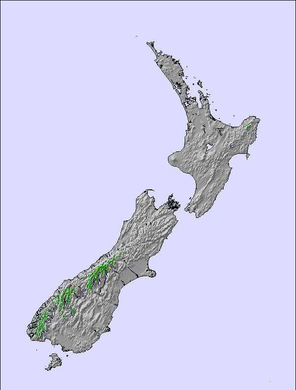
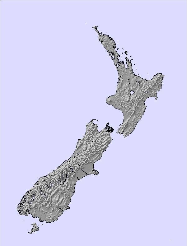
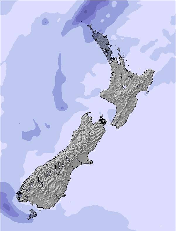
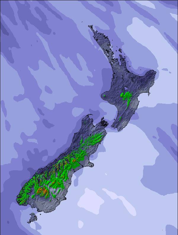
The above table gives the weather forecast for HeliPark New Zealand at the specific elevation of 1799 m. Our sophisticated weather models allow us to provide snow forecasts for the top, middle and bottom ski stations of HeliPark New Zealand. To access the weather forecasts for the other elevations, use the tab navigation above the table. For a wider view of the weather, check out the Weather Map of New Zealand.
Click here to read further information on freezing levels and how we forecast our temperatures.
No matter were in the world you ski / ride its all great, its all about what you make of it, but this place ( MT-POTTS ) makes it for you, were eles in the world can you chopper in, cat ski ( 14 runs on agood day )and get a beer at the end of the day all for $ 320 NZ, SIMPLE YOU CANT. The snow they get is very dry and man they get snow.I shouldnt be telling you this or you will all want to come.
JONATHAN from New Zealand writes:
No matter were in the world you ski / ride its all great, its all about what you make of it, but this place ( MT-POTTS ) makes it for you, were eles in the world can you chopper in, cat ski ( 14 runs on agood day )and get a beer at the end of the day all for $ 320 NZ, SIMPLE YOU CANT. The snow they get is very dry and man they get snow.I shouldnt be telling you this or you will all want to come.
Click here to submit your own review of HeliPark New Zealand
The HeliPark New Zealand skiing weather widget is available to embed on external websites free of charge. It provides a daily summary of our HeliPark New Zealand snow forecast and current weather conditions. Simply go to the feed configuration page and follow the 3 simple steps to grab the custom html code snippet and paste it into your own site. You can choose the snow forecast elevation (summit, mid-mountain or bottom lift) and metric/imperial units for the snow forecast feed to suit your own website…. Click here to get the code.
View detailed snow forecast for HeliPark New Zealand at:
snow-forecast.com

 Nearest