


View forecast
Mt Palandöken at 3100 m altitude
Issued by Snow-Forecast.com at: 2 am (local time) / 05 May 2024
Now
Sunday 5 | Monday 6 | Tuesday 7 | Wednesday 8 | Thursday 9 | Friday 10 | Saturday 11 | |||||||||||||||
AM | PM | night | AM | PM | night | AM | PM | night | AM | PM | night | AM | PM | night | AM | PM | night | AM | PM | night | |
cloudy | light snow | light snow | mod. snow | mod. snow | light snow | snow shwrs | light snow | mod. snow | snow shwrs | light snow | clear | some clouds | some clouds | some clouds | rain shwrs | risk thun- der | cloudy | light snow | risk thun- der | rain shwrs | |
km/h | |||||||||||||||||||||
Snow map | 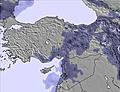 | 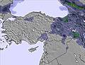 | 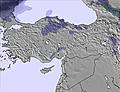 | 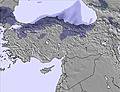 | 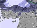 | 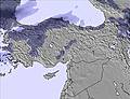 | 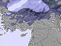 | ||||||||||||||
— | 1.0 | 1.0 | 5 | 5 | 1.0 | — | 2.0 | 6 | — | — | — | — | — | — | — | — | — | 3 | — | — | |
— | — | — | — | — | — | — | — | — | — | — | — | — | — | — | 1.0 | 1.0 | — | — | 2.0 | 1.0 | |
max°C | -2 | -2 | -3 | -4 | -3 | -4 | -3 | -2 | -3 | -3 | 0 | 0 | 1 | 3 | 2 | 3 | 4 | 5 | 0 | 3 | 3 |
min°C | -3 | -2 | -4 | -4 | -3 | -5 | -4 | -2 | -4 | -4 | -1 | -1 | -1 | 3 | 1 | 1 | 4 | 1 | -1 | 3 | 0 |
-12 | -10 | -12 | -10 | -7 | -9 | -6 | -2 | -8 | -7 | -4 | -5 | -4 | 0 | -4 | -4 | -2 | -7 | -10 | -4 | -5 | |
76 | 90 | 98 | 93 | 82 | 99 | 91 | 92 | 96 | 94 | 83 | 78 | 46 | 59 | 58 | 63 | 64 | 59 | 99 | 80 | 76 | |
2700 | 2850 | 2500 | 2500 | 2650 | 2450 | 2500 | 2800 | 2550 | 2550 | 3000 | 3000 | 3050 | 3500 | 3300 | 3250 | 3700 | 3700 | 2950 | 3500 | 3300 | |
5:09 | — | — | 5:07 | — | — | 5:07 | — | — | 5:05 | — | — | 5:05 | — | — | 5:03 | — | — | 5:03 | — | — | |
— | 7:13 | — | — | 7:14 | — | — | 7:15 | — | — | 7:15 | — | — | 7:16 | — | — | 7:17 | — | — | 7:19 | — | |
Next 0-3 days weather summary:
A heavy fall of snow, heaviest during Tue night. Temperatures will be below freezing (max -2°C on Sun morning, min -5°C on Mon night). Winds decreasing (strong winds from the SSW on Sun afternoon, calm by Mon morning).
Next 4-6 days weather summary:
Light rain (total 2.0mm), mostly falling on Fri morning. Freeze-thaw conditions (max 5°C on Fri night, min -4°C on Wed morning). Winds increasing (light winds from the NW on Wed morning, near gales from the S by Fri night).
Popular Mt Palandöken Pages
Snow Radar
Submit a reportLatest snow reports near Mt Palandöken:
0 km away from Mt Palandöken
5 hours ago
Rain showers reported from Erzurum Bölge at 1869 metres elevation 6 kms N of Mt Palandöken but it is forecast cold enough for snow at higher elevations in the ski area from Mt Palandöken
0 km away from Mt Palandöken
7 hours agoLight rain showers reported from Erzurum Bölge at 1869 metres elevation 6 kms N of Mt Palandöken but it is forecast cold enough for snow at higher elevations in the ski area from Mt Palandöken
Mt Palandöken Snow Conditions
| Top snow depth: | — |
|---|---|
| Bottom snow depth: | — |
| Fresh snowfall depth: | 2 cm |
| Last snowfall: | 4 May 2024 |
| Snow Alerts | Create Alert |
Other resorts in Turkey are reporting: powder (0) / good piste (0)
Snow-Forecast Partner Offers
Show your business here
Snow History
Week 1 of May has on average:
0.4 | Bluebird Powder days Fresh snow, mostly sunny, light wind. |
|---|---|
0.9 | Powder days Fresh snow, limited sun, any wind. |
0.8 | Bluebird days Average snow, mostly sunny, light wind. |

Mt Palandöken Forecast Snowfall
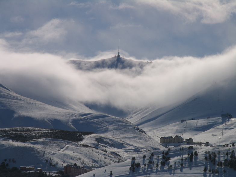
Photos of Mt Palandöken
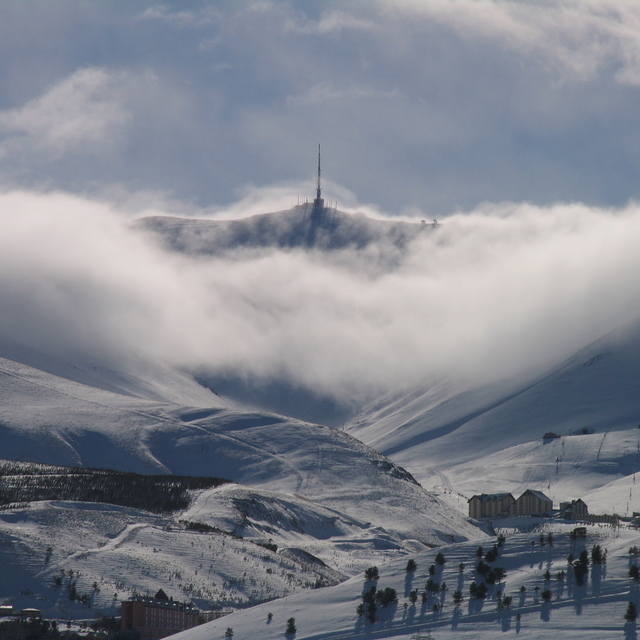
mt.palandöken ski center by Gasser Thierry
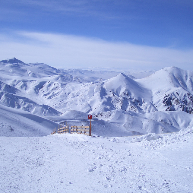
Mt Palandöken Number 21 by William
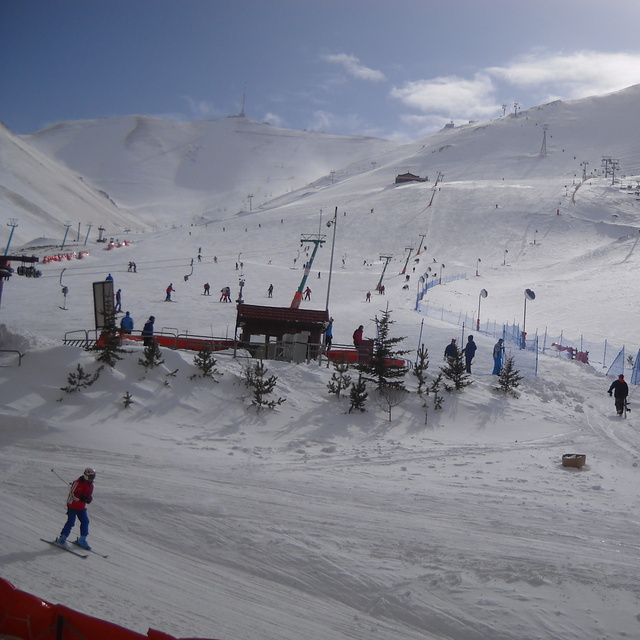
Palandöken
Other resorts in Turkey are reporting: powder (0) / good piste (0)
The above table gives the weather forecast for Mt Palandöken at the specific elevation of 3100 m. Our sophisticated weather models allow us to provide snow forecasts for the top, middle and bottom ski stations of Mt Palandöken. To access the weather forecasts for the other elevations, use the tab navigation above the table. For a wider view of the weather, check out the Weather Map of Turkey.
Click here to read further information on freezing levels and how we forecast our temperatures.
Resort name is also written as Mt Palandoken.
Visitor Reviews of Mt Palandöken
Overall 4.0 Based on 28 votes and 31 reviews
- Snowsure
- Variety of pistes
- Vote
- Simon from Turkey writes:
Just got back from a week in Mt Palandoken (now officially known as Ejder 3200). Flying in to Erzurum Airport followed by a 20 min transfer to the Dedemen Ski Lodge. Accommodation: excellent for the price with 3 square meals a day. Good choice, great staff and clean rooms. Ski rental: in hotel, good kit, excellent servicing. (TL100/£20) Lift Passes: TL60 per day (£12). Annoying that you have to change it daily though. The lift pass covers Mt Palandoken and Konakali which are separated by a 30 min taxi ride (TL70). Did not ski Konakli due to lack of snow. The lifts: not the best but functional. The piste map is not accurate (even the one in the resort). One long gondola to the top. Two chairs from bottom to mid-station and one good chair on left hand side at the base of the Ejder black run. An old T-bar on the right with half the tows missing. New chairs planned 'next year'! The pistes: well groomed despite lack of snow. Not all open and the off-piste was very thin. The skiing is very much at beginner/intermediate level on-piste but off-piste and into late Feb/Mar looks awesome. If you're prepared to boot/skin there are numerous 35 degree pitches just waiting to be smashed. Facilities: Not much on the Mountain, one nice coffee stop on right hand blue piste, for the rest its back to the hotel. Couple of nice bars. Teleski was our favourite and is in the Dedemen Ski Lodge. Ski School: The little ones in our party were well served by the in-house ski instructors but they only do 1 hr lessons morning and afternoon. Note: The Palot ski area bottom left on the map is NOT included on the lift pass as its private. TL40 to ski it for an afternoon. Summary: Great cheap skiing if you're in this part of the world. Probably keep you busy for 3 or 4 days max unless you're an off-piste powder hound.I'd go again for a weekend!
Visitor Reviews of Mt Palandöken
Simon from Turkey writes:
Just got back from a week in Mt Palandoken (now officially known as Ejder 3200). Flying in to Erzurum Airport followed by a 20 min transfer to the Dedemen Ski Lodge.
Accommodation: excellent for the price with 3 square meals a day. Good choice, great staff and clean rooms.
Ski rental: in hotel, good kit, excellent servicing. (TL100/£20)
Lift Passes: TL60 per day (£12). Annoying that you have to change it daily though. The lift pass covers Mt Palandoken and Konakali which are separated by a 30 min taxi ride (TL70). Did not ski Konakli due to lack of snow.
The lifts: not the best but functional. The piste map is not accurate (even the one in the resort). One long gondola to the top. Two chairs from bottom to mid-station and one good chair on left hand side at the base of the Ejder black run. An old T-bar on the right with half the tows missing. New chairs planned 'next year'!
The pistes: well groomed despite lack of snow. Not all open and the off-piste was very thin. The skiing is very much at beginner/intermediate level on-piste but off-piste and into late Feb/Mar looks awesome. If you're prepared to boot/skin there are numerous 35 degree pitches just waiting to be smashed.
Facilities: Not much on the Mountain, one nice coffee stop on right hand blue piste, for the rest its back to the hotel. Couple of nice bars. Teleski was our favourite and is in the Dedemen Ski Lodge.
Ski School: The little ones in our party were well served by the in-house ski instructors but they only do 1 hr lessons morning and afternoon.
Note: The Palot ski area bottom left on the map is NOT included on the lift pass as its private. TL40 to ski it for an afternoon.
Summary: Great cheap skiing if you're in this part of the world. Probably keep you busy for 3 or 4 days max unless you're an off-piste powder hound.I'd go again for a weekend!
Free Snow-Forecast.com weather widget for your website
The Mt Palandöken skiing weather widget is available to embed on external websites free of charge. It provides a daily summary of our Mt Palandöken snow forecast and current weather conditions. Simply go to the feed configuration page and follow the 3 simple steps to grab the custom html code snippet and paste it into your own site. You can choose the snow forecast elevation (summit, mid-mountain or bottom lift) and metric/imperial units for the snow forecast feed to suit your own website…. Click here to get the code.
View detailed snow forecast for Mt Palandöken at:
snow-forecast.com

 Nearest