

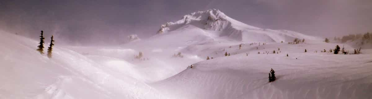
Massive Snowfall in the Alps
A huge snowfall is underway in the Alps, by far the biggest of the 24-25 season.
Please sign in with your Snow-Forecast account details below.


Montchavin Weather (Next 3 days): The snow forecast for Montchavin is: A dusting of new snow. Freeze-thaw conditions (max 2°C on Fri afternoon, min -3°C on Fri morning). Wind will be generally light.
Montchavin Weather (Days 4-6): Mild with light rain (total 7.0mm) on Tue night Becoming colder with a light covering of snow, mostly falling on Wed night. Freeze-thaw conditions (max 4°C on Tue afternoon, min -1°C on Mon morning). Wind will be generally light.
| Resort | Snow Depth | Temp. (°C) | Wind (km/h) | Weather | ||
|---|---|---|---|---|---|---|
| Top Lift: | -4 | |||||
| Middle Lift: | 1 | |||||
| Bottom Lift: | 5 |
Latest snow reports near Montchavin:
Powder day!. Another glorious day. from Val Thorens
Snow is falling at La Thuile. from La Thuile
Snowing at a moderate rate at La Rosière. from La Rosière
It is snowing steadily at Val Thorens. from Val Thorens
Snow is falling in Val Thorens. from Val Thorens

Friday 18 | Saturday 19 | Sunday 20 | Monday 21 | Tuesday 22 | Wednesday 23 | Thursday 24 | |||||||||||||||
AM | PM | night | AM | PM | night | AM | PM | night | AM | PM | night | AM | PM | night | AM | PM | night | AM | PM | night | |
clear | some clouds | clear | some clouds | cloudy | some clouds | snow shwrs | light snow | light snow | light snow | snow shwrs | some clouds | cloudy | light rain | light snow | light snow | light rain | light snow | light snow | light snow | light snow | |
km/h | |||||||||||||||||||||
Snow map |  |  |  |  |  |  |  | ||||||||||||||
— | — | — | — | — | — | — | — | 1.0 | 1.0 | — | — | — | — | — | 1.0 | — | 4 | 4 | — | 1.0 | |
— | — | — | — | — | — | — | — | — | — | — | — | — | 2.0 | 2.0 | — | 3 | — | — | — | — | |
max°C | -1 | 2 | 2 | 2 | 2 | 1 | 1 | 2 | 0 | 0 | 1 | 1 | 2 | 4 | 2 | 1 | 2 | 2 | -1 | 0 | -1 |
min°C | -3 | 1 | 0 | 1 | 2 | 0 | 0 | 2 | -1 | -1 | 1 | -1 | 0 | 3 | 1 | 1 | 2 | 0 | -1 | 0 | -1 |
-3 | -1 | -2 | -2 | -1 | -5 | -4 | -1 | -3 | -1 | 1 | -1 | -2 | 3 | -1 | 0 | 1 | 0 | -3 | -2 | -4 | |
77 | 56 | 54 | 77 | 81 | 77 | 87 | 83 | 91 | 93 | 86 | 74 | 70 | 79 | 85 | 95 | 96 | 99 | 99 | 99 | 100 | |
2050 | 2800 | 3100 | 2700 | 2600 | 2300 | 2400 | 2500 | 2100 | 2200 | 2400 | 2200 | 2500 | 2700 | 2450 | 2450 | 2600 | 2350 | 2150 | 2200 | 2150 | |
6:43 | — | — | 6:41 | — | — | 6:39 | — | — | 6:37 | — | — | 6:35 | — | — | 6:33 | — | — | 6:33 | — | — | |
— | — | 8:22 | — | — | 8:22 | — | — | 8:24 | — | — | 8:25 | — | — | 8:27 | — | — | 8:28 | — | — | 8:30 | |
A dusting of new snow. Freeze-thaw conditions (max 2°C on Fri afternoon, min -3°C on Fri morning). Wind will be generally light.
Mild with light rain (total 7.0mm) on Tue night Becoming colder with a light covering of snow, mostly falling on Wed night. Freeze-thaw conditions (max 4°C on Tue afternoon, min -1°C on Mon morning). Wind will be generally light.
Latest snow reports near Montchavin:
Powder day!. Another glorious day. from Val Thorens
Snow is falling at La Thuile. from La Thuile
Snowing at a moderate rate at La Rosière. from La Rosière
It is snowing steadily at Val Thorens. from Val Thorens
Snow is falling in Val Thorens. from Val Thorens
| Top snow depth: | — |
|---|---|
| Bottom snow depth: | — |
| Fresh snowfall depth: | 89 cm |
| Last snowfall: | 17 Apr 2025 |
| Snow Alerts | Create Alert |
0.5 | Bluebird Powder days Fresh snow, mostly sunny, light wind. |
|---|---|
1.3 | Powder days Fresh snow, limited sun, any wind. |
0.7 | Bluebird days Average snow, mostly sunny, light wind. |
The above table gives the weather forecast for Montchavin at the specific elevation of 2250 m. Our sophisticated weather models allow us to provide snow forecasts for the top, middle and bottom ski stations of Montchavin. To access the weather forecasts for the other elevations, use the tab navigation above the table. For a wider view of the weather, check out the Weather Map of France.
Click here to read further information on freezing levels and how we forecast our temperatures.
Overall 4.5 Based on 8 votes and 8 reviews
Montchavin is an old mountain village where you can smell the animals tucked away safely for the winter as you wander through the beautiful traditional village centre. It is essentially a family resort and the ski schools are excellent. There is a beginners area for children at the bottom of the slope by the first lift up and a newly developed larger area for adult beginners just up 2 lifts. There are limited bars and restaurants in the village, so they do get busy, but most people self cater out here. There is a free bus service between Montchavin and Les Coches, which allows visitors to benefit from the facilities in both villages - e.g the cinema and pool in Montchavin, and the ice rink in Les Coches. The locals are very friendly, there is a tourist information office in both Montchavin and Les Coches with loads of events each week, so non-skiers will be able to find something of interest to do. Although the village is low down, the pisteurs do a fantastic job each year keeping routes open. Snow cannons are in use if snow conditions are low and temperature allows. In recent years with climate change, we have always managed to ski back to the village and if you don't fancy it, you can download on two bubbles. The fantastic thing about Montchavin/Les Coches is its location slap bang in the middle of Paradiski. We leave our apartment, ski down to the first lift and at the top decide whether to head left or right for Les Arcs or La Plagne. So easy to access the whole Paradiski area with such a lot of varied terrain and runs and some excellent off-piste to be found if you know where to go. Get a guide - they'll be able to show you some great routes. When it's white-out conditions and blowing a gale higher up, you can ski some lovely tree lined runs just in and above Montchavin/Les Coches. I really can't recommend it enough.
Joanne W from United Kingdom writes:
Montchavin is an old mountain village where you can smell
the animals tucked away safely for the winter as you wander through the beautiful traditional village centre. It is essentially a family resort and the ski schools are excellent. There is a beginners area for children at the bottom of the slope by the first lift up and a newly developed larger area for adult beginners just up 2 lifts. There are limited bars and restaurants in the village, so they do get busy, but most people self cater out here. There is a free bus service between Montchavin and Les Coches, which allows visitors to benefit from the facilities in both villages - e.g the cinema and pool in Montchavin, and the ice rink in Les Coches. The locals are very friendly, there is a tourist information office in both Montchavin and Les Coches with loads of events each week, so non-skiers will be able to find something of interest to do. Although the village is low down, the pisteurs do a fantastic job each year keeping routes open. Snow cannons are in use if snow conditions are low and temperature allows. In recent years with climate change, we have always managed to ski back to the village and if you don't fancy it, you can download on two bubbles. The fantastic thing about Montchavin/Les Coches is its location slap bang in the middle of Paradiski. We leave our apartment, ski down to the first lift and at the top decide whether to head left or right for Les Arcs or La Plagne. So easy to access the whole Paradiski area with such a lot of varied terrain and runs and some excellent off-piste to be found if you know where to go. Get a guide - they'll be able to show you some great routes. When it's white-out conditions and blowing a gale higher up, you can ski some lovely tree lined runs just in and above Montchavin/Les Coches. I really can't recommend it enough.
The Montchavin skiing weather widget is available to embed on external websites free of charge. It provides a daily summary of our Montchavin snow forecast and current weather conditions. Simply go to the feed configuration page and follow the 3 simple steps to grab the custom html code snippet and paste it into your own site. You can choose the snow forecast elevation (summit, mid-mountain or bottom lift) and metric/imperial units for the snow forecast feed to suit your own website…. Click here to get the code.
View detailed snow forecast for Montchavin at:
snow-forecast.com


 Nearest