
Alps Glaciers Closing Fast as 5,000m Freezing Point Triggers Rapid Melt
Updated July 2, 2025: Europe’s glaciers closing fast, Alps hit 5,200m freezing point, and U.S. snowfields shrink in 100°F heat—click for full summer snow update.
By using Snow-Forecast, you agree to our Terms & Services.
Don't have an account? Join now
Alternatively, you can now use your Outside account to sign in to any brand in the Outside digital ecosystem, including Snow-Forecast, Surf-Forecast, and Mountain-Forecast.

Kühtai Weather (Next 3 days): The snow forecast for Kühtai is: Heavy rain (total 30.0mm), heaviest during Wed afternoon. Very mild (max 16°C on Thu afternoon, min 9°C on Fri night). Wind will be generally light.
Kühtai Weather (Days 4-6): Heavy rain (total 83.0mm), heaviest during Mon morning. Very mild (max 15°C on Sat afternoon, min 1°C on Mon night). Wind will be generally light.
| Resort | Snow Depth | Temp. (°C) | Wind (km/h) | Weather | ||
|---|---|---|---|---|---|---|
| Top Lift: | 0.0 m | 11 | ||||
| Middle Lift: | 13 | |||||
| Bottom Lift: | 0.0 m | 14 |
Latest snow reports near Kühtai:

Wed 2 | Thursday 3 | Friday 4 | Saturday 5 | Sunday 6 | Monday 7 | Tuesday 8 | ||||||||||||||
PM | night | AM | PM | night | AM | PM | night | AM | PM | night | AM | PM | night | AM | PM | night | AM | PM | night | |
mod. rain | rain shwrs | rain shwrs | risk thun- der | rain shwrs | risk thun- der | risk thun- der | rain shwrs | clear | risk thun- der | rain shwrs | risk thun- der | light rain | heavy rain | heavy rain | heavy rain | snow shwrs | light snow | snow shwrs | rain shwrs | |
km/h | ||||||||||||||||||||
Snow map |  |  |  |  |  |  |  | |||||||||||||
— | — | — | — | — | — | — | — | — | — | — | — | — | — | — | — | 1 | — | 1 | — | |
6 | 1 | 2 | 5 | 7 | 3 | 3 | 3 | — | 2 | 8 | 3 | 5 | 23 | 23 | 15 | 3 | 1 | 1 | 1 | |
max°C | 13 | 12 | 14 | 16 | 12 | 12 | 13 | 11 | 13 | 15 | 11 | 13 | 13 | 9 | 5 | 4 | 3 | 2 | 3 | 3 |
min°C | 13 | 11 | 12 | 12 | 10 | 10 | 12 | 9 | 10 | 15 | 10 | 11 | 11 | 6 | 4 | 4 | 1 | 1 | 2 | 2 |
13 | 11 | 12 | 12 | 10 | 10 | 12 | 8 | 10 | 15 | 10 | 11 | 11 | 6 | 3 | 4 | -1 | -1 | -1 | -1 | |
67 | 76 | 61 | 81 | 68 | 71 | 75 | 81 | 67 | 65 | 82 | 60 | 73 | 98 | 96 | 95 | 92 | 85 | 77 | 67 | |
4400 | 4300 | 4150 | 4150 | 4250 | 4000 | 4100 | 3950 | 4000 | 4200 | 4150 | 4050 | 4050 | 3500 | 3000 | 2950 | 2500 | 2600 | 2650 | 2900 | |
— | — | 5:24 | — | — | 5:24 | — | — | 5:26 | — | — | 5:26 | — | — | 5:26 | — | — | 5:28 | — | — | |
— | 9:15 | — | — | 9:15 | — | — | 9:14 | — | — | 9:14 | — | — | 9:13 | — | — | 9:13 | — | — | 9:13 | |
Heavy rain (total 30.0mm), heaviest during Wed afternoon. Very mild (max 16°C on Thu afternoon, min 9°C on Fri night). Wind will be generally light.
Heavy rain (total 83.0mm), heaviest during Mon morning. Very mild (max 15°C on Sat afternoon, min 1°C on Mon night). Wind will be generally light.
Latest snow reports near Kühtai:
| Top snow depth: | 0 cm |
|---|---|
| Bottom snow depth: | 0 cm |
| Fresh snowfall depth: | — |
| Last snowfall: | 28 May 2025 |
| Snow Alerts | Create Alert |
0.0 | Bluebird Powder days Fresh snow, mostly sunny, light wind. |
|---|---|
0.0 | Powder days Fresh snow, limited sun, any wind. |
0.0 | Bluebird days Average snow, mostly sunny, light wind. |
The above table gives the weather forecast for Kühtai at the specific elevation of 2270 m. Our sophisticated weather models allow us to provide snow forecasts for the top, middle and bottom ski stations of Kühtai. To access the weather forecasts for the other elevations, use the tab navigation above the table. For a wider view of the weather, check out the Weather Map of Austria.
Click here to read further information on freezing levels and how we forecast our temperatures.
Resort name is also written as Kuehtai.
Overall 4.0 Based on 13 votes and 7 reviews
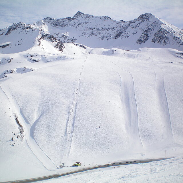
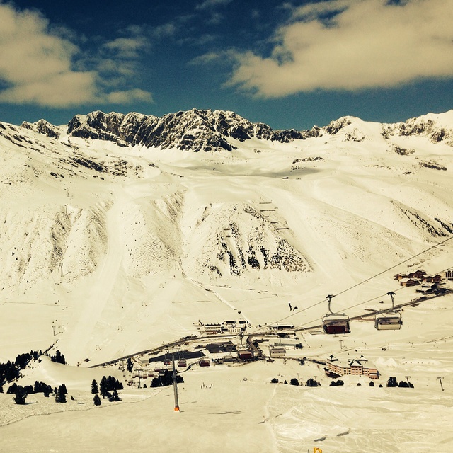
A long overdue review on Kuhtai, which 've skied may times in the past few years. In short, another classic medium size resort with approx 40 km of pistes which the Austrians do so well. With a base station of 2,000m it's super snow-sure if rather bleak as it's a one street station at the top of a pass, all above the tree line. Make no mistake though, this is a serious ski resort, sporting a modern lift system with all the pistes being either red or black, save one blue run that finishes at the top of a long red canyon; so it's not a resort for beginners! Its serious sporting intent is underlined by the fact the the US World Cup Ski Team is based here when the World Cup is in Europe. The slopes face both north and south so you can follow the sun each day, plus there are plenty of off-piste and back-country opportunities. Subsistence is good value compared to the big resorts like Soelden, Ischgl and St Anton. But best of all is the fact the pistes are generally deserted on mid week days and there are very few Brits around, so you really feel you are on a foreign holiday. Overall, highly recommended for long weekend or away days in neighbouring resorts. It's also worth noting the lift pass is shared with nearby Oetz, another similar sized gem.
Tirolerhund from United Kingdom writes:
A long overdue review on Kuhtai, which 've skied may times in the past few years. In short, another classic medium size resort with approx 40 km of pistes which the Austrians do so well.
With a base station of 2,000m it's super snow-sure if rather bleak as it's a one street station at the top of a pass, all above the tree line.
Make no mistake though, this is a serious ski resort, sporting a modern lift system with all the pistes being either red or black, save one blue run that finishes at the top of a long red canyon; so it's not a resort for beginners!
Its serious sporting intent is underlined by the fact the the US World Cup Ski Team is based here when the World Cup is in Europe.
The slopes face both north and south so you can follow the sun each day, plus there are plenty of off-piste and back-country opportunities.
Subsistence is good value compared to the big resorts like Soelden, Ischgl and St Anton. But best of all is the fact the pistes are generally deserted on mid week days and there are very few Brits around, so you really feel you are on a foreign holiday.
Overall, highly recommended for long weekend or away days in neighbouring resorts. It's also worth noting the lift pass is shared with nearby Oetz, another similar sized gem.
The Kühtai skiing weather widget is available to embed on external websites free of charge. It provides a daily summary of our Kühtai snow forecast and current weather conditions. Simply go to the feed configuration page and follow the 3 simple steps to grab the custom html code snippet and paste it into your own site. You can choose the snow forecast elevation (summit, mid-mountain or bottom lift) and metric/imperial units for the snow forecast feed to suit your own website…. Click here to get the code.
View detailed snow forecast for Kühtai at:
snow-forecast.com


 Nearest