


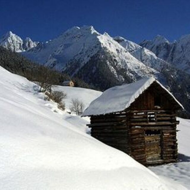
Global Weekly Snow Roundup #314
Weekly Global Snow News, updated 14 May 2026: Fresh snowfall in Argentina, Australia and Lesotho signals winter’s approach, while Japan maintains the world’s deepest snowpack.

Next 3 days weather summary:A moderate fall of snow, heaviest on Mon night. Temperatures will be below freezing (max -1°C on Mon afternoon, min -9°C on Sat morning). Wind will be generally light. | Days 4-6 weather summary:Some drizzle, heaviest during Wed afternoon. Freeze-thaw conditions (max 6°C on Thu afternoon, min -3°C on Tue morning). Wind will be generally light. | |||||||||||||||||
Saturday 16 | Sunday 17 | Monday 18 | Tuesday 19 | Wednesday 20 | Thursday 21 | |||||||||||||
AM | PM | night | AM | PM | night | AM | PM | night | AM | PM | night | AM | PM | night | AM | PM | night | |
light snow | light snow | snow shwrs | clear | snow shwrs | snow shwrs | light snow | light snow | mod. snow | some clouds | light snow | light snow | cloudy | snow shwrs | snow shwrs | some clouds | clear | clear | |
km/h | ||||||||||||||||||
Snow map |  |  |  |  |  |  | ||||||||||||
3 | 1 | — | — | — | — | — | 2 | 10 | — | — | 1 | — | — | — | — | — | — | |
— | — | — | — | — | — | — | — | — | — | — | — | — | 1 | — | — | — | — | |
max °C | -8 | -7 | -7 | -4 | -2 | -2 | -2 | -1 | -2 | -1 | 0 | 0 | 0 | 2 | 2 | 3 | 6 | 5 |
min °C | -9 | -7 | -7 | -5 | -3 | -3 | -3 | -1 | -4 | -3 | 0 | -1 | 0 | 1 | 1 | 1 | 4 | 4 |
-16 | -12 | -10 | -5 | -5 | -6 | -5 | -3 | -7 | -5 | 0 | -1 | -2 | -1 | 0 | -1 | 2 | 3 | |
89 | 94 | 75 | 57 | 85 | 88 | 91 | 85 | 89 | 67 | 90 | 96 | 78 | 76 | 76 | 59 | 57 | 39 | |
1600 | 1850 | 1450 | 2100 | 2400 | 1950 | 2400 | 2600 | 1900 | 2450 | 2700 | 2600 | 2750 | 2950 | 2950 | 3050 | 3400 | 3550 | |
5:41 | — | — | 5:39 | — | — | 5:37 | — | — | 5:37 | — | — | 5:35 | — | — | 5:35 | — | — | |
— | — | 8:45 | — | — | 8:46 | — | — | 8:47 | — | — | 8:49 | — | — | 8:51 | — | — | 8:52 | |
Latest snow reports near Kaunertal:
| Top snow depth: | 160 cm |
|---|---|
| Bottom snow depth: | 95 cm |
| Fresh snowfall depth: | 38 cm |
| Last snowfall: | 15 May 2026 |
| Snow Alerts | Create Alert |
0.7 | Bluebird Powder days Fresh snow, mostly sunny, light wind. |
|---|---|
2.0 | Powder days Fresh snow, limited sun, any wind. |
0.3 | Bluebird days Average snow, mostly sunny, light wind. |
The above table gives the weather forecast for Kaunertal at the specific elevation of 2692 m. Our sophisticated weather models allow us to provide snow forecasts for the top, middle and bottom ski stations of Kaunertal. To access the weather forecasts for the other elevations, use the tab navigation above the table. For a wider view of the weather, check out the Weather Map of Austria.
Click here to read further information on freezing levels and how we forecast our temperatures.
Overall 3.9 Based on 17 votes and 2 reviews
Awesome place, great crowd-free pistes and some off piste action. Drive up would get boring after a week but amazing, especially in avalanche season! Real high mountain feel, go for a pizza at Andreas's in Feichten on way back. Reasonable prices, you can always go to Fendels for a change.
Jon+Tom from Ireland writes:
Awesome place, great crowd-free pistes and some off piste action. Drive up would get boring after a week but amazing, especially in avalanche season! Real high mountain feel, go for a pizza at Andreas's in Feichten on way back.
Reasonable prices, you can always go to Fendels for a change.


 Nearest