
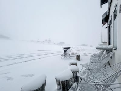
Snowfall at Mt Hutt Marks Winter's Arrival in the Southern Hemisphere
Updated May 7, 2025: Snowfall hits the Southern Hemisphere - marking winter's arrival with 80 cm (31”) of snow in Mt Hutt, while Australia’s Corin Forest opens early.
Please sign in with your Snow-Forecast account details below.

Katschberg-Aineck Weather (Next 3 days): The snow forecast for Katschberg-Aineck is: Moderate rain (total 16.0mm), heaviest on Sun afternoon. Very mild (max 15°C on Sat afternoon, min 4°C on Fri night). Wind will be generally light.
Katschberg-Aineck Weather (Days 4-6): Moderate rain (total 11.0mm), heaviest on Mon afternoon. Very mild (max 17°C on Wed afternoon, min 2°C on Tue night). Wind will be generally light.
| Resort | Snow Depth | Temp. (°C) | Wind (km/h) | Weather | ||
|---|---|---|---|---|---|---|
| Top Lift: | -2 | |||||
| Middle Lift: | 2 | |||||
| Bottom Lift: | 5 |
Latest snow reports near Katschberg-Aineck:
Light rain showers reported from Katschberg at 1637 metres elevation one km NNE of Katschberg-Aineck but it is forecast cold enough for snow at higher elevations in the ski area from Katschberg-Aineck
Rain reported from Obertauern (automatic) at 1742 metres elevation one km N of Obertauern but it is forecast cold enough for snow at the ski area from Obertauern
Rain reported from Murau at 818 metres elevation only 4 kms N of Murau/Frauenalpe but it is forecast cold enough for snow at the ski area from Murau/Frauenalpe

Friday 9 | Saturday 10 | Sunday 11 | Monday 12 | Tuesday 13 | Wednesday 14 | Thursday 15 | |||||||||||||||
AM | PM | night | AM | PM | night | AM | PM | night | AM | PM | night | AM | PM | night | AM | PM | night | AM | PM | night | |
light rain | light rain | light rain | some clouds | rain shwrs | rain shwrs | some clouds | risk thun- der | light rain | rain shwrs | light rain | light rain | some clouds | some clouds | clear | clear | some clouds | rain shwrs | clear | some clouds | clear | |
km/h | |||||||||||||||||||||
Snow map |  |  |  |  |  |  |  | ||||||||||||||
— | — | — | — | — | — | — | — | — | — | — | — | — | — | — | — | — | — | — | — | — | |
2.0 | 2.0 | 2.0 | — | 2.0 | 1.0 | — | 3 | 4 | 1.0 | 5 | 4 | — | — | — | — | — | 1.0 | — | — | — | |
max°C | 6 | 7 | 6 | 11 | 15 | 9 | 15 | 14 | 10 | 11 | 11 | 8 | 10 | 14 | 9 | 14 | 17 | 10 | 15 | 17 | 11 |
min°C | 5 | 7 | 4 | 6 | 13 | 5 | 9 | 13 | 8 | 9 | 10 | 6 | 7 | 14 | 2 | 8 | 16 | 5 | 10 | 16 | 6 |
5 | 7 | 4 | 6 | 13 | 5 | 9 | 13 | 8 | 9 | 10 | 6 | 6 | 14 | 1 | 8 | 16 | 5 | 10 | 16 | 5 | |
99 | 94 | 98 | 65 | 62 | 86 | 55 | 77 | 99 | 81 | 92 | 97 | 63 | 35 | 82 | 29 | 31 | 81 | 38 | 36 | 86 | |
2000 | 2200 | 2050 | 2500 | 2700 | 2400 | 2650 | 2800 | 2600 | 2600 | 2600 | 2200 | 2300 | 2650 | 1800 | 2600 | 2850 | 2200 | 2700 | 2900 | 2450 | |
5:37 | — | — | 5:37 | — | — | 5:35 | — | — | 5:33 | — | — | 5:33 | — | — | 5:31 | — | — | 5:30 | — | — | |
— | — | 8:24 | — | — | 8:27 | — | — | 8:28 | — | — | 8:29 | — | — | 8:30 | — | — | 8:31 | — | — | 8:32 | |
Moderate rain (total 16.0mm), heaviest on Sun afternoon. Very mild (max 15°C on Sat afternoon, min 4°C on Fri night). Wind will be generally light.
Moderate rain (total 11.0mm), heaviest on Mon afternoon. Very mild (max 17°C on Wed afternoon, min 2°C on Tue night). Wind will be generally light.
Latest snow reports near Katschberg-Aineck:
Light rain showers reported from Katschberg at 1637 metres elevation one km NNE of Katschberg-Aineck but it is forecast cold enough for snow at higher elevations in the ski area from Katschberg-Aineck
Rain reported from Obertauern (automatic) at 1742 metres elevation one km N of Obertauern but it is forecast cold enough for snow at the ski area from Obertauern
Rain reported from Murau at 818 metres elevation only 4 kms N of Murau/Frauenalpe but it is forecast cold enough for snow at the ski area from Murau/Frauenalpe
| Top snow depth: | — |
|---|---|
| Bottom snow depth: | — |
| Fresh snowfall depth: | 1 cm |
| Last snowfall: | 8 May 2025 |
| Snow Alerts | Create Alert |
0.0 | Bluebird Powder days Fresh snow, mostly sunny, light wind. |
|---|---|
0.0 | Powder days Fresh snow, limited sun, any wind. |
0.0 | Bluebird days Average snow, mostly sunny, light wind. |
The above table gives the weather forecast for Katschberg-Aineck at the specific elevation of 1060 m. Our sophisticated weather models allow us to provide snow forecasts for the top, middle and bottom ski stations of Katschberg-Aineck. To access the weather forecasts for the other elevations, use the tab navigation above the table. For a wider view of the weather, check out the Weather Map of Austria.
Click here to read further information on freezing levels and how we forecast our temperatures.
Overall 4.1 Based on 3 votes and 5 reviews
Just returned from the Hotel Cristallo in Katschberg (27.01.07). Hotel is fantastic and excellent value for money. Kids loved it. There was plenty of snow and the place looked very scenic. Great skiing for beginners but a little restricted for good intermediates. Most of the runs are quite short, but no queues for the lifts, so you can get straight back to the top for your next go! Would consider going back. Only down side was that persons without ski's on could not go on the lifts, so couldn't get to higher up bars.
Monty and Gill from United Kingdom writes:
Just returned from the Hotel Cristallo in Katschberg (27.01.07). Hotel is fantastic and excellent value for money. Kids loved it. There was plenty of snow and the place looked very scenic. Great skiing for beginners but a little restricted for good intermediates. Most of the runs are quite short, but no queues for the lifts, so you can get straight back to the top for your next go! Would consider going back. Only down side was that persons without ski's on could not go on the lifts, so couldn't get to higher up bars.
The Katschberg-Aineck skiing weather widget is available to embed on external websites free of charge. It provides a daily summary of our Katschberg-Aineck snow forecast and current weather conditions. Simply go to the feed configuration page and follow the 3 simple steps to grab the custom html code snippet and paste it into your own site. You can choose the snow forecast elevation (summit, mid-mountain or bottom lift) and metric/imperial units for the snow forecast feed to suit your own website…. Click here to get the code.
View detailed snow forecast for Katschberg-Aineck at:
snow-forecast.com


 Nearest