
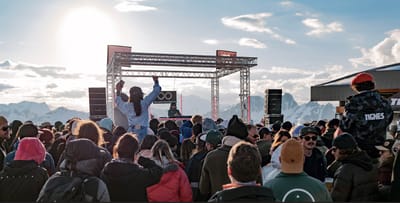
Tignes Unlimited Festival Into May
Tignes, one of the few French ski areas staying open into May, will round off the 2025–26 winter season with the return of the Tignes Unlimited electronic music festival, running from 25 April to 3 May 2026.

Next 3 days weather summary:Mostly dry. Freeze-thaw conditions (max 5°C on Thu afternoon, min -4°C on Tue night). Wind will be generally light. | Days 4-6 weather summary:Mostly dry. Freeze-thaw conditions (max 8°C on Sat afternoon, min 0°C on Sun night). Wind will be generally light. | |||||||||||||||||
Tuesday 21 | Wednesday 22 | Thursday 23 | Friday 24 | Saturday 25 | Sunday 26 | |||||||||||||
AM | PM | night | AM | PM | night | AM | PM | night | AM | PM | night | AM | PM | night | AM | PM | night | |
cloudy | light snow | snow shwrs | some clouds | some clouds | clear | clear | clear | clear | clear | clear | clear | clear | clear | clear | some clouds | some clouds | cloudy | |
km/h | ||||||||||||||||||
Snow map |  |  |  |  |  |  | ||||||||||||
— | — | — | — | — | — | — | — | — | — | — | — | — | — | — | — | — | — | |
— | — | — | — | — | — | — | — | — | — | — | — | — | — | — | — | — | — | |
max °C | -2 | 0 | -2 | -1 | 3 | -1 | 3 | 5 | 2 | 4 | 6 | 4 | 6 | 8 | 5 | 5 | 7 | 4 |
min °C | -3 | -1 | -4 | -3 | 2 | -2 | 0 | 5 | -1 | 1 | 6 | 1 | 3 | 7 | 1 | 2 | 7 | 0 |
-6 | -4 | -4 | -3 | 0 | -2 | -2 | 3 | -4 | -3 | 4 | -2 | 0 | 5 | -3 | -1 | 5 | 0 | |
74 | 66 | 75 | 55 | 50 | 53 | 19 | 24 | 48 | 26 | 36 | 58 | 35 | 59 | 68 | 46 | 38 | 65 | |
1650 | 1900 | 1450 | 1850 | 2250 | 1450 | 2400 | 2600 | 1750 | 2500 | 2750 | 2500 | 2900 | 2750 | 2500 | 2750 | 2900 | 2350 | |
6:09 | — | — | 6:09 | — | — | 6:07 | — | — | 6:05 | — | — | 6:03 | — | — | 6:01 | — | — | |
— | — | 8:05 | — | — | 8:06 | — | — | 8:07 | — | — | 8:08 | — | — | 8:10 | — | — | 8:12 | |
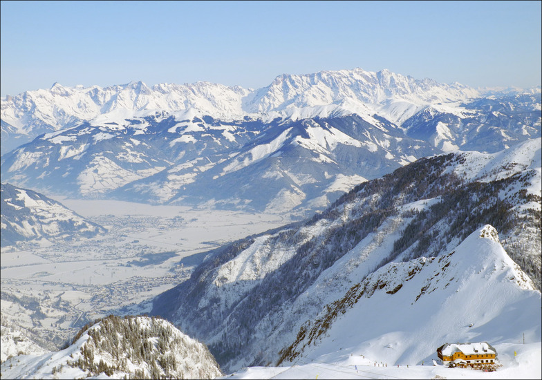
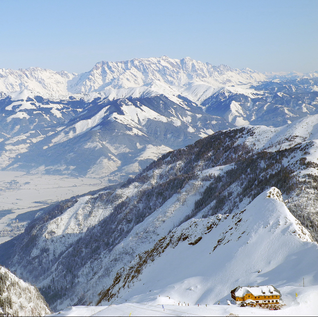
Latest snow reports near Kaprun:
| Top snow depth: | 190 cm |
|---|---|
| Bottom snow depth: | — |
| Fresh snowfall depth: | 4 cm |
| Last snowfall: | 19 Apr 2026 |
| Snow Alerts | Create Alert |
0.5 | Bluebird Powder days Fresh snow, mostly sunny, light wind. |
|---|---|
1.3 | Powder days Fresh snow, limited sun, any wind. |
0.6 | Bluebird days Average snow, mostly sunny, light wind. |
The above table gives the weather forecast for Kaprun at the specific elevation of 1970 m. Our sophisticated weather models allow us to provide snow forecasts for the top, middle and bottom ski stations of Kaprun. To access the weather forecasts for the other elevations, use the tab navigation above the table. For a wider view of the weather, check out the Weather Map of Austria.
Click here to read further information on freezing levels and how we forecast our temperatures.
Overall 4.2 Based on 28 votes and 29 reviews
There is extensive skiing at Kaprun with excellent slopes for all skill levels. My only concern was the very high speeds that many people were skiing at. It was frankly dangerous. There is no way this would be permitted in North America. Something needs to be done about it. We are aware of one fatality that occurred 2 weeks before we holidayed there.
Jonathan Mann from United Kingdom writes:
There is extensive skiing at Kaprun with excellent slopes for all skill levels. My only concern was the very high speeds that many people were skiing at. It was frankly dangerous. There is no way this would be permitted in North America. Something needs to be done about it. We are aware of one fatality that occurred 2 weeks before we holidayed there.


 Nearest