


View forecast
Hochzeiger at 2370 m altitude
Issued by Snow-Forecast.com at: 1 am (local time) / 02 May 2024
Now
Thursday 2 | Friday 3 | Saturday 4 | Sunday 5 | Monday 6 | Tuesday 7 | Wednesday 8 | |||||||||||||||
AM | PM | night | AM | PM | night | AM | PM | night | AM | PM | night | AM | PM | night | AM | PM | night | AM | PM | night | |
some clouds | light rain | light snow | light snow | light snow | light snow | cloudy | light rain | light snow | some clouds | rain shwrs | light snow | light snow | risk thun- der | mod. rain | light snow | light snow | light snow | light snow | light snow | light snow | |
km/h | |||||||||||||||||||||
Snow map |  |  |  |  |  |  |  | ||||||||||||||
— | — | 2.0 | 1.0 | — | 1.0 | — | — | — | — | — | — | — | — | — | 3 | 3 | 3 | — | — | 1.0 | |
— | 3 | — | — | — | — | — | 2.0 | — | — | 3 | 1.0 | 1.0 | 3 | 10 | — | — | — | — | 1.0 | — | |
max°C | 3 | 3 | 1 | -2 | -1 | -1 | 1 | 3 | 2 | 1 | 3 | 2 | 3 | 5 | 4 | 2 | 1 | 1 | 2 | 2 | 1 |
min°C | 3 | 2 | -2 | -3 | -1 | -2 | -1 | 2 | -1 | 0 | 2 | 1 | 1 | 5 | 2 | 2 | 1 | 0 | 1 | 2 | -1 |
0 | 0 | -5 | -6 | -3 | -4 | -4 | -1 | -4 | -2 | 2 | -1 | -1 | 5 | 2 | 2 | 1 | 0 | 1 | 1 | -3 | |
75 | 86 | 99 | 94 | 90 | 95 | 83 | 81 | 92 | 83 | 83 | 91 | 80 | 84 | 93 | 98 | 98 | 97 | 93 | 95 | 97 | |
2750 | 2650 | 2150 | 2000 | 2250 | 2050 | 2450 | 2700 | 2300 | 2550 | 2750 | 2600 | 2800 | 3000 | 2800 | 2650 | 2600 | 2500 | 2600 | 2650 | 2300 | |
5:58 | — | — | 5:56 | — | — | 5:54 | — | — | 5:54 | — | — | 5:52 | — | — | 5:50 | — | — | 5:48 | — | — | |
— | — | 8:29 | — | — | 8:30 | — | — | 8:31 | — | — | 8:32 | — | — | 8:34 | — | — | 8:36 | — | — | 8:37 | |
Next 0-3 days weather summary:
Light rain (total 5.0mm) at first, then becoming colder with a dusting of snow on Thu night. Freeze-thaw conditions (max 3°C on Thu morning, min -3°C on Fri morning). Wind will be generally light.
Next 4-6 days weather summary:
Mild with moderate rain (total 18.0mm) on Mon night, Becoming colder with a light covering of snow, mostly falling on Tue night. Freeze-thaw conditions (max 5°C on Mon afternoon, min 0°C on Sun morning). Wind will be generally light.
Popular Hochzeiger Pages
Snow Radar
Submit a reportLatest snow reports near Hochzeiger:
22 km away from Hochzeiger
2 hours ago
Rain reported from Pitztaler Gletscher at 2848 metres elevation only 4 kms SSE of Pitztal Glacier but it is forecast cold enough for snow at higher elevations in the ski area from Pitztal Glacier
35 km away from Hochzeiger
2 hours agoLight rain showers reported from Obergurgl at 1937 metres elevation one km SSE of Obergurgl but it is forecast cold enough for snow at higher elevations in the ski area from Obergurgl
35 km away from Hochzeiger
3 hours agoRain reported from Obergurgl at 1937 metres elevation one km SSE of Obergurgl but it is forecast cold enough for snow at higher elevations in the ski area from Obergurgl
Hochzeiger Snow Conditions
| Top snow depth: | — |
|---|---|
| Bottom snow depth: | — |
| Fresh snowfall depth: | — |
| Last snowfall: | 24 Apr 2024 |
| Snow Alerts | Create Alert |
Other resorts in Austria are reporting: powder (0) / good piste (3)
Snow-Forecast Partner Offers
Show your business here
Snow History
Week 1 of May has on average:
0.4 | Bluebird Powder days Fresh snow, mostly sunny, light wind. |
|---|---|
1.3 | Powder days Fresh snow, limited sun, any wind. |
0.3 | Bluebird days Average snow, mostly sunny, light wind. |
Hochzeiger Forecast Snowfall


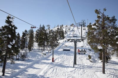
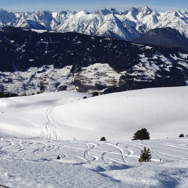
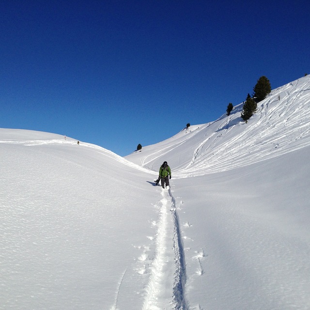
Photos of Hochzeiger
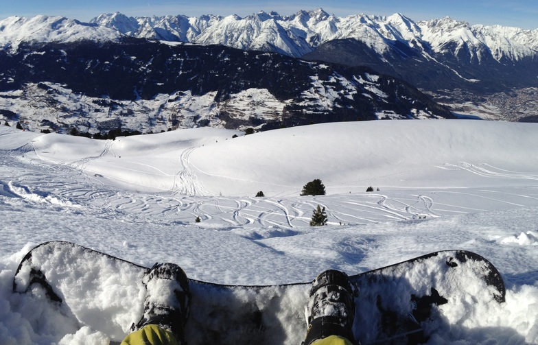
Terrain at Hochzeiger by Snow Forecast Admin
Hochzeiger Offpiste by Snow Forecast Admin
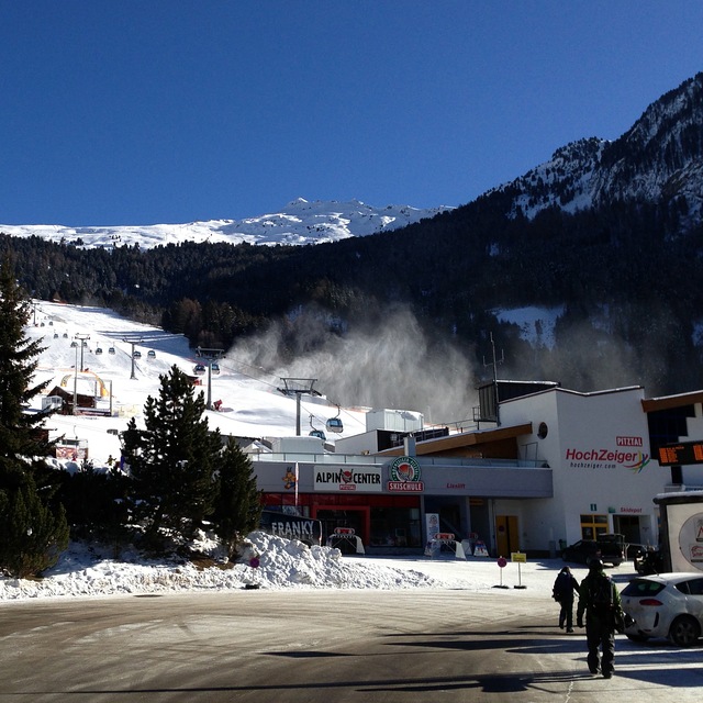
Hochzeiger Resort by Snow Forecast Admin
Other resorts in Austria are reporting: powder (0) / good piste (3)
The above table gives the weather forecast for Hochzeiger at the specific elevation of 2370 m. Our sophisticated weather models allow us to provide snow forecasts for the top, middle and bottom ski stations of Hochzeiger. To access the weather forecasts for the other elevations, use the tab navigation above the table. For a wider view of the weather, check out the Weather Map of Austria.
Click here to read further information on freezing levels and how we forecast our temperatures.
Visitor Reviews of Hochzeiger
Overall 3.3 Based on 3 votes and 1 review
- Snowsure
- Variety of pistes
- Vote
- mike Bourne from United Kingdom writes:
Hochzeiger resort is a great place to find that has not been over run by Brits. I have been going to this area since my army days of serious cross country skiing in 1967, when I was fit. My German friend introduced me to Hochzeiger 10 years ago and we normally stay in Wenns 6kms away. The hotel Schirgantblick is fantastic and will pick you up from the bars at the bottom of the lifts if you miss the last bus. The costs at this resort are a fraction of the large ones like St Anton. Last year, Feb 2008, we didn't come across any other Brits in the area and the hotel found us almost a novelty. Can't fault Hochzeiger, except my wife isn't keen on the free bus from Wenns (20mins) and 20 hairpin bends. Recommend it but fly to Innsbruck as the journey is only 55mins and the hotel will collect you free of charge.
Visitor Reviews of Hochzeiger
mike Bourne from United Kingdom writes:
Hochzeiger resort is a great place to find that has not been over run by Brits. I have been going to this area since my army days of serious cross country skiing in 1967, when I was fit. My German friend introduced me to Hochzeiger 10 years ago and we normally stay in Wenns 6kms away. The hotel Schirgantblick is fantastic and will pick you up from the bars at the bottom of the lifts if you miss the last bus. The costs at this resort are a fraction of the large ones like St Anton. Last year, Feb 2008, we didn't come across any other Brits in the area and the hotel found us almost a novelty. Can't fault Hochzeiger, except my wife isn't keen on the free bus from Wenns (20mins) and 20 hairpin bends. Recommend it but fly to Innsbruck as the journey is only 55mins and the hotel will collect you free of charge.
Free Snow-Forecast.com weather widget for your website
The Hochzeiger skiing weather widget is available to embed on external websites free of charge. It provides a daily summary of our Hochzeiger snow forecast and current weather conditions. Simply go to the feed configuration page and follow the 3 simple steps to grab the custom html code snippet and paste it into your own site. You can choose the snow forecast elevation (summit, mid-mountain or bottom lift) and metric/imperial units for the snow forecast feed to suit your own website…. Click here to get the code.
View detailed snow forecast for Hochzeiger at:
snow-forecast.com

 Nearest