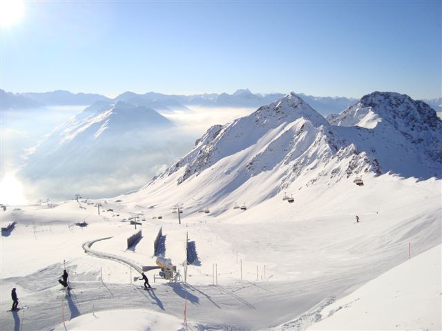

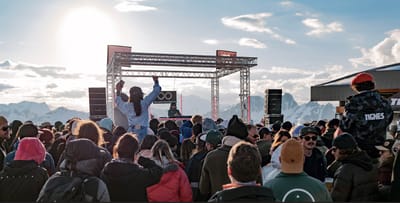
Tignes Unlimited Festival Into May
Tignes, one of the few French ski areas staying open into May, will round off the 2025–26 winter season with the return of the Tignes Unlimited electronic music festival, running from 25 April to 3 May 2026.

Next 3 days weather summary:Mostly dry. Freeze-thaw conditions (max 5°C on Thu afternoon, min -3°C on Tue night). Wind will be generally light. | Days 4-6 weather summary:Mostly dry. Mild temperatures (max 8°C on Fri afternoon, min 3°C on Sat night). Wind will be generally light. | |||||||||||||||||
Tuesday 21 | Wednesday 22 | Thursday 23 | Friday 24 | Saturday 25 | Sunday 26 | |||||||||||||
AM | PM | night | AM | PM | night | AM | PM | night | AM | PM | night | AM | PM | night | AM | PM | night | |
some clouds | snow shwrs | clear | clear | clear | clear | clear | clear | clear | clear | clear | clear | clear | clear | clear | clear | clear | some clouds | |
km/h | ||||||||||||||||||
Snow map |  |  |  |  |  |  | ||||||||||||
— | — | — | — | — | — | — | — | — | — | — | — | — | — | — | — | — | — | |
— | — | — | — | — | — | — | — | — | — | — | — | — | — | — | — | — | — | |
max °C | -2 | 0 | -2 | 0 | 3 | 1 | 3 | 5 | 3 | 6 | 8 | 6 | 6 | 7 | 5 | 6 | 8 | 6 |
min °C | -2 | 0 | -3 | -2 | 2 | 0 | 1 | 5 | 3 | 4 | 7 | 4 | 5 | 7 | 3 | 4 | 8 | 4 |
-4 | -2 | -3 | -2 | 0 | 0 | 0 | 3 | 0 | 2 | 6 | 4 | 4 | 6 | 1 | 2 | 7 | 4 | |
70 | 70 | 56 | 34 | 38 | 44 | 18 | 40 | 34 | 12 | 26 | 30 | 20 | 41 | 48 | 31 | 49 | 59 | |
2000 | 2200 | 1600 | 2250 | 2500 | 2200 | 2650 | 2800 | 2900 | 3150 | 3200 | 3400 | 3200 | 3050 | 3050 | 3150 | 3150 | 3100 | |
6:22 | — | — | 6:20 | — | — | 6:20 | — | — | 6:18 | — | — | 6:16 | — | — | 6:13 | — | — | |
— | — | 8:15 | — | — | 8:16 | — | — | 8:17 | — | — | 8:20 | — | — | 8:21 | — | — | 8:22 | |
Latest snow reports near Davos:
| Top snow depth: | 0 cm |
|---|---|
| Bottom snow depth: | 0 cm |
| Fresh snowfall depth: | 2 cm |
| Last snowfall: | 19 Apr 2026 |
| Snow Alerts | Create Alert |
0.7 | Bluebird Powder days Fresh snow, mostly sunny, light wind. |
|---|---|
1.5 | Powder days Fresh snow, limited sun, any wind. |
0.4 | Bluebird days Average snow, mostly sunny, light wind. |
The above table gives the weather forecast for Davos at the specific elevation of 2202 m. Our sophisticated weather models allow us to provide snow forecasts for the top, middle and bottom ski stations of Davos. To access the weather forecasts for the other elevations, use the tab navigation above the table. For a wider view of the weather, check out the Weather Map of Switzerland.
Click here to read further information on freezing levels and how we forecast our temperatures.
Overall 4.5 Based on 34 votes and 13 reviews
Yes, it’s a bit dated but this one is like a vintage car that gets better with age. The skiing is epic, long rolling piste. Some steep stuff around Klosters. Lots of off-piste and of course, it’s in the best snow location. It’s a must go.
Ranger dad from Germany writes:
Yes, it’s a bit dated but this one is like a vintage car that gets better with age. The skiing is epic, long rolling piste. Some steep stuff around Klosters. Lots of off-piste and of course, it’s in the best snow location. It’s a must go.


 Nearest