
Ski Hire by Intersport
CODE: FORECASTSKI

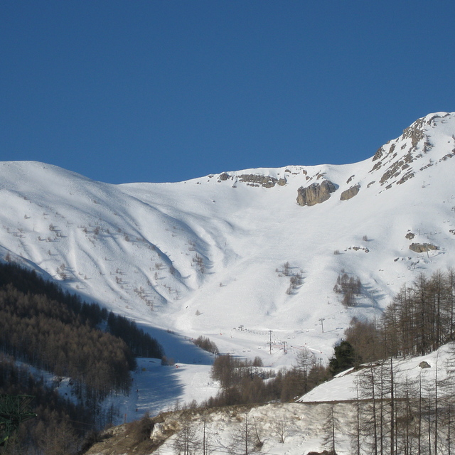
Auron Weather (Next 3 days): The snow forecast for Auron is: A moderate fall of snow, heaviest on Thu afternoon. Turning milder with moderate rain (total 10.0mm), heaviest on Thu night. Freeze-thaw conditions (max 2°C on Wed morning, min -13°C on Fri night). Winds decreasing (fresh winds from the WSW on Thu night, light winds from the NW by Fri night).
Auron Weather (Days 4-6): Moderate rain (total 13.0mm), heaviest on Mon night. Freeze-thaw conditions (max 4°C on Mon night, min -8°C on Sat afternoon). Wind will be generally light.
| Resort | Snow Depth | Temp. (°C) | Wind (km/h) | Weather | ||
|---|---|---|---|---|---|---|
| Top Lift: | -3 | |||||
| Middle Lift: | -1 | |||||
| Bottom Lift: | 1 |
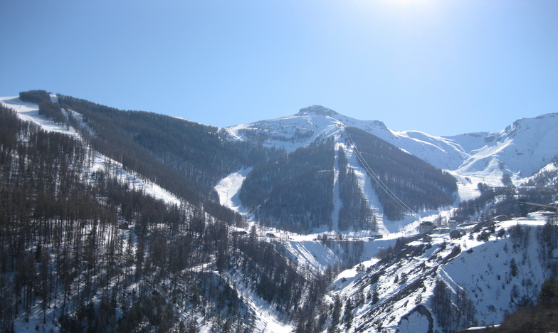
Latest snow reports near Auron:

Wednesday 20 | Thursday 21 | Friday 22 | Saturday 23 | Sunday 24 | Monday 25 | Tuesday 26 | |||||||||||||||
AM | PM | night | AM | PM | night | AM | PM | night | AM | PM | night | AM | PM | night | AM | PM | night | AM | PM | night | |
rain shwrs | clear | some clouds | snow shwrs | heavy snow | snow shwrs | clear | clear | clear | clear | clear | rain shwrs | light rain | cloudy | some clouds | some clouds | light rain | mod. rain | some clouds | some clouds | clear | |
km/h | |||||||||||||||||||||
Snow map |  |  |  |  |  |  |  | ||||||||||||||
— | — | — | — | 10 | 1.0 | — | — | — | — | — | — | — | — | — | — | — | — | — | — | — | |
1.0 | — | — | — | — | 9 | — | — | — | — | — | 1.0 | 1.0 | — | — | — | 3 | 8 | — | — | — | |
max°C | 2 | -2 | -7 | 0 | 0 | 2 | -2 | -6 | -12 | -2 | -3 | 3 | 3 | 3 | 2 | 3 | 3 | 4 | 2 | 1 | -4 |
min°C | 1 | -7 | -8 | -3 | 0 | -6 | -4 | -11 | -13 | -4 | -8 | -7 | 3 | 3 | -2 | 2 | 3 | 2 | 2 | -4 | -4 |
-4 | -14 | -14 | -7 | -5 | -12 | -8 | -17 | -18 | -4 | -11 | -10 | 1 | 1 | -4 | 0 | 1 | 0 | 0 | -7 | -7 | |
71 | 65 | 67 | 56 | 98 | 92 | 65 | 77 | 59 | 57 | 77 | 51 | 100 | 99 | 94 | 87 | 99 | 100 | 89 | 83 | 64 | |
1950 | 1400 | 600 | 1300 | 1800 | 1700 | 1000 | 750 | 0 | 1150 | 1400 | 1200 | 2400 | 2700 | 2650 | 2550 | 2500 | 2650 | 2600 | 2950 | 1400 | |
7:35 | — | — | 7:35 | — | — | 7:37 | — | — | 7:37 | — | — | 7:39 | — | — | 7:41 | — | — | 7:41 | — | — | |
— | 5:00 | — | — | 4:59 | — | — | 4:59 | — | — | 4:58 | — | — | 4:57 | — | — | 4:57 | — | — | 4:55 | — | |
A moderate fall of snow, heaviest on Thu afternoon. Turning milder with moderate rain (total 10.0mm), heaviest on Thu night. Freeze-thaw conditions (max 2°C on Wed morning, min -13°C on Fri night). Winds decreasing (fresh winds from the WSW on Thu night, light winds from the NW by Fri night).
Moderate rain (total 13.0mm), heaviest on Mon night. Freeze-thaw conditions (max 4°C on Mon night, min -8°C on Sat afternoon). Wind will be generally light.
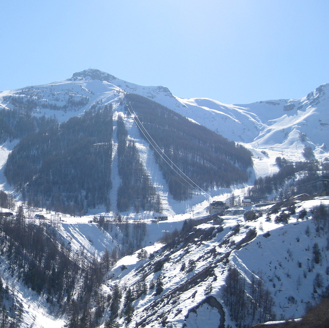
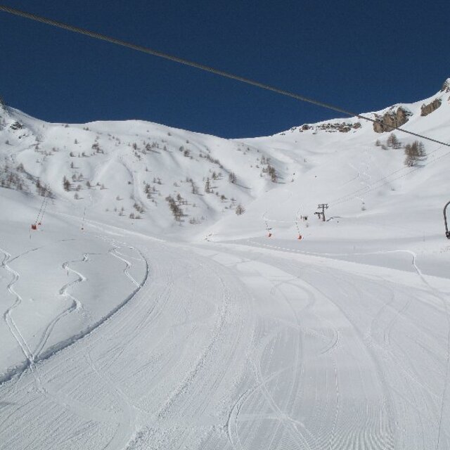
Latest snow reports near Auron:
| Top snow depth: | — |
|---|---|
| Bottom snow depth: | — |
| Fresh snowfall depth: | 6 cm |
| Last snowfall: | 19 Nov 2024 |
| Snow Alerts | Create Alert |
0.0 | Bluebird Powder days Fresh snow, mostly sunny, light wind. |
|---|---|
0.2 | Powder days Fresh snow, limited sun, any wind. |
0.4 | Bluebird days Average snow, mostly sunny, light wind. |
The above table gives the weather forecast for Auron at the specific elevation of 1600 m. Our sophisticated weather models allow us to provide snow forecasts for the top, middle and bottom ski stations of Auron. To access the weather forecasts for the other elevations, use the tab navigation above the table. For a wider view of the weather, check out the Weather Map of France.
Click here to read further information on freezing levels and how we forecast our temperatures.
Overall 3.7 Based on 16 votes and 7 reviews
I skied Auron and Vallberg as a kid of 12, 13, and 14. Wow, that was 47 years ago. Still looks like a great little place. Would love to go back some day. I remember one New Years eve we were swimming in the Med on the Cote D'Zure (where we lived) and the next day: New Years Day, we were in such a blizzard of a snow storm in Auron, even yellow goggles didn't help much. I have great memories!
Vickie Cantwell from United States writes:
I skied Auron and Vallberg as a kid of 12, 13, and 14. Wow, that was 47 years ago. Still looks like a great little place. Would love to go back some day. I remember one New Years eve we were swimming in the Med on the Cote D'Zure (where we lived) and the next day: New Years Day, we were in such a blizzard of a snow storm in Auron, even yellow goggles didn't help much. I have great memories!
The Auron skiing weather widget is available to embed on external websites free of charge. It provides a daily summary of our Auron snow forecast and current weather conditions. Simply go to the feed configuration page and follow the 3 simple steps to grab the custom html code snippet and paste it into your own site. You can choose the snow forecast elevation (summit, mid-mountain or bottom lift) and metric/imperial units for the snow forecast feed to suit your own website…. Click here to get the code.
View detailed snow forecast for Auron at:
snow-forecast.com


 Nearest