


View forecast
Alpe Devero at 1926 m altitude
Issued by Snow-Forecast.com at: 1 am (local time) / 03 May 2024
Now
Friday 3 | Saturday 4 | Sunday 5 | Monday 6 | Tuesday 7 | Wednesday 8 | Thursday 9 | |||||||||||||||
AM | PM | night | AM | PM | night | AM | PM | night | AM | PM | night | AM | PM | night | AM | PM | night | AM | PM | night | |
snow shwrs | light rain | snow shwrs | cloudy | light rain | rain shwrs | some clouds | cloudy | light rain | light rain | mod. rain | light snow | light snow | light rain | light snow | some clouds | cloudy | light rain | some clouds | some clouds | clear | |
km/h | |||||||||||||||||||||
Snow map |  |  |  |  |  |  |  | ||||||||||||||
— | — | 1.0 | — | — | — | — | — | — | — | — | 2.0 | 2.0 | — | — | — | — | — | — | — | — | |
— | 2.0 | — | — | 2.0 | 1.0 | — | — | 4 | 4 | 6 | 5 | 1.0 | 3 | 1.0 | — | — | 2.0 | — | — | — | |
max°C | 2 | 3 | 2 | 2 | 4 | 3 | 5 | 6 | 4 | 4 | 4 | 3 | 2 | 3 | 2 | 5 | 7 | 5 | 6 | 8 | 8 |
min°C | 0 | 3 | -2 | 0 | 3 | 1 | 3 | 5 | 4 | 4 | 3 | 2 | 1 | 3 | 1 | 3 | 6 | 4 | 4 | 7 | 6 |
-3 | 3 | -2 | 0 | 1 | 1 | 3 | 4 | 3 | 3 | 1 | 2 | -2 | 1 | -2 | 2 | 5 | 4 | 4 | 6 | 6 | |
83 | 84 | 87 | 80 | 87 | 83 | 74 | 92 | 99 | 100 | 99 | 98 | 88 | 89 | 91 | 70 | 87 | 91 | 74 | 74 | 72 | |
2200 | 2300 | 1600 | 2250 | 2400 | 2400 | 2700 | 2650 | 2550 | 2550 | 2450 | 2350 | 2250 | 2300 | 2150 | 2750 | 2750 | 2900 | 3200 | 3000 | 3200 | |
6:09 | — | — | 6:07 | — | — | 6:05 | — | — | 6:05 | — | — | 6:03 | — | — | 6:01 | — | — | 6:01 | — | — | |
— | — | 8:37 | — | — | 8:39 | — | — | 8:40 | — | — | 8:42 | — | — | 8:44 | — | — | 8:45 | — | — | 8:45 | |
Next 0-3 days weather summary:
Light rain (total 9.0mm), mostly falling on Fri afternoon. Freeze-thaw conditions (max 6°C on Sun afternoon, min -2°C on Fri night). Wind will be generally light.
Next 4-6 days weather summary:
Heavy rain (total 22.0mm), heaviest during Mon afternoon. Later becoming colder with a dusting of snow on Tue morning. Mild temperatures (max 7°C on Wed afternoon, min 1°C on Tue morning). Wind will be generally light.
Popular Alpe Devero Pages
Snow Radar
Submit a reportLatest snow reports near Alpe Devero:
38 km away from Alpe Devero
4 hours ago
Continuous light snow reported from Jungfrau Mountain at 3576 metres elevation 7 kms E of Mürren but it is probably falling as rain at the bottom of the ski area from Mürren
46 km away from Alpe Devero
4 hours agoContinuous moderate rain reported from Meiringen at 591 metres elevation only 2 kms WSW of Meiringen-Hasliberg but it is forecast cold enough for snow at higher elevations in the ski area from Meiringen-Hasliberg
Alpe Devero Snow Conditions
| Top snow depth: | — |
|---|---|
| Bottom snow depth: | — |
| Fresh snowfall depth: | 6 cm |
| Last snowfall: | 2 May 2024 |
| Snow Alerts | Create Alert |
Other resorts in Italy are reporting: powder (0) / good piste (0)
Snow-Forecast Partner Offers
Show your business here
Snow History
Week 1 of May has on average:
0.0 | Bluebird Powder days Fresh snow, mostly sunny, light wind. |
|---|---|
0.2 | Powder days Fresh snow, limited sun, any wind. |
0.1 | Bluebird days Average snow, mostly sunny, light wind. |
Alpe Devero Forecast Snowfall


Photos of Alpe Devero
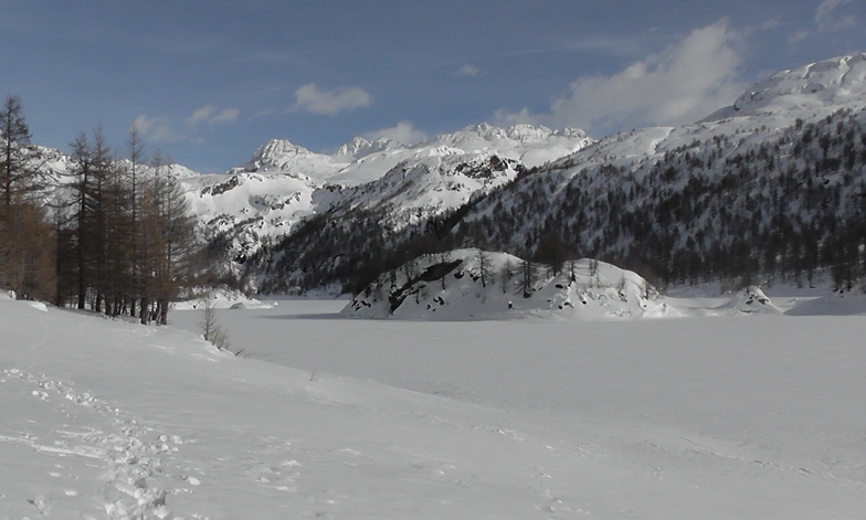
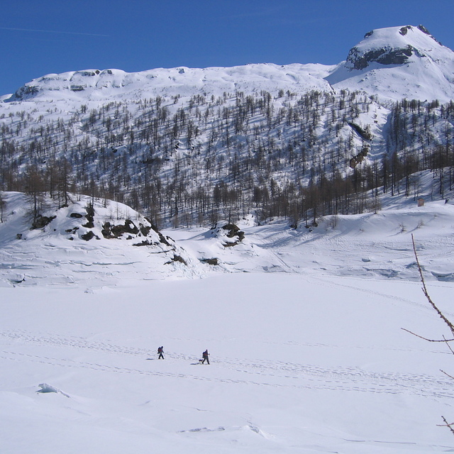
il lago ghiacciato by Tiziano
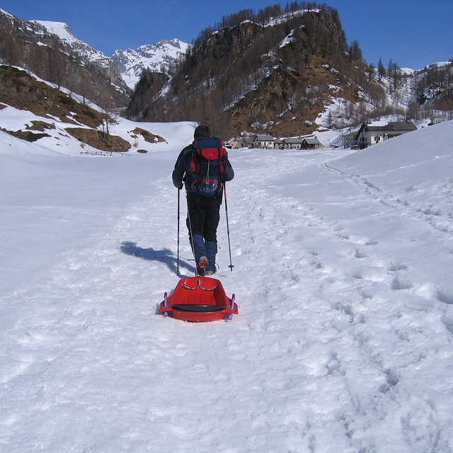
giochino da adulti by Tiziano
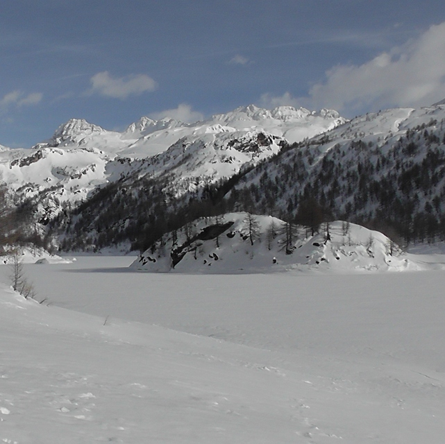
passeggiata sul lago ghiacciato by Tiziano
Other resorts in Italy are reporting: powder (0) / good piste (0)
The above table gives the weather forecast for Alpe Devero at the specific elevation of 1926 m. Our sophisticated weather models allow us to provide snow forecasts for the top, middle and bottom ski stations of Alpe Devero. To access the weather forecasts for the other elevations, use the tab navigation above the table. For a wider view of the weather, check out the Weather Map of Italy.
Click here to read further information on freezing levels and how we forecast our temperatures.
Visitor Reviews of Alpe Devero
Overall 3.3 Based on 1 vote and 1 review
- Snowsure
- Variety of pistes
- Vote
- mattia from Italy writes:
Nice resort without cars and with wonderful powder!!!!
Visitor Reviews of Alpe Devero
mattia from Italy writes:
Nice resort without cars and with wonderful powder!!!!
Free Snow-Forecast.com weather widget for your website
The Alpe Devero skiing weather widget is available to embed on external websites free of charge. It provides a daily summary of our Alpe Devero snow forecast and current weather conditions. Simply go to the feed configuration page and follow the 3 simple steps to grab the custom html code snippet and paste it into your own site. You can choose the snow forecast elevation (summit, mid-mountain or bottom lift) and metric/imperial units for the snow forecast feed to suit your own website…. Click here to get the code.
View detailed snow forecast for Alpe Devero at:
snow-forecast.com

 Nearest