How will “Beast from the East” & Storm Emma affect UK Mountains?

It’s hard to avoid a UK news bulletin that does not mention the “Beast from the East” that will dominate the weather over the coming week.
This potentially rare weather event is due to a polar vortex – an area of low pressure in the upper parts of the atmosphere that is more often found centred over NE Siberia and Canada. An event known as Sudden Stratospheric Warming (SSW) has occurred where the polar vortex expands and gets pushed south, carried along with the jet stream. This one in four-year event typically leads to cold snaps lasting up to a fortnight.

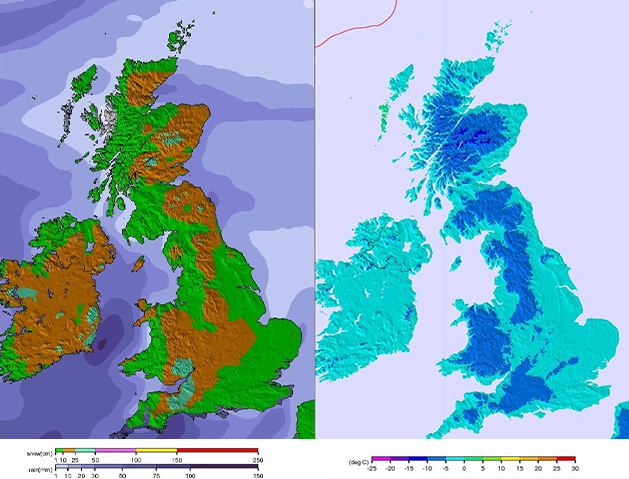
The worst weather in the UK is expected on Wednesday and Thursday this week as the Portuguese-named Storm Emma arrives. Strong winds later in the week could see wind chills close to -20°C.
Disruption to travel seems likely, and the Met Office has issued several warnings. Whilst this is not good news for commuters, ski locations of the UK could be in for a treat. Here is an overview.
Pen y Fan: in South Wales will be coldest on Wednesday night with the most snow (15cm) falling on Thursday night and Friday morning.
Allenheads: This location in Northumberland looks to be one of the snowiest in the UK with heavy snow forecast from Monday night for the rest of the week, heaviest on Wednesday.
Cairngorm: moderate snow all week, starting Monday evening.
Yad Moss: on the Scottish borders will see snow all week, heaviest on Monday night through to Wednesday night.
Comeragh Mountains (Ireland): Up to 30cm forecast over Thursday and Friday before becoming warming over the weekend.
Visit our UK Snow page for a snapshot of all our snow destinations.
Temperatures are set to rise by the Sunday where the snow is likely to be replaced by heavy rain in many places.
NOTE: conditions in the mountains can be extremely hazardous and change rapidly. Always check the local forecasts and tell someone where you are going if you do head out!


