Southern Hemisphere Weekly Roundup #255
(Updated 21 August 2024) A comprehensive review of snow conditions, weather, and updates for the Southern Hemisphere's winter sports destinations.
New Zealand and Australia Ride Weather Rollercoaster as Snow Holds
- Warmer temperatures and mixed weather conditions are signalling the onset of spring in the Southern Hemisphere's ski areas, with some regions seeing light snowfalls and others experiencing sunny, warmer days.
- New Zealand and Australia are witnessing a variety of weather, with colder temperatures maintaining good snow conditions, particularly after recent snowfalls, while South American resorts boast the deepest snowpacks globally.
- The ski season is nearing its end in Lesotho, Southern Africa, and other Southern Hemisphere locations, with some areas hosting final events as snow conditions decline.
WORLD OVERVIEW
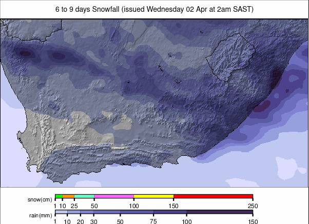
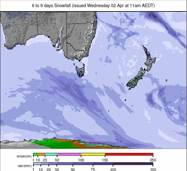
The main snow news this week comes from New Zealand, where snowfalls bigger than forecasting models had predicted brought up to 60cm (2 feet) of weekend powder to centres there. The fresh snow was a great boost as southern hemisphere resorts move into the final third of their season. Conditions across Australia, New Zealand, and South America are about the best they've been all winter, with most centers fully open, or nearly so, and snow depths healthy for most too. The season's end will arrive for some sooner than others, though, with southern Africa’s winter 2024 due to conclude at the end of next week. In the northern hemisphere, hot weather and high altitudes continue to dominate conditions. North America's 23-24 season finally ended last weekend with the last centre that had been open, Oregon's Timberline, ending its nine-month-long run. Still, it's only a few months now until the 24-25 season is due to kick off. There are four glacier areas open in Europe's Alps, albeit with diminishing open terrain and snow cover left on the ice. Two small centres in Norway are operating to but have temporarily closed to the public and are only welcoming race teams for training.
SOUTHERN HEMISPHERE
SOUTHERN HEMISPHERE INTRO
There’s been just a hint of spring in the air this week, with warmer temperatures in Lesotho, Southern Africa, and for some Australian slopes, although temperatures have still been dipping below freezing overnight, and there have been light snow showers again on Aussie slopes. For New Zealand's ski areas, it's been a bit of a rollercoaster, with tropical weather from the north doing battle with polar air from the south, resulting in a mix of pretty much everything over the last seven days, including marvellous ski conditions at times. The weekend, in particular, brought heavier snowfalls than expected, giving a great base boost and a perfect powder start to this week. South American ski areas continue to post the largest amounts of terrain and thickest-lying snowpacks anywhere in the world at present, thanks largely to the huge snowfalls of May and June. It has been very cold there again this week though, and while some areas have had nonstop sun, others have seen more relatively light snow showers. For a chunk of the southern hemisphere's ski areas, we're moving into the final month of the season, with the first centre expected to end its 2024 run at the end of next week, Lesotho's Afriski.
AUSTRALIA REPORT
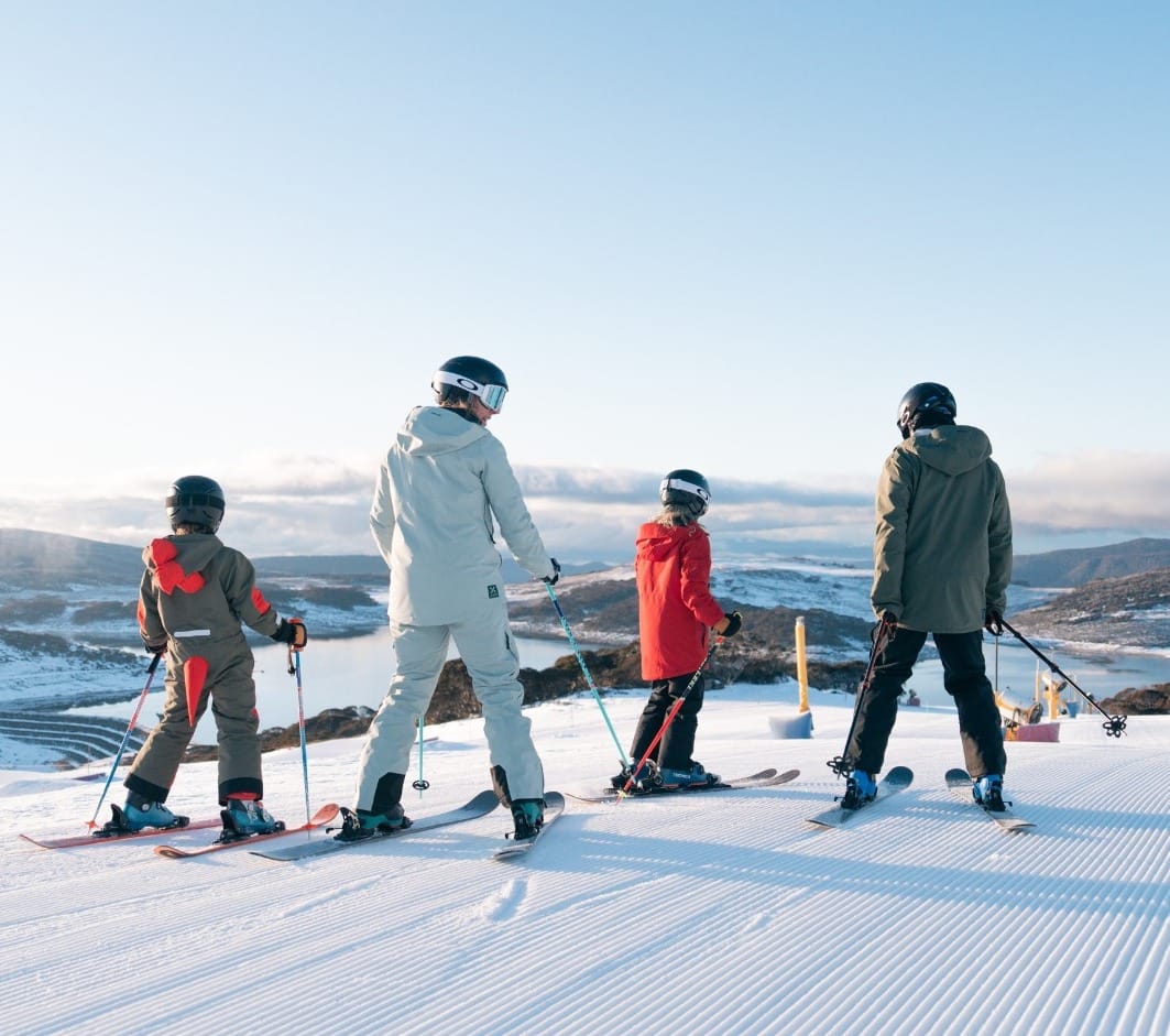
A mixed week of weather across Australia's ski slopes with a feeling of seasonal change in the air. We've had some light snow showers but also rain, periods of cloud and low visibility, and some great blue sky sunny days – in other words, a bit of everything but not a lot of any one thing. Temperatures have been varied too, still getting a few degrees below freezing at night on high slopes but marginal at best for snowmaking. Daytime highs have been creeping upwards, with +10 to 15°C reached on some afternoons. Conditions remain the best they have been all season across the country, thanks mostly to the snowstorms earlier this month. Perisher (60/125cm / 24/50”) continues to post the most terrain currently open in the world outside South America and the country’s deepest snowpack, just, with about 60km (37 miles) of runs open, around 90% of its full area. Thredbo (52/124cm / 21/50”) is close with a similar percentage of terrain open, and other Aussie centres are in a similar position. At Hotham Alpine Resort (54/82cm / 22/33”), which also reports 90% of its slopes open, they have been hosting FIS ANC ski and snowboard cross competitions with World Cup gold medallists and Olympians in the resort to compete this week.
AUSTRALIA FORECAST
It’s going to remain changeable, with more light snowfalls forecast in the latter half of this week, but also, that big temperature range is possible from around -5 to +15°C. Dry, sunny periods are in the mix too.
NEW ZEALAND REPORT
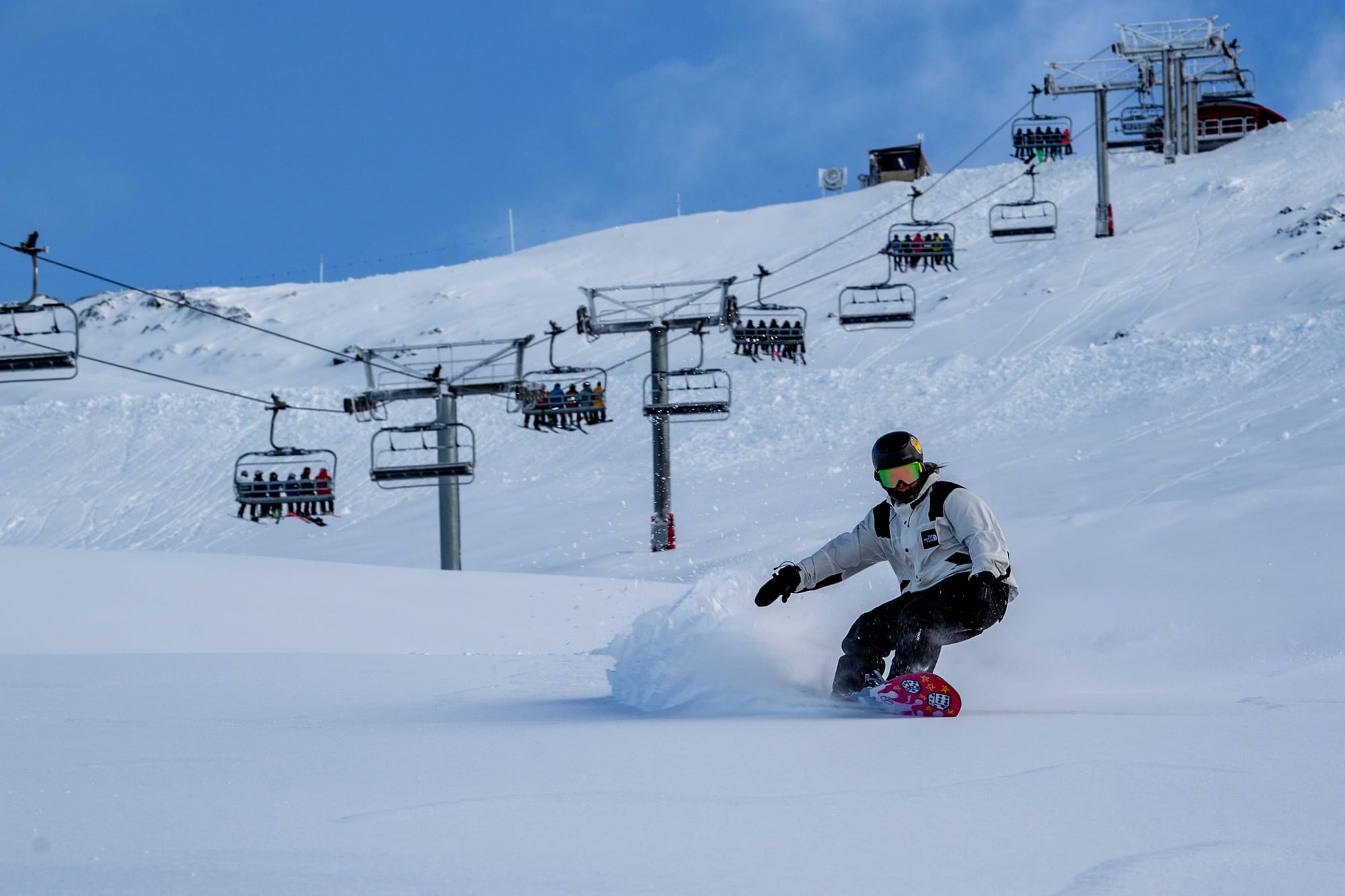
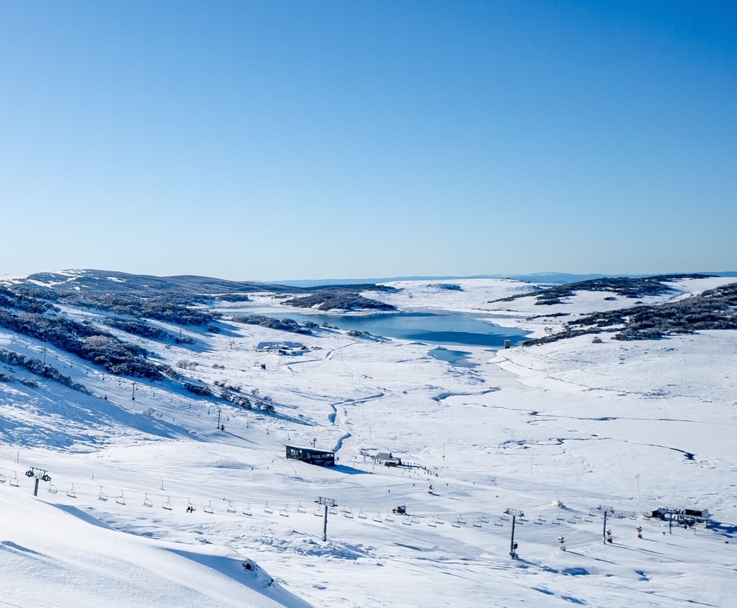
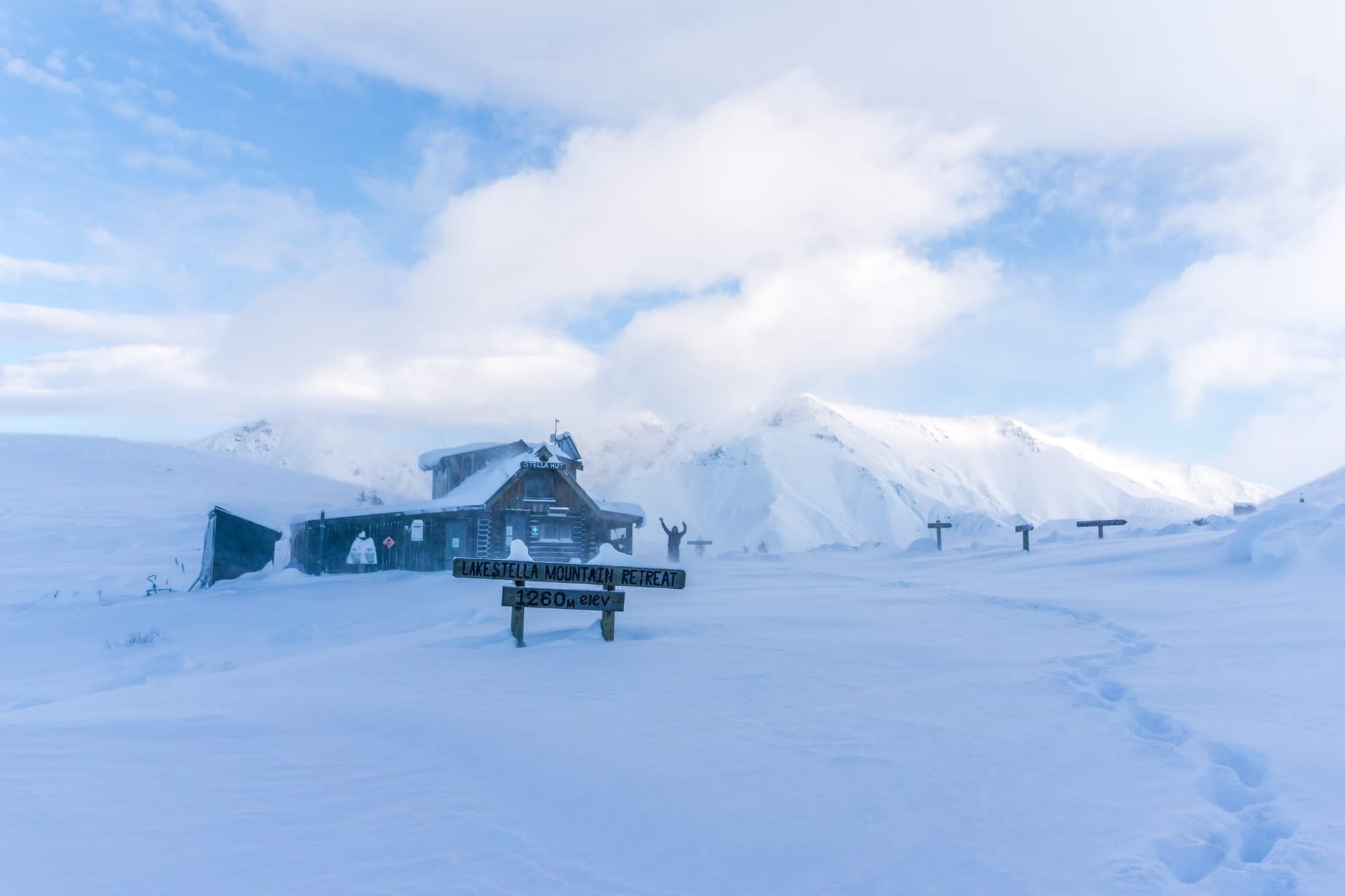
There’s been a similar weather mix in New Zealand to Australia, although temperatures, on the whole, have remained cooler and the light snowfalls have been a little heavier. On higher slopes, temperatures have not really gotten more than a degree above freezing, and overnight lows have been reported as far down as -12°C. Down at the resort level, though, it's been more like a -10 to +6°C range, and some centres have reported spells of rain. The milder weather, a subtropical and wet and windy system, gave way to a polar blast from Antarctica at the weekend, bringing snow to low levels for a time. At the end of last week, Broken River Ski Area was one of those closed due to light rainfall before the colder temperatures arrived. It was closed "to try and preserve the snow we have." Things then improved dramatically over the weekend with snowfall accumulations of over 50cm (20”) reported by Monday morning. Gale-force winds continued to cause problems for Mt Dobson (50/120cm / 20/48”) at times, and it was another one of those having to close some days for safety reasons due to the force of the winds. But the big picture remains very good. Mt Dobson is one of the centers that’s fully open when not closed by bad weather. By Monday, things were looking good, and the resort posted, “Afternoon pow! Thanks, everyone, for their patience today, and a big shout-out to the patrol team for getting us open in challenging conditions. The forecast is bluebird for tomorrow, and there are still fresh turns to be had!” Of the bigger resorts, Mt Hutt (105/203cm / 42/81”) is another of those with every slope open and every lift turning, while posting the deepest snow in the southern hemisphere outside of South America and the first in Australia/NZ to pass the 2m mark this season after getting 35cm (14”) over the weekend. Treble Cone (30/160cm / 12/64”) is not far behind on snow depth and is also fully open.
NEW ZEALAND FORECAST
The colder air is still being felt on the North Island, but subtropical nor’westers from the north have now returned to the South Island. It should continue to be in the -8 to +4°C range over the coming week with plenty of sunshine, but conditions becoming more changeable by the weekend with more snowfall, currently expected to be light to moderate, at the end of the week.
ARGENTINA REPORT
There have been predominantly sunny conditions for Argentinian ski areas over the last 7 days, with the only real exceptions further east and south at resorts in Mendoza, like Las Leñas (140/330cm / 56/132"), which have reported some light snowfall accumulations and more overcast skies. Full sun further north, but temperatures are still cold, mostly in the +4 to -8°C range through the 24-hour cycle. Catedral (40/165cm / 16/66") near ski town Bariloche has the most terrain open in the world at present for a single resort, with about 100km (63 miles) of runs available, around 80% of its full area. All of the country’s ski centers report 75-100% of their terrain open. Las Leñas is currently posting the deepest snowbase in the world on its upper runs at nearly 11 feet. Another Argentinian area, Chapelco (60/310cm / 24/124”) has the second most.
ARGENTINA FORECAST
It’ll be a snowy latter half of the week for quite a few Argentina regions, with 20-40cm (8-16”) snowfall totals expected by the weekend for resorts in Neuquén, but staying drier and sunnier in Mendoza. Temperatures should be mostly in the -7 to +7°C range across the country’s ski regions.
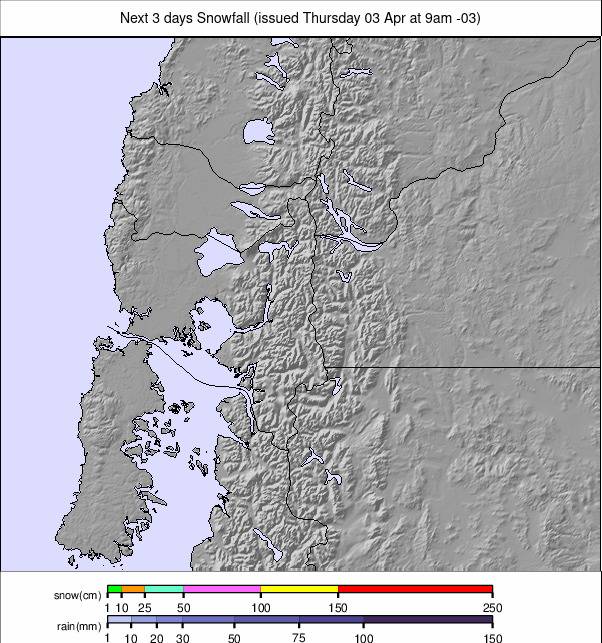
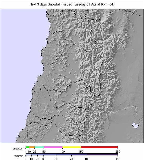
CHILE REPORT
After ski areas in the southern half of Chile saw the most snowfall in recent weeks, it has been the turn of the north to see more unsettled conditions and snow showers over the past seven days. Temperatures have been down close to freezing even in the afternoons, with overnight lows down towards -10°C or lower. Skies have been predominantly overcast in the north with light snow flurries, but clear, sunny weather in the south. Most of the country’s ski areas remain 80-100% open with good snow depths, still benefiting from the huge falls in May and June. The Tre Valles area connecting Valle Nevado (165/290cm / 66/116”), La Parva (180/290cm / 72/116”), and El Colorado (60/135cm / 24/114”) remains the largest area open in the country with about 100km (63 miles) of slopes open between the three of them. Portillo (113/181cm / 45/72”) is one of the centres that reports its slopes 100% open.
CHILE FORECAST
Snow showers in more northerly Chilean locations will fade out midweek to give dry, sunny, but cold conditions, initially subzero around the clock but creeping back above freezing in the daytime by the weekend. Further south, 20-30cm (8-12”) snowfall accumulations are expected over the latter half of the week, clearing here by the weekend.
SOUTH AFRICA REPORT
We are into the final fortnight of the 2024 season in southern Africa (the only continent with both northern and southern hemisphere ski areas), with Afriski (25/25cm / 10/10”) in Lesotho building up to its big winter finale celebrations at the end of the month. Temperatures are still rising, and it remains relentlessly sunny, which impacts the snowpack. Temperatures staying above freezing overnight means snowmaking can no longer be used to top up cover either. But so far, the main run remains complete, and the terrain park and nursery slope areas likewise.
SOUTH AFRICA FORECAST
Warming weather and more sunshine, with temperatures getting well into double figures above freezing in the afternoons, will continue to put pressure on snow conditions, and there’ll be a definite end-of-winter feel.