Southern Hemisphere Weekly Roundup #252
(Updated 31 July 2024) A comprehensive review of snow conditions, weather, and updates for the Southern Hemisphere's winter sports destinations.
New Zealand's South Island Hit by Heavy Snow, While North Island Lags Behind
- Australian ski resorts have greatly improved conditions with nearly 100% of terrain open after substantial snowfall, although weather fluctuations persist.
- New Zealand's South Island ski areas received significant snowfall, leading to improved conditions, while the North Island continues to struggle with limited snow cover.
- Argentina's ski resorts are experiencing excellent conditions, with some areas reporting the deepest snowpacks and largest open terrain worldwide, as more snow is forecast.
WORLD OVERVIEW
Winter is in full swing in the Southern Hemisphere, with August marking the final full month of the season for many areas. The latter half of the season has seen a boost with a return to snowier conditions in Australia, New Zealand, and South America. The fresh snow in Australia, though lighter than the last major fall a few weeks ago, has allowed more of the country's ski resorts to approach full operation. In New Zealand, the snowfall has been a significant boost after a winter with fewer major snowfalls so far (although most resorts were already close to full operations). In Argentina and Chile, the new snow is a welcome top-up on slopes already deeply covered from the huge falls in May and June. In the Northern Hemisphere, we are down to just five ski areas open—four in the Alps and one in North America—following the closure of two more European glaciers after Tignes last week. This time, it was the two Scandinavian centers that had remained open, both announcing they were closing to the public while staying open for race team training. Of those still open, the amount of terrain available is shrinking, as is the snow cover, as temperatures continue to rise well above freezing at high altitudes into August. Southern Hemisphere Southern Hemisphere Intro Conditions have switched back to wintry across many parts of the Southern Hemisphere this week after July was largely dry for most areas. The exception was a significant snowfall in Australia a fortnight ago, followed by another light snowfall over the weekend, with up to 25 cm (10”) reported. This time, it was New Zealand that received a much-needed heavy snowfall to start the week, with some areas getting more than half a meter (20”) of fresh snow. South American ski areas, which had started their 2024 winter season earlier after the biggest autumn snowfalls this century, saw the snow supply stall for much of July but have now experienced a return of heavy snowfall on the slopes of Argentina and Chile, expected to continue for the rest of this week. The start of August marks the beginning of the final month of the season for Lesotho’s Afriski in southern Africa, which will end its three-month 2024 season at the end of the month.
SOUTHERN HEMISPHERE
AUSTRALIA REPORT
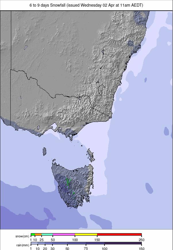
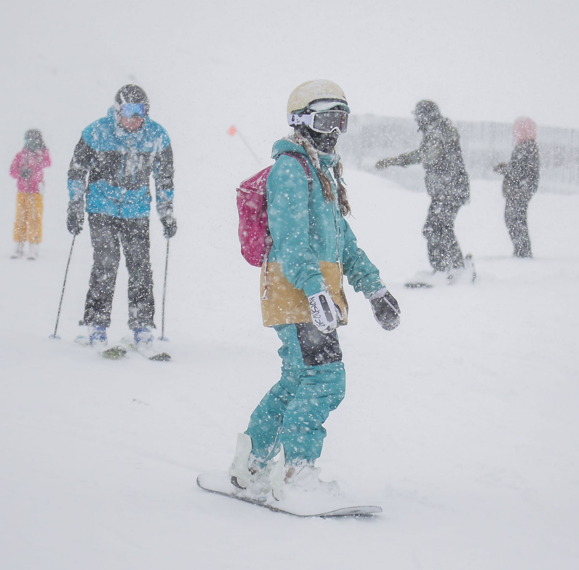
After the huge snowfalls the weekend before last, it has been a more settled week. However, snow conditions have been significantly improved across Australia, with terrain now closer to 100% open compared to almost zero before the major snowfall. Base depths are now closer to a meter than they were to zero. There have been some mostly light snow showers of typically just 5 cm (2”) or so a day over the last few days, but it has otherwise been a mostly dry week. Mt Buller (40/76 cm / 16/30”) reports it has had an additional 20 cm (8”) of snow through the weekend, and as a result, the Grimus and Shakey Knees lifts are now operating, bringing the total to 14 lifts, with the Standard and Bull Run Quad expected to open this week, bringing the total to 16 out of 20 lifts. Temperatures have fluctuated significantly, with overnight lows recorded as low as -11°C but daytime highs of +10°C have also been reported, with occasional rain showers. Victoria’s Falls Creek (50/92 cm / 20/37”) is reporting the deepest snow in the country, the highest percentage of open terrain (92%), and the most piste kilometres available at 45 km (28 miles). This is just half a kilometre more than the country’s largest area, Perisher (48/78 cm / 19/31”), over the border in New South Wales, which has almost all of its lifts running and about two-thirds of its runs open. Mt Buller (44/78 cm / 18/31”) continues to have the least terrain open of the country’s larger resorts, with just about a quarter of its slopes open, though this is still a significant improvement from the 5% it was stuck on before the big snowfall. Meanwhile, Selwyn Snow Resort reports all lifts running for the first time since 2019, after losing all or most of several seasons from 2020 to 2023 due to bushfires, COVID-19, and low snow.
AUSTRALIA FORECAST
It will be dry for the rest of the week with plenty of blue sky days and some light clouds. Temperatures will range from -8°C to +5°C over the course of each 24-hour period.
NEW ZEALAND REPORT
New Zealand's ski areas, particularly on the South Island, have seen some significant snowfalls to start this week, which is very welcome after a prolonged period of mostly dry weather through much of July. The snow is still falling as we publish this week’s report, with some areas, including Treble Cone (30/100 cm / 12/40”), reporting more than 50 cm (20”) in the first 48 hours of the storm. It was the first to post that it had reached a meter snow depth, though several others are close. Several areas, including Mt Hutt (45/90 cm / 18/36”) and Coronet Peak (20/50 cm / 8/20”), have been closed at times due to the storm. Temple Basin, the club field that has still not managed to open this year, says it received rain first, then snow, and is reviewing whether there’s been enough of the latter for them to open. Unfortunately, the North Island has not seen as much snowfall as the South, and Whakapapa (35/30 cm / 14/12”) continues to suffer from a lack of snow cover, allowing it to only open about a kilometer (mile) of runs so far. However, it is snowing there now, so everyone is watching to see what accumulates. Neighbouring (but now separately operated) Tūroa (16/70 cm / 6/28”) seems to have done better, with about two-thirds of its slopes open.
NEW ZEALAND FORECAST
The snow showers are expected to peter out on the South Island through the first few days of August, although it will remain cold with largely overcast skies. Sunny skies are expected to return to most areas by the weekend. However, the North Island is now expected to see more wintry conditions, hopefully good news for Whakapapa and others. Temperatures are generally in the -8°C to +4°C range in the mountains.
ARGENTINA REPORT
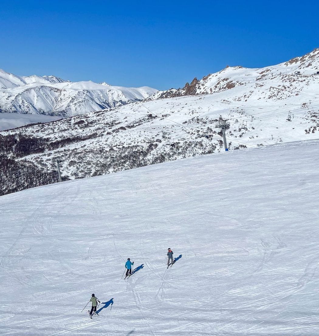
Argentina’s ski areas have had another mostly sunny and dry week, continuing the trend throughout this month. However, with clear skies, it has been frosty, with snow becoming icy in the mornings, and low temperatures down to -11°C over the weekend, with daytime highs still below freezing in most areas. Conditions remain excellent thanks to the snowiest start to the season in three decades, meaning most centers are fully open, or close to it. Catedral (15/150 cm / 6/60”), the country’s and South America's largest ski area by uplift, reports that it is almost fully open, with over 100 km (63 miles) of runs available across the mountain. This makes it the largest ski area open in the world at present. Chapelco (105/330 cm / 42/132”) continues to post the world’s deepest snowpack, at least on its upper slopes, and remains fully open. Las Leñas (130/310 cm / 52/124”) has the largest potential area in terms of skiable terrain, although much of that freeriding terrain is not currently lift-accessed. It reports about two-thirds of its lift-accessed terrain is open at present. The most fresh snowfall has again been reported down in the far south at Tierra del Fuego’s Cerro Castor (25/70 cm / 10/28”), where about two-thirds of the terrain is currently open.
ARGENTINA FORECAST
After a mostly dry and sunny July for much of Argentina, it looks like the start of August will see a return to the weather that dominated May and June in the country, with low temperatures and heavy snowfall forecast for the rest of the week. Daytime highs should remain below freezing at all levels, with 10-30 cm (4-13”) of snowfall expected daily, with the potential for 50-70 cm (20-28”) totals by the end of the weekend.
CHILE REPORT
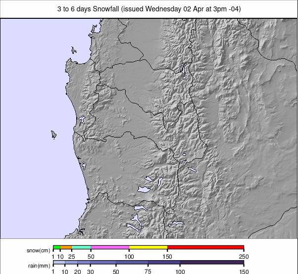
Chile has had another predominantly dry week with plenty of sunshine for most areas through the weekend. However, it is starting to look like more changeable conditions are on the way, with snowfall expected later in the week in central and northern areas, already arriving in the south. Snow levels have dropped a little more, but it's been mostly cold, so the depth numbers remain very healthy from the big May/June accumulations, and most Chilean centres report their slopes 90-100% open. Nevados de Chillan (140/250 cm / 56/100”) has moved to the top of the table for snow depth and has seen the most fresh snow through July of the country's larger centers, reporting its slopes 95% open. Further north, Portillo (125/190 cm / 50/76”) now has the second deepest cover and reports its slopes 100% open. The Tres Valles interconnected area of La Parva (90/145 cm / 36/58”), Valle Nevado (60/135 cm / 24/44”), and El Colorado (60/135 cm / 24/44”) continues to be the largest area open on the planet at present, with the three centers each between 90 and 100% open, offering about 120 km (75 miles) of slopes between them.
CHILE FORECAST
Some snowfall is forecast later in the week, but currently not as much as over the border in Argentina. After a sunny period, midweek clouds will roll in, and for most areas, Friday/Saturday will be the snowiest, with 5-15 cm (2-6”) accumulations expected. Overnight lows down to -15°C are expected, with daytime highs around +4 to +6°C. Further south, however, ski areas like Nevados de Chillan will again see much more snowfall through the week ahead.
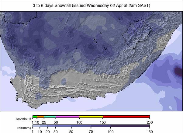
SOUTH AFRICA REPORT
There’s little change in southern Africa, with Lesotho’s Afriski (20/20 cm / 8/8”) completing its second month of operations, with one month to go, after reopening its mile-long (1.6 km) main slope in early June for the first time since the start of the 2024 season. The slope remains complete thanks to snowmaking, as the weather has remained predominantly dry but cold enough overnight for snowmaking top-ups as required. That said, daytime highs of 5-10°C are not thawing the slope quickly. Along with the main slope, Afriski has a nursery slope and some terrain park features operating.
SOUTH AFRICA FORECAST
It will remain sunny for the next few days, with temperatures in the -5°C to +8°C range over the 24-hour cycle. A front is expected to move through over the weekend, which should bring some natural snowfall.