Southern Hemisphere Weekly Roundup #259
(Updated 18 September 2024) A comprehensive review of snow conditions, weather, and updates for the Southern Hemisphere's winter sports destinations.
Southern Hemisphere Ski Season Winds Down: Australia Nearly Closed, Snow Still Falling in New Zealand
- The 2024 Southern Hemisphere ski season is ending, with Australia down to one resort and New Zealand seeing fresh snow and solid conditions.
- Argentina’s resorts remain open with significant snow cover, while Chile's major ski areas report most slopes still operational.
- Forecasts predict cooler temperatures and light snowfalls for New Zealand and Argentina, with mostly dry conditions in Chile.
WORLD OVERVIEW
We’re approaching the start of autumn by the astronomical measure of the seasons in the northern hemisphere and springtime in the southern hemisphere this coming weekend, three weeks after the change occurred by the meteorological measure. So full spring in the south – not that there’s been much doubt in countries like Australia where only one ski centre is still open after weeks of predominantly warm weather – and full autumn in the north, where it’s been feeling more like winter already in Europe this week.
It has indeed been quite the week in Europe with widespread snowfall down to low levels – quite unusual for mid-September and still with the final weeks of astronomical summertime. Snow was reported as low as 1,000m altitudes and as far apart as Slovenia and the Pyrenees, with quite significant accumulations at altitude. At least one glacier area plans to start its season early – later this week!
In North America ski resorts have been in the news for forest fires, sadly, rather than snowfall this week, with a fire burning through one resort, apparently causing little damage whilst others have had mandatory evacuation orders until it is safe again. However, in the high Rockies temperatures continue to drop below freezing overnight and snowmaking prep continues. Back in the southern hemisphere, although the season’s over in southern Africa and all but over in Australia; many of New Zealand's ski areas had a good snowfall this week and here and over in the Andes, most centres remain largely open for a week or two more.
SOUTHERN HEMISPHERE
SOUTHERN HEMISPHERE INTRO
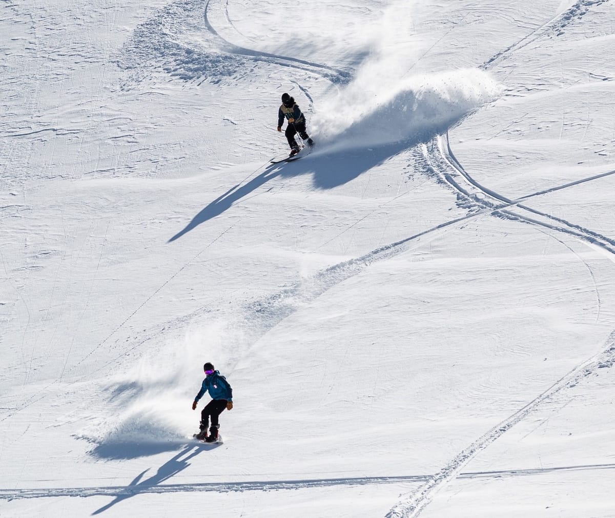
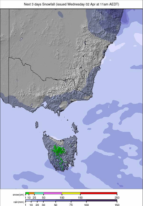
The 2024 season end is rapidly approaching now across the southern hemisphere's ski slopes with afternoon temperatures increasingly climbing above +10C with the result that base snow depth numbers are starting to decline and percentages of terrain open are dropping too. That's most marked in Australia where, at the time of writing, only one centre remained open and with less than 10% of its slopes still skiable. In New Zealand though it has been quite a good week overall, with a significant snowfall for some centres and here, along with in Argentina and Chile, most of the larger centres remain either 100% open or nearly so, for the final week or two of the season.
AUSTRALIA REPORT
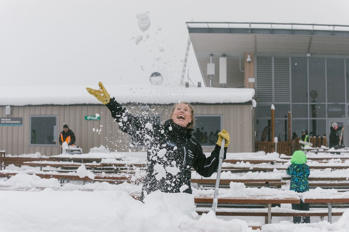
With Fall Creek, Charlotte Pass and Thredbo closing at the end of last week there’s only one ski area left open in Australia – the largest, Perisher (0/60cm / 0/24”). It’s got very terrain left open though with about a dozen easy runs and a similar number of lifts spinning at Mount Perisher and Front Valley. That represents about 5km of slopes or around 8% of the full terrain. Fortunately, lift tickets are half-price. It's been a mixed week with plenty of sunshine and some snow showers. Overnight lows down around -5C, daytime highs up to +9C. Ben Lomond in Tasmania was also open at the weekend with fresh snow, but only for sledging and snow play.
AUSTRALIA FORECAST
It’s a largely sunny forecast, again, but not so warm as it has been, with highs in the +6 to +8C range in the afternoons. Overnight lows almost as far below freezing as daytime highs are above are forecast with a small chance of light snow showers later in the week.
NEW ZEALAND REPORT
New Zealand's ski areas had a weekend boost last week with a 20-40cm (8-16") late winter snowfall to bolster base depths and, as the sunshine returned, provide some great powder days. Of course, the perennial problem of strong winds never really went away and some centres, or parts of centres, had to wait until the winds eased. Beyond this good news for snow conditions, the end of the 2024 season is fast approaching although you wouldn't really know that from the current low temperatures in the -190 to +3C range. For now, at least most of the country's bigger centres on the South Island remain open and are posting healthy snow depths whilst the North Island's season-long lack of snow cover continues, with Turoa (0/60cm / 0/24") and Whakapapa (21/41cm / 8/16") only able to offer very limited terrain still, although that has improved finally in the last 48 hours with 30-50cm (12-20”) of fresh snowfall. The stats for Mt Hutt (80/210cm / 32/84") by contrast are quite healthy though and with 100% of its slopes open too. It's a similar story at Cardrona (70/120cm / 28/48") and Coronet Peak (45/140cm / 15/56"). Each is amongst those looking good to continue skiing into October.
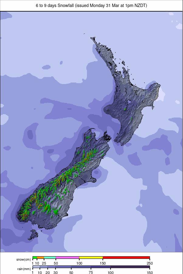
NEW ZEALAND FORECAST
After a drier start to the week it is actually looking rather wintery from now into the weekend with low temperatures, overcast skies and 5-15cm (2-6”) snowfalls forecast most days.
ARGENTINA REPORT
Most of Argentina’s ski areas remain open for what is the final week or two of the season for most. Warm daytime temperatures touching 15C at the base of the slopes in some areas over the past week have started to impact snow cover, but overnight lows still getting below freezing have maintained much of the cover to date. So the country's largest area, Catedral (50/180cm / 20/72"), reports a few fewer kilometres of slopes open, but still has more than three-quarters of its runs accessible and around 95km (60 miles) of slopes open, more than twice as many as its nearest competitor anywhere in the world. Similarly, the base at Chapelco (44/323cm / 17/129”) is down about 10cm/4” but still remains the deepest in the world up top.
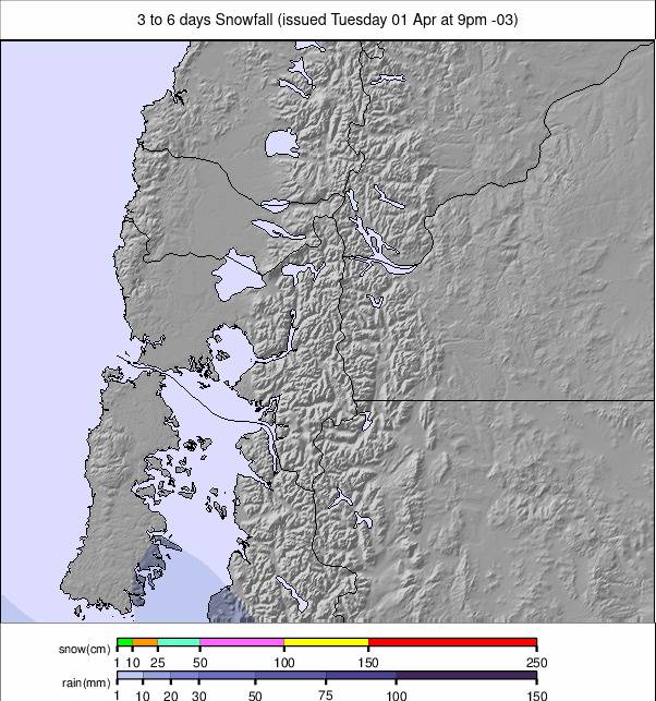
ARGENTINA FORECAST
After a largely dry and sunny week, it is looking more unsettled and colder over the coming days with temperatures dipping down closer to freezing even in the afternoons and overnight lows back below -5C. There's plenty of precipitation forecast again after the recent dry conditions, hopefully mostly late-season snowfall but potentially rain and sleet at times, particularly at lower levels, as well.
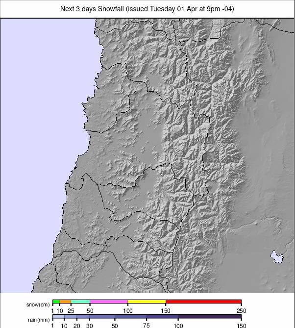
CHILE REPORT
We're into the final weeks of the season in Chile and there are some signs of that with warmer weather and fairly dry, mild conditions over the past week. Well, in the daytime at least, we're still seeing subzero temperatures at night. It's also noticeable that snow depths are down about 10% from a week ago in some areas. That said though, most are either fully open still or have at least 70-80% of their slopes still available for the final weeks. Portillo (70/138cm / 28/115") is one of those reporting every run open and every lift turning. Valle Nevado (150/250cm / 60/100"), likewise, it's also a joint poster of the country's deepest snowpack. The Tre Valles ski area of which it's a part is also posting the largest linked ski area open in the world at present with about 100km (69 miles) of slopes shared with neighbouring la Parva (150/250cm / 60/100”) and El Colorado (60/135cm / 24/54”), east of capital Santiago.
CHILE FORECAST
Mostly dry weather in northern Chile with temperatures ranging from -8 to +8C depending on altitude and time of day. Plenty of sunshine but occasional periods of cloud. More southerly ski areas will see cooler daytime temperatures and some lights now showers at times.