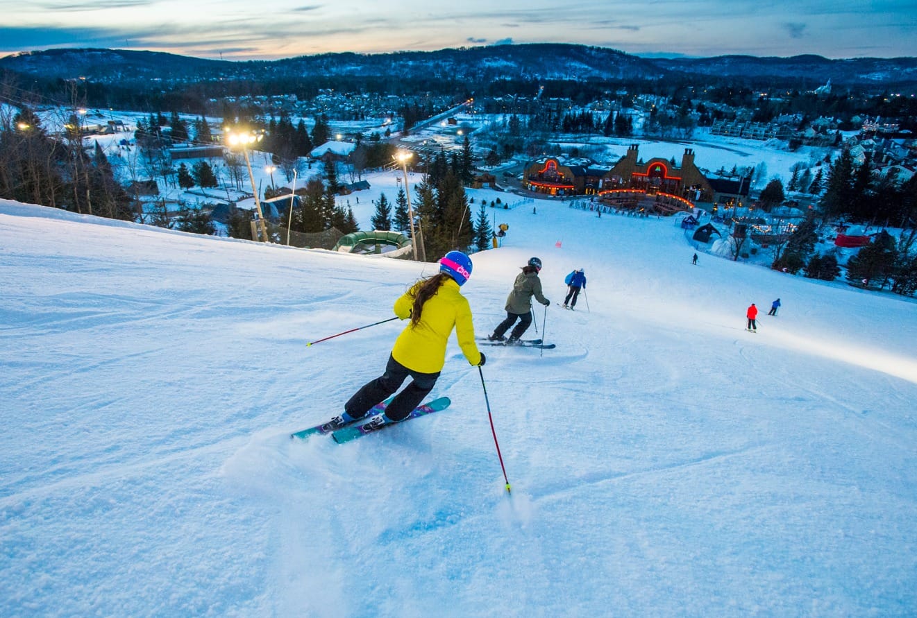
Spring blizzard Ezra dumps 14" on Midwest ski holdouts
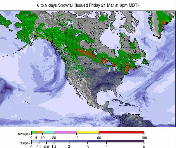
Updated March 26, 2025: Pacific Northwest smashes records with 5ft (1.5m) snowfall, Rockies see 14" (35cm) powder & Whistler boasts 8,000 open acres—but avalanche danger spikes. Don't miss the full report!
- Pacific Northwest buries rivals with 5ft of global snowfall record
- Avalanche danger spikes as Rockies notch 14" fresh powder
- Mt. Bachelor smashes 400" season total with more storms brewing
- Whistler dominates North America with 8,000 acres still open
NORTH AMERICA OVERVIEW
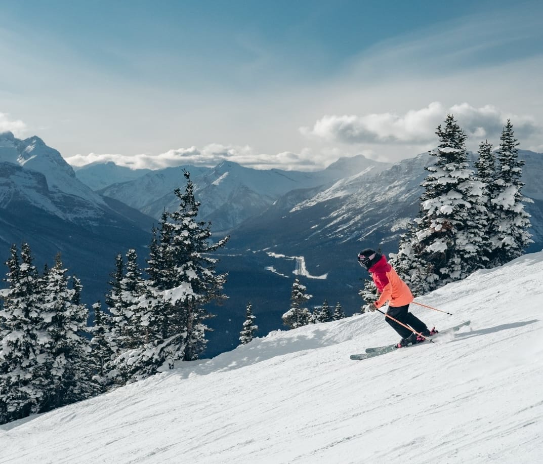
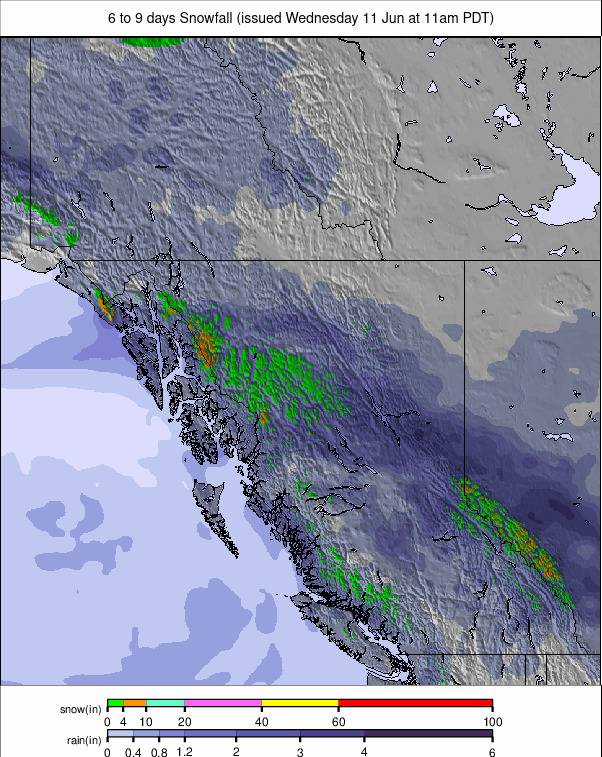
The northern Rockies and the Pacific Northwest have continued to dominate snowfall over the last seven days, posting by far the biggest accumulations—up to five feet (1.5m), not just in North America but the whole world. The snowfall has caused some operational issues and delays, and sadly, there have been fresh avalanche and tree-well deaths reported alongside all the powder joy it brings. Strong winds have also caused issues at times and led to the cancellation of the flagship downhill races at the World Cup Finals at Sun Valley in Idaho on Saturday. In the Midwest and on the East Coast, things are starting to wind down, with a growing number of lower, smaller centres ending their seasons already or planning to this coming weekend. After weeks of rather springlike conditions in the final days of winter, the weather has taken a turn to something more wintry now that it's springtime by both measures of the seasons, with lower temperatures and snow showers in recent days. So the bigger, higher centres are reporting all slopes open and full speed ahead toward Easter.
ROCKIES REPORT
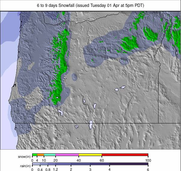
Another great week in the Rockies, where winter conditions have continued into the start of spring, and the snow has kept dumping. Colorado’s Winter Park (76/83” / 190/207cm), likely to stay open into May, posted one of the bigger accumulations with 14” (35cm) over the weekend. Steamboat (63/109” / 157/272cm) posted just an inch less over the same period. The deep snow from multiple storms in recent weeks has led to high avalanche danger and also warnings of tree-well dangers. Most ski areas in the region are at least 90% open, with Utah's Snowbird (52/141” / 135/353cm), another likely to stay open into May, posting the region's deepest snowpack.
ROCKIES FORECAST
Sunshine is expected to dominate for the rest of the week in the southern Rockies, with daytime highs into the 40s (°F). Further north, fronts are expected to bring fresh snowfall to end the week and then continue through the weekend, with temperatures a little cooler.
WEST COAST REPORT
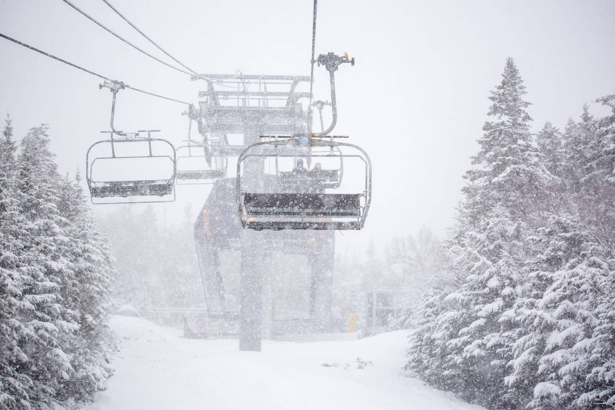
After the heavy snowfalls of recent weeks, it has been much drier, with sunny skies dominating in California. However, further north, it's been a different story, with the snow still dumping in Washington State and Oregon. Mt. Bachelor (125/370cm / 50/148”) passed 400” (10m) of total snowfall this season last weekend, reporting 60” (1.5m) in the last seven days. With their season average at 410” (1,025cm) and still two more months of their season left to run, it looks certain they’ll top that. “It’s still DEEP out there—expect limited grooming, and off-piste terrain is experts only. SIS and tree-well risk remain high. Ski or ride with a buddy and keep them in sight at all times,” a resort spokesperson commented. No surprise, after the big March snowstorms, that the five deepest snow depths in North America are all on the Pacific coast—in California, Oregon, Washington State, and Alaska—with Mammoth Mountain (114/202” / 285/505cm) currently topping the pile. Avalanche and tree-well danger is high, with Mt. Baker Ski Area closing for two days with an avalanche advisory issued.
WEST COAST FORECAST
Mostly sunny conditions for California, with a chance of weekend snowstorms. A much colder and snowier picture for the Pacific Northwest, where temperatures are not expected to climb above freezing often, and 3-9” (7-22cm) snowfalls are expected most days through the rest of this week and into the weekend on ski slopes in Oregon and Washington State.
MIDWEST REPORT
Most ski areas in the Midwest may have ended their seasons, and we may be into spring, but Mother Nature keeps reverting to winter mode. A spring blizzard moved from the central High Plains to the Upper Midwest and western Great Lakes ahead of last weekend. It was even given a name: Winter Storm Ezra. The combination of heavy falling snow and strong winds gusting at up to 60mph created blizzard conditions and near-zero visibility at times. The blizzard dropped up to 14 inches (35cm) in Iowa, and some parts of Michigan's Upper Peninsula saw 10 inches (25cm) or more. But still, ski areas have kept closing, with Wild Mountain, famously the first to open in North America in October 2023, among them. About a dozen ski areas remain open in the region, though, almost all in Michigan, Wisconsin, and Minnesota. Mount Bohemia (70/70” / 175/175cm) in Michigan reported 10” (25cm) from the latest storm and has the region’s deepest snow depth.
MIDWEST FORECAST
Cloudy and overcast for the next few days, with precipitation arriving at the weekend. However, as daytime highs may also reach the low 60s (°F), it looks like most areas will see more rain and sleet than snowfall.
EAST COAST REPORT
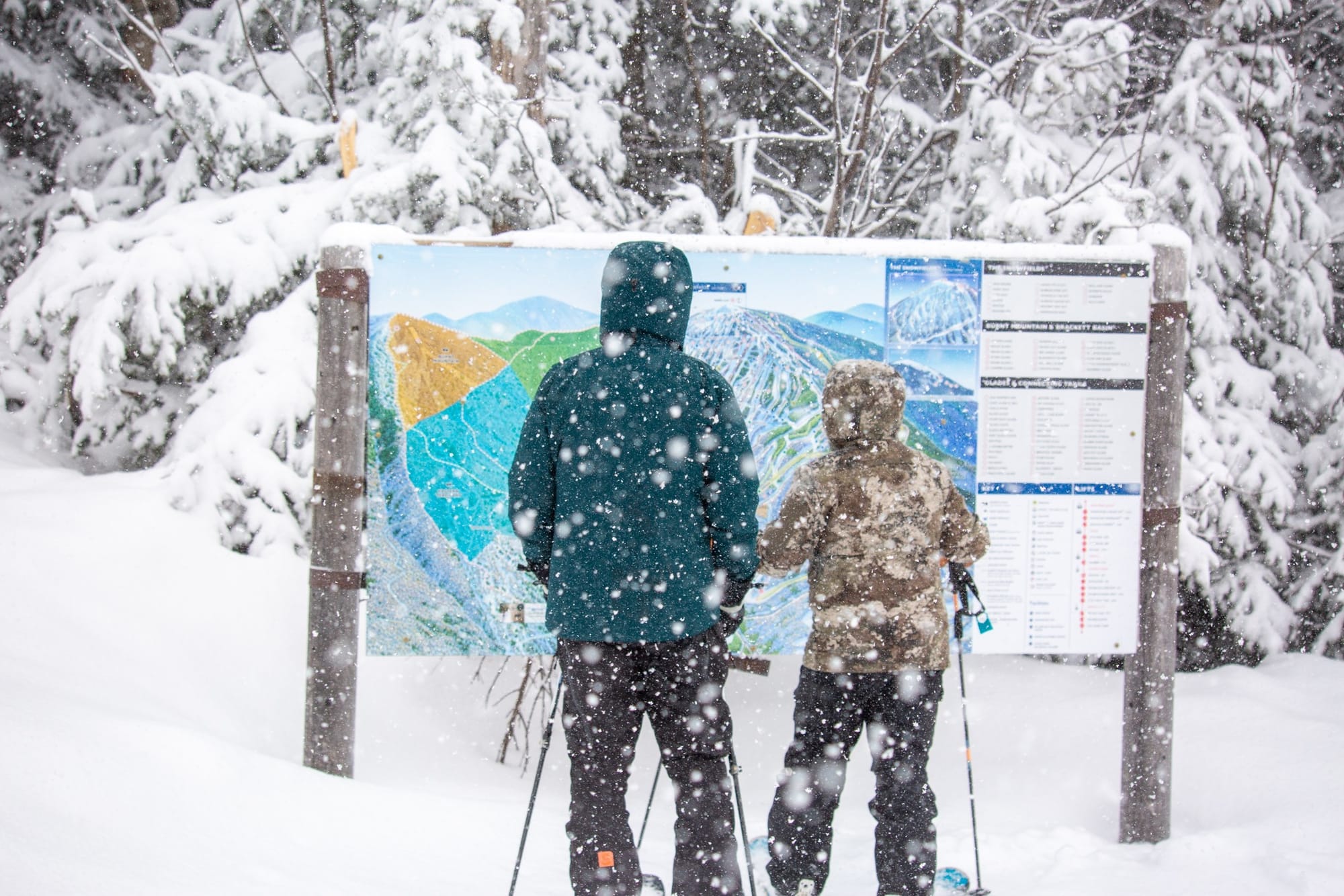
After weeks of mostly mild temperatures, things have gotten a little cooler in the Northeastern US since the weekend, with snow showers rather than rain and temperatures much closer to freezing. Snowfall totals of 1-4" (2-10cm) have been posted most days since a sunny weekend, with daytime highs staying in the 30s (°F) and overnight lows getting down into the low 20s or high teens, delivering classic freeze-thaw conditions. Most centres in the region remain fully open, although a few, like Vermont's Smugglers’ Notch (12/22” / 30/55cm), have dropped to nearer 60-70% open after the warm spell. The largest, Killington (18/34” / 45/85cm), and second-largest, Sunday River (35/55cm / 14/22”), are both still above 95% open, though.
EAST COAST FORECAST
A mixed bag of pretty much everything in the forecast for the coming week, with snow, sleet, and rain showers alternating with dry, sometimes sunny spells. Overnight lows up high remain below freezing, but daytime highs will reach into the 40s or even low 50s (°F) at times.
WESTERN CANADA REPORT
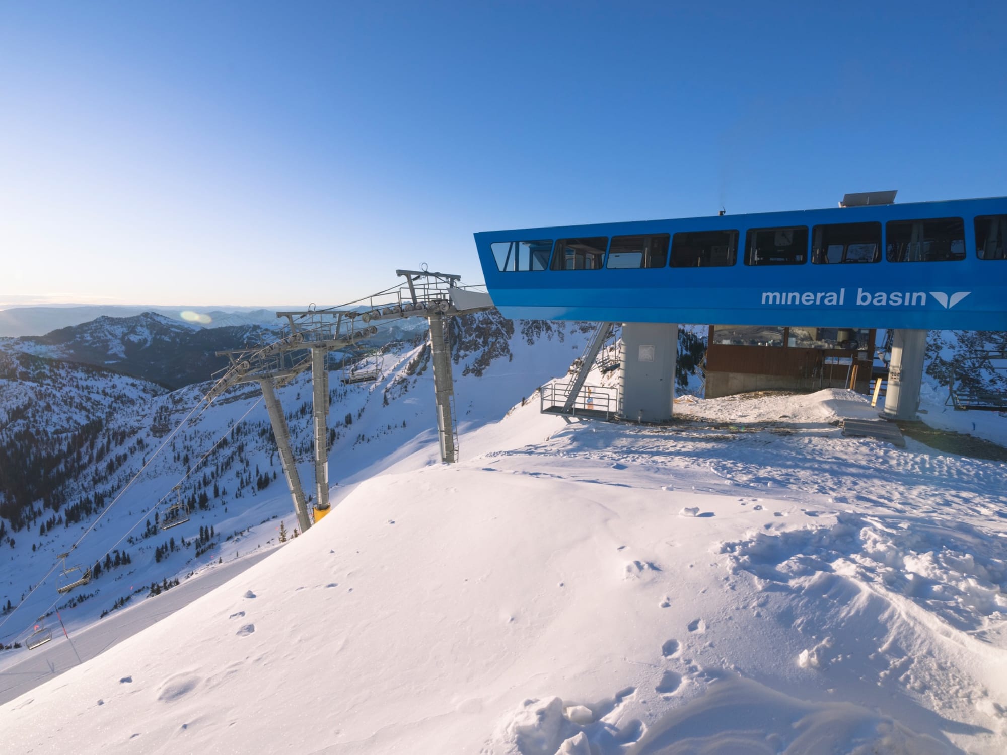
More low temperatures and snow showers in Western Canada through last weekend, but the start of this week has finally seen something a little more springlike and a little less wintry, with temperatures climbing well above freezing in valleys, the freezing point rising above 2,000m in the daytime, and some rain mixing with the snow showers. Overall, though, a good picture remains, with healthy snow depths, everything open, and everything still freezing overnight. Snow depths remain very good, and most centres are close to full operations, with nearly two months of the season still left for some. Whistler Blackcomb (20/280cm / 8/112”) reports its slopes are still 95% open—that’s over 8,000 acres, the most in North America.
WESTERN CANADA FORECAST
Fairly cold and fairly snowy for the rest of the week and through the weekend. Heavier falls in the next 24 hours, then lighter from Thursday. Temperatures are mostly in the -10 to +6°C range.
EASTERN CANADA REPORT
After a springlike spell earlier in the month, the weather has returned to something much more wintry in Eastern Canada over the past week, with temperatures hovering close to freezing (a few degrees on either side) and light-moderate snowfalls (5-15cm / 2-6" on average) on multiple days through the past seven. Sunny spells between the showers. Most of the region's ski areas remain close to full operations. The largest, Tremblant (185/305cm / 74/122”), continues to post the deepest base in the region and indeed one of the deepest in Canada.
EASTERN CANADA FORECAST
Sunshine and light snow/sleet/rain showers for the rest of the week, with temperatures in the -10°C (up high overnight) to +6°C (in valleys in the afternoon) range. In the longer, less certain forecast, heavier snow/sleet/rain is expected at the weekend.


