Massive Snowfall Blankets North America: Tahoe Gets 4.5 Feet, Rockies 40 Inches
Updated February 19, 2025: Huge snowfalls blanket North America—Tahoe sees 4.5 feet (135 cm), Rockies get 40” (1 m), and the East Coast digs out from a Nor’easter.
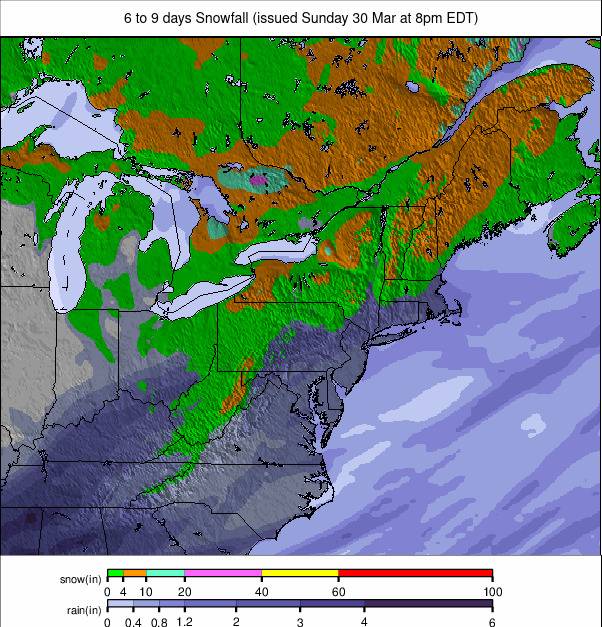
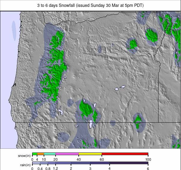
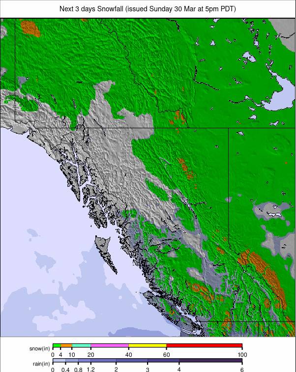
Western Canada Braces for Massive 100 cm Snow Dump This Weekend
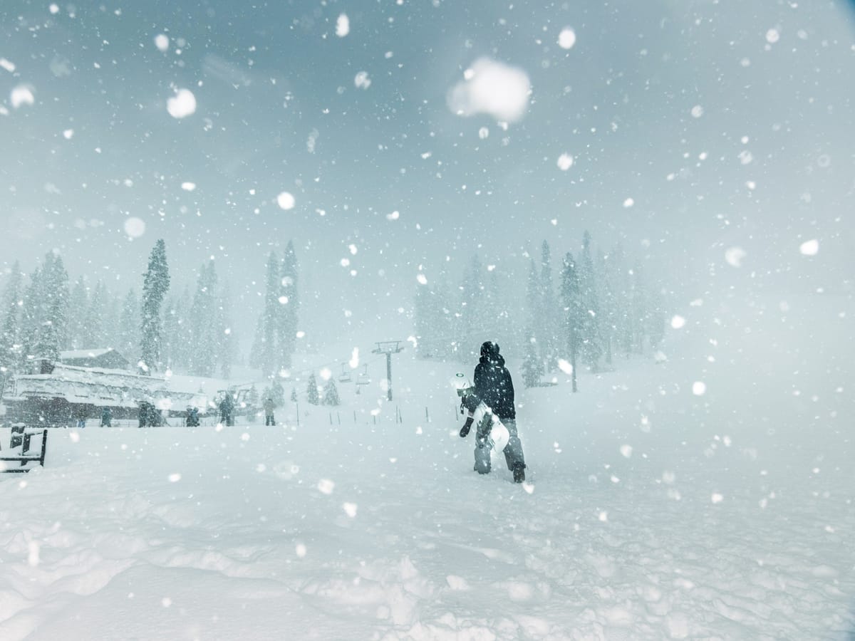
- Tahoe Snowed Under - Up to 4.5 Feet of Snow in Just 48 Hours
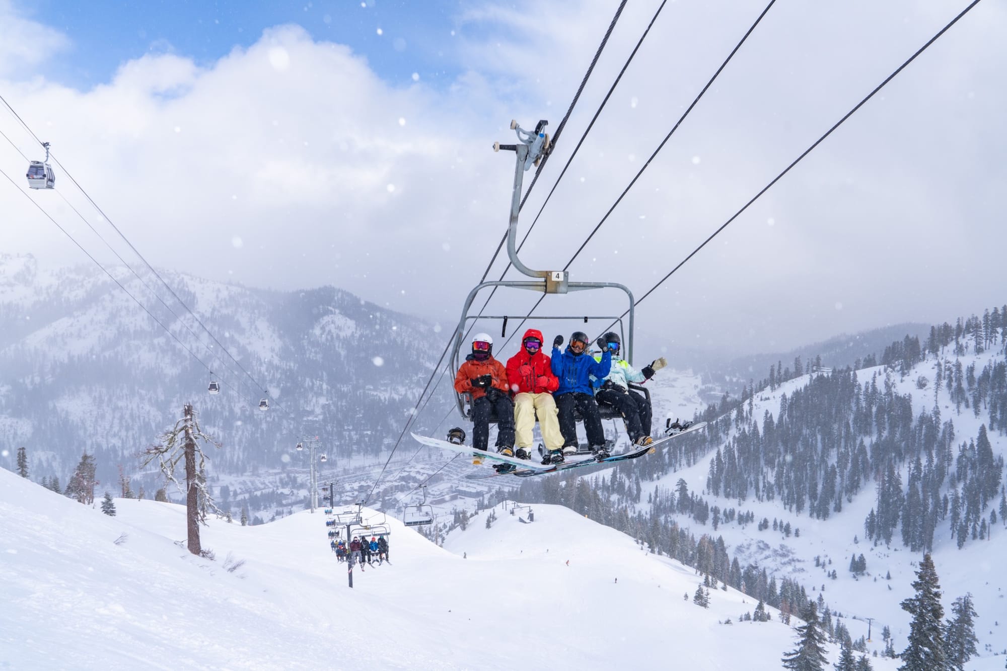
- Rockies Score Best Conditions of the Season with Deep Powder Everywhere
- Brutal Cold Shuts Down Midwest Resorts as Winter Storm Kingston Hits
- East Coast Enjoys Epic Nor’easter Snow—Every Run Open at Killington
NORTH AMERICA OVERVIEW
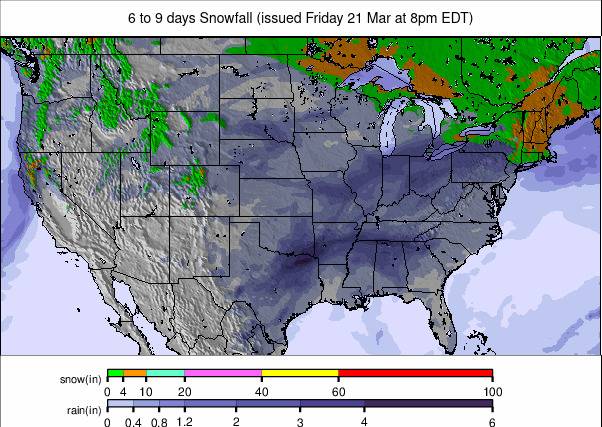
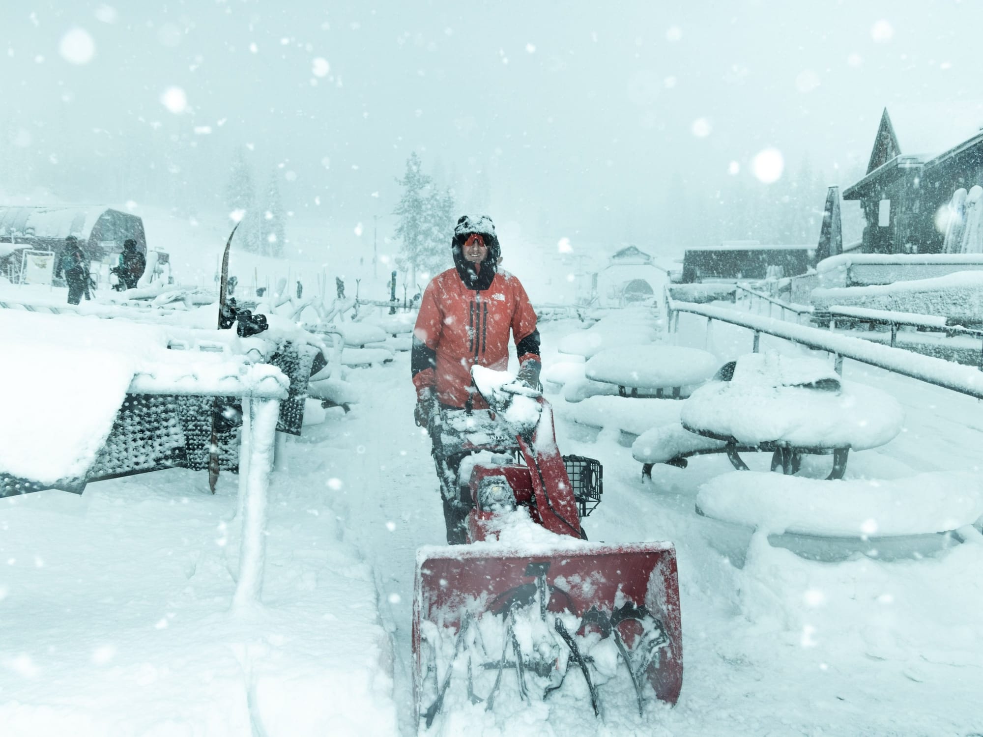
It's been an excellent week for snowfall across North America, probably the best of the season to date. Although some weeks have seen heavier falls, none have seen quite so much snow falling across the continent’s ski regions simultaneously, as severe storm systems moved in from all sides. California and the West Coast saw the heaviest snow, with accumulations of up to 4.5 feet (135 cm) in 48 hours in the Tahoe region at the end of last week, topping the tables. Inland, the Rockies region also saw some big falls—up to 20" (50 cm) in 24 hours in Colorado and Utah. There have been significant snowfalls on the East Coast as well, particularly in New England and Quebec, providing a refreshing cover there. After some digging out and de-icing, this leaves slopes across the continent fully open with plenty of fresh snow cover. In the Midwest, extreme cold has been the main factor, with Winter Storm Kingston bringing brutal temperatures and closing slopes.
ROCKIES REPORT
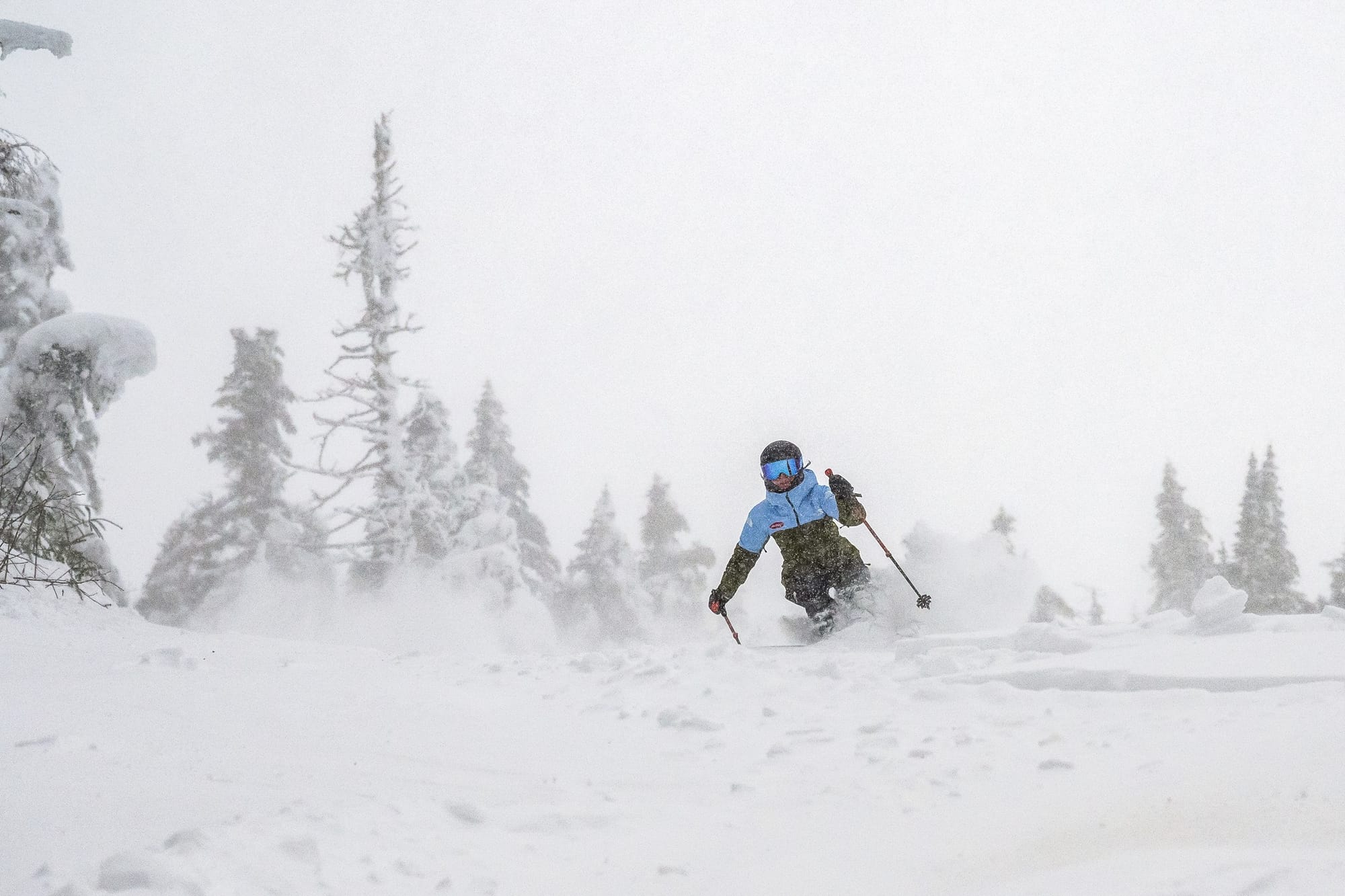
It’s been another largely good week in the Rockies, with significant snow totals helping to liven up the latter half of the season after a rather dry first half. Steamboat (58/94” / 145/235 cm) posted one of the biggest 72-hour accumulations in North America going into the weekend, with over two feet (25”/63 cm) of snowfall. This resulted in deep, light powder conditions, with every run open and every lift operating. By the start of the week, some areas, including Vail, were reporting 40” (1 meter) accumulations. Although accumulations elsewhere were not quite as big, the overall picture remains the same—everything is open, and fresh powder is available across most ski areas in the Rockies. In other words, these are about the best conditions of the winter so far.
ROCKIES FORECAST
Mostly sunny conditions are expected for the week ahead. Overnight lows on high slopes will drop into the teens (Fahrenheit), while daytime highs will reach the 40s in more southerly resorts, which may impact snow cover and quality. Light snowfall (just a few inches/5 cm) is expected from a weak front around Thursday.
WEST COAST REPORT
The main snow news on the West Coast this week was another intense weather system hitting Californian ski areas. This one was briefer than the previous week’s but delivered more snow in a much shorter period—up to 4 feet (1.2 meters) of snow on higher slopes in a 36-48 hour period, up until last Friday morning. As with the previous storm, very strong winds and occasional rain at lower elevations were factors, temporarily closing a lot of terrain as the system moved through. Initially, the biggest accumulations were at more southerly ski areas, such as June Mountain, which reported 26" (55 cm) in 24 hours, and nearby Mammoth, which received 16" (40 cm). China Peak reported 18" (45 cm) over the same period.
WEST COAST FORECAST
Conditions currently look more settled in the southern part of the region, with plenty of sunshine and temperatures ranging from the high 20s to low 40s Fahrenheit. Light snowfall is expected in California over the next few days and again over the weekend. More significant snowfall is expected further north, in Oregon and Washington, with over a foot (30 cm) predicted around the same time.
MIDWEST REPORT
Winter Storm Kingston has been the big news in recent days, bringing brutal cold and wintry weather, with over a foot (12”) of snowfall recorded. While the snowfall is always welcome, extreme lows—up to 40 degrees below average—led to widespread ski area closures at the start of the week for safety reasons. Conditions have since warmed slightly, and resorts have reopened over the past 24 hours, though some are still operating with limited hours. However, it remains cold and snowy. Ski areas in Michigan continue to report the deepest snow in the region, with Crystal Mountain (46/58” / 115/145 cm) posting the highest totals. It has received over 20” (50 cm) of fresh snow this week.
MIDWEST FORECAST
It will remain cold, though not as extreme in the latter half of this week, with temperatures ranging from 10 to 30 degrees below freezing in many areas. Skies will be mostly cloudy, but much less precipitation is expected.
EAST COAST REPORT
A named storm system from a serious Nor’easter brought heavy snow, violent gales, and continuing low temperatures to the Northeast at the end of last week and through the weekend. Since then, it has remained very cold, but the sunshine has returned, and skiers and boarders have been enjoying the fresh conditions. Ski areas continue to report excellent conditions, and most are now fully open after the slow start to the season at the end of last year. Base depths are also finally beginning to build. The region's largest resort, Vermont's Killington (14/30" / 35/75 cm), reports every run open, while New York State's Whiteface (40/53" / 100/132 cm) has the region’s deepest snowpack.

EAST COAST FORECAST
The calmer weather of the past few days is set to continue into next week, with sunny conditions expected. However, temperatures will remain very cold, ranging from the low single digits up to the 20s Fahrenheit, staying well below freezing at all elevations throughout the day.
WESTERN CANADA REPORT
Western Canada has seen slightly more snowfall this week compared to the previous few, but accumulations have remained light, with most areas receiving 2-5 cm (1-2 inches) daily. This snowfall has coincided with a slight temperature increase—still almost exclusively subzero, but now ranging from 0 to -15°C, rather than -5 to -30°C. Conditions remain good across Alberta and British Columbia, helped by the consistently low temperatures and regular refreshes of a few centimeters of snow. This has built up to 7-day totals of 25-50 cm (10-20”). Most areas have all slopes open, with Mt. Washington (175/310 cm / 70/124”) on Vancouver Island posting the deepest base in the region—and in North America.
WESTERN CANADA FORECAST
It looks much snowier for the coming week, with significant accumulations forecast for Western Canada, heaviest over the weekend. Seven-day potential storm totals of 50-100 cm (20-40”) are possible if the forecast holds.
EASTERN CANADA REPORT
Eastern Canada has had a great week of snow showers, along with ongoing cold temperatures. Tremblant (135/240 cm / 54/96”), Quebec's largest ski area, had already been posting the region’s deepest snow and most open terrain, but reported an additional 50 cm (20”) of fresh snowfall in the seven days leading up to last weekend, resulting in the best powder conditions of the season so far. Strong winds have been an issue at times, with Summit St. Sauveur (35/60 cm / 14/24") among the resorts that had to close higher lifts occasionally as a result.
EASTERN CANADA FORECAST
Conditions have become drier and sunnier over the past few days, and that trend looks set to continue until the end of the week. However, temperatures remain very cold.