North America Weekly Roundup #279
Updated February 5, 2025: The West Coast sees limited snow amid heavy rain, while Idaho and Wyoming enjoy 2-3 feet of fresh snow. Canada faces extreme cold.
Cold Fronts Dominate North America’s Ski Scene: Big Snowfall for the Rockies and East Coast
- West Coast Storm Fizzles: California's Rain Delays Huge Snowfall, Ski Areas Struggle
- Wyoming & Idaho Lead the Charge: 3 Feet of Fresh Snow at Jackson Hole
- Extreme Cold Hits Canada: Alberta Resorts Close Due to -30°C Temperatures
- East Coast Snowpacks at Their Best: Whiteface Reports Deepest Snow in Years
- Big White & BC Shine: Alberta and BC Ski Resorts See Major Snowfall Boosts
NORTH AMERICA OVERVIEW
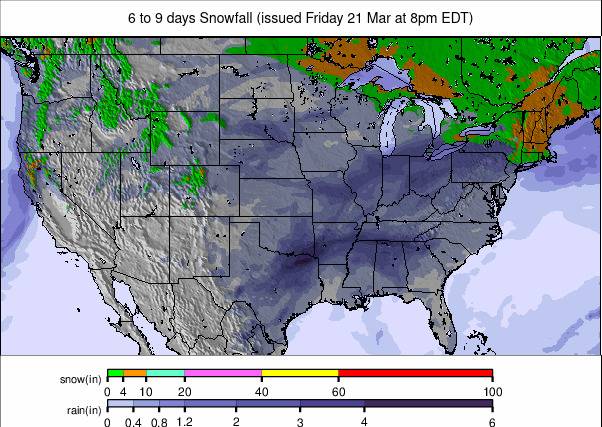
We had been expecting to report on vast snowfall accumulations on the West Coast in this week's update. As we published last week's report, it was just starting to become clear that a huge storm was due to bring a lot of precipitation from the Pacific, and 12 hours later, models were showing some ski areas in California potentially seeing 10 feet (3 metres) of snowfall by the start of this week. Alas, what they got instead was torrential rain, followed by just a foot or so (30-60cm) of snowfall on their higher terrain. The rain and gale-force winds closed several centres. The biggest snowfalls of the week—2-3 feet (60-90cm)—were instead reported inland in Idaho and Wyoming. Further north over the Canadian border and further east in the Northeast corner of North America, very cold weather continued to be a big factor, with lows below -30°C leading some well-known ski areas in Alberta to close for several days for safety reasons.
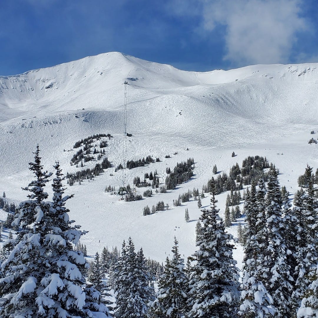
ROCKIES REPORT
Although the forecast a week ago predicted the Rockies would stay relatively dry while the West Coast got dumped on, in reality, the northern part of the region—Jackson Hole (32/83” / 81/208cm) in Wyoming and Sun Valley (48/72” / 120/180cm) in Idaho—posted some of the biggest accumulations in the world over the weekend and the start of this week, even more than California. Some snowfall occurred further south as well, though not as much, but conditions remain good on the groomers in Colorado and Utah. Snowbird (65/65” / 163/163cm) recorded 13” (33cm) of snowfall in the first three days of this week. Meanwhile, in Colorado, Keystone reported this week that it has reached 100% terrain open for the first time this season—3,149 acres of skiing and riding.
ROCKIES FORECAST
Predominantly dry, sunny, and cold, but with something of a north/south divide. Ski areas in Colorado may see base temperatures well into the 40s°F in the afternoons and very little snow. Further north from Utah upwards, fronts will bring 10-20” (25-50cm) of snowfall through the coming week, with highs remaining much closer to freezing.
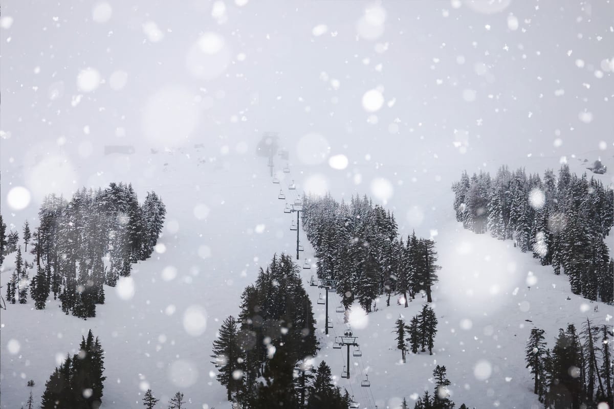
WEST COAST REPORT
Soon after we completed last week’s report, forecasting models for the snowstorms hitting the West Coast jumped from predicting 1-2 feet over the weekend to an astonishing 1-3 metres (3-10 feet!). Unfortunately, it was warmer than forecast, so a lot of the "atmospheric river" that hit the West fell as rain on lower slopes, with more limited accumulations up high. The region also endured violent gales, with winds reaching 80 mph, essentially making some centres unskiable over the weekend. The Palisades (46/117cm / 18/47”) recorded a 14” (36cm) 72-hour accumulation up to Tuesday but noted that only 13% of its terrain was open due to the storm's impact on both upper and lower mountain areas.
WEST COAST FORECAST
The ongoing storm in the latter half of this week currently looks more promising for positive snowfall totals. Temperatures are dropping, with highs expected to be close to freezing and lows in the teens as the storm continues through Thursday and Friday. Several feet (60cm) of snow are possible by the weekend, when conditions should finally start to clear.
MIDWEST REPORT
Cold weather and snow showers have been the dominant theme over the past week in the Midwest, with temperatures reaching single digits and at times even dropping below 0°F overnight in the northern part of the region. Highs have remained in the 20s°F, meaning temperatures have stayed below freezing around the clock. Most ski centres in the region are now fully open, and snowmaking can operate as needed thanks to the consistently low temperatures. Crystal Mountain (46/58” / 115/145cm) in Michigan is currently posting the region’s deepest snow and has all 59 of its runs open.
MIDWEST FORECAST
It looks like a good end to the week, with 2-4 inches (5-10cm) of snowfall forecast most days into the start of next week. Temperatures will remain well below freezing, ranging from single digits to the 20s°F.
EAST COAST REPORT
Conditions continue to be at their seasonal peak, with multiple fronts bringing light to moderate snowfall this week, along with low temperatures—at times, very cold indeed. An extreme cold warning was issued at the start of the week, with temperatures dropping to the -30s°F in parts of Maine. It may be the healthiest snowpack for slopes in Upstate New York in several years now, following weeks of good snowfall. Conditions have also improved significantly across the entire region compared to a month ago. Whiteface (24/40” / 60/100cm) currently reports the deepest snow depth in the region.
EAST COAST FORECAST
Conditions will remain cold, with the next fronts expected to move through around Thursday and Sunday, with sunny weather prevailing in between.
WESTERN CANADA REPORT
It has been a mostly good week in Western Canada, with some of the biggest snowfalls of the season so far in Alberta and BC, with 7-day totals reaching half a metre (20") in some areas and 24-hour accumulations of 30cm (a foot). BC's Big White (175/175cm / 70/70") was among those reporting one of the biggest snowfalls while also noting that all 120 of its trails are open. Additionally, in a nod to Canadian patriotism, Big White highlighted that it remains a 100% Canadian family-run resort. The only downside to the recent weather has been even lower temperatures than in previous weeks, which have forced some ski areas in Alberta and BC to limit lift openings. In some cases, including Nakiska, ski centres were closed completely for several days due to safety concerns.
WESTERN CANADA FORECAST
After some final midweek snow showers, fairly dry and frequently sunny conditions are expected into next week. Temperatures will remain cold, typically ranging from freezing down to -25°C. Some centres have already announced closures on Wednesday and Thursday due to the expected low temperatures.
EASTERN CANADA REPORT
Another cold week with plenty of light to moderate snow showers in Eastern Canada over the past seven days. Mont Tremblant (80/186cm / 32/74”) recorded temperatures between -5°C and -25°C over the past week, and its base has increased while remaining fully open. In Ontario, Blue Mountain (61/105cm / 25/42”) currently reports the deepest base and has 100% of its slopes open. In fact, after a tricky start to the 2024/25 season at the end of last year, most Eastern Canadian ski areas now report that more than 90% of their slopes are open.
EASTERN CANADA FORECAST
Cold conditions will persist, with significant snowfall expected in the latter half of this week. Cumulative snowfall totals of 10-30cm (4-12”) are expected by the end of the weekend.


