North America & Canada Weekly Roundup #273
Updated 25 December 2024: Pacific Northwest has Deepest Snow in the World whilst Rockies brace for a post-Christmas snowstorm. East Coast skiing hits season’s best conditions
- Pacific Northwest Leads with Deepest Snow in the World
- Rockies Brace for Post-Christmas Snowstorm
- East Coast Skiing Hits Season’s Best Conditions
- Western Canada: Whistler Opens 6,000 Acres
- Southern Rockies Enjoy Sunshine Before Snow Arrives
- Eastern Canada Stays Cold, Tremblant Tops Snow Depths
USA / Canada Overview
After the big West Coast snowfalls last week, it has been quieter across most of North America. However, the Northeast has experienced markedly colder temperatures, consistent below-freezing conditions and light to moderate snowfalls. In contrast, the southern Rockies, which have had a dry December so far, are finally seeing snow-bearing fronts move in. Snowfall is also returning to the West Coast mountain regions, particularly in the Pacific Northwest, where resorts are reporting the deepest snow accumulations in the world so far this season.
Rockies Report
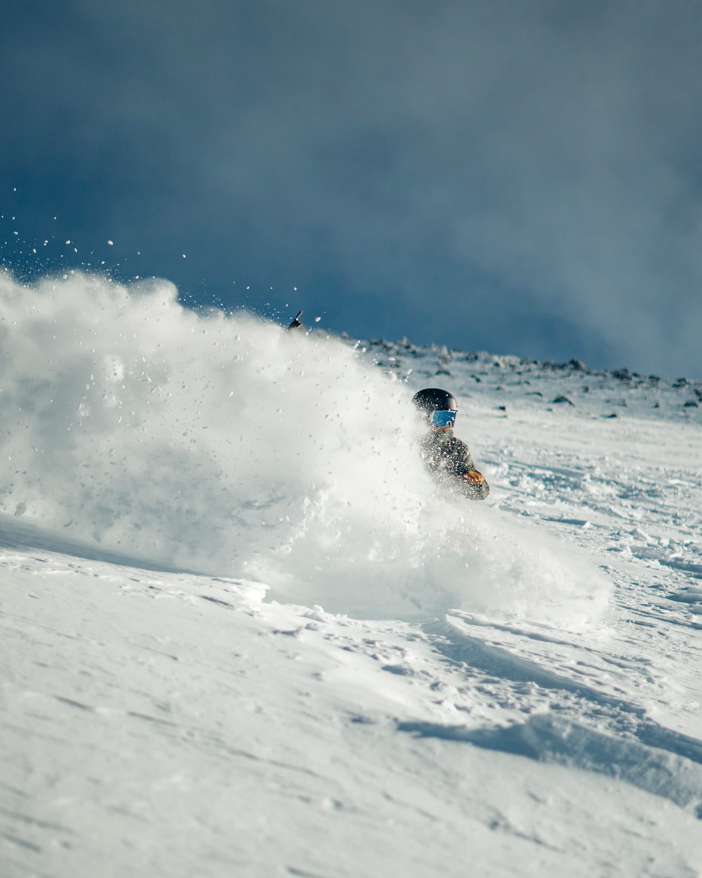
The Southern Rockies have continued to experience dry conditions, with plenty of sunshine across Colorado and only the occasional light snow shower. Resort base temperatures have risen into the 40s, though upper slopes have remained well below freezing. Despite these challenges, ski areas have opened more terrain for Christmas week, with most runs operational thanks to strong November snowfalls.
Further north, conditions have been better, with more cloud cover, slightly heavier snow showers, and colder temperatures. Snowmass has the most terrain open in the region (80% of slopes), while Idaho’s Tamarack Resort boasts the deepest snow depth. Meanwhile, the Arizona Snowbowl has all lifts and runs operational for the season.
Rockies Forecast
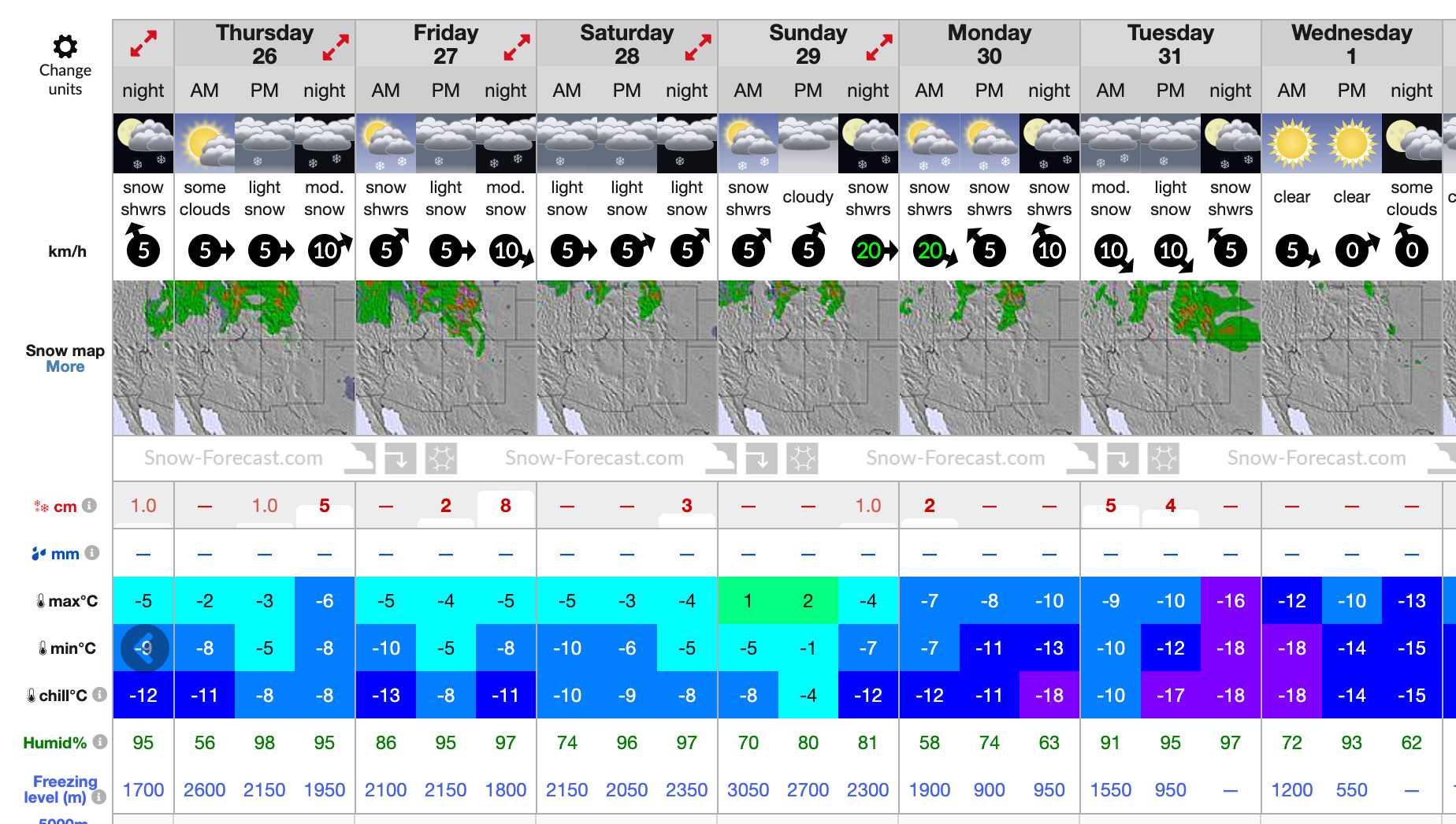
Post-Christmas, the Rockies are expected to see a colder and more wintry outlook. Snowfall will intensify, particularly in the north, with snow expected most days. Temperatures at resort bases will dip closer to freezing, with upper mountain slopes remaining well below freezing.
West Coast Report
The Western US is experiencing unsettled conditions, with a mix of sunny skies and increasingly heavy snowfalls leading up to Christmas weekend. Washington state continues to lead with the deepest snow in the country, including Mt. Baker, which tops the snow accumulation charts. Mt. Bachelor in Oregon boasts the most open terrain in the region, with 95% of the slopes operational.
California has also seen significant snowfall, with some resorts like Mammoth expecting up to a foot more snow by midweek. Northern regions in Oregon and Washington have had more consistent snowfalls, keeping conditions favorable.
West Coast Forecast
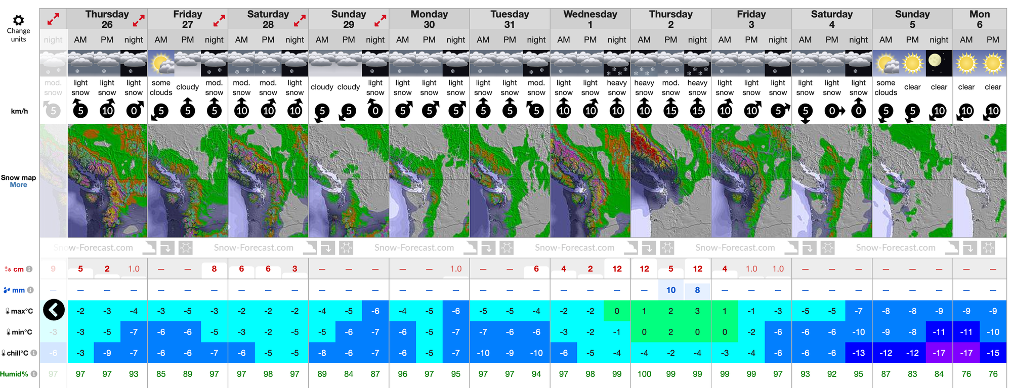
The week will close with a cold and snowy outlook for the Pacific Coast mountain ranges. Moderate to heavy snowfalls are expected, with 1-2 feet of snow forecasted and up to three feet in the most optimistic scenarios for California. Temperatures will range from the mid-teens to the mid-thirties Fahrenheit.
Midwest Report
The Midwest has enjoyed a week of predominantly cold weather, allowing snowmaking machines to operate at full capacity. Light to moderate natural snowfalls have been reported, with Michigan’s Ski Brule maintaining the deepest snow in the region. Michigan-based ski areas dominate in terms of terrain open, with Wisconsin’s Cascade Mountain leading with 34 open runs, representing 70% of its area.
Midwest Forecast
Unfortunately, rising temperatures could bring rain instead of snow to parts of Michigan, Wisconsin, and Minnesota later in the week. Primarily overcast skies are expected, with limited snowfall potential.
East Coast Report
The East Coast has had its best week of the season, with consistently cold temperatures and frequent light to moderate snow showers. After a slow start to the season, ski areas are catching up, with Vermont’s Sugarbush and Killington opening significant terrain. West Virginia’s Snowshoe Mountain is reporting the deepest snowpack in the region.
East Coast Forecast
The remainder of the week will be cold and mostly dry, with temperatures ranging from the low teens to freezing. While some light snow showers are expected, accumulations will be minimal.
Western Canada Report
Western Canada continues to benefit from excellent snow conditions. Mount Washington on Vancouver Island boasts the deepest snow base in the world, with light snowfalls refreshing it daily. Whistler Blackcomb is leading North America with over 6,000 acres of open terrain, while inland resorts like Big White have reported 30-40cm of fresh snow this week.
Western Canada Forecast
Temperatures will remain below freezing, with highs near freezing and lows at -15°C. Most days will bring overcast skies and light to moderate snowfall, typically in the 2-10cm range.
Eastern Canada Report
Eastern Canada is enjoying some of the best conditions of the season, with temperatures ranging from -5°C to -20°C. The region has seen a mix of sunny skies and light to moderate snowfalls. Tremblant leads with the deepest snow and the most terrain open in the region, marking a strong start to the season.
Eastern Canada Forecast
Cold temperatures will persist, staying between -4°C and -16°C. The region will see mostly clear skies with occasional light snowfall, providing an inch or two of fresh cover.

