Japan Weekly Roundup #278
Updated Jan 29: Japan’s epic snow continues! 50cm (20”) fresh now, over 1m (40”) coming next week. Hakuba boasts one of the world’s deepest bases! Read more →
• Japan’s slopes stay deep—Hakuba boasts one of the world’s biggest bases.
• Heavy snowfall hits Japan—50cm fresh powder now, over a metre next week
• Niseko, Rusutsu & Nozawa fully open—epic conditions hold strong
• Sunshine dominates, but Arctic cold keeps Japan’s record depths intact
• Storm cycle ahead—Japan braces for metre-plus snowfall early next week
JAPAN REPORT

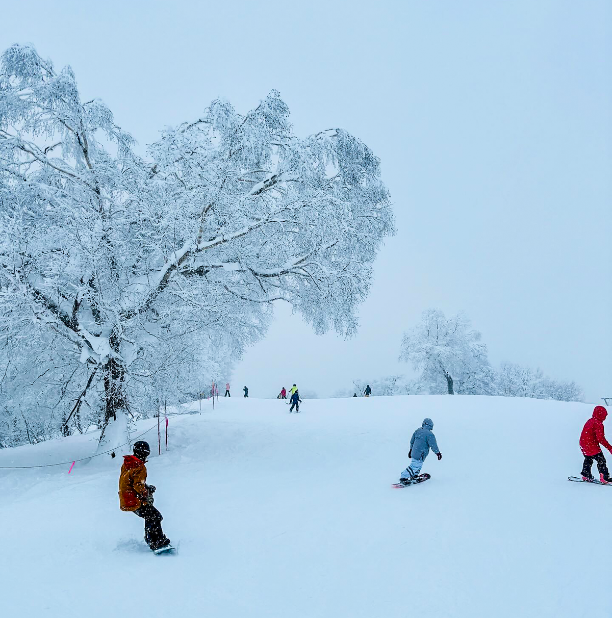
After all the snowfall of the past few months, Japan has had a much quieter week, with sunshine dominating in many areas. However, it has remained cold, with temperatures typically in the -10C to +2C range, so not much thawing is occurring. Base depths here remain the world's deepest, with several Japanese resorts posting 4m+ (over 13 feet) of snow on their upper slopes.
Of the big-name resorts, Niseko (130/265cm / 52/106”) reports its slopes 100% open. Rusutsu (160/195cm / 64/78”) is about the same. On the mainland, Nagano’s Nozawa Onsen (150/240cm / 60/96”) and Hakuba’s Happo One (90/360cm / 36/144”), the latter posting one of the deepest bases in the world right now, are also fully open.
Current picks for the top 5 resorts in Japan today (29th Jan):
1. Happo One – 345cm upper depth, 100% open, packed powder and groomed snow.
2. Niseko Hirafu – 250cm upper depth, 100% open, powder conditions.
3. Nozawa Onsen – 240cm upper depth, 90% open, packed powder and groomed snow.
4. Naeba – 260cm upper depth, 80% open, packed powder and groomed snow.
5. Rusutsu Resort – 165cm upper depth, 85% open, packed powder and groomed snow.
JAPAN FORECAST
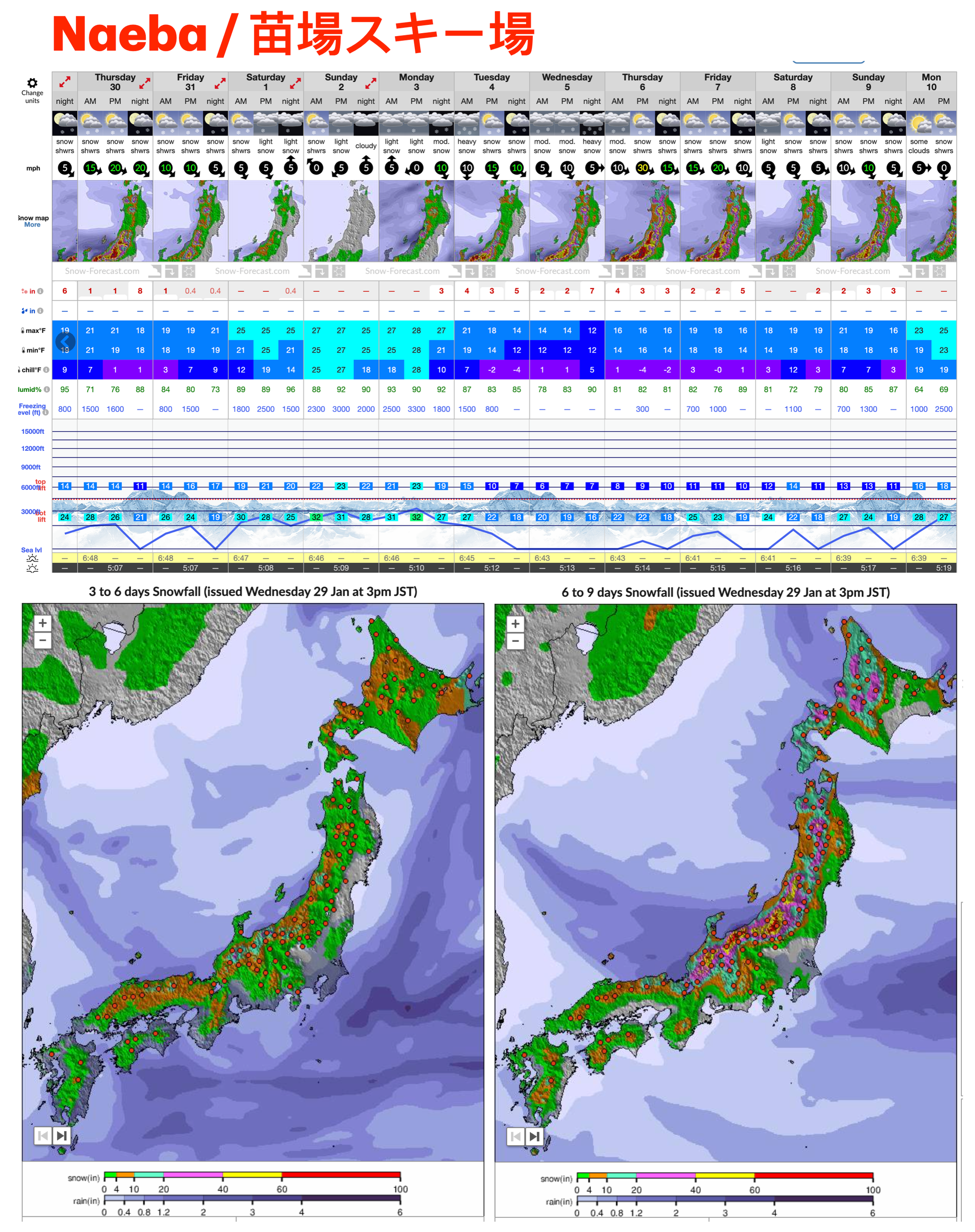
The recent drier weather has ended with light snowfall in the past 24 hours, with heavy snowfall starting now for the latter half of this week, potentially delivering over half a metre (50cm) of fresh powder by Thursday evening.
Another brief break with milder, sunnier skies this weekend before another massive snowstorm is expected to bring over a metre (40”) of snowfall to start next week if the forecasting models prove precise.


