Southern Alps Brace for 50cm+ Snow Blast Before Easter
Updated April 16, 2025: Heavy snow hits southern Alps with up to 20" (50cm) expected by Easter—plus rising avalanche risk and major resort closures.
- Cervinia & Zermatt Could Score 100cm by Monday
- Avalanche Risk Soars as Heavy Snow Hits Western Alps
- Resort Closures Midweek Amid Intense Rain-Snow Storm
- Scandinavia Shines: Deep Powder & 100% Terrain Open
EUROPE OVERVIEW
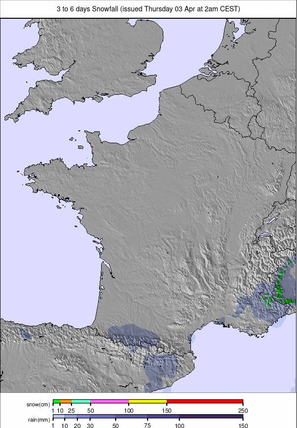
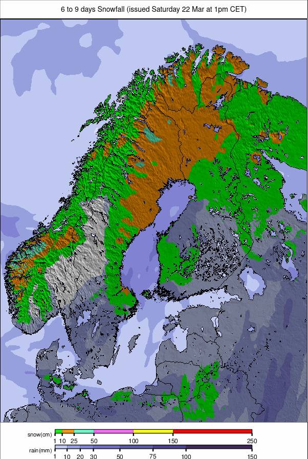
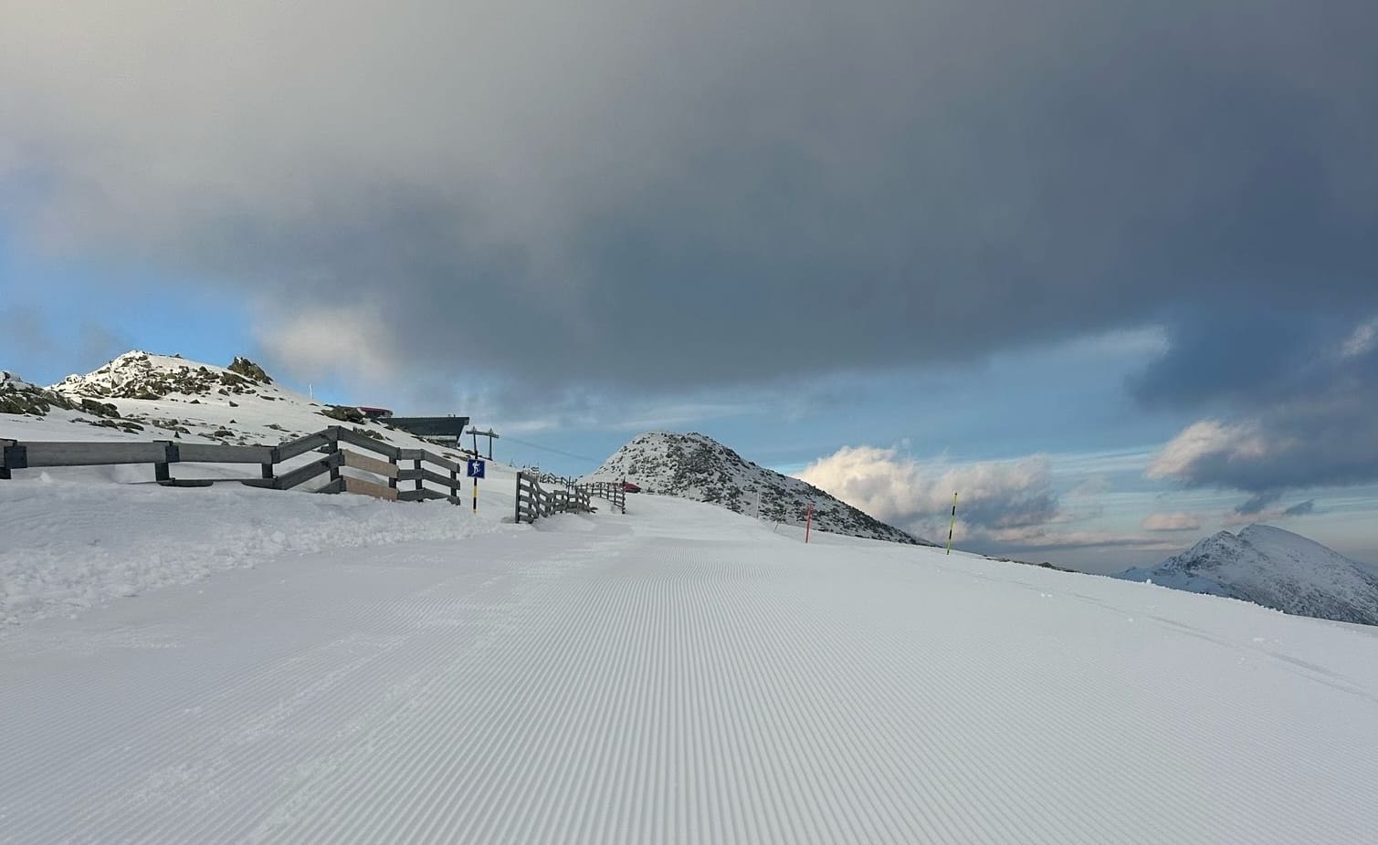
With the late Easter week finally here, Europe's weather has become more unsettled after a fortnight of largely sunny, settled weather in the Alps. Multiple fronts are currently moving across the continent, bringing mostly light rain, sleet, and snow showers, depending a lot on altitude. However, an intense system in the southwestern Alps is expected to bring a mix of heavy rain and significant snowfall over the next 48 hours, with rain initially up to around 2,200m and snow above, with the snowline dropping until Thursday evening. The best-case scenario is for up to half a metre (20") of snowfall accumulation on high slopes by Easter Day, with the southern Alps set to see the most. For most, though, it will be much less. The avalanche danger is set to be very high later this week in the most impacted areas, and there’s a high risk of flooding for the areas set to see the most precipitation too, from the combination of rain and heavy snowmelt. That’s led many to close all or most slopes on Wednesday, and many will remain so on Thursday.
With Easter so late this year, about 75% of Europe's ski areas have already ended their seasons. However, most of the bigger, well-known resorts are still open, although for many of those, the coming Sunday or Monday will be the final day of 24-25. The season is already over in several countries, including Bulgaria and Scotland. Hundreds of ski areas do plan to stay open later in April, though, with many continuing into May and a few beyond.
AUSTRIA REPORT
About 90% of Austria’s ski areas have ended their seasons, but more than 50 are continuing on to Easter or beyond, including many of the country's bigger centres. That said, a second of its four 200km (125-mile) plus areas, 2025 World Alpine Skiing Championships host Saalbach Hinterglemm, ended its season last weekend, joining the SkiWelt, which closed at the start of the month. There have been light snow showers on high slopes at Austrian resorts, but the snowline has been above 2,000m, with temperatures down at 1,000m altitudes reaching +20°C in the afternoons. Austria’s two other 200km+ centres, Ischgl (90/110cm / 36/44”) and the Arlberg (20/120cm / 8/48”), both have the most terrain still open, about 195km (121 miles) each.
AUSTRIA FORECAST
Heavier showers are currently in the forecast, including for Easter Sunday, but with the snowline still above 2,000m—often 2,500m—these again will most likely be rain and sleet on much of the mountain, with just higher slopes getting a decent dump. Sunny spells continue in between times.
FRANCE REPORT
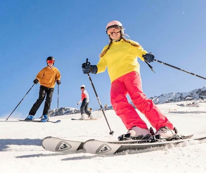
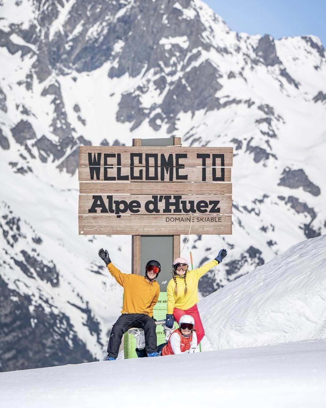
Snowfall returned to the French Alps at the start of the week, with accumulations of 5-10cm (2-4”) above 2,000m reported initially in the southern Alps but now across the region. Snow showers are continuing as we publish this report, and by the start of next week, totals may exceed 50cm (20”) for some higher areas. Although a little cooler, it remains spring temperatures, so the snow is mostly falling above 2,000m, and the snowpack stats continue to diminish with thawing rates exceeding fresh snow accumulation—nice though it is to ski and ride on. About 20% of French ski areas remain open, including most of the big, well-known areas. Les 3 Vallées (130/180cm / 52/72”) continues to post the most terrain open in the world, with around 400km (250 miles) of slopes still skiable.
FRANCE FORECAST
Forecasting models currently predict quite heavy snowfall over the coming week on high slopes, particularly on Wednesday and Thursday. It will be heavy rain on lower mountain slopes, initially up to 2,200m, but falling at night down to 1,400m. There’ll be a break in the showers around Friday/Saturday and some sunny spells between the periods of grey skies.
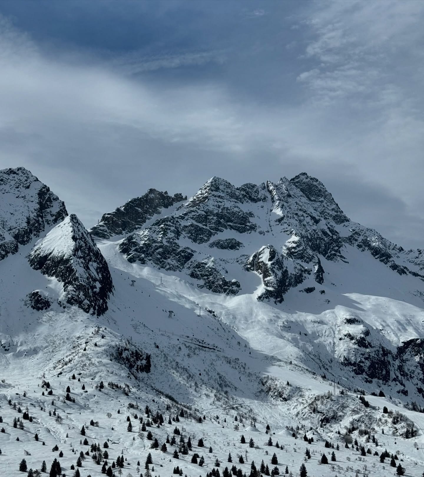
ITALY REPORT
About 75% of Italy’s ski areas have closed, but the country has seen cooling temperatures and fresh snowfalls on higher slopes from the Western Italian Alps along the French border across to the eastern Dolomites, where they border Slovenia. Light snow showers have been reported on higher ground all week, with sleet and rain at lower altitudes. Trentino’s Madonna di Campiglio (40/166cm / 16/66”) was typical in posting a 10cm (4”) accumulation on Tuesday. Cervinia (35/165cm / 14/66”) posted the same and is expected to be one of the bigger winners in the upcoming snowfall through to Easter, potentially getting between 50-100cm (20-40”) thanks to its location, favourable to the current system, and altitude. Its shared area with Zermatt is also still 90% open thanks to its altitude, the largest area currently accessible from both countries.
ITALY FORECAST
Italy is well positioned to benefit from the systems moving up from the south, with its western ski areas expected to see the biggest accumulations up to Easter and lighter falls in the Dolomites. As with France, the western Alps are expected to see an intense weather system move through on Wednesday/Thursday, with heavy snowfall above 2,000m and heavy rain below. The Piedmont region may see flooding as a result.
SWITZERLAND REPORT
Swiss centres too have seen a return of more unsettled conditions after the sunny first fortnight of the month. Weather systems have brought rain, sleet, and snowfall here too, particularly to the south and western Swiss Alps. About a third of the country's bigger ski areas remain open, with Zermatt (0/90cm / 0/36”) currently reporting the most terrain in the country open—at least when the weather is favourable. It's at 90% on sunny/busy days but dropped to only 30% midweek as bad weather closed slopes. That said, 30% is still nearly 100km (63 miles) of runs. Its near-neighbour Saas Fee (20/250cm / 8/100”) continues to report the deepest snow in the country and now the joint deepest in Europe; about three-quarters of its slopes remain open. It’s one of many areas currently closed on Wednesday and maybe on Thursday due to the heavy rain/snow mix hitting the region
SWITZERLAND FORECAST
The recent weather change looks to be locked in through to next week now, although there’ll still be plenty of sunny spells. Switzerland too, especially the west, is set to see the intense weather system over the next 48 hours. The most optimistic forecast suggests cumulative totals could reach the metre mark (40”) by Easter Monday at a few spots above 2,500-3,000m. For most, the accumulations will be much more modest though, and with temperatures peaking at +20°C in low Alpine valleys, it's going to be rain on lower mountains.
PYRENEES REPORT
The Pyrenees and wider Iberian peninsula have continued to see more unsettled and often colder conditions with more precipitation than further north. That has translated into snowfall on higher slopes, although we are down to half-a-dozen ski areas left open in the region, divided up fairly evenly between Andorra, France, and Spain. Andorra’s Grandvalira (120/180cm / 48/72”) still has about half its terrain—120km (75 miles) of runs—open, and its Ordino/Arcalis sector has climbed up through the season to now post Europe’s deepest snowpack at 2.5m. All ski areas in the Pyrenees are currently expected to close after Easter, but Europe’s most southerly ski area, Spain’s Sierra Nevada, which is reporting one of the continent’s deepest snowpacks and more fresh snowfall this week, plans to stay open into May.
PYRENEES FORECAST
A sunny few days are forecast through to the end of this week, with temperatures ranging between -10°C overnight and +10°C in the afternoons under the clear skies. A fresh front moves in for the weekend, which should bring rain/sleet or, fingers crossed, some fresh snowfall for the Easter weekend.
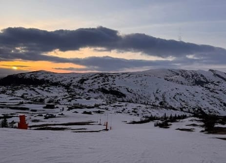
SCANDINAVIA REPORT
Northern Scandinavian ski areas again topped European snowfall tables for much of the past week. Sweden’s Björkliden (107/107cm / 43/43”) posted more than 20cm (8”), and there were similar totals for other areas up in the Arctic Circle, with other centres in the northern part of the wider Scandinavian area posting more like 5-10cm (2-4”) totals. Unlike the rest of the northern hemisphere, most centres in the region remain open and also still have 80-100% of their runs skiable, with bigger resorts intending to keep operating into early May. The largest, Sweden’s Åre (25/55cm / 10/22”), is among them and still reports 98% of its slopes open.
SCANDINAVIA FORECAST
It’s expected to be largely dry and sunny across much of the region over the coming week, with just occasional snow/sleet/rain showers. Temperatures in the -2 to +8°C range, but colder in the far north, where overnight lows will still drop below -10°C and daytime highs only get a few degrees above freezing.
EASTERN EUROPE REPORT
Bulgaria’s season drew to a close at the weekend, with Bansko the last there to end its season on Sunday. However, half a dozen higher centres remain open in the northeast of the region in Czechia, Slovakia, and Poland, with at least one of these planning to make it into May. It has been a little cooler in this part of Europe, and there was some snowfall before the weekend. In fact, it was really resorts here, in the Pyrenees, and Scandinavia that were posting any snowfall in Europe through the latter half of the week and weekend, while it remained dry in the Alps and Dolomites. Jasná (30/60cm / 12/24”) still has about a third of its slopes open.
EASTERN EUROPE FORECAST
An end-of-the-season feel, with temperatures remaining above freezing at all levels—temperatures in the +2 to +9°C range. Frequent showers of varying intensities, but likely to be almost entirely rain.
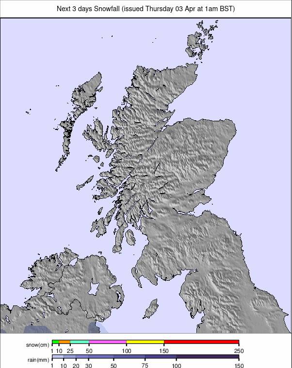
SCOTLAND REPORT
Scotland’s fortnight of more-or-less non-stop warm, sunny weather concluded at the weekend when clouds began to roll in and the first showers for several weeks were recorded, lessening the extreme fire danger reported at the end of last week. There have been some light snow showers turning peaks white for the first time since March, but as of yet, nothing like enough for slopes to re-open. With the Easter weekend soon to be behind us, it's looking increasingly unlikely that any slopes will open again now until next winter.
SCOTLAND FORECAST
Mixed weather continues through the weekend, with sub-zero temperatures overnight and staying in single figures during the daytime. Dry spells interspersed with mostly sharp, short showers, which may fall as snow on higher peaks.