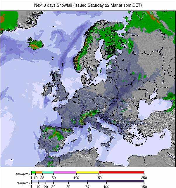
Scandinavia Sees Biggest Snow Totals Again, Up To 30cm Forecast This Week
Updated April 9, 2025: Spring sun dominates the Alps, but Scandinavia scores 12" of fresh snow and Sierra Nevada extends to May—click for Europe's full snow scene!
- Warm, sunny weather dominates the Alps as freeze-thaw conditions continue
- Pyrenees hang on with fresh snow and late-season openings
- Les 3 Vallées leads Europe for open terrain as spring closes in
- Eastern Europe picks up to 30cm of fresh snow on high slopes
EUROPE OVERVIEW
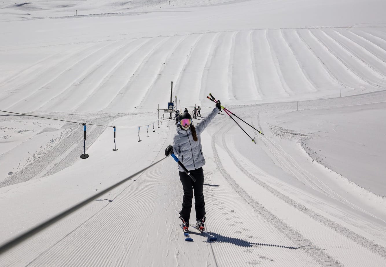
It's been a dry and sunny week for many parts of Europe, including the Alps and the Dolomites. Spring conditions continue to be the norm here, with snow melting from valleys and the freezing point rising as high as 3,000m on some afternoons, although usually dropping to low levels still overnight, continuing freeze-thaw conditions. What snowfall there has been has been reported in the far north of Scandinavia, Eastern Europe, and some more in the Pyrenees too. But we certainly do not yet see the big spring snowfalls we saw on higher slopes in the Alps in both 2023 and 2024. As we move further into springtime, the number of ski areas ending their seasons continues to grow. The percentages closed vary from 90% or more in some countries to less than a third for most Scandinavian nations.
AUSTRIA REPORT
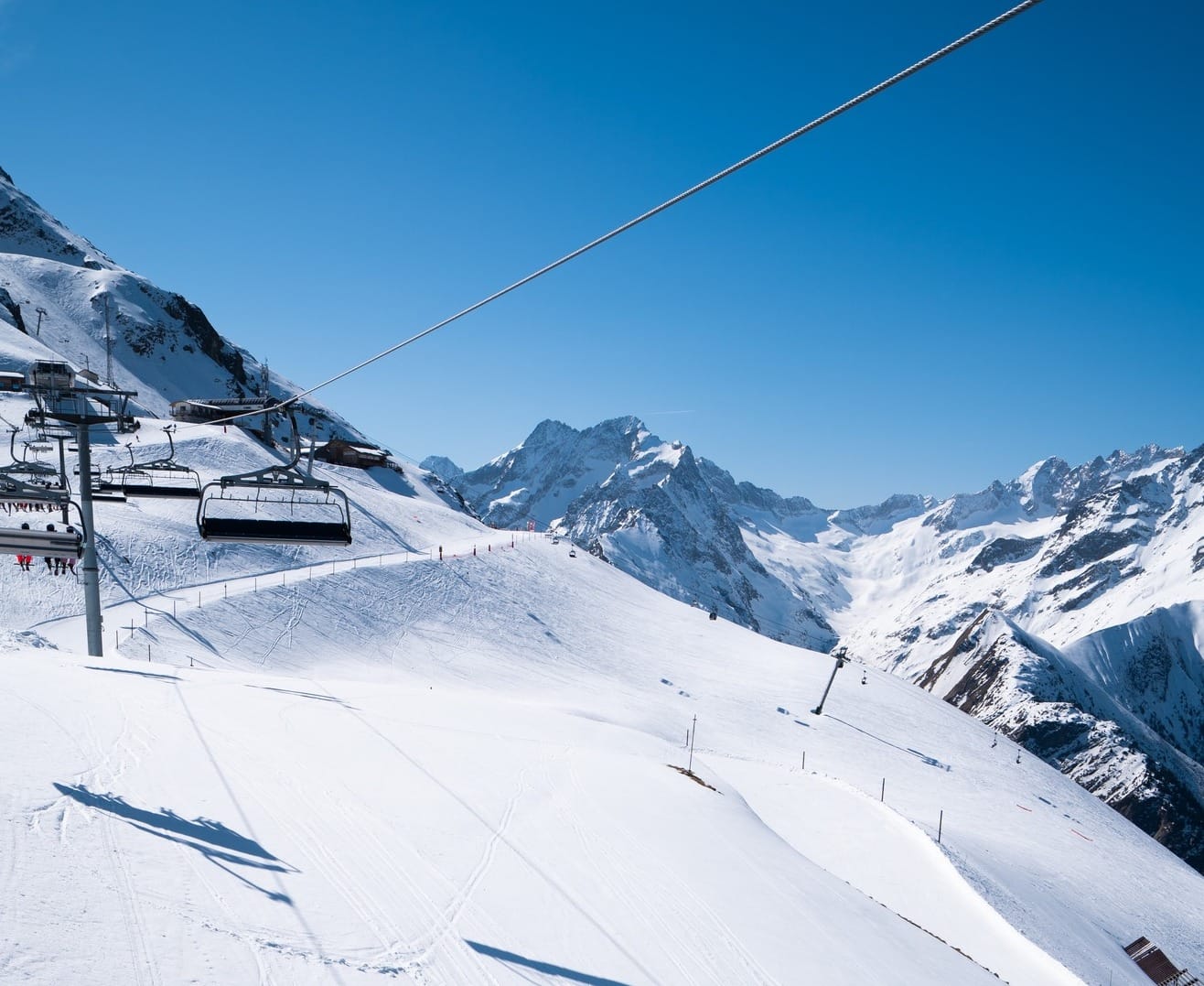
About 90% of Austria’s ski areas have now ended their seasons, but 30 or so of the country’s higher centres are still operating some terrain, most of those now aiming to continue to the Easter weekend and a dozen or so into May. After seeing some of the biggest snowfalls in Europe last week, most Austrian resorts have seen non-stop sunshine over the last seven days, with the freezing point rising and temperatures getting above +15C in valleys. However, high slopes have still seen -10C or below overnight at 2,500m and above, so it’s been freeze-thaw. Sölden (10/254cm / 4/102") has the deepest snow in Austria and still reports its large domain as 98% open.
AUSTRIA FORECAST
It's expected to continue to be warm and sunny for the Austrian mountains through the remainder of this week and into the weekend. The freezing point should hit 3,000m in the daytime, dropping to 1,500m overnight.
FRANCE REPORT
About three dozen of France’s larger, higher ski areas remain open, some closing this coming weekend but most aiming to make it through to the Easter weekend or beyond. It’s been a mostly dry, sunny, and warm week, most noticeable on lower mountain slopes where remaining snow is soft — the best conditions, of course, in the mornings up above 2,000m. Les 3 Vallées (160/210cm / 64/84”) still reports more than 80% of their slopes open, the most in the world by some distance. Flaine (0/270cm / 0/108") is still posting the deepest snow in the country, with 70% of the Grand Massif region still open.
FRANCE FORECAST
It’s expected to get very warm — into the low 20s — in Alpine valleys over the next few days, but for now, overnight lows will still be getting five or six degrees below freezing and there's hope of a little fresh snowfall up high. Dry to end the week, with the forecast currently indicating a temperature drop and snowfall to start the week up to Easter.
ITALY REPORT
It's been a sunny week in Italy also, where about three-quarters of the country's ski areas have now ended their seasons. That has mostly been the less-well-known, lower-lying smaller centres, but a few big names, including Val Gardena, ended their 24-25 season on Sunday. Like most of Central Europe, it has been a predominantly sunny week with very mild temperatures at lower altitudes, but there was some snowfall towards the end of last week in the west, Bardonecchia (40/120cm / 16/48") posting a 10cm (4") accumulation up high last Friday. It has about a third of its terrain still open.
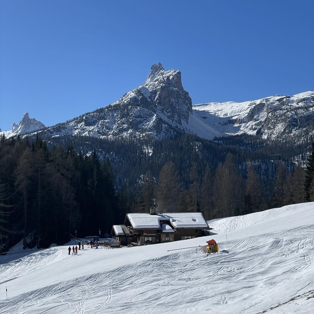
ITALY FORECAST
Predominantly dry and sunny for much of Italy for the coming week, with just the occasional cloudy spell and little or no precipitation in the forecast. Temperatures are largely above freezing, with the freezing point moving up above 3,000m altitude in the afternoons, still getting below zero on high slopes overnight, however.
SWITZERLAND REPORT
It’s been a predominantly warm and sunny week in Switzerland too, with temperatures reaching +20C in some lower valleys and wall-to-wall sunshine over much of the past week. There were some good snowfalls in the middle of last week, with Saas Fee (38/299cm / 15/120”) posting one of the bigger accumulations on the day we published last week's report – a 35cm/14” accumulation taking it to one of the deepest in Europe. It’s also one of the Swiss ski areas still open, with about two-thirds of smaller, lower areas now closed for the season.
SWITZERLAND FORECAST
Dry weather is set to continue at least to the start of next week, when there are early signs of a return of snowy weather. The freezing point will move between 1,500 and 3,500m altitude, with temperatures from -5C overnight at 3,000m to +15 to +19C in Swiss valleys in the daytime.
PYRENEES REPORT
Although the big snowfalls in the Alps in the first half of last week eclipsed the 7-day totals in the Pyrenees, the region has actually seen more consistent snowfalls and cold weather than further north for much of the past month. That has continued to some extent over the last week with cooler temperatures and snow showers in the region into the weekend, when the Alps have had full sun and warm weather. It’s been mostly sunny in the Pyrenees too since Sunday though. Grandvalira posted 10cm (4”) of fresh on high slopes into the weekend, although it did describe conditions otherwise as “wet snow.” Only about half a dozen ski areas in the region remain open, with the last expected to close at the end of the Easter weekend. However, Europe’s most southerly ski area, Sierra Nevada, down on Spain’s Mediterranean coast, announced on Tuesday that it is staying open until May 4th.
PYRENEES FORECAST
It looks like a more unsettled end to the week ahead with some precipitation and the potential for a few centimetres of snowfall on the highest slopes overnight, but mostly it will be too warm for snow, with daytime highs reaching +15C.
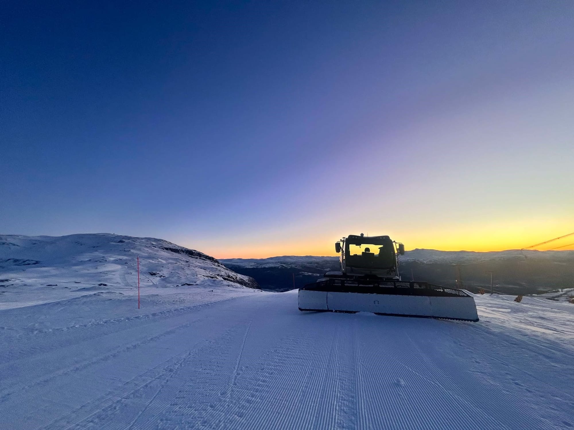
SCANDINAVIA REPORT
The blocking patterns on weather across much of Europe this week have led to northern Scandinavia continuing to see some of the biggest snowfalls again this week. Norway's northerly Narvik (40/70cm / 16/28"), up within the Arctic Circle, posted the biggest accumulation in Europe over the weekend with an 18cm (7") fall, although it did still describe conditions as "wet snow." Nonetheless, it’s the far north that’s closest to wintery in Europe now, with Scandinavia as a whole reporting cooler temperatures than further south, and still light overnight falls of a centimetre or two (an inch) are being widely reported. Sweden’s Åre (62/62cm / 25/25”) remains fully open with the most terrain in Scandinavia and plans to stay open into May.
SCANDINAVIA FORECAST
Most areas are set to remain dry and sunny for most of the coming week, with temperatures in the -8 to +7C range. However, colder and at times snowier weather is expected in the north and east, with a front moving through on Thursday potentially bringing up to 30cm (12”) in 24-hour snowfall totals.
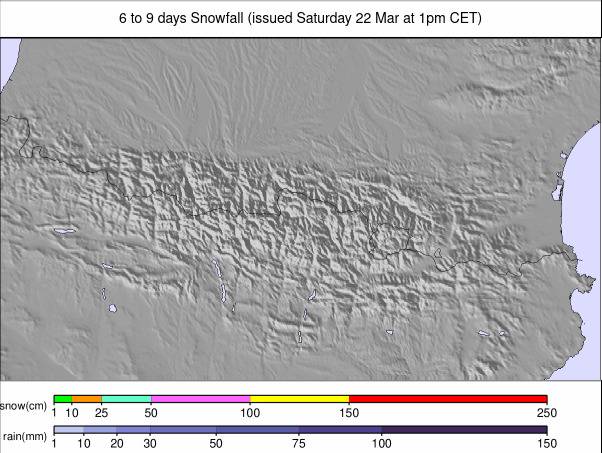
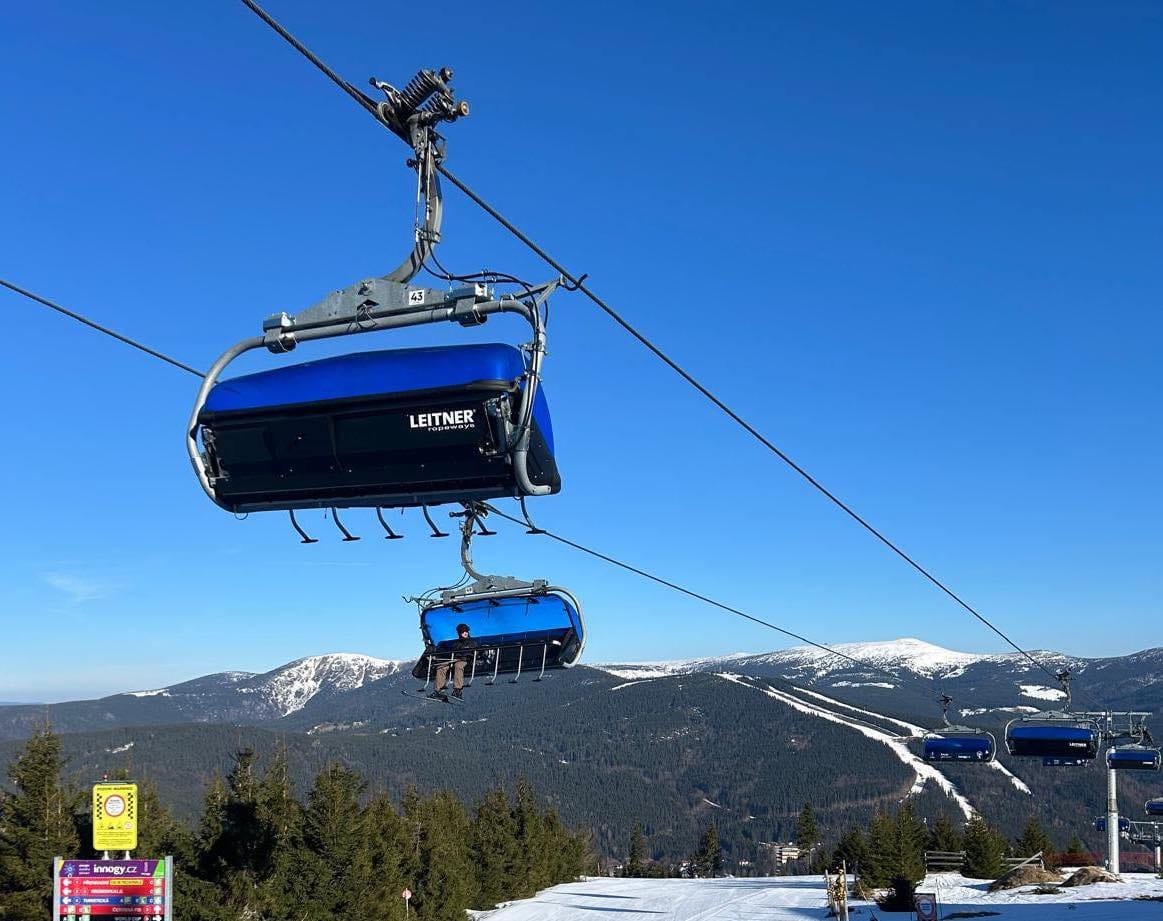
EASTERN EUROPE REPORT
Most of Eastern Europe’s ski areas have now closed, including Czechia’s largest, Špindlerův Mlýn, but Bulgaria’s Bansko is still going until this coming Sunday and has been reporting cooler weather with some snowfall up high in the local Pirin Mountains over the past week. It's a similar story up in Slovakia, where Jasna (20/60cm / 8/24”) with 30% of its slopes still operational, reported 15cm (6”) of fresh snowfall on Sunday. In fact, the wider region around Czechia, Poland, and Slovakia posted up to 30cm (a foot) of weekend snowfall. Tatranská Lomnica (30/60cm / 12/24") topped the tables and reports a third of its slopes are still open.
EASTERN EUROPE FORECAST
Fairly wintry conditions are expected to end the week and through the weekend in Northeastern Europe. Although daytime highs will reach +10C at lower levels, high slopes will be in the -6 to +2C range through the 24-hour cycle and snowfall is expected up top.
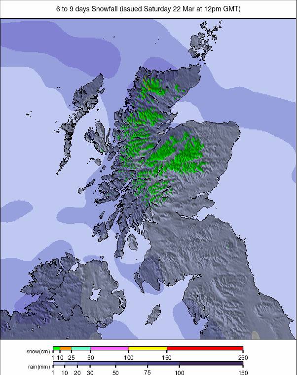
SCOTLAND REPORT
Scotland saw some of the highest temperatures in the warm first week of April, with lots of sunshine and no precipitation. Overnight lows in the Highlands have been dropping below freezing, but with daytime highs above +15C, there's little snow to be seen on summits anymore and no centres open. Glencoe has committed to keeping its all-weather snow slope open, which it uses for sledging. It, Cairngorm, and possibly other centres say they'll still reopen if there is some late-season heavy snowfall, but currently, there's no real sign of that.
SCOTLAND FORECAST
Looking a little cooler and more unsettled in the run-up to the Easter weekend, but still plenty of sunshine and with temperatures still getting into double figures, precipitation seems more likely to be rain at most levels, with just the outside chance of an overnight snowfall.