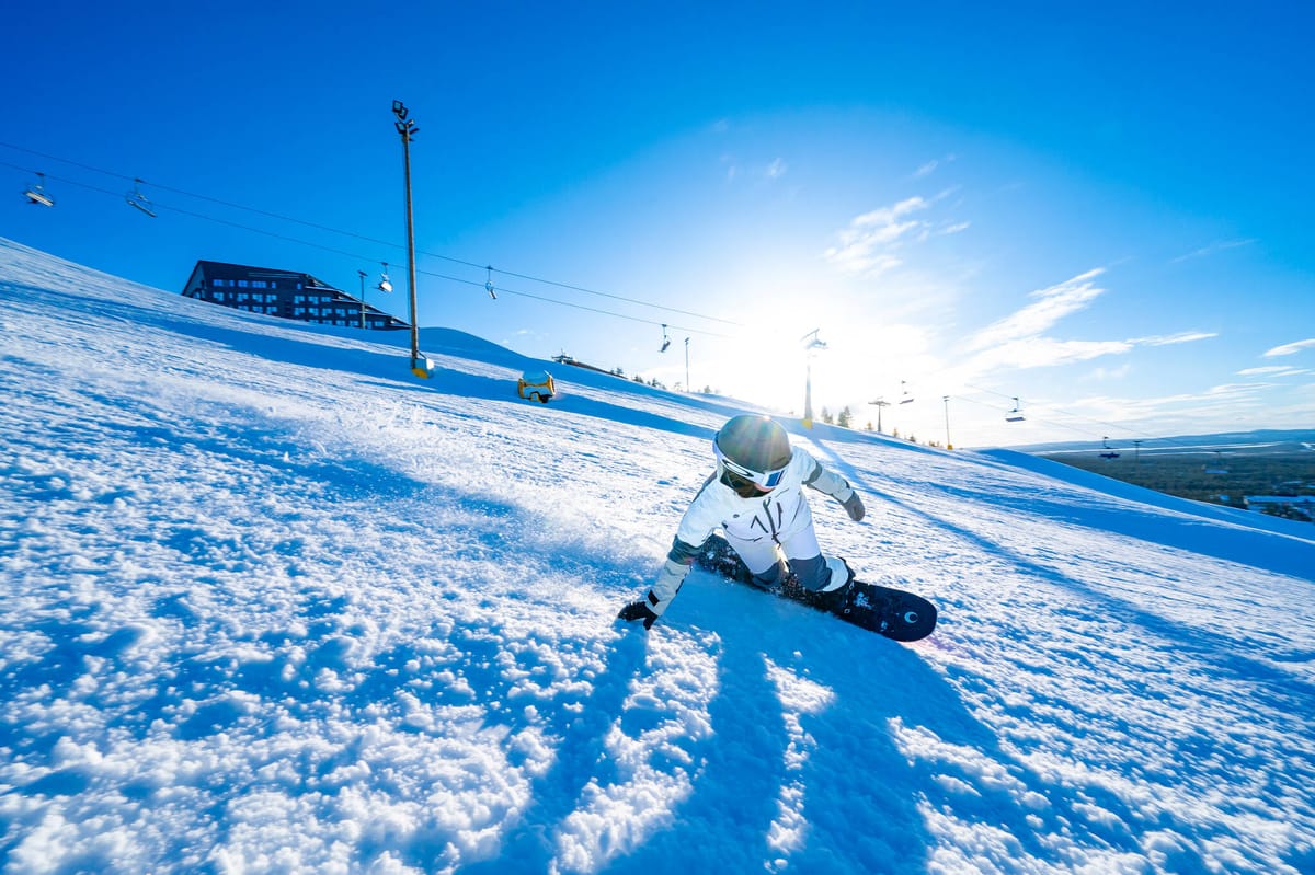
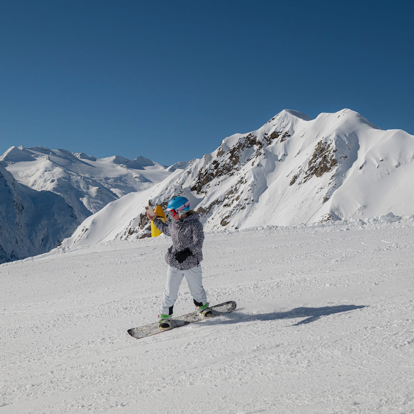
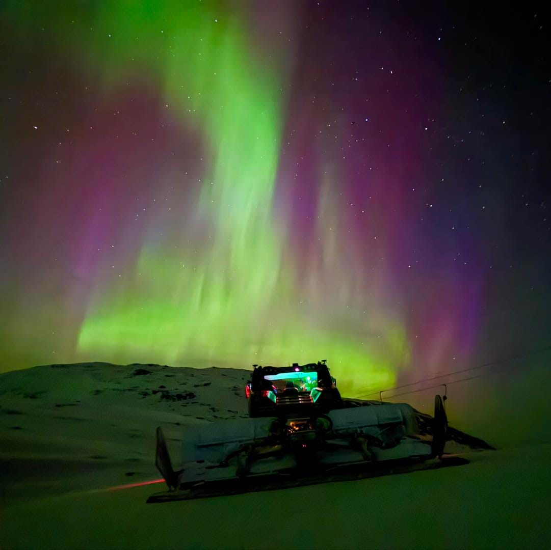
Swiss resorts see 20" fresh powder ahead of World Championships
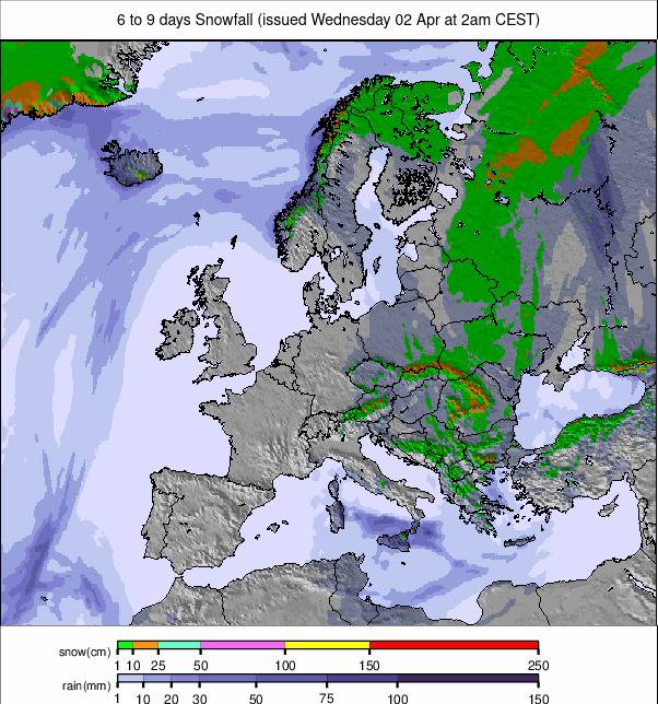
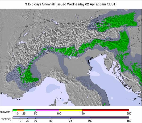
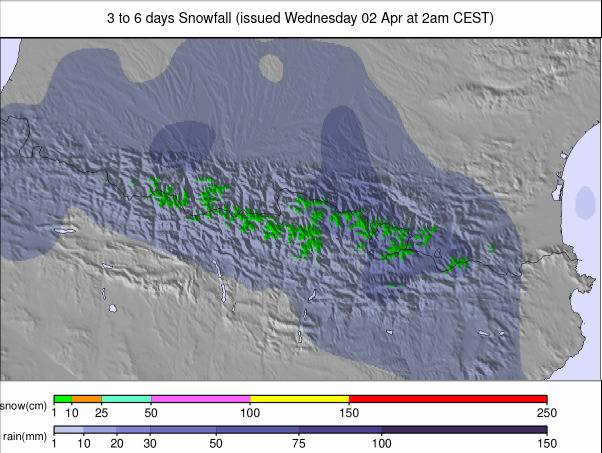
Updated March 26, 2025: Alps blasted by 50cm (20") of fresh snow as storms hit, Pyrenees post deepest bases, and Switzerland's Saas Fee boasts 280cm (112") powder—spring thaw begins in Austria.
- Alps hit by 50cm snow dump as storms end sunny spell
- Pyrenees boast deepest snow in Europe—avalanche risk high
- Scandinavia’s slopes stay pristine as Scotland gives up
- Spring thaw begins as Austria’s giant SkiWelt closes
EUROPE OVERVIEW
Strong winds across Europe at the weekend brought the period of calm, sunny weather in the Alps to a dramatic end. Many ski areas closed more exposed parts of their slopes, and some planned competitions on Saturday and Sunday were cancelled or moved forward to Friday ahead of the stormy weather. The storms also led to a change in the weather since the weekend, with much more unsettled conditions, such as snow, sleet, and rain showers across many of Europe’s mountain ranges. The snowfalls kept coming, though, with accumulations of up to half a metre (20") by the start of this week, by which time winds were starting to die back too. Most ski areas remain close to full operation, but there are signs of spring, with some lower-lying resorts dropping back to 70-80% open. There's also the feeling of the beginning-of-the-end of winter 24-25, with the first smaller, lower resorts starting to close until winter 25-26 and the first of the bigger ones signing off this weekend. Outside of the Alps, Scandinavian ski areas continue to report some of Europe’s best conditions, but across the North Sea, there's little left open in Scotland. Conditions remain the best they've been all season in the Pyrenees, and resorts in Eastern Europe are battling thin cover for some and warm temperatures for others.
AUSTRIA REPORT
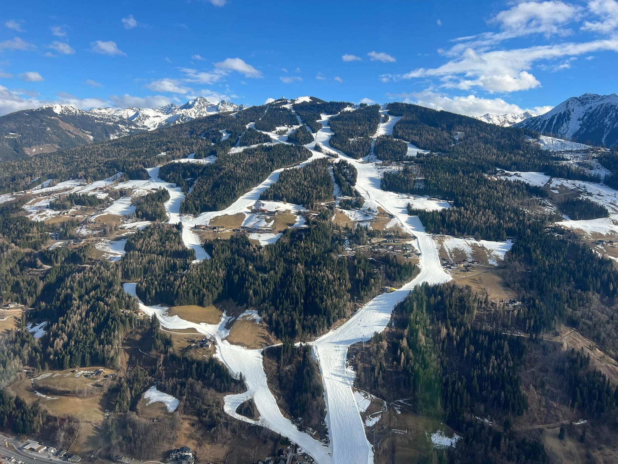
The first of Europe’s giant ski areas, the SkiWelt Wilder Kaiser-Brixental (50/75cm / 20/30”), home to resorts including Soll, Westendorf, and Ellmau, will end its season this coming weekend. Elsewhere, parts of the Ski Juwel region, including the Niederau sector, have already closed, ending their season on Sunday. Like the rest of Austria, they enjoyed mostly dry and sunny weather up to the weekend, with valley temperatures climbing to a high of +16°C in the afternoons and rarely dropping below freezing overnight, even at 2,000m. Since Sunday, though, more unsettled weather has moved in, with light-moderate snowfall on higher slopes and rain in the valleys. St. Anton (55/140cm / 22/56”) was among the first in the country to report light snowfall since Saturday. The snow line has been between 1,000 and 2,000m altitudes, so rain and sleet have fallen on lower slopes at times.
AUSTRIA FORECAST
It currently looks like a cool but sunny latter half of the week, with just light snow showers expected (rain and sleet at lower levels). Afternoon temperatures will reach up to +10°C in valleys, with overnight lows of -5°C at 2,000m, meaning freeze-thaw conditions up high and just thawing down low.
FRANCE REPORT
It was quite a wintry weekend in the French Alps as the weather turned following the sunshine all last week. Ski areas reported strong winds and light-moderate snowfalls, which for many areas accumulated to 20-40cm (8-16”) by the start of this week. Serre Chevalier (35/140cm / 14/56”) posted 20cm (8”) on Saturday. Since then, it has been a little cooler, with temperatures in the -10 to +10°C range, so freeze-thaw conditions continue for the snowpack. Most French areas plan to remain open at least up to the Easter weekend. However, snow depths are declining slightly overall this week, with settling/thawing outweighing snow gained, and the amount of terrain the big areas have open has dropped a little too. Flaine (0/295cm / 0/118”) and the Grand Massif continue to post Europe’s deepest base, even if it is below 3m/10 feet for the first time since early January. It also still has more than 80% of its terrain open.
FRANCE FORECAST
Continuing to be largely dry with light snowfall, plenty of sunshine, and temperatures starting to creep up a few degrees into the weekend.
ITALY REPORT
As with the rest of Western Europe, conditions in Italy became more unsettled from the weekend after the previous week's non-stop sunshine. Sestriere (25/45cm / 10/18”) was one of the first to report fresh snow accumulation—10cm (4”) in the 24 hours to Saturday morning—and similar snowfalls were then reported across the country over the next few days, with mostly 5-20cm (2-8”) falls. The Monterosa region was one of the bigger winners, posting 20cm (8”) on Saturday. Rather than the common west/east weather split this season, the snowfall was widespread, with the Dolomites seeing some good snowfalls too. However, with spring temperatures, lower slopes did see sleet and rain at times. It's been drier since the start of the week, with more sunny periods and lighter snow showers.
ITALY FORECAST
The snowy conditions are expected to ease off through the latter half of this week, with sunny skies returning into the weekend. The freezing point is expected to be between 1,400m and 2,400m, with daytime highs above +10°C in valleys and overnight lows of -5°C at 2,000m altitudes.
SWITZERLAND REPORT
Snowfall returned to Switzerland on Saturday, ending a week of dry, sunny weather here too. Splügen (20/120cm / 8/48”) was the first to report a measurable dump, with a 5cm (2”) accumulation on Saturday morning for a nice weekend refresh. The snowfall became more widespread and intensified through the weekend, with totals of up to 50cm (20”) by the start of the week. It led to weekend competitions at the FIS Snowboard, Freestyle, and Freeski World Championships, currently taking place in St. Moritz, being moved forward to Friday ahead of the front moving in. Saas Fee (60/280cm / 24/112”) is currently posting Switzerland’s deepest snow cover.
SWITZERLAND FORECAST
Remaining unsettled for the remainder of the week, with snow showers continuing but dry spells too. For some areas, particularly in the north and west, the dry spells will extend to several days with plenty of sunshine before snow showers return at the weekend. Temperatures are a little cooler, mostly in the -4 to +6°C range.
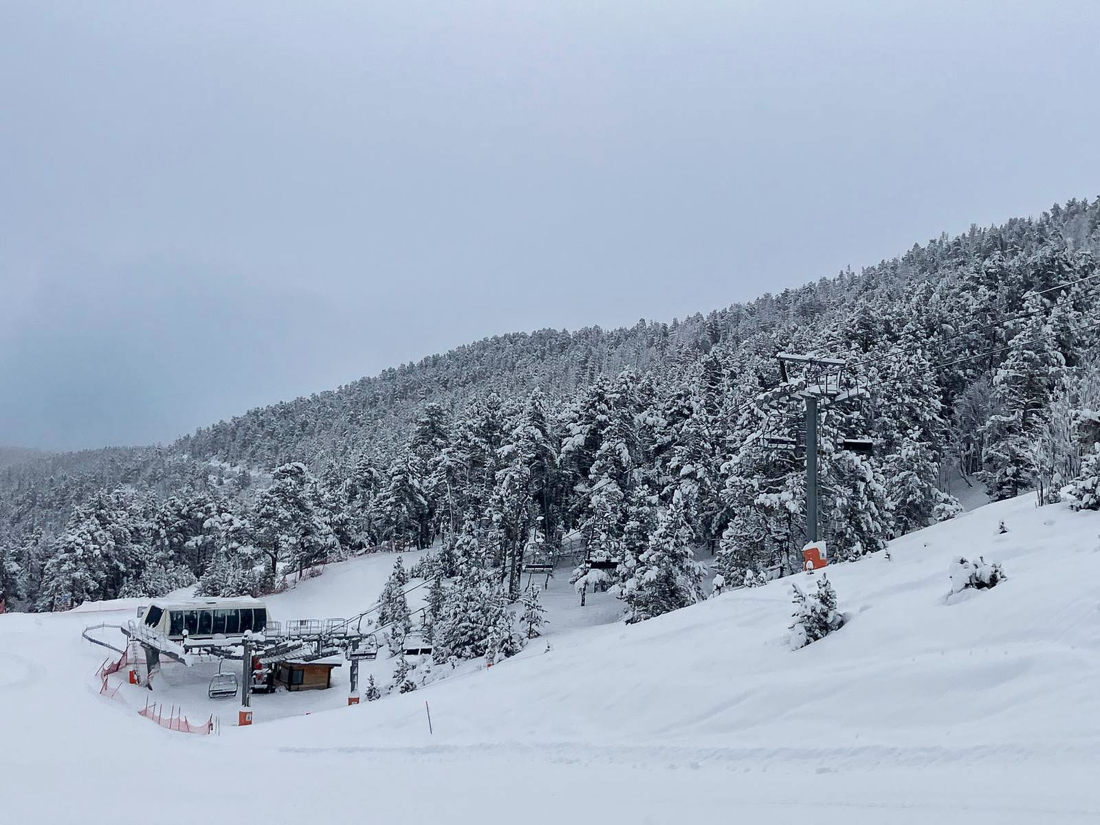
PYRENEES REPORT
The Pyrenees were hit by violent gales at the weekend, which led many ski areas to close completely or most of their terrain. Spain’s Baqueira Beret (95/105cm / 38/42") dropped to only around 10% of its terrain open for a period before bouncing back up to 110km (about 70 miles) of slopes. The Pyrenees have seen some of the most consistently wintry, snowy conditions in Europe through March, and as a result, the avalanche danger remains relatively high (Level 3 'considerable' on the scale to 5). Andorra's Grandvalira (130/200cm / 52/80”) is now posting the deepest snow in the region as well as the most terrain open at 205km (approximately 130 miles), the most of the season to date, following more snowfall in the last week.
PYRENEES FORECAST
Snow showers continue through the remainder of this week, with quite a big temperature range from -10°C overnight on high slopes to +12°C at resort bases in the afternoons. So freeze-thaw conditions prevail, with skies expected to clear and increasingly sunny weather into next week.
SCANDINAVIA REPORT
It’s been a largely dry and sunny week right across Scandinavian ski slopes, with what snowfall there has been—and it hasn’t been much—reported in the far north up towards the Arctic Circle. Temperatures have been mostly good for maintaining snow conditions, in the -15 to +5°C range on the whole. Sweden’s Åre (60/90cm / 24/36”) is posting the most open terrain still, with 98% of its runs currently skiable. Myrkdalen (50/210cm / 20/84”) near Voss on Norway’s coast, famed for its free-riding terrain and deep powder, has the deepest snow in the region.
SCANDINAVIA FORECAST
Quite a big temperature range from -10 to +10°C across the region. Quite a lot of dry, sunny weather but occasional showers, mostly snow but occasionally sleet or rain, heaviest further north.
EASTERN EUROPE REPORT
It feels very much like the end of the season across Eastern European ski regions, and indeed, a growing number have now ended their seasons. The higher, larger big-name resorts plan to keep going for a week or two more, though. Most are reporting their base depths dropping fast and more limited terrain open, although the majority still have 60-80% of their slopes open. There's a big range in temperatures, with high terrain still getting below freezing at night, but down at resort level, it stays above zero 24/7, with afternoon highs up to +15°C, so the spring thaw continues. Bulgaria's Bansko (20/120cm / 8/48”) still reports 80% of its slopes open, but fellow Bulgarian ski area Borovets (20/100cm / 8/40”) has less than half of theirs skiable.
EASTERN EUROPE FORECAST
Showery weather for the rest of the week and through the weekend. Temperatures in the -5 to +10°C range, with the freezing point moving between 1,000 and 2,500m altitudes, so the showers will be snow, sleet, or rain depending on altitude and time of day.
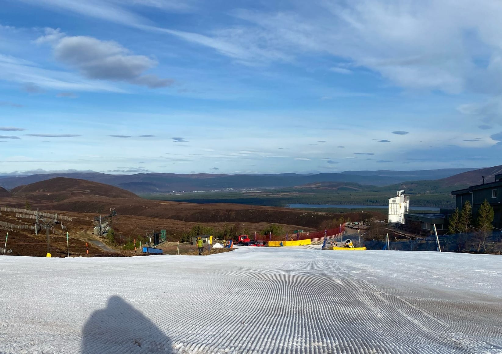
SCOTLAND REPORT
No real respite for Scottish ski areas, with warm, wet, and windy weather at the weekend leading to the closure of the only natural-snow lift-accessed terrain still operating in the country at Cairngorm Mountain. It's been mostly dry with rain showers, and valley temperatures have reached +12°C, so there's no real hope of Glenshee re-opening. At the time of writing, there was only the small nursery slope area maintained by all-weather snowmaking at the base of Cairngorm or the dry ski slope (with a snow sledging area) at Glencoe available in the Highlands.
SCOTLAND FORECAST
Sunshine and showers with temperatures ranging from -5 to +10°C. Hill snow showers at times, but sleet and rain also falling.


