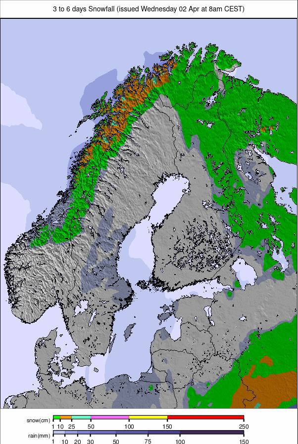
Scandinavia Leads with 50cm Snowfall as Alps Stay Mostly Dry
Updated February 26, 2025: Snowfall returns across Europe with Scandinavia receiving up to 50cm (20”) and the Pyrenees seeing significant fresh snow. Read the full report here.
- Scandinavia sees heaviest snowfall in Europe with 50cm in Norway
- Fresh snow in the Pyrenees brings best conditions in weeks
- French Alps get long-awaited snow boost after warm spell
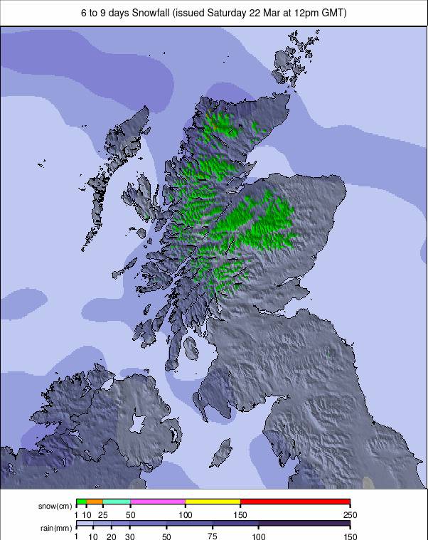
- Scottish ski season struggles as warm weather wipes out snow
- Light snow forecast for Austria after three dry weeks
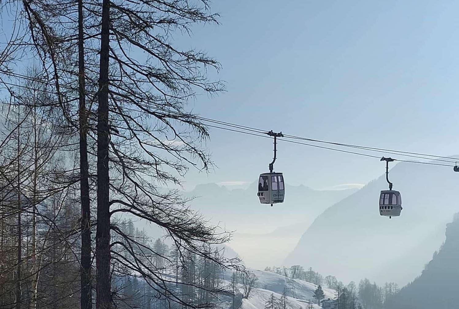
EUROPE OVERVIEW
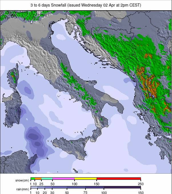
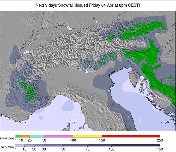
Another fairly dry week across Europe, with temperatures becoming more spring-like a little earlier than they should. There have been some light snowfalls this week, in contrast to the sunny weather in many areas last week, but in most cases, only a centimetre or two has accumulated. The exceptions have come in the north, with centres in Scandinavia reporting cumulative totals of up to 50cm over the last seven days, and the south, with 19-20cm falls in the most southerly Alps and back in the Pyrenees. In terms of groomed terrain, it's looking good in most areas, with European resorts reporting the most terrain open this winter in recent weeks, with the vast majority at 90-100%. There are exceptions, though, with parts of the Pyrenees still not quite having made it to full operation and Scottish ski centres are back to rebuilding their bases, with most slopes closed after another thaw over the weekend.
AUSTRIA REPORT
A fairly dry week in Austria with plenty of sunny weather, but also periods of low clouds and light snowfalls. Temperatures have been a little on the warm side, but then it is spring next week, reaching +10C at bases. So with three weeks now since any significant snowfall, it's very much older snow and green valleys, with the white pistes cutting down across them, maintained to resort bases. Most of the country’s ski areas remain fully open. The Arlberg (45/140cm / 18/56”) is reporting the most at 280km (175 miles) but others include Saalbach Hinterglemm (50/100cm / 20/40”) and Ischgl Samnaun (60/90cm / 24/36”) each have more than 200km (125 miles) of slopes open.
AUSTRIA FORECAST
Similar conditions will be experienced for the next few days, although heavier snowfall is forecast for Wednesday/Thursday. This looks more like 5-15cm (2-6”) rather than anything major at this stage, however.
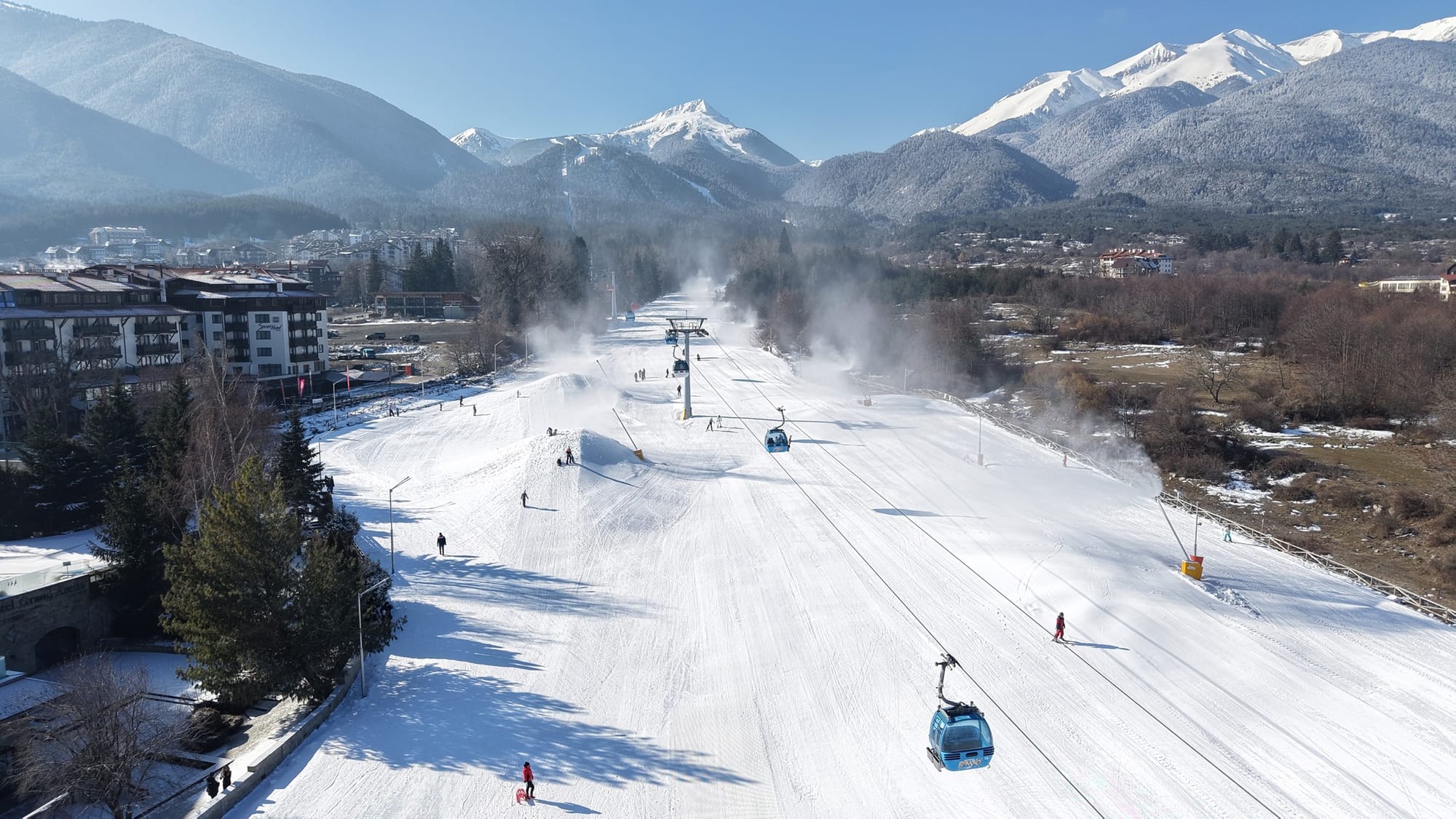
FRANCE REPORT
It’s been an increasingly wintry start to the week in the French Alps after some warm temperatures last week. The snowfall began on Sunday in the south with Isola 2000 (70/100cm / 28/40”) down near the Med the first in the region to report a 6cm (4”) accumulation, then by Monday ski areas further north were posting 5-10cm (2-4”) accumulations and similar totals over the next few days brought 72 hour accumulations as high as 30cm/12” on higher elevations, the most for several weeks. Flaine (10/310cm / 4/124”) and Chamonix (20/300cm / 8/120”) continue to post the deepest snow in the country and in Europe, with most French ski regions remaining fully open.
FRANCE FORECAST
Back to sunshine for most areas for the latter half of this week but with slightly cooler temperatures than last week, highs around -6C at low elevation after lunch, lows down to -15C at 3,000m overnight.
ITALY REPORT
It’s been a fairly quiet week on Italian slopes, particularly in the east and north. Some very light snowfall, just a few centimetres (an inch) at a time, has made it into the south and west of the country. Bardonecchia (40/120cm / 16/48") up near the French border was one area reporting light snowfalls. But for most, there's been a mix of sunshine, hill fog, heavy clouds and sometimes clear skies. Temperatures have also been climbing a little too high for what's still wintertime, at least in lower valleys, where the numbers have got as high as +12C. But as previously, careful slope management and snowmaking as required during overnight lows mean most Italian ski regions remain fully open as we start March.
ITALY FORECAST
It’s currently expected to be much sunnier for the final few days of February with temperatures down a little, although potentially still getting up towards +10C at 1,000m altitudes.
SWITZERLAND REPORT
Swiss ski areas have enjoyed similar conditions to resorts elsewhere in the Alps with lows down towards -10C still on higher slopes, but daytime highs creeping up to high single figures in valleys in the afternoons. There's also been a similar mix of light snow showers, hill fog and general murk, interspersed with overcast skies and sunny spells. The fog caused very low visibility at times, with Verbier being one of the areas impacted. Here too though most ski areas are close to full operations. Glacier 3000 (40/250cm / 16/100") and Saas-Fee (70/240cm / 28/96") are posting two of the three deepest bases in the country right now.
SWITZERLAND FORECAST
It currently looks like the latter half of this week will bring more consistently clear and sunny weather across the Swiss Alps, with temperatures in the -10 to +6 C range.
PYRENEES REPORT
The Pyrenees saw some of Europe’s best snowfalls at the weekend as a weak front moved into the south of the continent. Ski areas on the French side of the mountains did best, posting up to 15cm (6”) accumulations in 24 hours, in Andorra and Spain they saw rather less. Nonetheless, slopes across the region got a nice refresh after the warm, dry weather the previous week. Andorra’s huge Grandvalira (70/125cm / 28/50”) has the most terrain open at 85% overall (about 190km/125 miles of slopes), with some of its sectors including Ordino/Arcalis and Pal/Arinsal reported to be 100% open. The deepest snow depths are reported on the French side of the border though, up to 1.8m (6 feet).
PYRENEES FORECAST
It's currently expected to be drier over the latter half of this week, although still with plenty of cloud and the occasional light snowfall. Temperatures vary between around -7 and +7C so some base level thawing but equally temperatures low enough for snowmaking as required.
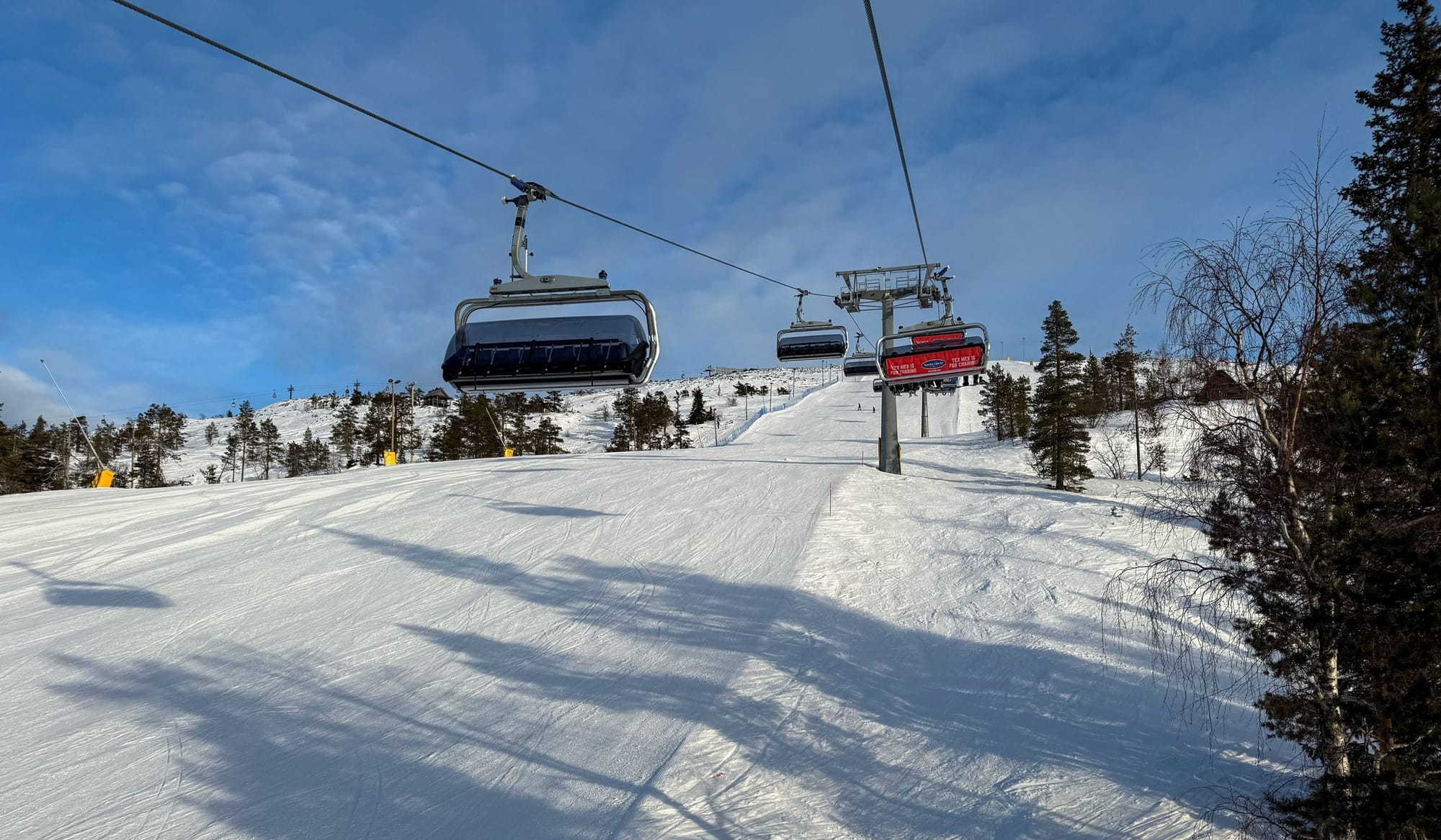
SCANDINAVIA REPORT
It's been a better week in most respects across Scandinavian ski slopes, with plenty of fresh snowfall, heaviest in the west, with some centres in Coastal Norway reporting over half a metre (20") accumulating since the start of the weekend. Temperatures have also been climbing, the downside of that being reports of some rain rather than snowfall, at times, on lower slopes. Strong winds have also been an issue. Norway's Geilo (30/70cm / 12/28") posted one of the better snowfalls, with 18cm (7”) in 24 hours to start the week. There was also fresh snowfall at Sweden’s northerly Riksgränsen (80/142cm / 32/57”) which opened for its 2025 season at the weekend.
SCANDINAVIA FORECAST
It’s looking like a colder, drier latter half of the week in most areas with temperatures dipping back below freezing for the final days of the month and sunshine more widespread.
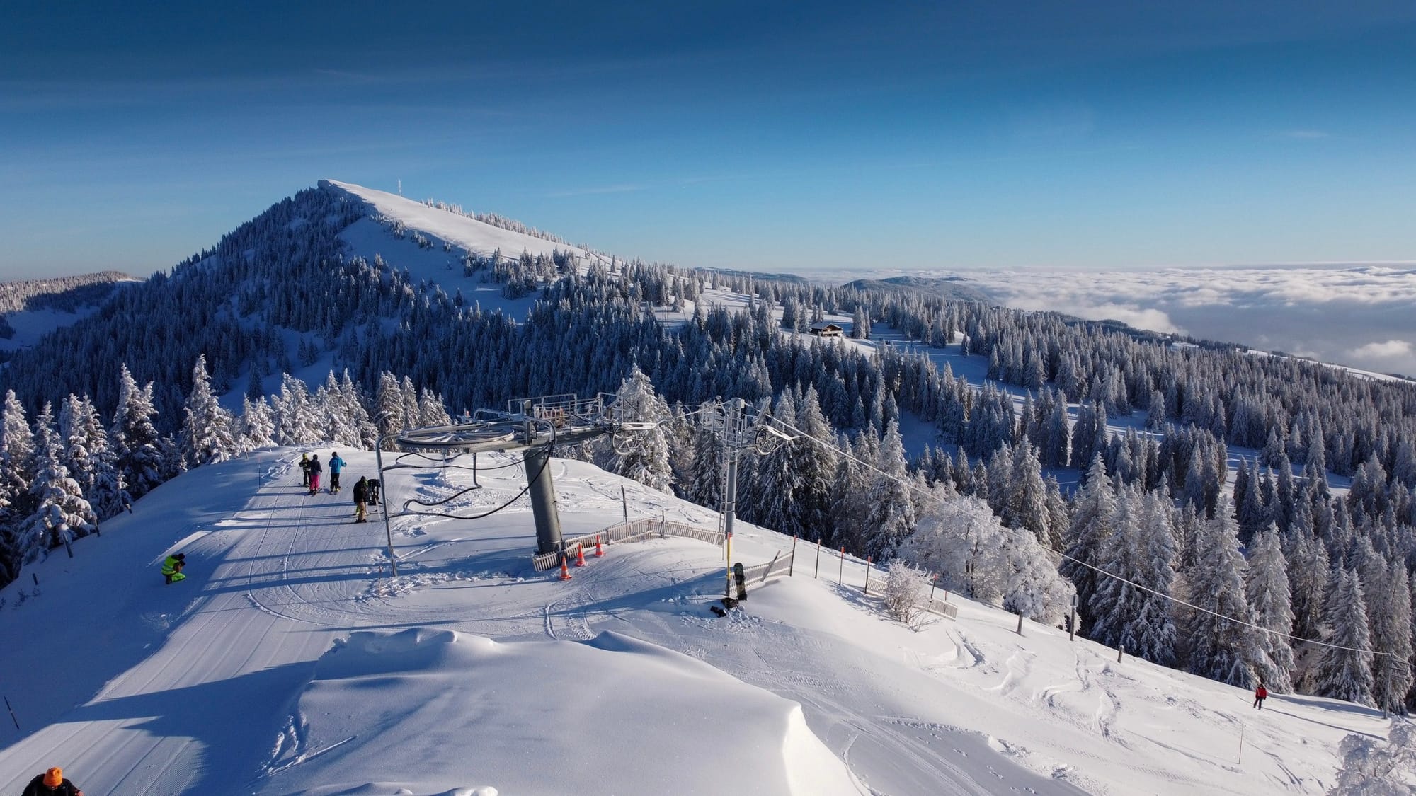
EASTERN EUROPE REPORT
The weather has continued to be colder down in The Balkans than up in the Alps over the past week, although there have been some similar light-moderate snowfalls in Bulgaria. Further north ski areas like Czechia’s Špindlerův Mlýn (65/130cm / 26/53”) and Slovakia’s Jasna (30/60cm / 12/24”) have posted more of a mix of snowy and sunny days, temperatures getting a little warmer, up towards +10C in afternoons at resort levels. But both remain 80-100% open.
EASTERN EUROPE FORECAST
There are signs of a significant snowfall on its way to the Balkans this weekend, with 20-40cm accumulations in the forecast at present, it’s just a little way out for certainty. It’s looking snowier too in the north of the region over the latter half of the week and through the weekend but accumulations are more likely to be in the 5-10cm (2-4 inches) daily bracket.
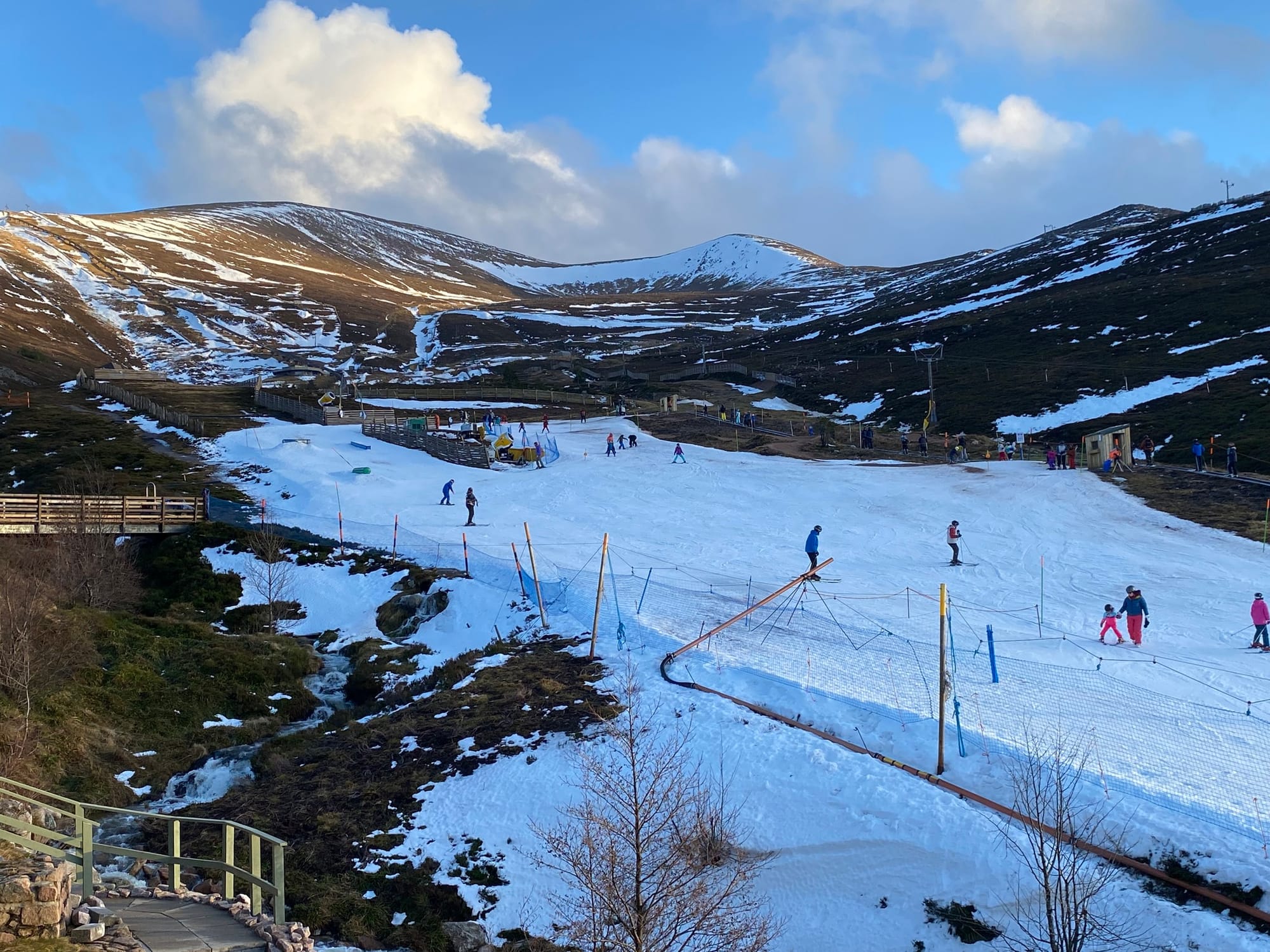
SCOTLAND REPORT
Scottish ski centres have had a challenging week unfortunately with the forecast 10-15 degree jump in temperatures at the end of last week, accompanied by heavy rain and gale force winds, wiping out much of the thin natural snow cover and preventing weekend operations at most areas, even of their small deeper-snow areas created with their all-weather snowmaking systems. Temperatures have started to cool again, and the snow machines are running, so small areas of snow—mostly for beginners and sledgers—are open at Glencoe, The Lecht, and Cairngorm, with a little more at Glenshee. We’ll need more cold, snowy weather – which has begun to return - before there’s any hope of more extensive natural terrain reopening. Nevis Range, which does not have a working all-weather snowmaking machine, is still yet to open this season.
SCOTLAND FORECAST
A little colder with the chance of some hill snow, particularly on the highest slopes, but it looks like we need lower temperatures to return before there’s any real hope of bases rebuilding to adequate levels for snowsports to resume outside the machine-made areas.