Fresh Snow Hits Alps as Springlike Conditions Persist, Pyrenees See Best Coverage
Updated February 19, 2025: Fresh snow refreshed the Alps, but warm valley temps bring a spring feel. Pyrenees boast peak conditions, and Bulgaria finally sees snowfall. Read the full report here.
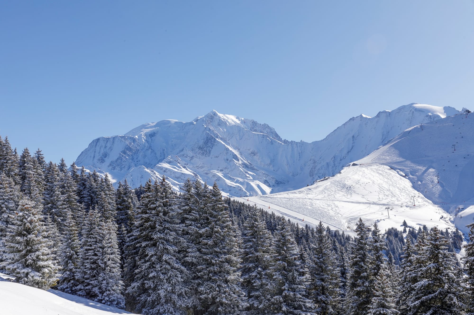
50cm Dump in Chamonix Sparks Avalanche Warnings After Turbulent Weekend
- Fresh Snow Boosts Alps, But Spring Temps Bring Mixed Conditions
- Pyrenees Enjoy Best Coverage of Season After Heavy Snowfall
- Austria’s Slopes Stay Open, But Snowline Creeps Higher
- Switzerland’s Springlike Sun Persists, With Midweek Snow Possible
EUROPE OVERVIEW
The period of cold, dry weather that dominated conditions in the Alps through much of the first half of February began to break down in the middle of last week. From Thursday to Saturday, many areas saw some snowfall, with some parts of the French Alps receiving up to half a metre over four days. That gave slopes a nice refresh while also increasing avalanche danger slightly since the weekend, though conditions have been predominantly sunny and borderline springlike in much of the Alps. The Pyrenees, which had experienced a snowy first half of the month, have also seen sunnier weather again, with rather warm temperatures reaching high elevations. Eastern Europe has been more changeable, with Bulgaria seeing a return of snowfall after a month of mostly dry weather. Scandinavia and Scotland have also experienced mixed conditions, but the overall picture remains positive, with most areas fully open and offering peak-season conditions as the start of the spring thaw draws ever closer.
AUSTRIA REPORT
The sunny spell that dominated the first 10 days of February came to an end last week, as fronts brought snow showers—unfortunately falling as rain and sleet at times on lower slopes—for a few days before widespread sunshine returned at the weekend and has remained since. Austrian ski areas are fully open, with most reporting 95% or more of their slopes available. Temperatures have been warming in valleys, melting the natural snow cover. As a result, there is a springtime-style scenario of white pistes built up with machine-made snow snaking down snowless hillsides at lower elevations, with the snowline moving up the mountainside. The Arlberg Region (45/140cm / 18/56") is posting the most terrain open in the country above Lech and Zürs, with 285km (178 miles) of runs. Saalbach Hinterglemm (50/100cm / 20/40”), still celebrating after successfully hosting the 2025 FIS Alpine Skiing World Championships, is in second place with 240km (150 miles) of slopes.
AUSTRIA FORECAST
The sunny weather looks set to continue at least into the weekend, with the freezing point moving between 500 and 2,500m.
FRANCE REPORT
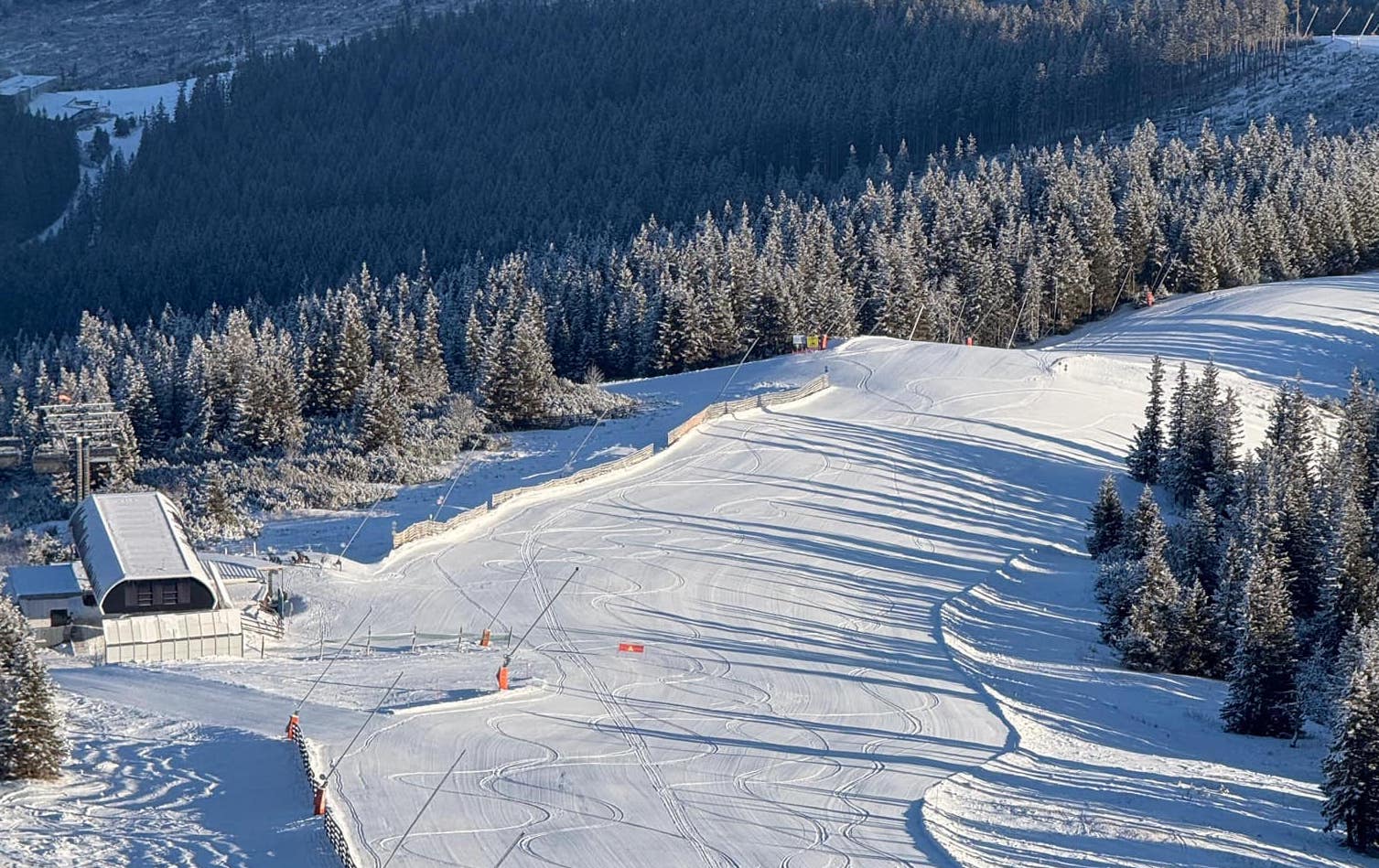
We've returned to predominantly dry and sunny weather in France, though more snowfall occurred at the end of last week. Chamonix (10/195cm / 4/79”) posted one of the biggest accumulations in the Alps going into last weekend, with a 50cm (20”) total over the last three days of last week. Unfortunately, as that snowfall arrived with periods of strong winds, avalanche danger levels increased considerably, resulting in three fatalities from two separate incidents on Saturday. Since then, it has been largely dry with plenty of sunshine. Valley temperatures have been warming in the afternoons, though overnight lows remain below -10°C at high altitudes. In terms of open terrain, reports remain good, with most resorts fully open for the busy half-term holiday period. The Grand Massif around Flaine (0/330cm / 0/132”) is posting the country's and Europe's deepest snow.
FRANCE FORECAST
Dry and mostly sunny conditions will continue, with temperatures reaching +10°C at 1,000m altitude and getting above freezing up to 2,500m. Lows of -6°C are expected at 3,500m.
ITALY REPORT
We've been experiencing predominantly sunny weather in Italy this week, with warm valley temperatures reaching as high as +8/+9°C in the afternoons, giving something of a springlike feel. However, overnight lows have still dipped into negative figures, allowing snowmaking systems to top up losses and keep terrain open. Most Italian ski areas continue to operate with all groomed runs open; however, finding powder off-piste is becoming more difficult. The Milky Way/Via Lattea (70/170cm / 28/68cm) is posting the most terrain open in the country, with 330km (207 miles) of slopes available.
ITALY FORECAST
No significant changes are expected, with sunny weather continuing at least into the weekend. Temperatures will remain in the -8 to +8°C range, with the freezing point fluctuating between 500m and 2,500m.
SWITZERLAND REPORT
Sunshine has dominated in Switzerland since the end of last week, which saw some small snowfalls before the weekend. The clear skies allowed afternoon temperatures to top +10°C at times below 1,000m in the lower valleys, creating an early springlike feel. The 4 Valleys around Verbier (35/150cm / 14/60”) and Zermatt/Cervinia (20/150cm / 8/60”) are posting the most terrain open in the country, with 90-100% of slopes available and 320km (200+ miles) each. Base depths are averaging 70% of the usual level for this point in the season, with Melchsee-Frutt (170/270cm / 64/108”) reporting the deepest snow in the country.
SWITZERLAND FORECAST
Light midweek snowfall is possible over the next few days, but for most, the forecast is ongoing sunshine through to the start of next week. It will remain rather warm, with afternoon highs reaching double figures above freezing in valleys.
PYRENEES REPORT
After a fortnight of snowy weather that ended a long dry spell in the Pyrenees, conditions have returned to predominantly sunny weather since the weekend. Unfortunately, rather warm valley temperatures reaching +10°C in the afternoons have slightly undone some of the recent snowfall's benefits. However, the region's ski areas still have the most terrain open that they've had available all winter, thanks to the new snow, which added half a metre (20") to some bases. Andorra's Grandvalira (75/125cm / 30/50”), the region's largest ski area, has reached 90% terrain availability, offering nearly 200km (125 miles) of slopes.
PYRENEES FORECAST
Warm and sunny conditions will continue for a few more days, but a weather front is expected by the end of the week, bringing a rapid temperature drop back below freezing at lower elevations and 10-20cm (4-8 inches) of fresh snowfall.
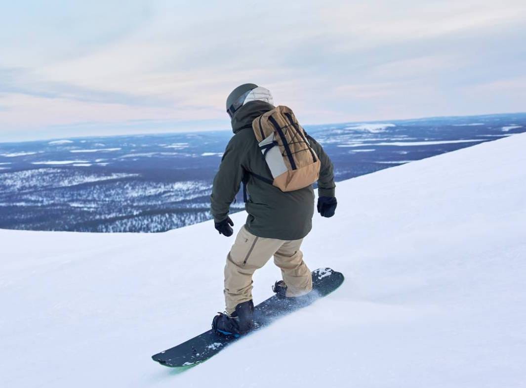
SCANDINAVIA REPORT
Lots of dry and sunny weather for Scandinavia over the past week. It’s remained below freezing most of the time, but temperatures have been creeping up, with highs around the freezing mark and lows typically in the mid-minus teens rather than the -20s or -30s we saw in recent weeks. The amount of terrain open keeps creeping up, partly as daylight increases. Western Norway’s Myrkdalen (90/190cm / 36/76") continues to post the deepest base in the region, which hasn't changed since seven days ago. Sweden's Åre has the most terrain available—75km (47 miles) of slopes—again unchanged from a week ago. That increased daylight also means that Riksgränsen, up in the Arctic Circle, will start its 2025 season this coming weekend. They’ll be skiing under the midnight sun there in just over two months.
SCANDINAVIA FORECAST
Becoming more unsettled, with light snow showers (typically 2-5cm/1-2” per 24 hours) moving in, and sunny spells between the showers.
EASTERN EUROPE REPORT
After more than a month of dry, sunny, but mostly cold weather in Bulgaria, snowfall has finally returned to the region, bringing 5-10cm (2-4") accumulations on each of several days through the weekend and the start of this week, giving a much-needed slope refresh. That said, base depths were already healthy and held up well through the dry spell, so pretty much everything was open—it’s just nice to get fresh natural snow on top. Further north, in Czechia, Slovakia, Poland, and the wider region, it's gone the other way with drier weather this week, although some light rain, sleet, and snow showers have been reported. Most areas are close to full operations too, with Jasná (30/60cm / 12/24") posting the most, and 90% of its slopes open.
EASTERN EUROPE FORECAST
Mostly sunny across Eastern Europe for the coming week, but temperatures are typically cooler than further west, with lows getting down to -15°C and highs only reaching +5°C in the afternoons.
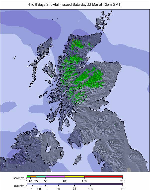
SCOTLAND REPORT
A mixed week of weather in the Scottish Highlands as the long period of cold but dry weather has begun to break down, with rain, sleet, and snow showers rolling in as temperatures rise. So far, there's little change from a week ago, with Glencoe having the most terrain open, including some natural snow runs, while The Lecht, Glenshee, and Cairngorm are operating predominantly with snow made by their all-weather snowmaking machines. That means limited terrain, and in Cairngorm's case in particular, lift passes often sell out due to the limited snow space during the half-term holidays. At this point, it's difficult to know if the recent snowfall will allow more to open or if the warmer end to the week will actually set things back from where they are now.
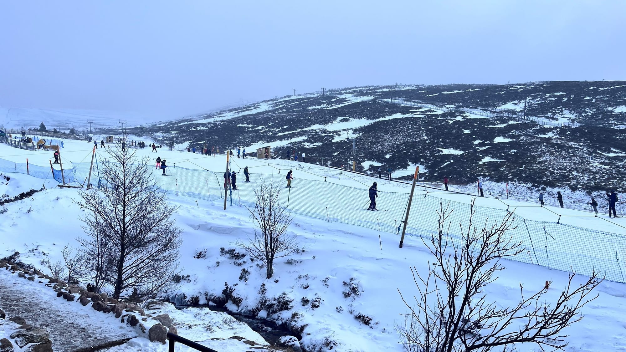
SCOTLAND FORECAST
It's not really looking good, unfortunately. There should be more hill snow, but valley temperatures reaching +12°C over the weekend mean rain at most levels until temperatures dip again.