Europe Weekly Roundup #279
Updated February 5, 2025: Bluebird skies follow last week’s record snowfall, with Europe’s top resorts fully open. The Pyrenees see their best conditions yet, and fresh snow returns this weekend.
Europe Basks in Sunshine, While the Pyrenees Hit Peak Snowfall
- Pyrenees See Best Snow of the Season After Surprising Snowfall Boost
- Switzerland's Ski Resorts Hit Peak Form with 90cm Snowfall and Sunshine
- Austria Opens 240km of Ski Runs, Leading the World in Terrain Access
- Chamonix Hits 13 Feet of Snow, One of Europe's Deepest Snowpacks
- France Forecasts Clear Days, But Chilly Temps Persist for Perfect Skiing
EUROPE OVERVIEW
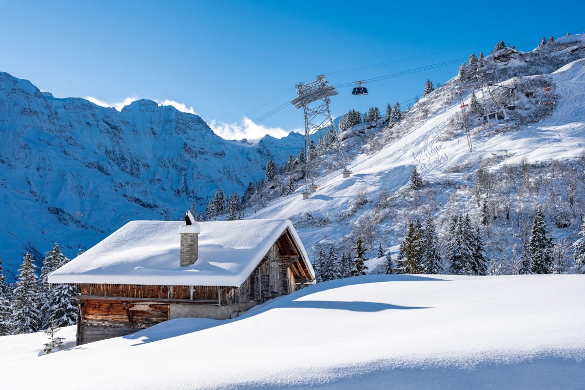
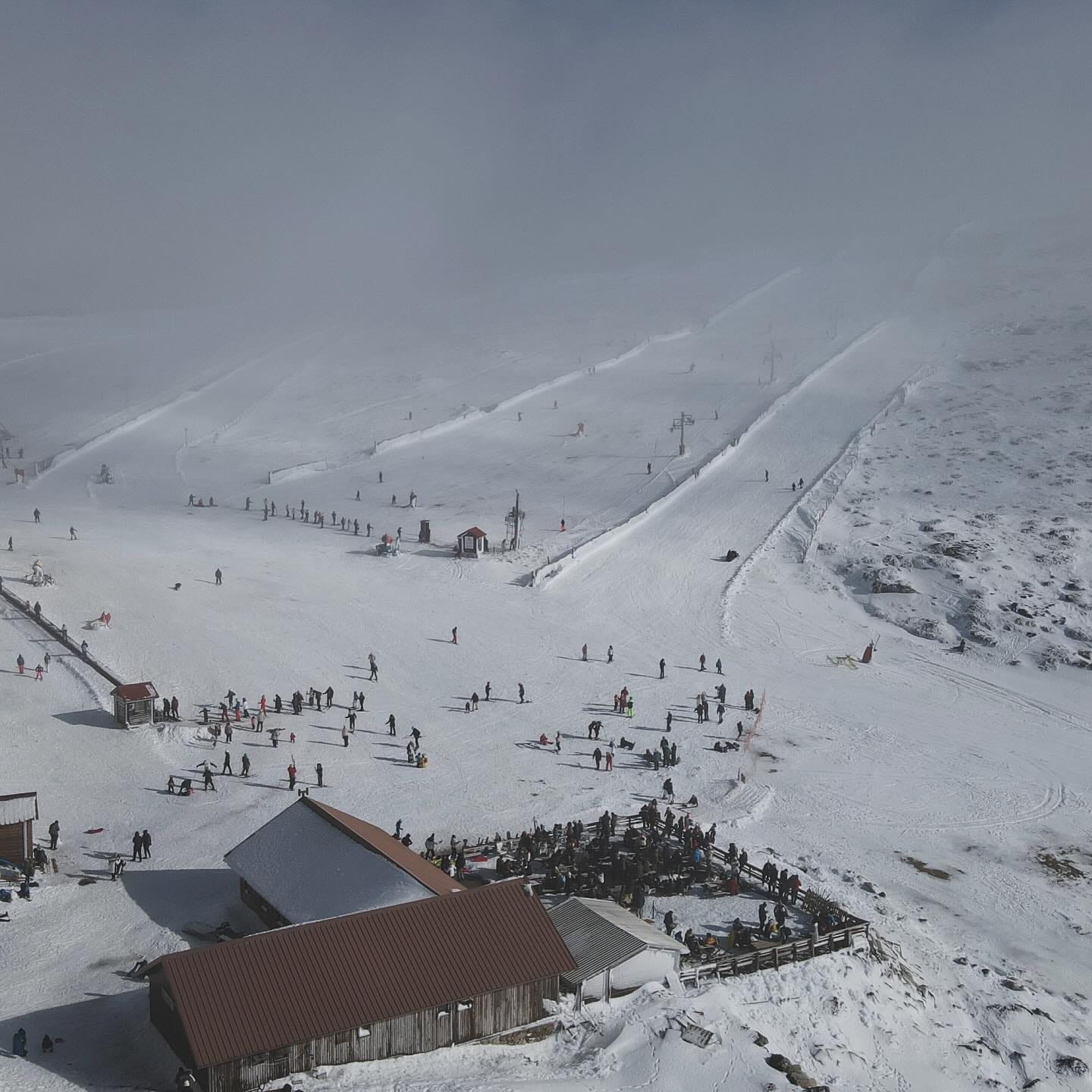
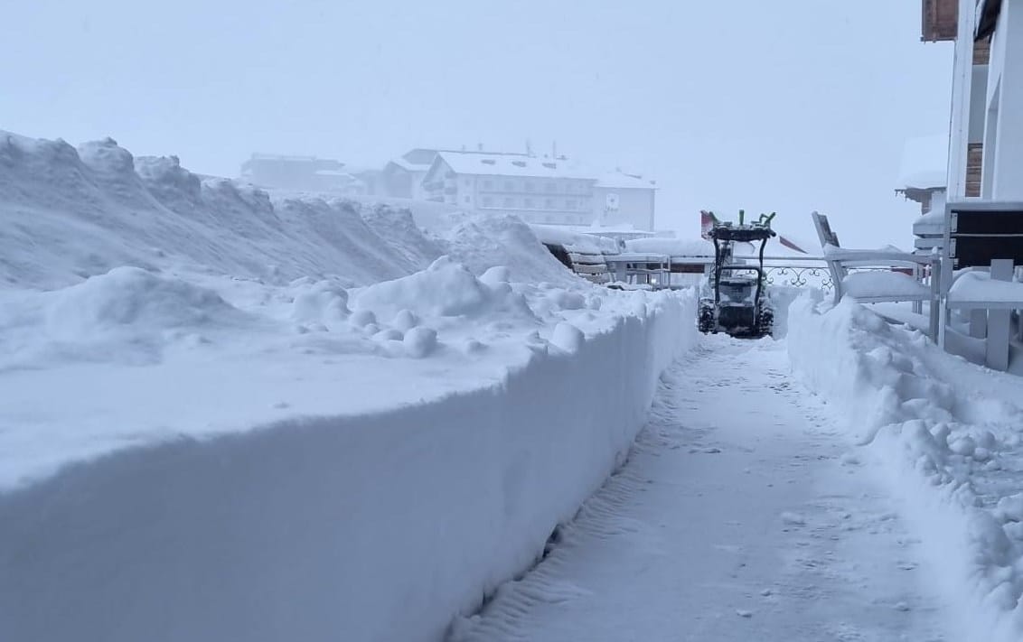
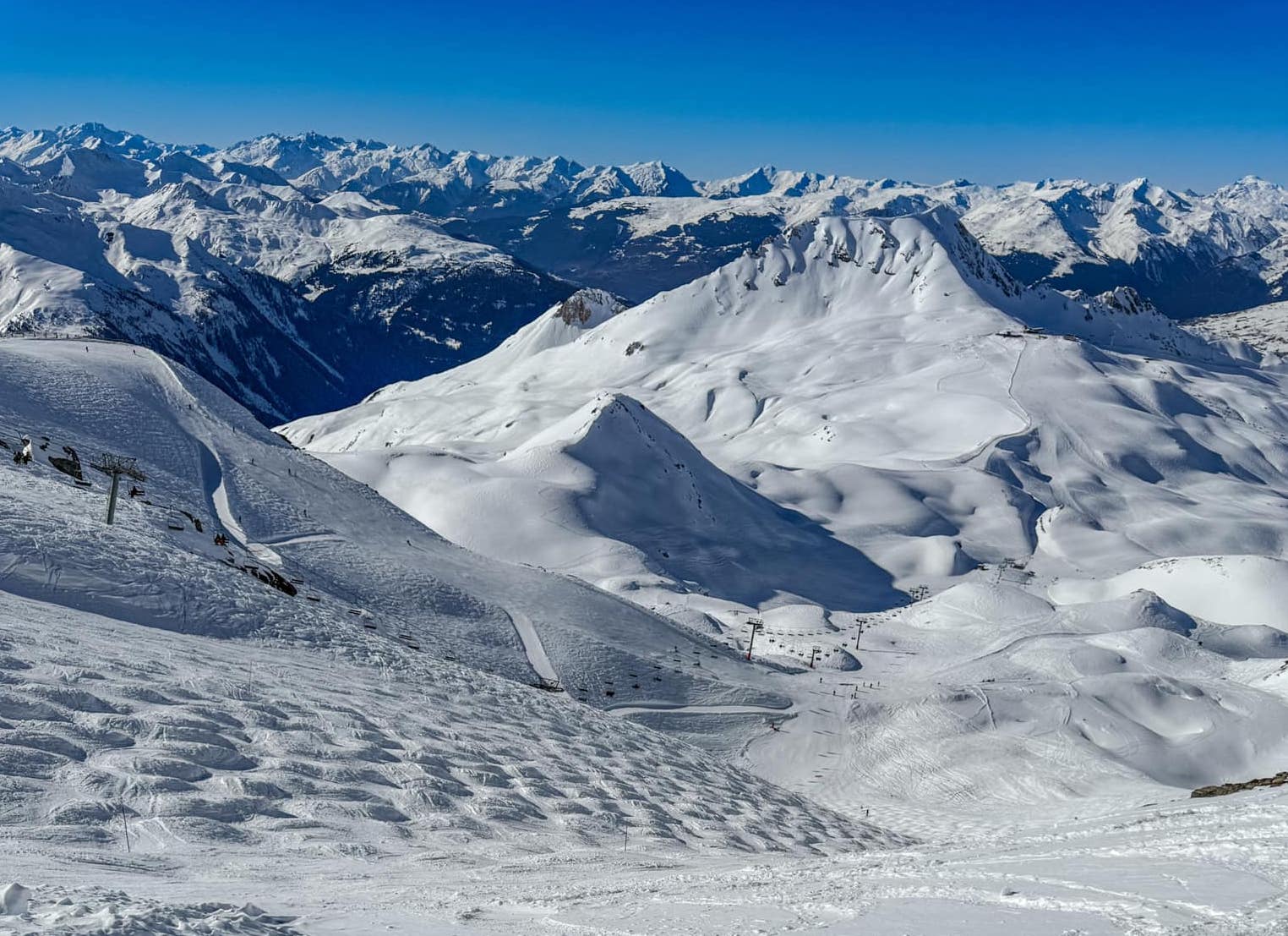
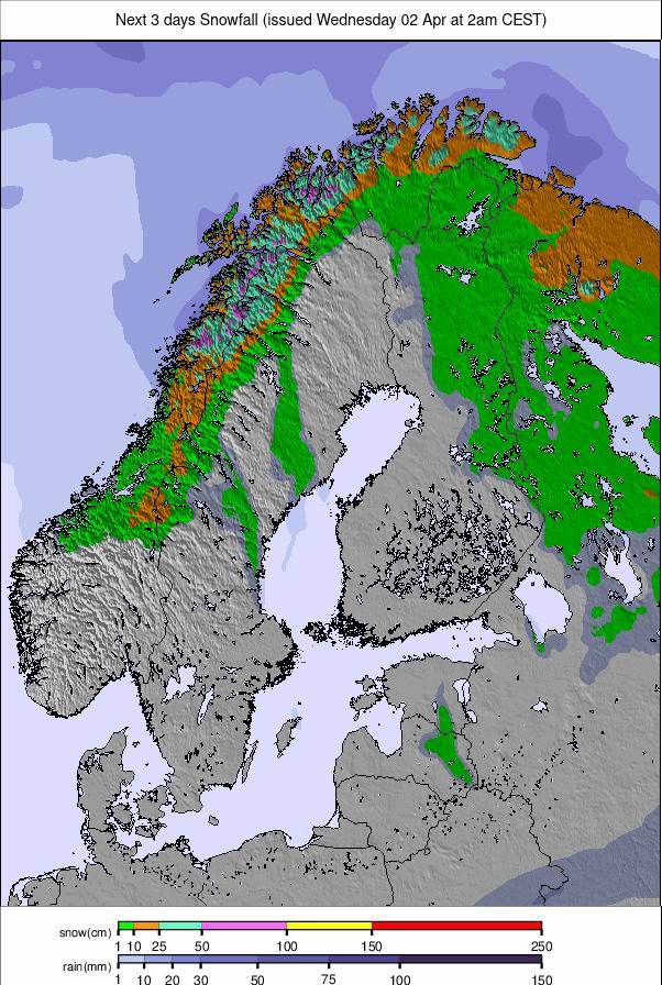
Much of Europe has had a much calmer week of weather after last week’s snowiest seven days of the season for many resorts, especially in the western Alps. There has been plenty of sunshine and some beautiful days for those lucky enough to be out on the slopes to enjoy the fresh snow. The considerable-high avalanche danger has also dropped a little, with the only fly in the ointment being some rather warm temperatures at times on valley-level terrain, melting away some of the freshly fallen snow. That's also caused fog at times in some areas. The main exception to the sunny weather has been the Pyrenees, where the forecast snowfall that didn't really arrive last week showed up this week instead, giving the best conditions of the season to date there and allowing centres to edge closer to fully opening—something few have managed so far this season. Up in the north, things have unfortunately warmed up in Scotland, thawing much of the thin cover that had allowed the most terrain to open yet this season over the weekend. It is now cooling again. Scandinavia saw less snowfall than the previous week, but here too, more terrain has been opening, partly as daylight hours are rapidly increasing. Björkliden, up in the Swedish Arctic Circle, begins its 2025 season this coming weekend, with its neighbour Riksgränsen set to join it later this month.
AUSTRIA REPORT
It’s been a predominantly sunny week in Austria following the big snowfalls that ended last Friday in most parts of the country. By then, centres had posted up to 60cm (2 feet) of accumulation in the latter half of last week. Conditions are reported to be the best they’ve been all season, with almost all slopes open and all lifts operating. Sölden (45/220cm / 18/88”) has the deepest reported snowpack in the country on its 3,000m slopes. Four centres are each posting more than 200km (125 miles) of runs open—the most in the world—led by Saalbach Hinterglemm Leogang Fieberbrunn (50/110cm / 20/40”) with 240km (150 miles) of runs available, while also now hosting the biannual FIS Alpine Skiing World Cup.
AUSTRIA FORECAST
After the sunny week, it will get cloudier towards the weekend, with some centres set to receive a few centimetres (an inch or so) of snowfall, but there's nothing much in the immediate forecast. Temperatures should remain in the -5 to +5°C range on the whole.
FRANCE REPORT
After the huge snowfalls last week, which saw up to 1.2m (4 feet) of snowfall in 72 hours on French ski slopes, it has been a much quieter week, with predominantly dry conditions and a decreasing avalanche risk. Temperatures have been getting a little warm again down in valleys, reaching high single figures around 1,000m altitudes, with the freezing point at 2,000m by the afternoons. Conditions continue to be excellent, with the fresh snow and most centres being fully open. Avoriaz (165/350cm / 66/140”), Les Arcs (70/300cm / 28/120”), and Chamonix (20/390cm / 8/116”) are the only three centres in Europe reporting more than 3m (10 feet) of snow lying on their higher slopes. Chamonix reports 300cm (10 feet) lying at Grands Montets, and 390cm (13 feet) up at the Aiguille du Midi at the top of the Vallée Blanche.
FRANCE FORECAST
The weather will continue to be mostly dry, with plenty of sunshine into next week. Temperatures will range from -8 to +8°C, depending on altitude and time of day. Some clouds will bubble up from time to time, but nothing significant is expected.
ITALY REPORT
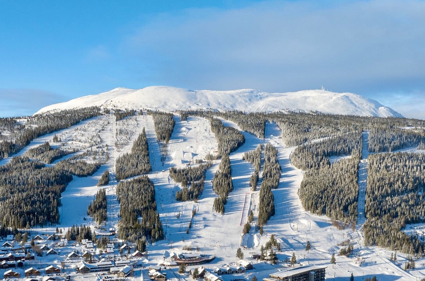
Italian ski areas are still celebrating after what was by far the snowiest week of the season to date in the final days of January. As elsewhere in western Europe, it has gone back to mostly dry, generally sunny conditions since, but bases remain greatly bolstered, and terrain open has increased thanks to all the snowfall. La Thuile (185/270cm / 74/108”), over on the French border, which reported an 80cm (32”) accumulation during the January snowstorms, has the deepest snowpack in the country. Cervinia (40/150cm / 16/60”) has the most terrain available thanks to its Zermatt connection, about 280km (175 miles) of high-altitude slopes. The Portes du Soleil region (130/160cm / 52/64”), incorporating Morgins and Champéry on the Swiss side, has the greatest area available to ski from Switzerland at present—about 560km (350 miles) of pistes.
ITALY FORECAST
Mostly dry for the remainder of this week, with plenty of sunshine initially, but clouds will start to build towards the weekend. Currently, it looks like the Dolomites could see 5-10cm (2-4") of snowfall at the weekend, while western parts of the country will remain mostly dry.
SWITZERLAND REPORT
Sunshine returned to Swiss ski slopes around Friday/Saturday last week after the country's ski areas had reported up to 90cm (three feet) of snowfall in the preceding few days. Here too, the accumulations were the biggest they'd received all winter, giving powder conditions as well as considerable to high avalanche danger. About 85% of Swiss slopes are open, with the percentages generally higher at the bigger destination resorts. The freezing point has been around 2,000m, with temperatures ranging from +8°C in low valleys in the afternoon to -10°C up high overnight.
SWITZERLAND FORECAST
A few more days of full sunshine are expected before clouds move in towards the end of the week. The western side of the country should stay dry but overcast, with temperatures in the +7 to -7°C range. However, in central and eastern Switzerland, those clouds could bring 5-10cm (2-4”) of fresh snowfall by the start of next week.
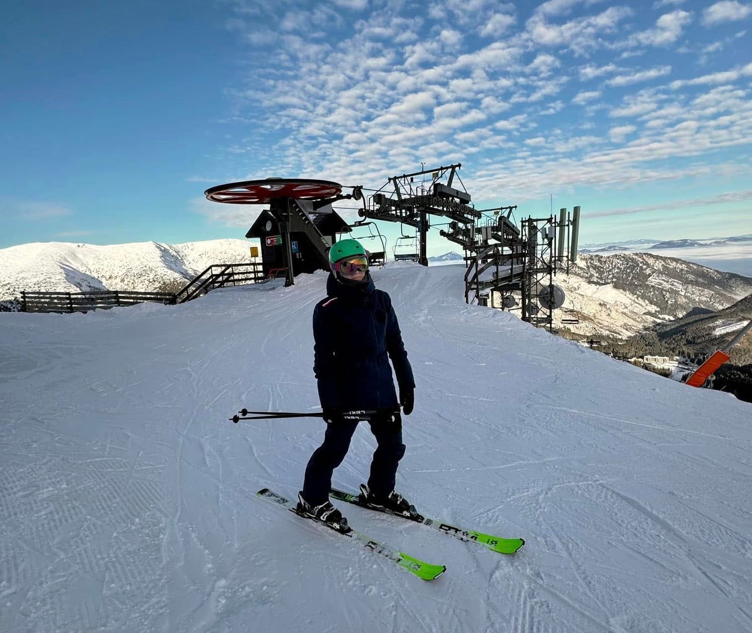
PYRENEES REPORT
Some light snowfall last weekend followed slightly more substantial accumulations at the end of last week, but overall, it was more of the same in the Pyrenees, where most areas have still not yet been able to open more than 65-75% of their slopes this season due to a lack of natural snowfall. That said, snow did keep falling this week—more so than forecast—and many areas in the region have reported their bases up by 10-30cm (4-12") compared to a week ago, with the most terrain open they've had all season.
PYRENEES FORECAST
Back to sunshine for the next few days, with temperatures in the -8 to -4°C range. A fresh front should bring 10-20cm (4-8”) of snowfall going into the weekend, potentially one of the biggest accumulations in Europe for the latter half of this week.
SCANDINAVIA REPORT
After last week's snowfalls, it has been much drier with plenty of sunshine across Scandinavia. For most areas temperatures have remained below freezing around the clock, getting down as low as -20C though more commonly -2 to -10C. There have been some snowfalls, including for the region’s largest single area, Sweden’s Åre (45/85cm / 18/34”), but for most it has just been a few centimetres. There have been heavier snowfalls further north up in Narvik and on the west coast of Norway. Bases have started building again though with Norway’s famous powder haven of Myrkdalen (90/180cm / 36/72”), up 30cm/a foot, in the last week.
SCANDINAVIA FORECAST
Predominantly cold and fairly dry with temperatures generally in the freezing to -20C range. Lots of sunshine but fronts carrying snow-bearing clouds also moving through at times. Accumulations are expected to be light, with 5-10cm (2-4") most likely.
EASTERN EUROPE REPORT
It's been a largely sunny week in Czechia, Poland, Slovakia and other countries in Eastern Europe with temperatures mostly in the -5 to +5C range. Hill fog and strong winds have been an issue at times, but most destination resorts in the region remain 50-75% open. The sunny weather has continued in the Balkans with warm temperatures last week leading to a slight drop in reported base depths, although most centres in Bulgaria remain fully open.
EASTERN EUROPE FORECAST
Remain mostly sunny in the Giant and Tatra mountains of Czechia and Slovakia but a weak front midweek may bring a few centimetres (an inch) or so of snowfall to slopes before full sun returns later this week. There's no change in the sunshine forecast for the Balkans, but temperatures should stay colder than they were in recent weeks, rarely getting above freezing.


