Winter Park snow
Ski USA - Colorado

Winter Park Snow Forecast

Weather Forecast for Winter Park at 3674 m
Issued: 5 pm  25 Apr 2025 (local time)

New snow in Winter Park

0.5cm0.2in
Fri 25th (PM)
The snow forecast for Winter Park is: A dusting of snow on Fri afternoon. Freezing level rising with drizzle on Sat afternoon. Freeze-thaw conditions (max 5°C on Sat afternoon, min -9°C on Sun night). Winds increasing (light winds from the SW on Sat afternoon, strong winds from the W by Mon morning).

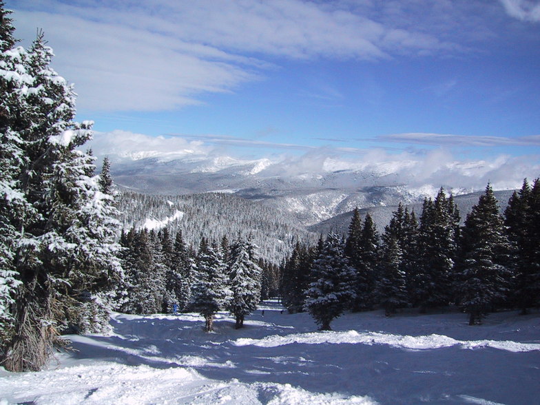
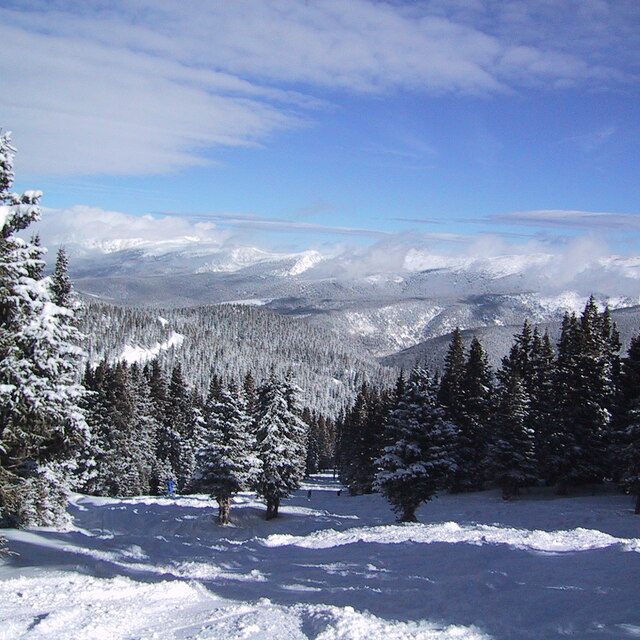
Winter Park Weather (Next 3 days): The snow forecast for Winter Park is: A dusting of snow on Fri afternoon. Freezing level rising with drizzle on Sat afternoon. Freeze-thaw conditions (max 5°C on Sat afternoon, min -9°C on Sun night). Winds increasing (light winds from the SW on Sat afternoon, strong winds from the W by Mon morning).

Winter Park Weather (Days 4-6): A moderate fall of snow, heaviest on Tue night. Freeze-thaw conditions (max 1°C on Wed afternoon, min -8°C on Mon night). Winds decreasing (strong winds from the W on Mon afternoon, calm by Tue morning).


Winter Park Live Weather

ResortSnow DepthTemp. (°C)Wind (km/h)Weather
Top Lift: 1.9m
0
10
light snow
Middle Lift: 
3
5
light rain
Bottom Lift: 1.6m
6
5
light rain
Powered by Snow-Forecast.comSnow-Forecast.com
6 Day Forecast
Issued: 5 pm 25 Apr 2025 / Updates in ::
Change Forecast Height
Choose Forecast
Last 6 daysScroll left for last 6 daysNow
Fri
25
Saturday
26
Sunday
27
Monday
28
Tuesday
29
Wednesday
30
Thursday
1
PM
night
AM
PM
night
AM
PM
night
AM
PM
night
AM
PM
night
AM
PM
night
AM
PM
night
light snow
snow showers
part cloud
light rain
snow showers
clear
cloud
clear
light snow
snow showers
part cloud
snow showers
light snow
snow showers
snow showers
light snow
light snow
light snow
snow showers
snow showers
light snow
snow shwrs
some clouds
light rain
snow shwrs
clear
cloudy
clear
light snow
snow shwrs
some clouds
snow shwrs
light snow
snow shwrs
snow shwrs
light snow
light snow
light snow
snow shwrs
snow shwrs
 km/h
15
SW
10
SSW
15
SW
20
WSW
15
SW
15
SSW
35
SW
25
SW
30
W
40
W
5
SE
0
SW
5
NW
5
WSW
5
WNW
15
NW
10
WNW
15
NW
20
WNW
5
W
Snow map
 cm 
1.0
1.0
1.0
3
1.0
3
2.0
 mm 
1.0
max°C
2
-3
4
5
-1
5
5
-4
-6
-4
-6
-2
0
-4
-1
1
-3
0
2
-1
min°C
0
-4
1
4
-2
2
-1
-9
-8
-4
-8
-5
-3
-6
-2
-2
-5
-2
2
-3
chill°C 
-3
-9
-4
2
-6
-2
-7
-17
-17
-13
-11
-5
-3
-9
-4
-7
-9
-7
-3
-6
Humid% 
55
77
32
32
46
23
31
46
54
54
73
58
46
87
62
55
81
70
53
66
Freezing level (m
3900
3150
3850
4250
3550
3950
4200
2800
2700
3150
2650
3100
3650
2850
3350
3750
3000
3300
3900
3250
topliftbotliftSea lvl1000m2000m3000m4000m5000m
1-435-242-7-7-4-7-4-2-5-2-1-4-12-282101241110023-256-1671692
Sunrise
6:09
6:07
6:07
6:05
6:05
6:03
Sunset
7:51
7:52
7:52
7:53
7:54
7:55
7:57

Snow Radar

Latest snow reports near Winter Park:

No recent snow reports

No recent snow reports

Winter Park Snow Conditions

Top snow depth:188cm
Bottom snow depth:160cm
Fresh snowfall depth:
Last snowfall:21 Apr 2025
Snow AlertsCreate Alert
Other resorts in USA - Colorado are reporting: powder (0) / good piste (0)

Snow-Forecast Partner Offers

Snow History

Week 4 of April has on average:
0.7
Bluebird Powder days
Fresh snow, mostly sunny, light wind.
2.2
Powder days
Fresh snow, limited sun, any wind.
0.7
Bluebird days
Average snow, mostly sunny, light wind.