
Pre-2025-Season Snowfall in Southern Hemisphere
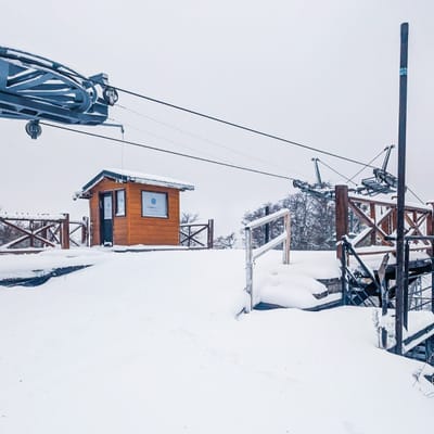
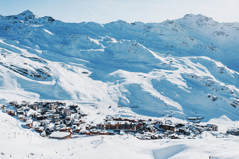
Ski areas on three continents across the southern hemisphere have been reporting fresh snowfall ahead of the 2025 season, which is now only a month away.
Please sign in with your Snow-Forecast account details below.


Val Thorens Weather (Next 3 days): The snow forecast for Val Thorens is: Moderate rain (total 12.0mm), heaviest on Tue night. Mild temperatures (max 8°C on Wed afternoon, min 1°C on Mon morning). Wind will be generally light.
Val Thorens Weather (Days 4-6): Light rain (total 6.0mm), mostly falling on Sat afternoon. Very mild (max 14°C on Fri afternoon, min 5°C on Thu morning). Wind will be generally light.
| Resort | Snow Depth | Temp. (°C) | Wind (km/h) | Weather | ||
|---|---|---|---|---|---|---|
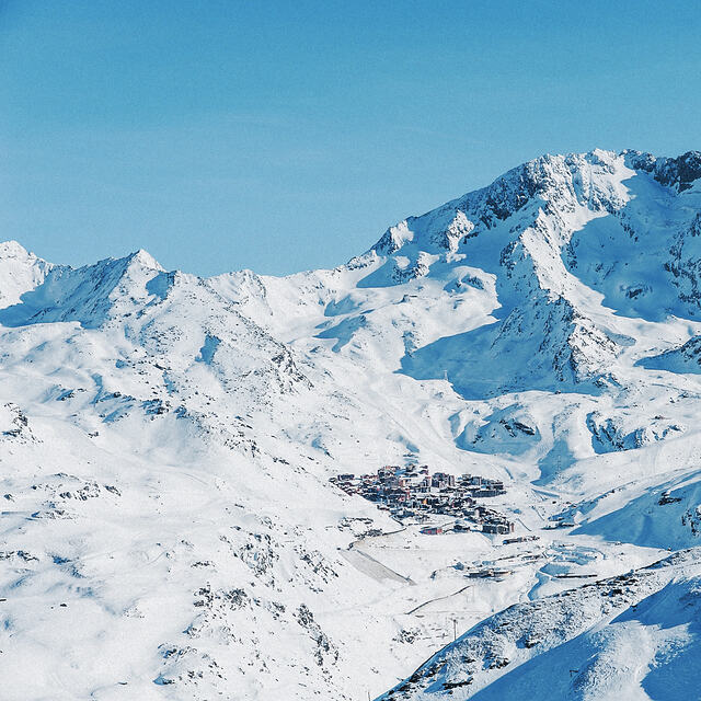
| Top Lift: | 2.0 m | -4 | ||||
| Middle Lift: | -1 | |||||
| Bottom Lift: | 1.5 m | 1 |
Latest snow reports near Val Thorens:
Very good piste conditions, best at top. Overcast skies, very low temperatures. from Val Thorens

Monday 28 | Tuesday 29 | Wednesday 30 | Thursday 1 | Friday 2 | Saturday 3 | Sunday 4 | |||||||||||||||
AM | PM | night | AM | PM | night | AM | PM | night | AM | PM | night | AM | PM | night | AM | PM | night | AM | PM | night | |
clear | rain shwrs | rain shwrs | clear | risk thun- der | rain shwrs | clear | rain shwrs | rain shwrs | clear | clear | clear | clear | some clouds | some clouds | some clouds | light rain | rain shwrs | rain shwrs | risk thun- der | snow shwrs | |
km/h | |||||||||||||||||||||
Snow map |  |  |  |  |  |  |  | ||||||||||||||
— | — | — | — | — | — | — | — | — | — | — | — | — | — | — | — | — | — | — | — | 7 | |
— | 1.0 | 2.0 | — | 1.0 | 4 | — | 1.0 | 3 | — | — | — | — | — | — | — | 3 | 3 | 1.0 | 4 | 7 | |
max°C | 3 | 5 | 4 | 5 | 7 | 5 | 6 | 8 | 6 | 9 | 11 | 9 | 11 | 14 | 11 | 11 | 11 | 8 | 10 | 11 | 7 |
min°C | 1 | 5 | 1 | 2 | 7 | 1 | 3 | 8 | 4 | 5 | 11 | 6 | 8 | 13 | 8 | 9 | 10 | 6 | 7 | 9 | 1 |
-2 | 4 | -1 | 0 | 7 | -1 | 3 | 8 | 3 | 5 | 11 | 6 | 8 | 13 | 7 | 9 | 10 | 5 | 6 | 8 | -2 | |
66 | 74 | 70 | 52 | 62 | 71 | 44 | 54 | 72 | 40 | 60 | 51 | 27 | 44 | 52 | 56 | 76 | 82 | 66 | 71 | 87 | |
2750 | 2850 | 2750 | 2900 | 3100 | 3000 | 3000 | 3300 | 3250 | 3400 | 3600 | 3700 | 3850 | 4000 | 3900 | 3650 | 3650 | 3500 | 3550 | 3500 | 2650 | |
6:28 | — | — | 6:26 | — | — | 6:24 | — | — | 6:22 | — | — | 6:20 | — | — | 6:20 | — | — | 6:18 | — | — | |
— | — | 8:35 | — | — | 8:36 | — | — | 8:37 | — | — | 8:38 | — | — | 8:39 | — | — | 8:40 | — | — | 8:42 | |
Moderate rain (total 12.0mm), heaviest on Tue night. Mild temperatures (max 8°C on Wed afternoon, min 1°C on Mon morning). Wind will be generally light.
Light rain (total 6.0mm), mostly falling on Sat afternoon. Very mild (max 14°C on Fri afternoon, min 5°C on Thu morning). Wind will be generally light.
Latest snow reports near Val Thorens:
Very good piste conditions, best at top. Overcast skies, very low temperatures. from Val Thorens
| Top snow depth: | 195 cm |
|---|---|
| Bottom snow depth: | 145 cm |
| Fresh snowfall depth: | 7 cm |
| Last snowfall: | 27 Apr 2025 |
| Snow Alerts | Create Alert |
0.3 | Bluebird Powder days Fresh snow, mostly sunny, light wind. |
|---|---|
1.5 | Powder days Fresh snow, limited sun, any wind. |
0.1 | Bluebird days Average snow, mostly sunny, light wind. |
The above table gives the weather forecast for Val Thorens at the specific elevation of 2300 m. Our sophisticated weather models allow us to provide snow forecasts for the top, middle and bottom ski stations of Val Thorens. To access the weather forecasts for the other elevations, use the tab navigation above the table. For a wider view of the weather, check out the Weather Map of France.
Click here to read further information on freezing levels and how we forecast our temperatures.
Overall 4.3 Based on 68 votes and 44 reviews
What can you say about VT? Well, it is a world class resort centre for sure. Excellent facilities and of course being at the base of the resort is 2300m it is one of the most snow sure resorts in the Alps. The variety of terrain is excellent, and for the lower standard skier or boarder / novice the resort is actually perfect in many respects. There are a couple of free lifts in the town which you could easily use to get your kids finding their feet. But also there is plenty of easy enough skiing round the town to keep a beginner going and help them enjoy getting started. For the intermediate and expert VT has lots to offer with numerous really nice long blue runs and reds, and the south facing Goitschel black run, which can be excellent when pisted the night before. Off-piste, if you get a good snow season, is tremendous and lots of it. It will track out very quickly though as the high capacity uplift and popularity mean you could lose fresh tracks by lunchtime particularly during busy periods. Also worth mentioning is the Orelle valley, which a lot of people don't seem to check out. It is the only south facing valley in Les 3 Valleys, and was always one of my favourite places to go as the runs there are also really rather nice. Plenty of positives then. There is however, one not so positive. The Val Thorens Snowpark. It used to be one of the premier parks anywhere in the Alps I would say, with usually 3 lines of 3 kickers which were 5m, 10m and 15-18m lines. Now it seems there is way less investment in the development of the park, and the same across Les 3 V so if you like this part of skiing you're likely to get disappointed now. In 2019 there was only one XL jump setup which had two options on it as usual. No L size (10m) line, and only small jumps and rails around other than that. This season it looks the same with only one main kicker setup. It really isn't what you should be able to expect of somewhere you'll be paying over 1000 Euros if you want a season pass, or 300 notes for a 6 day pass. They really should be doing better than this, as the parks are always a very popular area in any resort. On-mountain facilities are pretty decent with sheltered picnic areas for pack lunches, and lots of options for food around. There are also plenty on mountain toilet options, one set at the top of the Plateau lifts, some at the top of La Morraine gondola, and some more at the Cairn/Carron gondola station. The Face West restaurant right in the centre of town is, I would say, perfect for an apres-ski feed and beer. Its a bit pricey, but the view out is better than any other such place in the Alps, I would contest, and it gets the afternoon sun beautifully with it's westerly aspect. A beer is about 10 Euros, Croque Monsuire with fries the same, pizzas are 20 Euros and are nice, and their crepes are superb. All in all, it is a great resort with lots of options and plenty of snow sure capability. The only downside may be park skiing if that's on your agenda, but there's always Austria and Switzerland where they seem to want to keep that alive and inspiring.
Baz from United Kingdom writes:
What can you say about VT? Well, it is a world class resort centre for sure. Excellent facilities and of course being at the base of the resort is 2300m it is one of the most snow sure resorts in the Alps. The variety of terrain is excellent, and for the lower standard skier or boarder / novice the resort is actually perfect in many respects. There are a couple of free lifts in the town which you could easily use to get your kids finding their feet. But also there is plenty of easy enough skiing round the town to keep a beginner going and help them enjoy getting started. For the intermediate and expert VT has lots to offer with numerous really nice long blue runs and reds, and the south facing Goitschel black run, which can be excellent when pisted the night before. Off-piste, if you get a good snow season, is tremendous and lots of it. It will track out very quickly though as the high capacity uplift and popularity mean you could lose fresh tracks by lunchtime particularly during busy periods. Also worth mentioning is the Orelle valley, which a lot of people don't seem to check out. It is the only south facing valley in Les 3 Valleys, and was always one of my favourite places to go as the runs there are also really rather nice. Plenty of positives then.
There is however, one not so positive. The Val Thorens Snowpark. It used to be one of the premier parks anywhere in the Alps I would say, with usually 3 lines of 3 kickers which were 5m, 10m and 15-18m lines. Now it seems there is way less investment in the development of the park, and the same across Les 3 V so if you like this part of skiing you're likely to get disappointed now. In 2019 there was only one XL jump setup which had two options on it as usual. No L size (10m) line, and only small jumps and rails around other than that. This season it looks the same with only one main kicker setup. It really isn't what you should be able to expect of somewhere you'll be paying over 1000 Euros if you want a season pass, or 300 notes for a 6 day pass. They really should be doing better than this, as the parks are always a very popular area in any resort.
On-mountain facilities are pretty decent with sheltered picnic areas for pack lunches, and lots of options for food around. There are also plenty on mountain toilet options, one set at the top of the Plateau lifts, some at the top of La Morraine gondola, and some more at the Cairn/Carron gondola station. The Face West restaurant right in the centre of town is, I would say, perfect for an apres-ski feed and beer. Its a bit pricey, but the view out is better than any other such place in the Alps, I would contest, and it gets the afternoon sun beautifully with it's westerly aspect. A beer is about 10 Euros, Croque Monsuire with fries the same, pizzas are 20 Euros and are nice, and their crepes are superb.
All in all, it is a great resort with lots of options and plenty of snow sure capability. The only downside may be park skiing if that's on your agenda, but there's always Austria and Switzerland where they seem to want to keep that alive and inspiring.
The Val Thorens skiing weather widget is available to embed on external websites free of charge. It provides a daily summary of our Val Thorens snow forecast and current weather conditions. Simply go to the feed configuration page and follow the 3 simple steps to grab the custom html code snippet and paste it into your own site. You can choose the snow forecast elevation (summit, mid-mountain or bottom lift) and metric/imperial units for the snow forecast feed to suit your own website…. Click here to get the code.
View detailed snow forecast for Val Thorens at:
snow-forecast.com


 Nearest