

French Ski Areas Announce 2025 Summer Ski Plans
Three French ski areas have announced their opening plans in May, June and July after the winter season ends on May 4th.
Please sign in with your Snow-Forecast account details below.

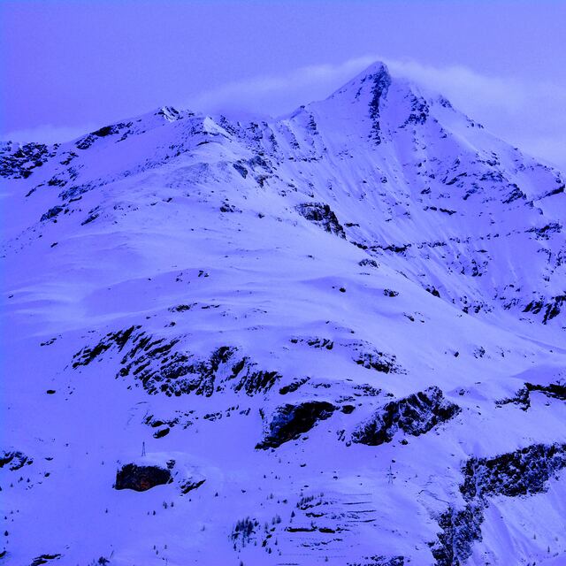
Tignes Weather (Next 3 days): The snow forecast for Tignes is: Light rain (total 6.0mm), mostly falling on Tue afternoon. Mild temperatures (max 8°C on Thu afternoon, min 1°C on Tue morning). Wind will be generally light.
Tignes Weather (Days 4-6): Heavy rain (total 20.0mm), heaviest during Sat night. Very mild (max 11°C on Fri afternoon, min 4°C on Sun night). Wind will be generally light.
| Resort | Snow Depth | Temp. (°C) | Wind (km/h) | Weather | ||
|---|---|---|---|---|---|---|
| Top Lift: | 1.8 m | -4 | ||||
| Middle Lift: | 1 | |||||
| Bottom Lift: | 0.27 m | 5 |
Latest snow reports near Tignes:
Typical spring snow, firm in the morning, slushy in the afternoon. Light clouds dotting the sky. from Val Thorens

Tuesday 29 | Wednesday 30 | Thursday 1 | Friday 2 | Saturday 3 | Sunday 4 | Monday 5 | |||||||||||||||
AM | PM | night | AM | PM | night | AM | PM | night | AM | PM | night | AM | PM | night | AM | PM | night | AM | PM | night | |
clear | rain shwrs | rain shwrs | clear | some clouds | rain shwrs | clear | rain shwrs | rain shwrs | clear | some clouds | rain shwrs | clear | light rain | rain shwrs | some clouds | risk thun- der | rain shwrs | mod. rain | light snow | light snow | |
km/h | |||||||||||||||||||||
Snow map |  |  |  |  |  |  |  | ||||||||||||||
— | — | — | — | — | — | — | — | — | — | — | — | — | — | — | — | — | — | — | 1.0 | 1.0 | |
— | 2.0 | 1.0 | — | — | 1.0 | — | 1.0 | 1.0 | — | — | 1.0 | — | 1.0 | 10 | — | 3 | 5 | 8 | 9 | — | |
max°C | 3 | 4 | 4 | 4 | 6 | 5 | 7 | 8 | 7 | 9 | 11 | 9 | 10 | 10 | 6 | 8 | 9 | 7 | 3 | 2 | 1 |
min°C | 1 | 4 | 2 | 3 | 6 | 4 | 5 | 8 | 6 | 7 | 11 | 8 | 9 | 10 | 6 | 7 | 7 | 4 | 2 | 2 | 0 |
-1 | 3 | 0 | 3 | 6 | 4 | 5 | 8 | 6 | 7 | 11 | 8 | 9 | 8 | 6 | 6 | 6 | 4 | 1 | 0 | -2 | |
60 | 68 | 50 | 35 | 56 | 69 | 46 | 57 | 49 | 31 | 48 | 71 | 52 | 61 | 82 | 49 | 74 | 81 | 99 | 97 | 99 | |
2900 | 3050 | 3000 | 3050 | 3300 | 3200 | 3350 | 3600 | 3600 | 3700 | 3900 | 3750 | 3750 | 3800 | 3400 | 3550 | 3500 | 3200 | 2850 | 2800 | 2550 | |
6:24 | — | — | 6:22 | — | — | 6:20 | — | — | 6:20 | — | — | 6:18 | — | — | 6:16 | — | — | 6:15 | — | — | |
— | — | 8:35 | — | — | 8:37 | — | — | 8:37 | — | — | 8:38 | — | — | 8:39 | — | — | 8:42 | — | — | 8:43 | |
Light rain (total 6.0mm), mostly falling on Tue afternoon. Mild temperatures (max 8°C on Thu afternoon, min 1°C on Tue morning). Wind will be generally light.
Heavy rain (total 20.0mm), heaviest during Sat night. Very mild (max 11°C on Fri afternoon, min 4°C on Sun night). Wind will be generally light.
Latest snow reports near Tignes:
Typical spring snow, firm in the morning, slushy in the afternoon. Light clouds dotting the sky. from Val Thorens
| Top snow depth: | 178 cm |
|---|---|
| Bottom snow depth: | 27 cm |
| Fresh snowfall depth: | — |
| Last snowfall: | 27 Apr 2025 |
| Snow Alerts | Create Alert |
0.3 | Bluebird Powder days Fresh snow, mostly sunny, light wind. |
|---|---|
1.9 | Powder days Fresh snow, limited sun, any wind. |
0.3 | Bluebird days Average snow, mostly sunny, light wind. |
The above table gives the weather forecast for Tignes at the specific elevation of 2506 m. Our sophisticated weather models allow us to provide snow forecasts for the top, middle and bottom ski stations of Tignes. To access the weather forecasts for the other elevations, use the tab navigation above the table. For a wider view of the weather, check out the Weather Map of France.
Click here to read further information on freezing levels and how we forecast our temperatures.
Overall 4.2 Based on 97 votes and 99 reviews
Skiing is awesome here, but so are the opportunistic thieves. Take very good care of your belongings, my party has already had helmets, goggles and even skis stolen. Watch your stuff everyone.
James from United Kingdom writes:
Skiing is awesome here, but so are the opportunistic thieves. Take very good care of your belongings, my party has already had helmets, goggles and even skis stolen. Watch your stuff everyone.
The Tignes skiing weather widget is available to embed on external websites free of charge. It provides a daily summary of our Tignes snow forecast and current weather conditions. Simply go to the feed configuration page and follow the 3 simple steps to grab the custom html code snippet and paste it into your own site. You can choose the snow forecast elevation (summit, mid-mountain or bottom lift) and metric/imperial units for the snow forecast feed to suit your own website…. Click here to get the code.
View detailed snow forecast for Tignes at:
snow-forecast.com


 Nearest