
Ski Lessons by SkiBro
BOOK NOW
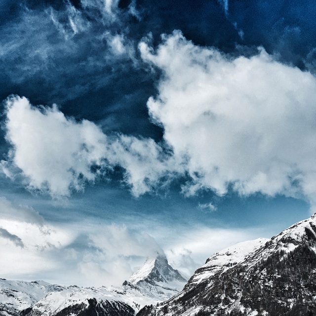
Ski lessons in Zermatt
Book now
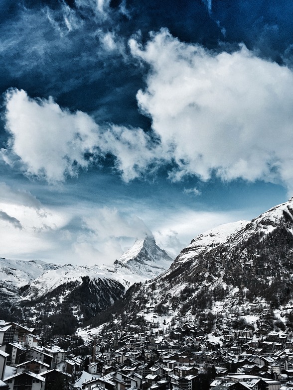

Zermatt Weather (Next 3 days): The snow forecast for Zermatt is: A moderate fall of snow, heaviest on Sun night. Temperatures will be below freezing (max 0°C on Mon afternoon, min -13°C on Sat night). Wind will be generally light.
Zermatt Weather (Days 4-6): A light covering of new snow, mostly falling on Tue night. Freeze-thaw conditions (max 1°C on Thu afternoon, min -13°C on Wed night). Wind will be generally light.
| Resort | Snow Depth | Temp. (°C) | Wind (km/h) | Weather | ||
|---|---|---|---|---|---|---|
| Top Lift: | 2.1 m | -16 | ||||
| Middle Lift: | -8 | |||||
| Bottom Lift: | 0.05 m | -1 |
Latest snow reports near Zermatt:
Moderate rain reported from Sion at 339 metres elevation only 2 kms NW of Veysonnaz-Printse but it is forecast cold enough for snow at the ski area from Veysonnaz-Printse
Light rain reported from Sion at 339 metres elevation only 2 kms NW of Veysonnaz-Printse but it is forecast cold enough for snow at the ski area from Veysonnaz-Printse
Snowing at Saas Fee. from Saas Fee

Saturday 20 | Sunday 21 | Monday 22 | Tuesday 23 | Wednesday 24 | Thursday 25 | Friday 26 | |||||||||||||||
AM | PM | night | AM | PM | night | AM | PM | night | AM | PM | night | AM | PM | night | AM | PM | night | AM | PM | night | |
snow shwrs | light snow | snow shwrs | light snow | light snow | mod. snow | light snow | light snow | light snow | light snow | light snow | light snow | light snow | light snow | snow shwrs | clear | snow shwrs | light snow | some clouds | light rain | light snow | |
km/h | |||||||||||||||||||||
Snow map |  |  |  |  |  |  |  | ||||||||||||||
1.0 | 1.0 | — | 1.0 | 3 | 5 | 1.0 | 5 | 2.0 | — | 1.0 | 1.0 | — | 1.0 | — | — | — | 1.0 | — | — | 2.0 | |
— | — | — | — | — | — | — | — | — | — | — | — | — | — | — | — | — | — | — | 2.0 | — | |
max°C | -2 | -1 | -6 | -3 | -1 | -4 | -2 | 0 | -3 | -3 | -1 | -4 | -3 | -2 | -7 | -2 | 1 | -1 | 2 | 3 | 1 |
min°C | -4 | -1 | -13 | -5 | -2 | -7 | -3 | -1 | -12 | -7 | -2 | -11 | -7 | -2 | -13 | -7 | 0 | -7 | -2 | 3 | 0 |
-9 | -5 | -18 | -9 | -6 | -12 | -5 | -4 | -17 | -11 | -5 | -16 | -12 | -6 | -13 | -7 | -2 | -12 | -5 | 1 | -4 | |
71 | 75 | 81 | 83 | 91 | 95 | 76 | 91 | 98 | 76 | 76 | 99 | 74 | 70 | 99 | 46 | 62 | 95 | 82 | 87 | 94 | |
1200 | 1350 | 250 | 1150 | 1200 | 700 | 1450 | 1500 | 350 | 1050 | 1350 | 200 | 1000 | 1250 | 150 | 1300 | 1750 | 900 | 1800 | 2000 | 1800 | |
6:33 | — | — | 6:31 | — | — | 6:30 | — | — | 6:28 | — | — | 6:26 | — | — | 6:24 | — | — | 6:22 | — | — | |
— | — | 8:22 | — | — | 8:23 | — | — | 8:24 | — | — | 8:27 | — | — | 8:28 | — | — | 8:29 | — | — | 8:30 | |
A moderate fall of snow, heaviest on Sun night. Temperatures will be below freezing (max 0°C on Mon afternoon, min -13°C on Sat night). Wind will be generally light.
A light covering of new snow, mostly falling on Tue night. Freeze-thaw conditions (max 1°C on Thu afternoon, min -13°C on Wed night). Wind will be generally light.
Latest snow reports near Zermatt:
Moderate rain reported from Sion at 339 metres elevation only 2 kms NW of Veysonnaz-Printse but it is forecast cold enough for snow at the ski area from Veysonnaz-Printse
Light rain reported from Sion at 339 metres elevation only 2 kms NW of Veysonnaz-Printse but it is forecast cold enough for snow at the ski area from Veysonnaz-Printse
Snowing at Saas Fee. from Saas Fee
| Top snow depth: | 210 cm |
|---|---|
| Bottom snow depth: | 5 cm |
| Fresh snowfall depth: | 11 cm |
| Last snowfall: | 19 Apr 2024 |
| Snow Alerts | Create Alert |
0.0 | Bluebird Powder days Fresh snow, mostly sunny, light wind. |
|---|---|
0.7 | Powder days Fresh snow, limited sun, any wind. |
0.0 | Bluebird days Average snow, mostly sunny, light wind. |
The above table gives the weather forecast for Zermatt at the specific elevation of 1619 m. Our sophisticated weather models allow us to provide snow forecasts for the top, middle and bottom ski stations of Zermatt. To access the weather forecasts for the other elevations, use the tab navigation above the table. For a wider view of the weather, check out the Weather Map of Switzerland.
Click here to read further information on freezing levels and how we forecast our temperatures.
Overall 4.1 Based on 77 votes and 72 reviews
Never again skiing in Zermatt before Christmas! While the Austrians open all their lifts in the morning, whether it is snowing, storming or foggy, the people of Zermatt first open a small part of their lifts. If you are lucky, one or two are added in the afternoon, if you are unlucky, none at all. So it was with us in four days we were there from 09 to 12.12.2021. With us on Zermatt side on all four days only 15 lifts of 54 were open. Also, if it was windy at the pass to Italy, one could have opened more lifts and departures on Zermatter side in the lee, in order not to annoy the guests (e. g. the slopes from Riffelberg to Furi and from Riffelberg to the Riffelalp, etc.) And then the price you have to shell out for 4 days: 316 € for 15 open lifts in Zermatt. For comparison in the same period 08 to 12 Dec: 189 € for 31 open lifts in Ischgl. I was so far in the Kaunertal, Ischgl, Kappl, Galtür, Ötztal, Zillertal, Kitzbühl, Warth-Schröcken, Damüls and Oberstdorf to ski. Everywhere they open all the lifts in the morning. If it is very windy, one or the other gondola is stopped briefly until the gust has subsided. But Zermatt is quite different, they open only a few lifts in the morning and then wait to see how full the lifts are. Such a thing is not possible in a place with such a reputation! Besides, if they were honest, they would admit that the range of slopes is only from blue to light red, there is not a single challenge for good skiers. Since the people of Zermatt are so uppity, they also have zero complaint management. I had complained twice to the CEO and the marketing manager, but there was no response at all. So much for Zermatt, there the rich are more important than the rest of the people!
AlexSki from United States writes:
Never again skiing in Zermatt before Christmas!
While the Austrians open all their lifts in the morning, whether it is snowing, storming or foggy, the people of Zermatt first open a small part of their lifts. If you are lucky, one or two are added in the afternoon, if you are unlucky, none at all.
So it was with us in four days we were there from 09 to 12.12.2021.
With us on Zermatt side on all four days only 15 lifts of 54 were open.
Also, if it was windy at the pass to Italy, one could have opened more lifts and departures on Zermatter side in the lee, in order not to annoy the guests (e. g. the slopes from Riffelberg to Furi and from Riffelberg to the Riffelalp, etc.) And then the price you have to shell out for 4 days: 316 € for 15 open lifts in Zermatt.
For comparison in the same period 08 to 12 Dec: 189 € for 31 open lifts in Ischgl.
I was so far in the Kaunertal, Ischgl, Kappl, Galtür, Ötztal, Zillertal, Kitzbühl, Warth-Schröcken, Damüls and Oberstdorf to ski.
Everywhere they open all the lifts in the morning. If it is very windy, one or the other gondola is stopped briefly until the gust has subsided.
But Zermatt is quite different, they open only a few lifts in the morning and then wait to see how full the lifts are.
Such a thing is not possible in a place with such a reputation!
Besides, if they were honest, they would admit that the range of slopes is only from blue to light red, there is not a single challenge for good skiers.
Since the people of Zermatt are so uppity, they also have zero complaint management. I had complained twice to the CEO and the marketing manager, but there was no response at all.
So much for Zermatt, there the rich are more important than the rest of the people!
The Zermatt skiing weather widget is available to embed on external websites free of charge. It provides a daily summary of our Zermatt snow forecast and current weather conditions. Simply go to the feed configuration page and follow the 3 simple steps to grab the custom html code snippet and paste it into your own site. You can choose the snow forecast elevation (summit, mid-mountain or bottom lift) and metric/imperial units for the snow forecast feed to suit your own website…. Click here to get the code.
View detailed snow forecast for Zermatt at:
snow-forecast.com


 Nearest