
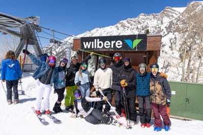
Ski Lessons by SkiBro
BOOK NOW
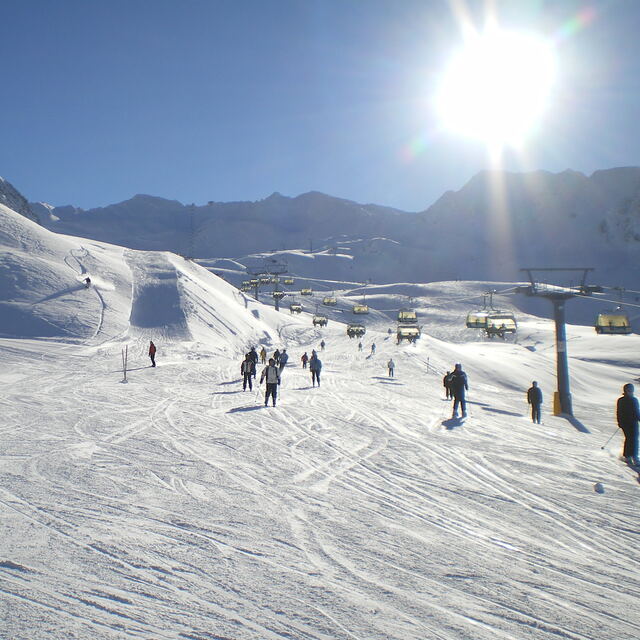
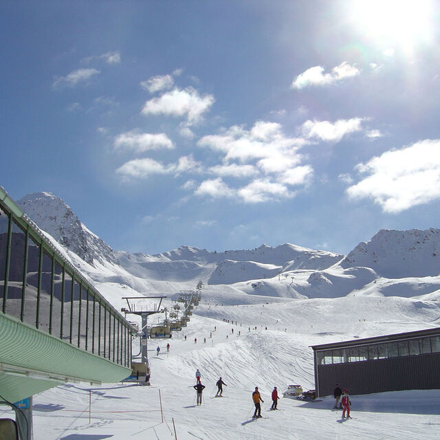
Ski lessons in Obergurgl
Book now
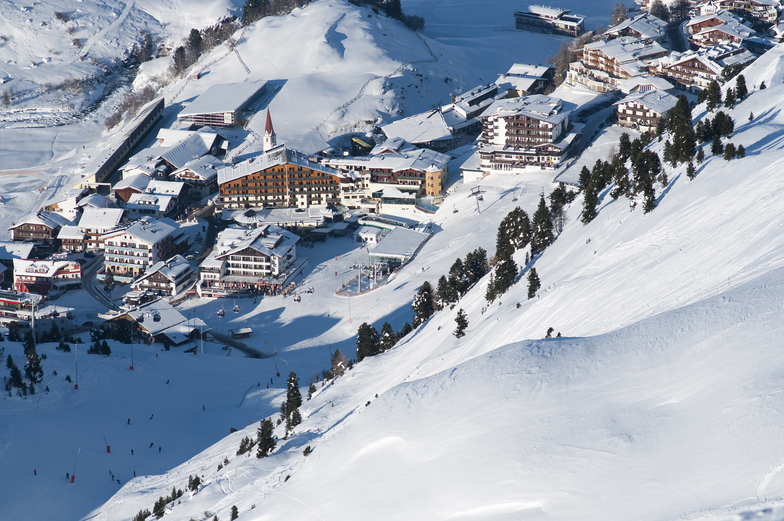

Obergurgl Weather (Next 3 days): The snow forecast for Obergurgl is: A light covering of new snow, mostly falling on Wed afternoon. Temperatures will be below freezing (max -3°C on Fri afternoon, min -10°C on Wed morning). Wind will be generally light.
Obergurgl Weather (Days 4-6): A dusting of new snow. Freeze-thaw conditions (max 5°C on Mon afternoon, min -4°C on Sat morning). Wind will be generally light.
| Resort | Snow Depth | Temp. (°C) | Wind (km/h) | Weather | ||
|---|---|---|---|---|---|---|
| Top Lift: | 0.0 m | -11 | ||||
| Middle Lift: | -7 | |||||
| Bottom Lift: | 0.0 m | -1 |
Latest snow reports near Obergurgl:
Rain reported from Obergurgl at 1937 metres elevation one km SSE of Obergurgl but it is forecast cold enough for snow at the ski area from Obergurgl
Light rain reported from Flughafen Innsbruck Automatic Weather Station at 721 metres elevation 5 kms WNW of Muttereralm but it is forecast cold enough for snow at the ski area from Muttereralm
Snowing heavily at Obsteig/Grünberg. from Obsteig/Grünberg
Rain reported from Landeck at 785 metres elevation only 2 kms NW of Landeck-Zams-Fliess but it is forecast cold enough for snow at the ski area from Landeck-Zams-Fliess

Wednesday 24 | Thursday 25 | Friday 26 | Saturday 27 | Sunday 28 | Monday 29 | Tuesday 30 | |||||||||||||||
AM | PM | night | AM | PM | night | AM | PM | night | AM | PM | night | AM | PM | night | AM | PM | night | AM | PM | night | |
snow shwrs | light snow | snow shwrs | clear | light snow | light snow | light snow | light snow | light snow | light snow | light snow | light snow | light snow | cloudy | cloudy | clear | some clouds | some clouds | some clouds | rain shwrs | rain shwrs | |
km/h | |||||||||||||||||||||
Snow map |  |  |  |  |  |  |  | ||||||||||||||
— | 2.0 | 1.0 | — | — | 1.0 | — | — | 1.0 | — | 1.0 | 2.0 | — | — | — | — | — | — | — | — | — | |
— | — | — | — | — | — | — | — | — | — | — | — | — | — | — | — | — | — | — | 2.0 | 1.0 | |
max°C | -8 | -6 | -8 | -8 | -4 | -5 | -6 | -3 | -4 | -4 | -2 | -2 | 0 | 2 | 2 | 4 | 5 | 4 | 5 | 6 | 5 |
min°C | -10 | -7 | -10 | -9 | -5 | -7 | -7 | -4 | -5 | -4 | -3 | -2 | -1 | 1 | 1 | 2 | 4 | 3 | 4 | 6 | 3 |
-14 | -7 | -14 | -9 | -5 | -10 | -10 | -7 | -9 | -8 | -8 | -7 | -4 | -3 | -3 | 0 | 2 | 0 | 1 | 3 | 0 | |
85 | 91 | 80 | 73 | 73 | 90 | 90 | 86 | 87 | 88 | 92 | 90 | 74 | 88 | 86 | 54 | 71 | 87 | 78 | 71 | 62 | |
1400 | 1650 | 550 | 1450 | 1900 | 1250 | 1700 | 2000 | 1600 | 1900 | 2200 | 2100 | 2550 | 2700 | 2700 | 3000 | 3100 | 3000 | 3100 | 3200 | 3050 | |
6:11 | — | — | 6:09 | — | — | 6:07 | — | — | 6:05 | — | — | 6:03 | — | — | 6:03 | — | — | 6:01 | — | — | |
— | — | 8:16 | — | — | 8:17 | — | — | 8:19 | — | — | 8:21 | — | — | 8:22 | — | — | 8:22 | — | — | 8:24 | |
A light covering of new snow, mostly falling on Wed afternoon. Temperatures will be below freezing (max -3°C on Fri afternoon, min -10°C on Wed morning). Wind will be generally light.
A dusting of new snow. Freeze-thaw conditions (max 5°C on Mon afternoon, min -4°C on Sat morning). Wind will be generally light.
Latest snow reports near Obergurgl:
Rain reported from Obergurgl at 1937 metres elevation one km SSE of Obergurgl but it is forecast cold enough for snow at the ski area from Obergurgl
Light rain reported from Flughafen Innsbruck Automatic Weather Station at 721 metres elevation 5 kms WNW of Muttereralm but it is forecast cold enough for snow at the ski area from Muttereralm
Snowing heavily at Obsteig/Grünberg. from Obsteig/Grünberg
Rain reported from Landeck at 785 metres elevation only 2 kms NW of Landeck-Zams-Fliess but it is forecast cold enough for snow at the ski area from Landeck-Zams-Fliess
| Top snow depth: | 0 cm |
|---|---|
| Bottom snow depth: | 0 cm |
| Fresh snowfall depth: | 15 cm |
| Last snowfall: | 23 Apr 2024 |
| Snow Alerts | Create Alert |
0.6 | Bluebird Powder days Fresh snow, mostly sunny, light wind. |
|---|---|
1.5 | Powder days Fresh snow, limited sun, any wind. |
0.6 | Bluebird days Average snow, mostly sunny, light wind. |
The above table gives the weather forecast for Obergurgl at the specific elevation of 2440 m. Our sophisticated weather models allow us to provide snow forecasts for the top, middle and bottom ski stations of Obergurgl. To access the weather forecasts for the other elevations, use the tab navigation above the table. For a wider view of the weather, check out the Weather Map of Austria.
Click here to read further information on freezing levels and how we forecast our temperatures.
Overall 4.1 Based on 34 votes and 47 reviews
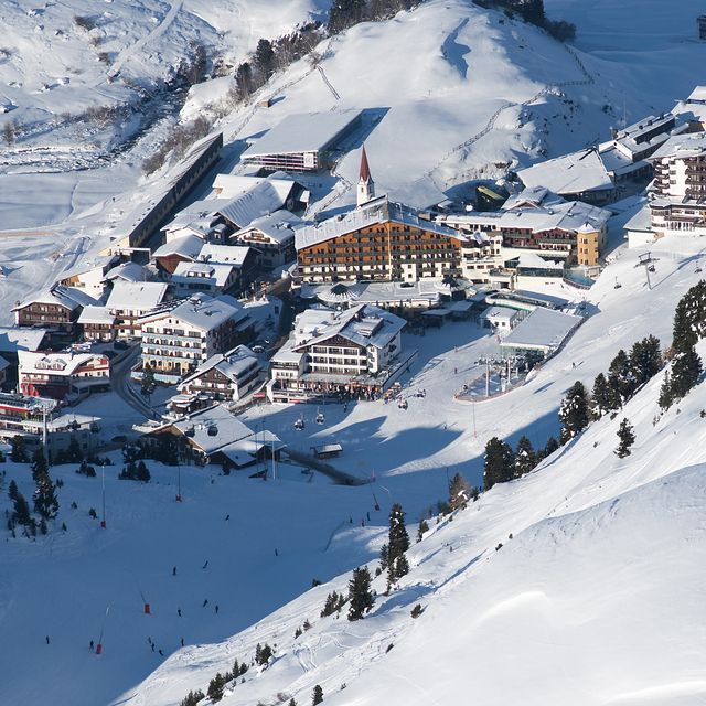
Have been three times now and really like this resort. It has a nice feel to it in a traditional way but modern too. So much nicer than Solden down the road. It’s more older and family focused I would say. Having said that, the bus service that runs around the resort and back to Solden is very good. So, if you fancy it, you can go there too; takes about 20 mins. I would say Obergurgl and Hochgurgl are intermediate and above level. They are not good for beginners. Yes, the piste map is covered with blue runs. But, as with other Austrian resorts I have been to, I would say they are more red than blue in places. There is also plenty of easy access off-piste to have a go at. Most just on the edges of runs. Snow was excellent being a high resort and has kept well where other lower resorts this season (2024) had suffered. I preferred the Hochgurgl side so if you get the choice then get a hotel that side. However, it is easy just to catch the many busses ( 5 mins) down the road to the Hochgurgl lift from Obergurgl or a slightly longer route is the ski down from the top to the lift that crosses the valley between the two. The motorcycle museum is a must see too while you are there and excellent place to stop for lunch. If you’ve not tried this resort then I would highly recommend. With a short transfer time from Innsbruck it is also a great choice for a short break. We went Wednesday to Sunday, which worked well as Saturday is the change over day and quite on the slopes.
Fantastic just not for beginners from United Kingdom writes:
Have been three times now and really like this resort. It has a nice feel to it in a traditional way but modern too. So much nicer than Solden down the road. It’s more older and family focused I would say. Having said that, the bus service that runs around the resort and back to Solden is very good. So, if you fancy it, you can go there too; takes about 20 mins.
I would say Obergurgl and Hochgurgl are intermediate and above level. They are not good for beginners. Yes, the piste map is covered with blue runs. But, as with other Austrian resorts I have been to, I would say they are more red than blue in places.
There is also plenty of easy access off-piste to have a go at. Most just on the edges of runs. Snow was excellent being a high resort and has kept well where other lower resorts this season (2024) had suffered.
I preferred the Hochgurgl side so if you get the choice then get a hotel that side. However, it is easy just to catch the many busses ( 5 mins) down the road to the Hochgurgl lift from Obergurgl or a slightly longer route is the ski down from the top to the lift that crosses the valley between the two.
The motorcycle museum is a must see too while you are there and excellent place to stop for lunch.
If you’ve not tried this resort then I would highly recommend. With a short transfer time from Innsbruck it is also a great choice for a short break. We went Wednesday to Sunday, which worked well as Saturday is the change over day and quite on the slopes.
The Obergurgl skiing weather widget is available to embed on external websites free of charge. It provides a daily summary of our Obergurgl snow forecast and current weather conditions. Simply go to the feed configuration page and follow the 3 simple steps to grab the custom html code snippet and paste it into your own site. You can choose the snow forecast elevation (summit, mid-mountain or bottom lift) and metric/imperial units for the snow forecast feed to suit your own website…. Click here to get the code.
View detailed snow forecast for Obergurgl at:
snow-forecast.com


 Nearest