

A New Largest Ski Area in New Zealand?
The Remarkables is hoping to overtake Cardrona as New Zealand’s largest ski area under a major NZD 150 million‑plus expansion proposal lodged by owner NZSki.

Next 3 days weather summary:Heavy rain (total 34.0mm), heaviest during Sat night. Very mild (max 18°C on Thu afternoon, min 13°C on Sat night). Wind will be generally light. | Days 4-6 weather summary:Heavy rain (total 43.0mm), heaviest during Sun afternoon. Very mild (max 16°C on Sun morning, min 10°C on Tue night). Wind will be generally light. | |||||||||||||||||
Thursday 25 | Friday 26 | Saturday 27 | Sunday 28 | Monday 29 | Tuesday 30 | |||||||||||||
AM | PM | night | AM | PM | night | AM | PM | night | AM | PM | night | AM | PM | night | AM | PM | night | |
clear | t-storm risk | rain shwrs | some clouds | t-storm risk | t-storm risk | t-storm risk | t-storm risk | rain shwrs | t-storm risk | mod. rain | mod. rain | light rain | mod. rain | rain shwrs | some clouds | t-storm risk | rain shwrs | |
km/h | ||||||||||||||||||
Snow map |  |  |  |  |  |  | ||||||||||||
— | — | — | — | — | — | — | — | — | — | — | — | — | — | — | — | — | — | |
mm | — | 3 | 3 | — | 3 | 6 | 1 | 5 | 13 | 4 | 6 | 6 | 2 | 8 | 4 | — | 5 | 8 |
max °C | 16 | 18 | 16 | 16 | 18 | 16 | 16 | 17 | 15 | 16 | 16 | 14 | 14 | 14 | 12 | 14 | 15 | 13 |
min °C | 14 | 17 | 14 | 14 | 17 | 14 | 14 | 17 | 13 | 15 | 16 | 12 | 13 | 12 | 11 | 13 | 14 | 10 |
chill °C | 14 | 17 | 14 | 14 | 17 | 14 | 14 | 17 | 13 | 15 | 16 | 11 | 12 | 12 | 11 | 13 | 14 | 10 |
Humid % | 66 | 59 | 76 | 70 | 62 | 74 | 72 | 67 | 75 | 65 | 67 | 66 | 66 | 90 | 73 | 66 | 78 | 75 |
Freeze m | 4400 | 4650 | 4450 | 4450 | 4650 | 4500 | 4500 | 4700 | 4600 | 4550 | 4600 | 4450 | 4350 | 4200 | 4350 | 4250 | 4300 | 4200 |
5:26 | — | — | 5:26 | — | — | 5:28 | — | — | 5:28 | — | — | 5:28 | — | — | 5:28 | — | — | |
— | — | 9:15 | — | — | 9:15 | — | — | 9:15 | — | — | 9:15 | — | — | 9:15 | — | — | 9:15 | |
Go pro and carve into:
Avalanche information: European Avalanche Warning Services (EAWS)
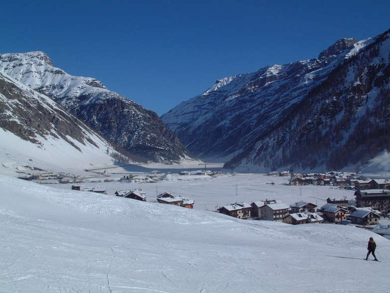
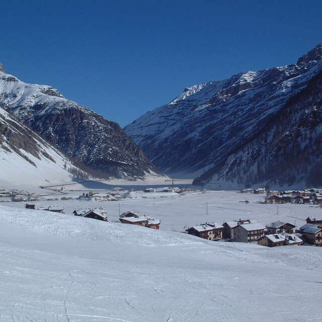
Latest snow reports near Livigno:
| Top snow depth: | 0 cm |
|---|---|
| Bottom snow depth: | 0 cm |
| Fresh snowfall depth: | — |
| Last snowfall: | 10 Jun 2026 |
| Snow Alerts | Create Alert |
0.0 | Bluebird Powder days Fresh snow, mostly sunny, light wind. |
|---|---|
0.1 | Powder days Fresh snow, limited sun, any wind. |
0.0 | Bluebird days Average snow, mostly sunny, light wind. |
The above table gives the weather forecast for Livigno at the specific elevation of 2306 m. Our sophisticated weather models allow us to provide snow forecasts for the top, middle and bottom ski stations of Livigno. To access the weather forecasts for the other elevations, use the tab navigation above the table. For a wider view of the weather, check out the Weather Map of Italy.
Click here to read further information on freezing levels and how we forecast our temperatures.
Overall 4.6 Based on 71 votes and 78 reviews
Troppi ubriachi stranieri fuori controllo in pista, fate molta attenzione. Non ci sono controlli sulle piste, e gli stranieri sono liberi di fare quello che vogliono. Personalmente sono stato travolto 3 volte in una mattinata.
marco from Italy writes:
Troppi ubriachi stranieri fuori controllo in pista, fate molta attenzione. Non ci sono controlli sulle piste, e gli stranieri sono liberi di fare quello che vogliono. Personalmente sono stato travolto 3 volte in una mattinata.


 Nearest