
Ski Lessons by SkiBro
BOOK NOW
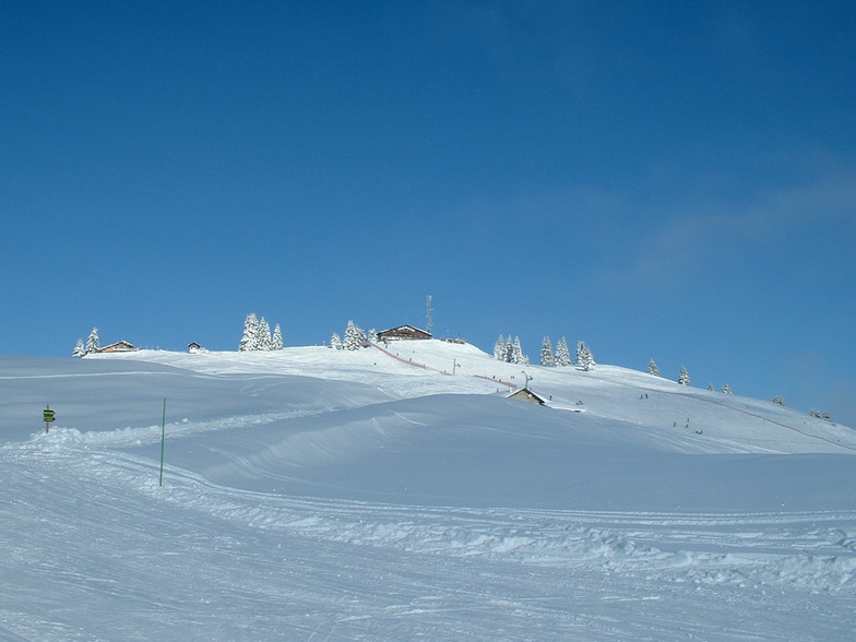
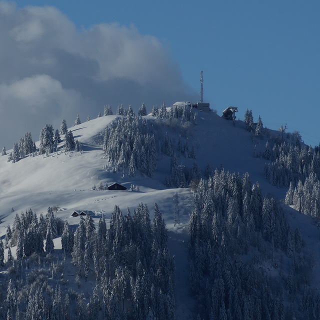
Ski lessons in La Clusaz
Book now


La Clusaz Weather (Next 3 days): The snow forecast for La Clusaz is: Light rain (total 4.0mm), mostly falling on Sun afternoon. Mild temperatures (max 8°C on Mon afternoon, min 1°C on Sat morning). Wind will be generally light.
La Clusaz Weather (Days 4-6): Mild with moderate rain (total 19.0mm) on Wed night, Becoming colder with a light covering of snow, mostly falling on Thu afternoon. Freeze-thaw conditions (max 9°C on Tue afternoon, min -2°C on Thu night). Wind will be generally light.
| Resort | Snow Depth | Temp. (°C) | Wind (km/h) | Weather | ||
|---|---|---|---|---|---|---|
| Top Lift: | 2.4 m | -3 | ||||
| Middle Lift: | 1 | |||||
| Bottom Lift: | 1 |
Latest snow reports near La Clusaz:
Continuous light rain reported from Annecy – Haute-Savoie – Mont Blanc Airport at 459 metres elevation only 3 kms NW of Annecy-LeSemnoz but it is forecast cold enough for snow at the ski area from Annecy-LeSemnoz
Light rain reported from Chambéry Aix-les-Bains Airport at 235 metres elevation 9 kms SW of Savoie Grand Revard but it is forecast cold enough for snow at higher elevations in the ski area from Savoie Grand Revard
Resort closed for the season. See you this summer! from La Giettaz en Aravis

Saturday 27 | Sunday 28 | Monday 29 | Tuesday 30 | Wednesday 1 | Thursday 2 | Friday 3 | |||||||||||||||
AM | PM | night | AM | PM | night | AM | PM | night | AM | PM | night | AM | PM | night | AM | PM | night | AM | PM | night | |
some clouds | cloudy | cloudy | cloudy | light rain | light rain | cloudy | cloudy | light rain | cloudy | light rain | light rain | some clouds | light rain | mod. rain | light rain | light snow | light snow | some clouds | clear | some clouds | |
km/h | |||||||||||||||||||||
Snow map |  |  |  |  |  |  |  | ||||||||||||||
— | — | — | — | — | — | — | — | — | — | — | — | — | — | — | — | 4 | 3 | — | — | — | |
— | — | — | — | 2.0 | 1.0 | — | — | 1.0 | — | 2.0 | 1.0 | — | 3 | 10 | 1.0 | 2.0 | — | — | — | — | |
max°C | 4 | 6 | 6 | 5 | 5 | 4 | 6 | 8 | 6 | 7 | 9 | 7 | 6 | 6 | 4 | 4 | 4 | -1 | 2 | 7 | 6 |
min°C | 1 | 6 | 4 | 4 | 5 | 3 | 4 | 7 | 6 | 6 | 8 | 5 | 5 | 5 | 3 | 4 | -1 | -2 | 0 | 5 | 5 |
-2 | 3 | 0 | 1 | 3 | 1 | 2 | 7 | 5 | 4 | 8 | 3 | 5 | 5 | 3 | 4 | -4 | -2 | 0 | 4 | 4 | |
52 | 49 | 63 | 70 | 86 | 77 | 61 | 76 | 67 | 66 | 79 | 81 | 81 | 97 | 90 | 87 | 99 | 96 | 72 | 49 | 57 | |
2350 | 2600 | 2550 | 2550 | 2500 | 2600 | 2700 | 2750 | 3100 | 2950 | 2850 | 2650 | 2550 | 2600 | 2350 | 2400 | 1500 | 1350 | 2150 | 2600 | 2750 | |
6:26 | — | — | 6:24 | — | — | 6:24 | — | — | 6:22 | — | — | 6:20 | — | — | 6:18 | — | — | 6:16 | — | — | |
— | — | 8:37 | — | — | 8:37 | — | — | 8:38 | — | — | 8:40 | — | — | 8:42 | — | — | 8:43 | — | — | 8:45 | |
Light rain (total 4.0mm), mostly falling on Sun afternoon. Mild temperatures (max 8°C on Mon afternoon, min 1°C on Sat morning). Wind will be generally light.
Mild with moderate rain (total 19.0mm) on Wed night, Becoming colder with a light covering of snow, mostly falling on Thu afternoon. Freeze-thaw conditions (max 9°C on Tue afternoon, min -2°C on Thu night). Wind will be generally light.
Latest snow reports near La Clusaz:
Continuous light rain reported from Annecy – Haute-Savoie – Mont Blanc Airport at 459 metres elevation only 3 kms NW of Annecy-LeSemnoz but it is forecast cold enough for snow at the ski area from Annecy-LeSemnoz
Light rain reported from Chambéry Aix-les-Bains Airport at 235 metres elevation 9 kms SW of Savoie Grand Revard but it is forecast cold enough for snow at higher elevations in the ski area from Savoie Grand Revard
Resort closed for the season. See you this summer! from La Giettaz en Aravis
| Top snow depth: | 235 cm |
|---|---|
| Bottom snow depth: | — |
| Fresh snowfall depth: | 2 cm |
| Last snowfall: | 26 Apr 2024 |
| Snow Alerts | Create Alert |
0.2 | Bluebird Powder days Fresh snow, mostly sunny, light wind. |
|---|---|
0.6 | Powder days Fresh snow, limited sun, any wind. |
0.1 | Bluebird days Average snow, mostly sunny, light wind. |

The above table gives the weather forecast for La Clusaz at the specific elevation of 1742 m. Our sophisticated weather models allow us to provide snow forecasts for the top, middle and bottom ski stations of La Clusaz. To access the weather forecasts for the other elevations, use the tab navigation above the table. For a wider view of the weather, check out the Weather Map of France.
Click here to read further information on freezing levels and how we forecast our temperatures.
Overall 4.1 Based on 31 votes and 23 reviews
The most bad prepared pistes I have ever seen. We traveled 1200 km for nothing. Cheaters, one you report about pistes on internet, completely different in realty.
Vladimir Boschi from Croatia writes:
The most bad prepared pistes I have ever seen.
We traveled 1200 km for nothing.
Cheaters, one you report about pistes on internet, completely different in realty.
The La Clusaz skiing weather widget is available to embed on external websites free of charge. It provides a daily summary of our La Clusaz snow forecast and current weather conditions. Simply go to the feed configuration page and follow the 3 simple steps to grab the custom html code snippet and paste it into your own site. You can choose the snow forecast elevation (summit, mid-mountain or bottom lift) and metric/imperial units for the snow forecast feed to suit your own website…. Click here to get the code.
View detailed snow forecast for La Clusaz at:
snow-forecast.com


 Nearest