
Ski Lessons by SkiBro
BOOK NOW
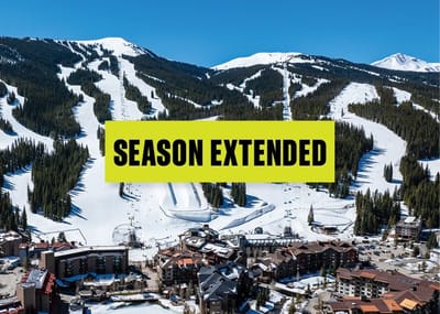
Ski lessons in Alpe d'Huez
Book now


Alpe d'Huez Weather (Next 3 days): The snow forecast for Alpe d'Huez is: A moderate fall of snow, heaviest on Wed morning. Temperatures will be below freezing (max -3°C on Fri morning, min -9°C on Thu morning). Wind will be generally light.
Alpe d'Huez Weather (Days 4-6): A dusting of new snow. Temperatures will be below freezing (max -2°C on Fri afternoon, min -7°C on Sun night). Wind will be generally light.
| Resort | Snow Depth | Temp. (°C) | Wind (km/h) | Weather | ||
|---|---|---|---|---|---|---|
| Top Lift: | 4.0 m | -12 | ||||
| Middle Lift: | -4 | |||||
| Bottom Lift: | 0.19 m | 7 |
Latest snow reports near Alpe d'Huez:
Plenty of good snow at altitude. Clouds expected later. from Val Thorens

Tue 16 | Wednesday 17 | Thursday 18 | Friday 19 | Saturday 20 | Sunday 21 | Monday 22 | ||||||||||||||
PM | night | AM | PM | night | AM | PM | night | AM | PM | night | AM | PM | night | AM | PM | night | AM | PM | night | |
clear | snow shwrs | light snow | light snow | light snow | light snow | light snow | snow shwrs | clear | some clouds | snow shwrs | snow shwrs | some clouds | clear | some clouds | snow shwrs | snow shwrs | clear | snow shwrs | snow shwrs | |
km/h | ||||||||||||||||||||
Snow map |  |  |  |  |  |  |  | |||||||||||||
— | 1.0 | 3 | 1.0 | 1.0 | 3 | 2.0 | 1.0 | — | — | 1.0 | — | — | — | — | — | — | — | — | — | |
— | — | — | — | — | — | — | — | — | — | — | — | — | — | — | — | — | — | — | — | |
max°C | -4 | -5 | -7 | -6 | -7 | -8 | -8 | -6 | -3 | -2 | -3 | -4 | -3 | -4 | -5 | -5 | -6 | -6 | -4 | -4 |
min°C | -4 | -7 | -7 | -6 | -8 | -9 | -8 | -8 | -5 | -2 | -5 | -6 | -3 | -6 | -6 | -5 | -7 | -7 | -4 | -4 |
-10 | -13 | -13 | -11 | -12 | -15 | -14 | -15 | -10 | -6 | -10 | -12 | -9 | -12 | -12 | -10 | -10 | -11 | -7 | -9 | |
67 | 84 | 92 | 84 | 87 | 92 | 86 | 55 | 37 | 72 | 89 | 51 | 56 | 53 | 47 | 74 | 65 | 55 | 70 | 60 | |
1750 | 1250 | 1350 | 1500 | 1050 | 1050 | 1250 | 950 | 1650 | 1950 | 1200 | 1550 | 1750 | 1200 | 1400 | 1600 | 1050 | 1450 | 1800 | 1300 | |
— | — | 6:46 | — | — | 6:45 | — | — | 6:43 | — | — | 6:41 | — | — | 6:39 | — | — | 6:37 | — | — | |
— | 8:22 | — | — | 8:23 | — | — | 8:24 | — | — | 8:25 | — | — | 8:28 | — | — | 8:29 | — | — | 8:30 | |
A moderate fall of snow, heaviest on Wed morning. Temperatures will be below freezing (max -3°C on Fri morning, min -9°C on Thu morning). Wind will be generally light.
A dusting of new snow. Temperatures will be below freezing (max -2°C on Fri afternoon, min -7°C on Sun night). Wind will be generally light.
Latest snow reports near Alpe d'Huez:
Plenty of good snow at altitude. Clouds expected later. from Val Thorens
| Top snow depth: | 400 cm |
|---|---|
| Bottom snow depth: | 19 cm |
| Fresh snowfall depth: | — |
| Last snowfall: | 9 Apr 2024 |
| Snow Alerts | Create Alert |
0.4 | Bluebird Powder days Fresh snow, mostly sunny, light wind. |
|---|---|
0.9 | Powder days Fresh snow, limited sun, any wind. |
0.7 | Bluebird days Average snow, mostly sunny, light wind. |
The above table gives the weather forecast for Alpe d'Huez at the specific elevation of 2225 m. Our sophisticated weather models allow us to provide snow forecasts for the top, middle and bottom ski stations of Alpe d'Huez. To access the weather forecasts for the other elevations, use the tab navigation above the table. For a wider view of the weather, check out the Weather Map of France.
Click here to read further information on freezing levels and how we forecast our temperatures.
Overall 4.0 Based on 69 votes and 109 reviews
I hadn't been to Alpe d'Huez for a while and visited there for a few weeks in March and early April this season (2022). They have clearly invested a fair bit in the lift system over the intervening period. Many new high speed lifts around. The area itself is still basically the same, and is really what you would expect from a large alpine resort in the French Alps. A high degree of variety in terrain, runs, off-piste and aspect of slope and lots of ski-in ski-out options. Skiing around town is all easy stuff really and offers a perfect domain for people that are starting out, or have not got much skill yet. But as mentioned the options for up to expert level are also excellent. The on-mountain facilities are rather decent and well maintained including toilets, restaurants, information and the general maintenance of the resort to a high standard including grooming and prep work of pistes / lifts. The snowpark in Alpe d'Huez has improved significantly from the last time I went there. They now have a very decent setup. There was an extensive area for intermediates and loads of rails and boxes around. Their large line had a couple of decent booters. Then in the run up to the French Freeski Slopestyle Champs at the end of March they built up two insanely large, very poppy kickers to go with the two large kickers that were there before. The comp jumps basically became little more than decorative following the comp, but they were there if anyone felt either mental or exceedingly brave. The park is very popular, no doubt owing to location and design. The location of the park is perfect, being as it is about 2100m elevation and west facing, meaning the kickers don't get the sun on their take off in the afternoons, and the landings will soften in the sun, which is exactly what you want. This season has been rather unseasonably warm, but even so the park was skiing beautifully until 08th April. The main downside for Alpe d'Huez, I would say, is the car parking situation, if you are travelling there by car. It is almost all paid for parking in the town, which I'm sure helps the residents, but is a pain in the you know what if you're holidaying there. And there simply isn't enough. But difficulty finding a space is not an uncommon thing in ski resorts generally... All things considered I would not hesitate in recommending Alpe d'Huez to anyone for a trip as it will not disappoint any level of skier/boarder. The resort is also mainly above 1800m making it fairly well snow sure for the vast majority of any season, even ones like this one which was very low snowfall and warmer than average generally.
Baz from United Kingdom writes:
I hadn't been to Alpe d'Huez for a while and visited there for a few weeks in March and early April this season (2022). They have clearly invested a fair bit in the lift system over the intervening period. Many new high speed lifts around.
The area itself is still basically the same, and is really what you would expect from a large alpine resort in the French Alps. A high degree of variety in terrain, runs, off-piste and aspect of slope and lots of ski-in ski-out options. Skiing around town is all easy stuff really and offers a perfect domain for people that are starting out, or have not got much skill yet. But as mentioned the options for up to expert level are also excellent.
The on-mountain facilities are rather decent and well maintained including toilets, restaurants, information and the general maintenance of the resort to a high standard including grooming and prep work of pistes / lifts. The snowpark in Alpe d'Huez has improved significantly from the last time I went there. They now have a very decent setup. There was an extensive area for intermediates and loads of rails and boxes around. Their large line had a couple of decent booters. Then in the run up to the French Freeski Slopestyle Champs at the end of March they built up two insanely large, very poppy kickers to go with the two large kickers that were there before. The comp jumps basically became little more than decorative following the comp, but they were there if anyone felt either mental or exceedingly brave. The park is very popular, no doubt owing to location and design. The location of the park is perfect, being as it is about 2100m elevation and west facing, meaning the kickers don't get the sun on their take off in the afternoons, and the landings will soften in the sun, which is exactly what you want. This season has been rather unseasonably warm, but even so the park was skiing beautifully until 08th April.
The main downside for Alpe d'Huez, I would say, is the car parking situation, if you are travelling there by car. It is almost all paid for parking in the town, which I'm sure helps the residents, but is a pain in the you know what if you're holidaying there. And there simply isn't enough. But difficulty finding a space is not an uncommon thing in ski resorts generally...
All things considered I would not hesitate in recommending Alpe d'Huez to anyone for a trip as it will not disappoint any level of skier/boarder. The resort is also mainly above 1800m making it fairly well snow sure for the vast majority of any season, even ones like this one which was very low snowfall and warmer than average generally.
The Alpe d'Huez skiing weather widget is available to embed on external websites free of charge. It provides a daily summary of our Alpe d'Huez snow forecast and current weather conditions. Simply go to the feed configuration page and follow the 3 simple steps to grab the custom html code snippet and paste it into your own site. You can choose the snow forecast elevation (summit, mid-mountain or bottom lift) and metric/imperial units for the snow forecast feed to suit your own website…. Click here to get the code.
View detailed snow forecast for Alpe d'Huez at:
snow-forecast.com


 Nearest